Showing posts with label Wreck Island. Show all posts

Friday, July 11, 2014

The Massasauga Park, Ontario, August, 2013: Camping and Canoeing at Blackstone Harbour and Wreck Island


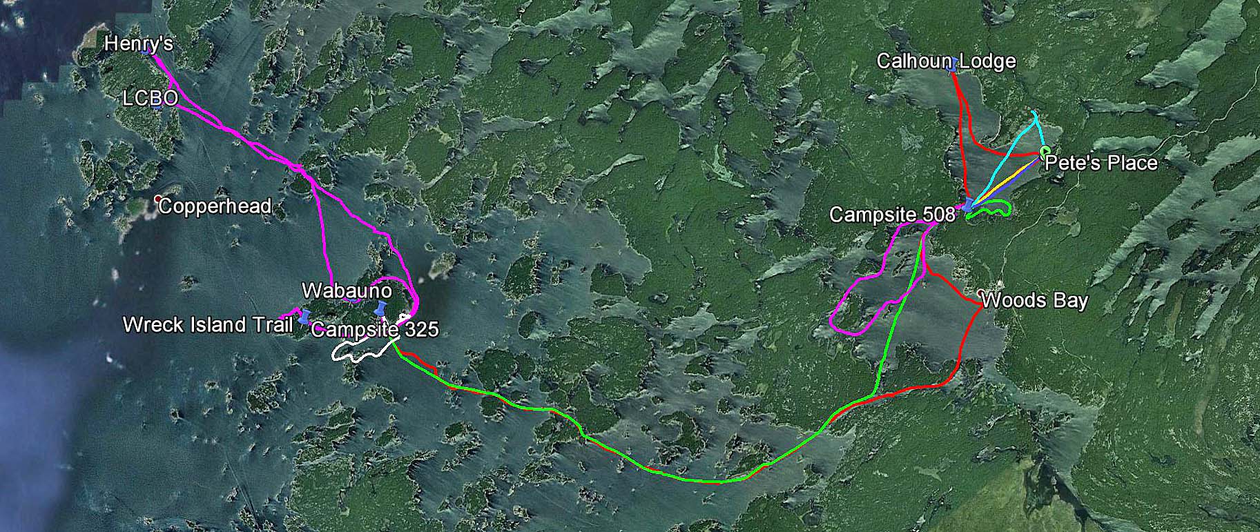
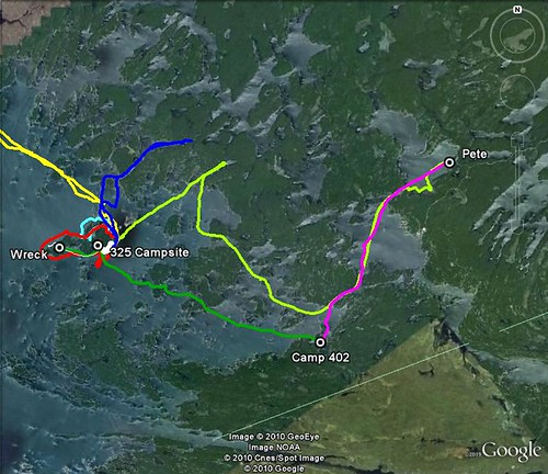
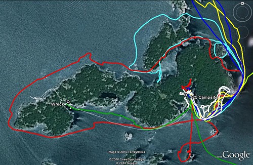
Our GPS tracks in the Massassauga Park
Initially Catherine and I were planning to stay in the Massasauga Provincial Park over the Canada Day long weekend, on a campsite near the channel. In March, 2013 we called Ontario Park Reservation and the site was still available, yet a day or two later, when we finally called to book it, it was taken! Since it was still available for the Simcoe Day long weekend in August, we quickly booked it — and managed to reserve a campsite in Killarney Park over the July long weekend instead. But it was not the end of the story: a month later, while chatting with my clients, it turned out that they were also spending weekends camping and canoeing and were looking forward to going camping over the Canada Day long weekend.

“Which park are you going to?” I asked.
“The Massasauga”, they said. “We had already reserved a campsite”.
“Which one?”
“The one near the channel”, they said to my astonishment!

Wow, what are the chances of this happening?

Pete's Place, we depart from here
So, on August 1, 2013 (the 69th anniversary of the Warsaw Uprising) we arrived at the Massasauga Park, Pete’s Place, to start our sixth trip in this park. There were not too many people around — we met a young guy of Serbian or Croatian origin from Toronto who was dragging his small kayak to the water. He was staying on one of the campsites located along Captain’s Allan Strait and we paddled together until we reached our campsite.
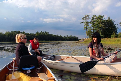
Evening paddle on Woods Bay
We had stayed on that campsite in July, 2011 with some friends, as well as part of our group had camped on it in 2010. It was located on the shores of the only channel leading to Woods Bay (and to Georgian Bay), so there was plenty of boat traffic. Nevertheless, the boats did not bother us — we could hardly see them — and we even enjoyed sitting on the rock and watching the passing boats and the setting sun. The campsite also looked out on a small island (private, but without any structures), sometimes we swam to the island and relaxed on its rocks.
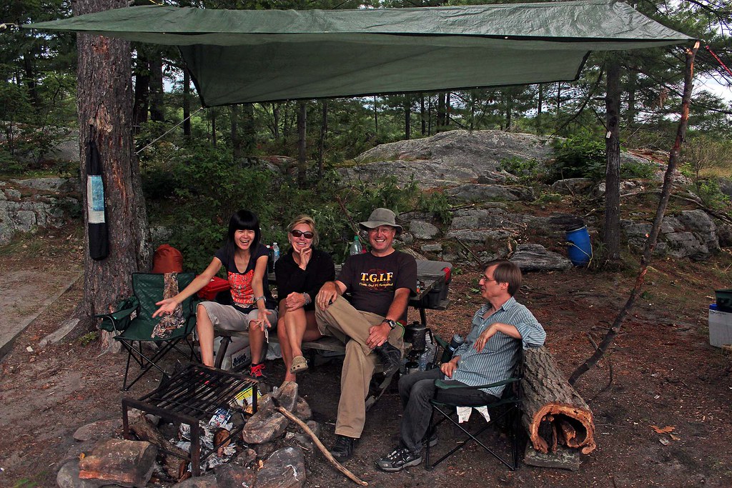
Lynn, Catherine, Jack and Wayne at our Blackstone
Harbour campsite, near the channel
The next day Lynn and Wayne arrived and set up their new tent and a tarp. Later in the evening all of us went for a paddle on Woods Bay, around Georgina and Fritz Islands. The weather was perfect and we could enjoy the wonderful sunset. Once we were back, we had a campfire.

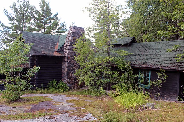
Since Catherine had left her hat in the car, the next morning we paddled to Pete’s Point (about 15 minutes) to fetch it and then we headed to Calhoun Lodge, facing a rather strong head wind. While Catherine, Lynn and Wayne went on a rigorous hike on the Baker Homestead hiking trail, I spent all this time exploring the lodge and adjacent buildings. 
Calhoun Lodge
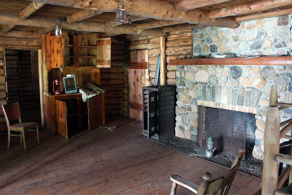
Although I had visited the lodge several years ago (also with the same group), this time I appreciated its past history much more: Several months ago I had been contacted by Mr. Dave Nadzam from Ohio, who had seen my photos of Calhoun Lodge and made a few comments. It turned out that Dave, as a teenager, used to visit the Lodge and of course, knew its owner, Joseph Calhoun. He emailed me several photos depicting him having a wonderful time at the Lodge and wrote a couple of stories about the Lodge, ‘Judge’ Calhoun and his family. I also sent him the Massasauga Park tabloid and a brochure about Calhoun Lodge. So, now I was taking photographs and videos of the Lodge and later emailed them to Dave.

At Calhoun Lodge
I intended to incorporate his stories and some of the photographs in my blog — but he created his own blog, “The Calhoun Lodge: Willebejobe”, (https://dhnadzam.wordpress.com/), where you can find plenty of photos and very interesting stories related to the Lodge and its inhabitants-it is really worth visiting! I found it fascinating to read about the owner, “Judge” Jo Calhoun and his family (including his sister, who starred in almost 50 silent movies), Dave’s personal stories and finally stories about the Taylor family, who purchased the property from Mr. Calhoun.
The Maintenance Shed
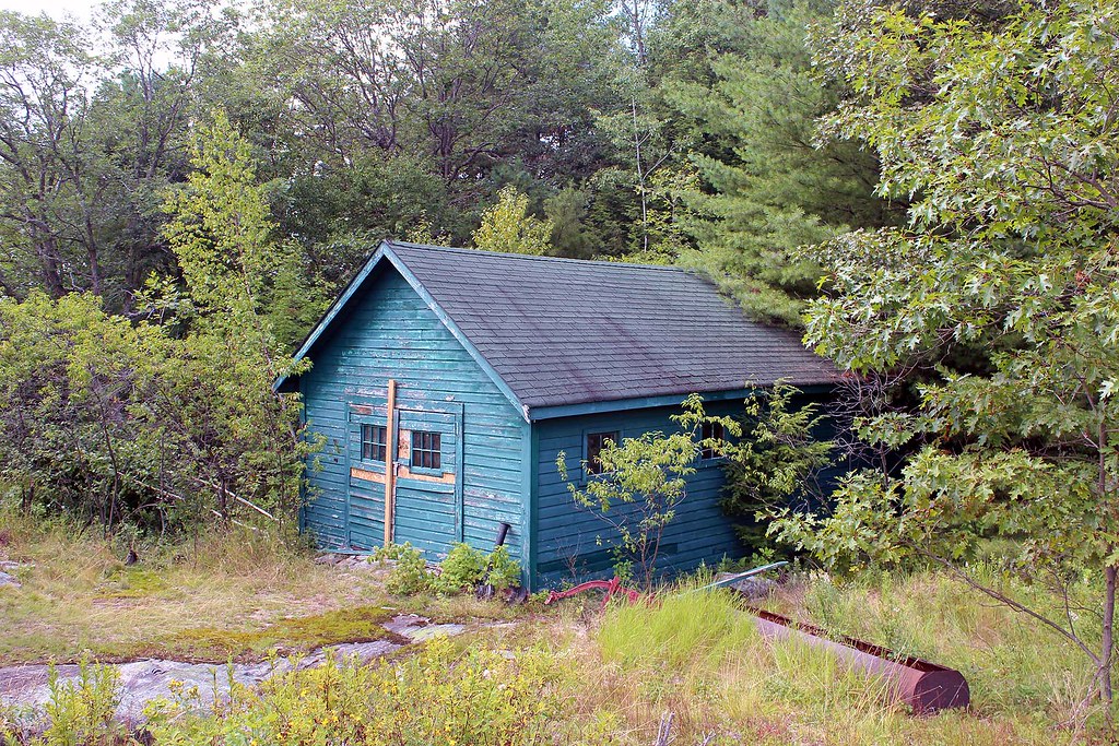
Most of the buildings still survive in various state of (dis)repair. One of them, the maintenance shed, has a rather gloomy history: On May 24, 1968, Jerome Cassanette, the caretaker, dressed in his best clothes, and with a bottle of the Judge’s finest scotch, went to the maintenance shed, closed the shed door, started the tractor and then lay on the work bench until he succumbed to the fumes. The Judge, arriving from Ohio the next day, discovered his body. It is said that Jerome’s ghost haunts the property even to this day. While I was there alone, taking photos and exploring the buildings, I did not see any ghosts, although I was rather more concerned about encountering a black bear or an Eastern Massasauga Rattlesnake, the only venomous snake in Ontario (the park is named after this snake).
Inside Calhoun Lodge
Dave also scanned and posted a brochure published by Ontario Parks called “Calhoun Lodge and the Baker Homestead” (https://dhnadzam.files.wordpress.com/2013/08/calhoun-lodge-and-baker-homestead1.pdf) which has many photographs and tells about the Lodge and its history. Sometimes when we see abandoned houses, we wonder what had occurred there and wish they could speak. Well, this time all you have to do is go to Dave’s blog and in no time you will look at this place from a very different perspective!
Map of the Massasauga area at the Moon River Marina
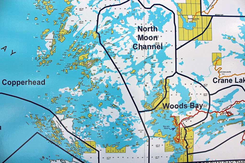
On Sunday, August 4, 2013, we paddled to the falls (vis-à-vis Pete’s) and later gave a lift to Lynn & Wayne to the parking lot where they had parked their car; after saying good bye, we drove to the town of MacTier with our canoe on the roof. Yeah, we were planning to do some paddling on Lake Joseph, but eventually got too lazy and just spent a few hours in town.
Wreck Island
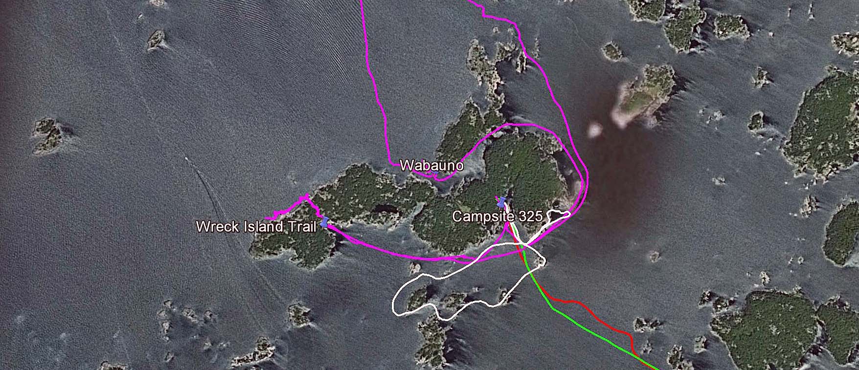
On Tuesday, August 6, 2014, we packed up our stuff and headed to Wreck Island. The weather was awesome and even though we had to paddle on relatively open water, we had no problems with waves or winds. Unfortunately, some motorboats were totally oblivious to our presence and we had to carefully watch for the big rollers they created. At one point three powerful speedboats darted about 100 meters in front of our canoe. In no time they vanished, yet the high waves they had left behind literally swamped our canoe — had not we positioned the canoe perpendicularly to the waves, it would have likely capsized.
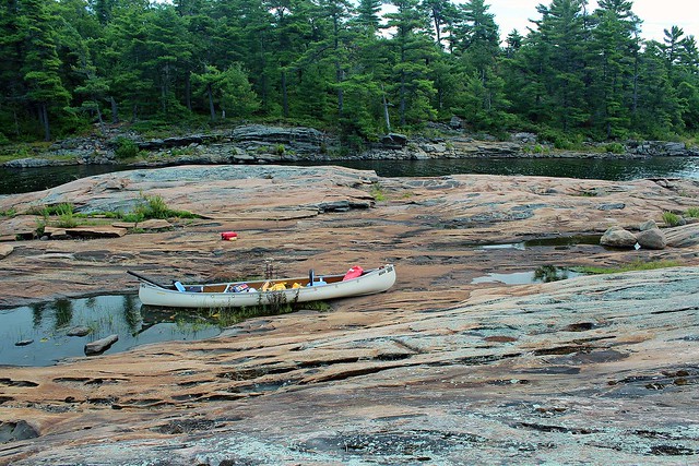
Our campsite on Wreck Island
We had visited Wreck Island twice before: in 2008, during our first canoeing trip (it was just a day visit) and then in 2009, when we stayed for several days on the only campsite located on the island. We truly enjoyed our stay and thus 4 years later we were looking forward to visiting our ‘old’ campsite again!

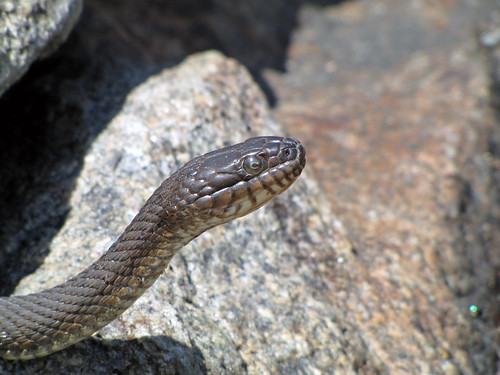
Since the water level was lower than in 2009, our ‘private’ island on the ‘private’ bay became a peninsula. We still remembered plenty of water snakes inhabiting the island in 2009-they were quite ubiquitous, swimming everywhere and sticking their heads from numerous crevices. They were there again-one, very long and thick, was living under a flat rock, most of the time part of his body exposed to the sun. It was shocking to think that we probably had seen him as a toddler back in 2009! Others either swam or hid in cracks.
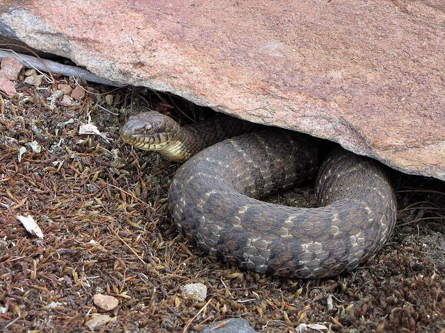
Water Snake
While Catherine spent several hours painting the canoe with First Nation artwork, I tried fishing, but she was obviously much more successful in her activity than I was at mine. This time we did not see any wildlife — we kind of missed the lonely, shy black bear that inhabited the island in 2009 and sometimes was observing us from across the small bay!
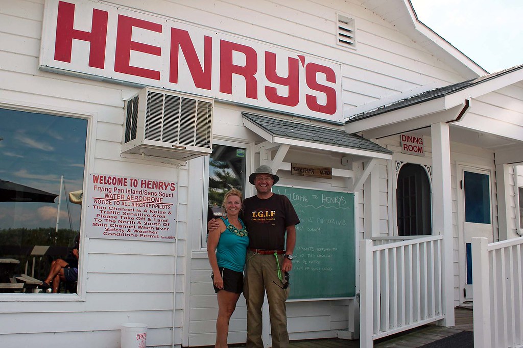
At Henry's Restaurant on Fryingpan Island
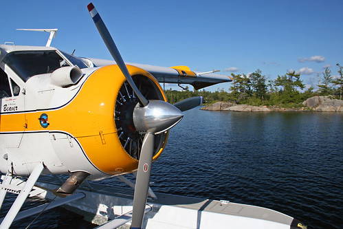
On August 8, 2013, we paddled to the famous Henry’s Restaurant on Frying Pan Island. As our trip required us to be traverse through quite exposed areas, I had made sure that the weather forecast did not call for any rapid weather changes and we were monitoring the sky and cloud patterns. We saw an OPP (Ontario Provincial Police) boat, checking boaters’ safety equipment-one hapless kayaker, who seemingly forgot to bring a life jacket, was turned back by the police. When we arrived at Henry’s, there were plenty of impressive boats, cruisers and sailboats (and one float plane) at the restaurant’s docks, yet we did not see any other canoes — we were the only brave ones!
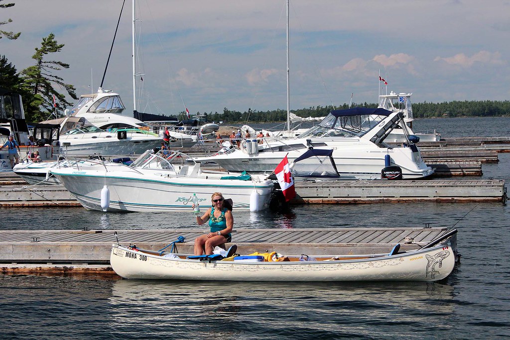
We were the only canoeists that have arrive by canoe!
We just had French fries and briefly talked to the restaurant’s owner. Whereas the chips and fish are good, we did not think they were that great to justify their high price. Later we headed to the small store on the island.  Catherine bought ice cream, I opted for several cans of cold beer and we headed back to Wreck Island. At one point we were almost hit by a fast-moving motorboat — the driver saw us at the last moment and appeared visibly embarrassed and even terrified.
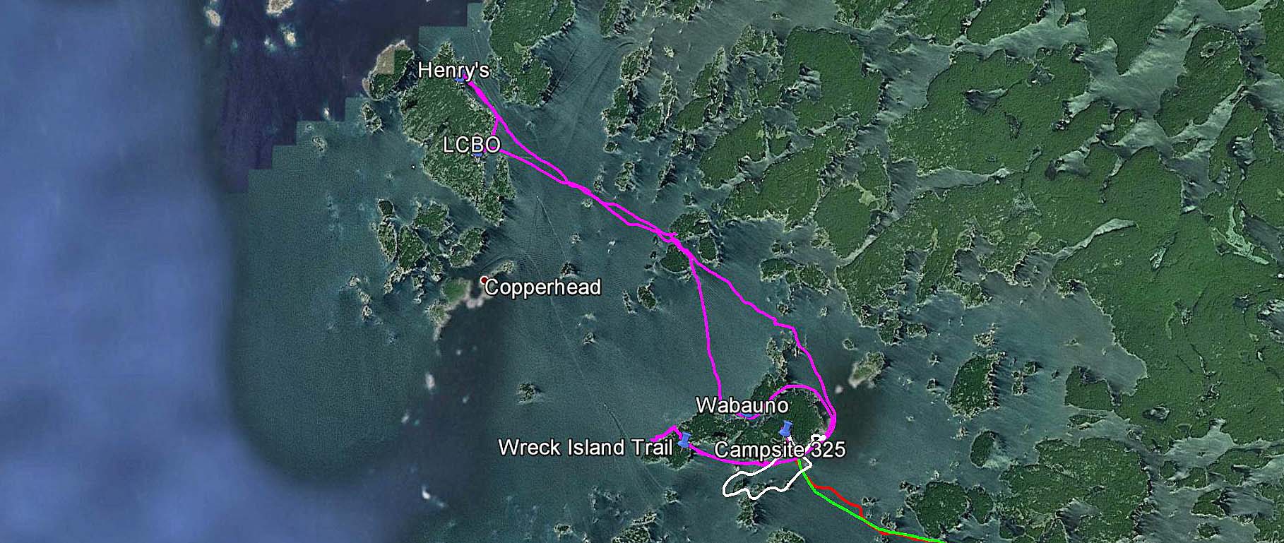
GPS tracks-poaddling to Fryingpan Island and back to Wreck Island
Instead of paddling directly to our campsite on the south shores of the island, I proceeded towards an entrance to a passage between Wreck Island and Bradden Island. There I was paddling back and forth around small rocky islands at the mouth of the passage and constantly scanning the area around the canoe. Catherine had no idea what I was doing or looking for and became quite perplexed by my peculiar behavior, yet I totally ignored her bemusement and kept paddling hither and thither.

“Do you remember the story of the Waubuno?” I asked her.

Considering all the many stories I had been regaling her with, Catherine could not recall this name.
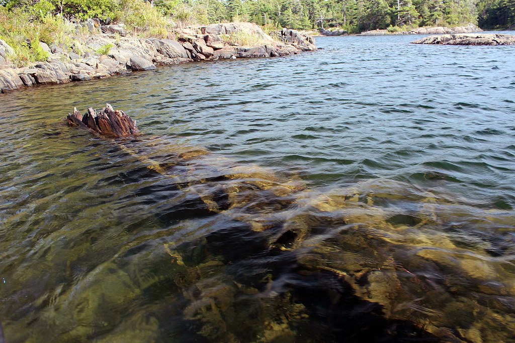
Remains of the hull of the Waubuno
“Well, there is a Historical Plaque in Parry Sound in Waubuno Park, where a sizable anchor is located. So, to make the story short, let me just read you what it says”, I said and pulled out a sheet of paper containing the text.

“This anchor, recovered in 1959, belonged to the steamer "Waubuno", a wooden sidewheeler of some 180 tonnes which was built at Port Robinson in 1865. She carried freight and passengers in the shipping trade which flourished on Lake Huron during the nineteenth century. Commanded by Captain J. Burkett, she sailed from Collingwood on November 22, 1879, bound for Parry Sound. The "Waubuno" encountered a violent gale later that day and sank in Georgian Bay some 32 km south of here. All on board perished, and although some wreckage was later discovered, the bodies of the 24 victims were never found. The specific cause of this disaster has never been determined.”

“Wow, what a terrible disaster!” she exclaimed.

I pointed to something sticking out of the water.

“And we’re now looking at what remains of the hull of the Waubuno!”

Both of us were quietly looking at this old, rusty and decaying object which 134 years ago was part of this well-known ship.
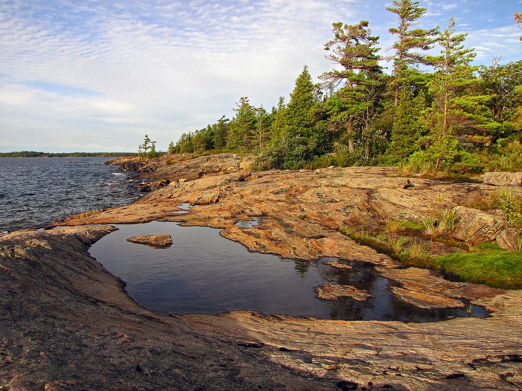
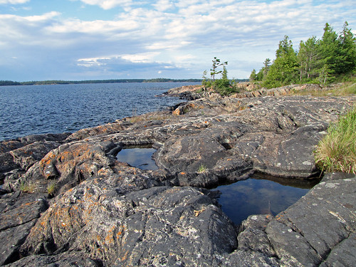
Rock formation on Wreck Island

Then we paddled past the campsite to the beginning of the Wreck Island hiking trail. There was one cruiser docked, whose occupants were having a small campfire on shore. We spoke to them for a while-they complained about the price of gas the boat was consuming-even a short trip ended up costing several dozens dollars. Also, when it was windy, they often had to wake up in the middle of the night to check if the wind did not push the boat towards the rocky shore. Listening to such stories-and they are quite common-made us appreciate our canoe even more!
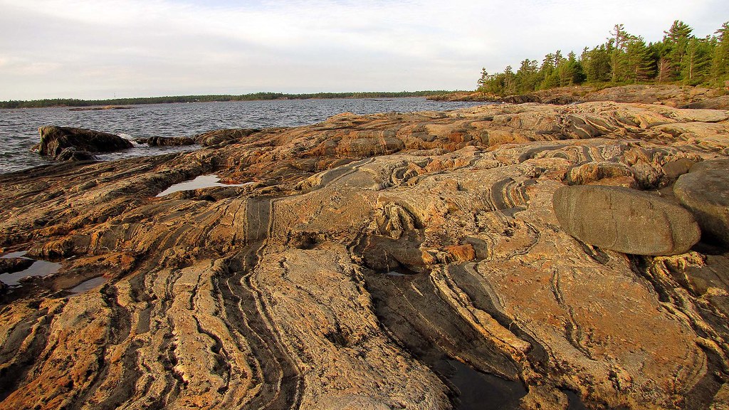
Rock formation on Wreck Island
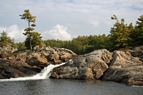
The Wreck Island Trail is quite short, but it is absolutely spectacular due to impressive rock formations! I was devouring the amazing and unique scenery and every few seconds took a photo — I could literally feel my camera overheating! I am not a geologist, but let me quote a few passages from “Wreck Island Trail” by Ontario Parks:

Geologists believe that the rocks in this area have experienced a mid-continental collision beginning some 1.1 billion years ago. Mountain building was followed by millions of years of erosion. Some 450 million years ago a marine sea flooded this area leaving deposits of limestone, yet none of these thick deposits have survived the subsequent erosion on Wreck Island.

Fantastic rock formations on Wreck Island
Glaciation has also contributed to sculpting the park’s landscape. Continental glaciation finished the job of removing the last traces of soft limestone. The last sheet covered the Wreck Island area approximately 60,000 years ago, however, it was 14,000 years ago that an event far to the north of Hudson Bay would leave a lasting record on the island. A catastrophic release of glacial meltwater occurred, releasing a huge quantity of debris-laden water with “nowhere to go”. Ice still covered this part of Georgian Bay, including Wreck Island, as the water rushed southward. It traveled beneath the ice under tremendous pressure. The water was able to push up the base of the glacier and travel along the ground. The rushing torrents was filled with sharp grit, cobbles and boulders. This torrent attacked the rock surfaces of Wreck Island much like a giant sand blaster, resulting in the erosional processes evident today.
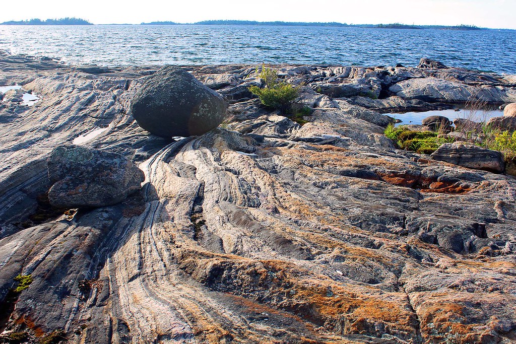
Percussion Boulder

Percussion Boulders

Fourteen thousand years ago a catastrophic release of glacial meltwater occurred, releasing a huge quantity of debris-laden water with “nowhere to go”. Ice still covered this part of Georgian Bay, including Wreck Island, as the water rushed southward. It traveled beneath the ice under tremendous pressure.
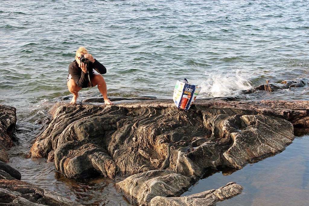
Taking photos on Wreck Island
The water was able to push up the base of the glacier and travel along the ground. The rushing torrent was filled with sharp grit, cobbles and boulders. This torrent attacked the rock surfaces of Wreck Island much like a giant sand blaster, resulting in the erosional processes evident today. The large, black boulders is one of those rocks which were bouncing along under the ice hammering the rock surfaces. These rocks are known as percussion boulders, they were swept along in a high speed sheet of water under tremendous pressure. Geologists think this incredible flow may have been short lived, lasting anywhere from only a number of hours to several days.

Amazing sunset on Wreck Island
We know that these percussion boulders have traveled a long distance; this black boulder looks very different than the bedrock on which it sits. The boulder is gabbro from far north of here and contains green epidote.

It was a wonderful evening and I took over one hundred photographs with the rock bathed with the setting sun, yet no photograph will convey the exceptional beauty of this area.
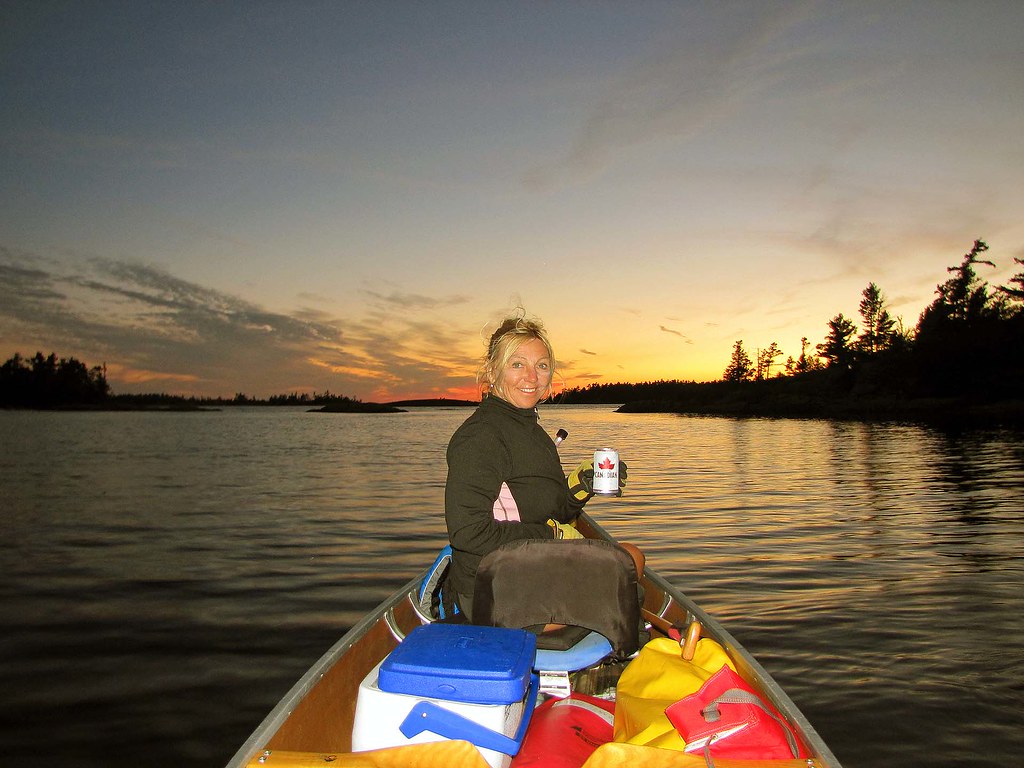
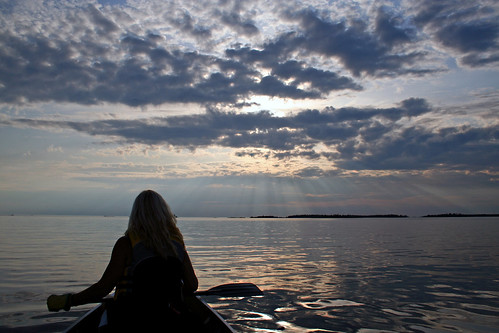
Enjoying the sunset near Wreck Island
It was getting dark and we slowly returned to the canoe. It was very hot, I was thirsty and had a few cans of still cold beer-it was so delicious and refreshing! We paddled for a while and finally reached our campsite in total darkness.

Next day we paddled back to Pete’s Access point, stopping along the way in Captain Allan Strait to eat Pickerel Weed, examine Arrowheads and look (unsuccessfully) for wild rice. At one point a group of seadoo riders suddenly showed up in the channel and kept going very fast in spite of our canoe being there. Since it was still early, we went to Moon River Marine for popsicles and beer, then sat down in wooden chairs and were watching and chatting with patrons loading their boats to depart to their cottages-well, a very busy Friday evening! In less than 30 minutes we arrived to the Pete’s Access point, packed the car and placed the canoe on the roof—just in time before a thunderstorm hit.
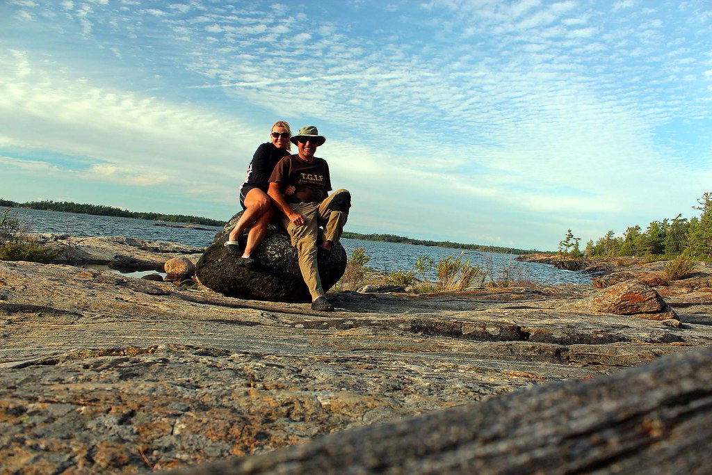
On Wreck Island-Percussion Boulder
What can I say… yet another awesome canoeing & camping trip!


Saturday, July 10, 2010

Canoeing in the Massasauga Park and Sharing it with Black Bears, July 07-14, 2009 and September 25-28, 2009


Wreck Island, July 07-14, 2009 


The Massassauga Provincial Park, stretching along the coast of Georgian bay from Parry Sound to the Moon River, takes in hundreds of windswept islands as well as inland forests and lakes. My first canoeing visit to this park was in 2008 and it was such a good trip that I decided to come back, this time taking a more ambitious route, albeit without any portaging. It is one of the few parks which offers plenty of prolonged canoeing trips, allowing the paddler to sit IN the canoe ON the water, as opposite to WALKING on land UNDER the canoe (i.e., portaging!). Needless to day, I much prefer the former! Our camping destination was Wreck Island and its lone campsite #325. Miraculously, it was not even very difficult to reserve it since not too many people are willing to cross open waters of Georgian Bay—and perhaps they’re right, as we were to find out later.
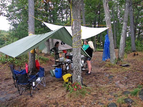
Our campsite on Wreck Island

Wreck Island is also associated with a well-known ship, the Waubuno, which transported passengers and freight between Collingwood and Parry Sound in the 1860s and 1870s. On November 21, 1879, the ship left the town of Collingwood for Parry Sound; it had been trying to leave that town for 3 days, but due to snow and fierce winds it was kept in port. Since it was likely the last voyage the ship could make before ice made future trip impossible until the following Spring, the captain must have decided to tread dangerously and get the ship to Parry Sound. The ship, with 24 crew and passengers, was last spotted afloat by the lighthouse keeper at Christian Island. When it failed to turn up at its destination, a search was commenced and many scattered articles belonging to the missing vessels were found, but no bodies. Other parts of the ship have been recovered over the years. A hull which is though to be that of the Waubuno can be seen in the waters near Wreck Island.


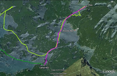
After departing Toronto on July 07, 2009 and a 3 hour drive, we arrived at Pete’s Point Access Point. It was quite windy—the waves on Blackstone Harbour did not appear to subside at all—to the contrary, I had a feeling they were getting bigger by the minute. However, we bravely got into our packed canoe and started to paddle towards the channel connecting Blackstone Harbour with Woods Bay. During a calm weather it should take us about 4.5 hours to reach Wreck Island, but we soon realized it would be impossible to get there today at all—we were paddling against the wind and even though we were still in a relatively sheltered bay, the canoe proceeded very slowly forward, rocking up and down on the waves—we could only imagine what would happen out on Georgian Bay! With some difficulty we traversed Woods Bay and reached the calm waters of Captain Allan Straits, even contemplating staying on one of the many campsites located on the shores. Yet we decided to paddle on and reach campsite number 402, where we had camped for several days in 2008.

Bearproofing was a good idea, as there was at least one bear on the island!
The campsite, located in a bay and sheltered from the main channel by islands, was very nice and had not changed since last year. Because we were only supposed to spend one night on this campsite, we quickly set up our tent and started the fire.


The weather greatly improved the next day, so we packed our stuff and quickly got on the water. After passing Pleasant Island on our right, we entered very picturesque and rocky passage through a cluster of islands (Sharpe, Omar). Soon, Wreck Island came into sight; led by my trusty GPS, we slowly paddled into a small bay... and there it was! The site was breathtaking! We had our ‘private’ bay, with a ‘private’ island, as well as an awesome view of Georgian Bay and several islands. Although there were several tent pads in the forest, we set up our tent on the flat rocky hill so that it was close to the fire and offered an unobstructed view of the area.

Wreck Island... a perfect bay, a perfect campsite!

The small island, which was accessible by foot, turned out to be a great fishing and swimming spot—as well as a very convenient place to have our meals. We noticed plenty of water snakes swimming around the island—they lived in many crevices of the island.

...and perfect fishing!

Soon, when we had our meals, we could see up to 6 snakes’ heads protruding from cracks or slithering on the rock and getting into the water. Of course, those snakes are harmless and never interested in attacking humans, but if threatened, they can be quite vicious and bite with their sharp teeth.


Although not venomous, their saliva contains anticoagulant which may cause profuse bleeding lasting for up to 9 hours; in addition, it can also bring about nasty infection requiring medical attention.

Garpikes. Many years ago a friend of mine caught a few garpikes and insisted on eating them. He saw they had a lot of bones and very little meat, which was not very tasty

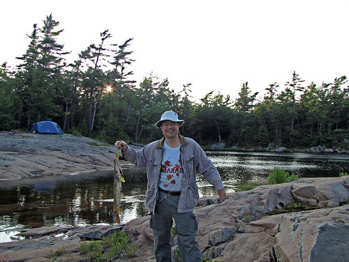
My paddling partner, oblivious to the dangers, would do a daily swim around the bay. The snakes would come out patrolling as soon as she hit the water, their heads held up like periscopes, as if ready to fire off a torpedo into an unsuspecting victim. It was surreal.! I tried my luck with fishing and during our stay I caught two pikes, 2 and 4 kg., which turned out to be delicious!

There were plenty of water snakes on our campsite!

Besides camping on Wreck Island, we also paddled to Henry’s Fish Restaurant, a very well-known place. It made the top 100 in Saveur magazine; its fish and chips are supposedly one of the best in the world! Its fame is so widespread that people from many countries made the point of visiting this place—including some famous locals, like Goldie Hawn and Kurt Russell. Since it’s located on an island (appropriately called Frying Pan Island), the only way is by water or by air. It’s possible to take a Cessna float plane from Parry Sound and after a 10 minute flight over the 30,000 islands, land on the water and step in for a very original dinning experience! Frying Pan Island was north of Wreck Island, about 2 hours away by canoe—but since we had to paddle on unprotected and open waters of Georgian Bay, we decided to take advantage of the calm and relatively windless weather and paddle there the next day, July 09, 2009. By the way, we had a marine radio with us and listened to marine weather forecast which were very accurate, at least for the next 12 to 24 hours.

Our canoe trip to Fryingpan Island, to the famous Henry's Restaurant

The paddle went off without any problems—after making a semi-circle to the left, we were again paddling on the open waters of Georgian Bay. We passed Alice Island to our right, through a passage between Saville Island and Barnicke Island, then between Isabel Island and Florence Island and were slowly approaching the sizable Frying Pan Island. As we were nearing the shore, a peculiar and rather familiar looking sign caught our attention. “Is it what we think it is?”, we wondered.

Frying Pan Island
Yes, the LCBO store on an island! We would make a lot of purchases in this store during our canoe trip in following years

Indeed, as we approached the building, we were right—it was the ‘famous’ LCBO sign! (for those not living in Ontario: government-owned LCBO stores are generally the only stores allowed to sell hard liquor in Ontario).


It was impossible to pass such an opportunity—after all, the only other LCBO store in the Massasauga Park was at the Moon River Marina, about 5 hours from Wreck Island! Two employees on the dock helped us to moor the canoe, although they were generally accustomed to helping secure bigger motor boats. The store sold a lot of stuff, including, of course, LCBO-related supplies. We opted for cold beer and coolers; then paddled for a minute or so to a small island vis-à-vis the store, where we relaxed and gulped the drinks while observing the arriving flotilla of a variety of vessels whose owners were mainly in need of cold beer. My partner even managed to snag a cup of ice for a real "on the rocks" experience. Well-rested, we embarked for our final destination. When approaching the restaurant’s dock, we felt a little uneasy, seeing all the big, expensive and luxurious yachts, cabin cruisers and float planes at its dock—our canoe was much smaller than their dinghies—yet we still got a royal treatment from the two employees on the dock, a.k.a. parking attendants.


Henry’s Fish Restaurant was quite large and rustic, offering an assortment of fish dishes. We decided on an ‘all you can eat’ special (at $24.99 per person, not cheap) and in no time were served plates of battered fried fish, coleslaw and French fries. While we were eating, another float plane landed nearby, discharging several people, as well as a water taxi from Parry Sound arrived with yet more hungry visitors. We asked the waitress about tips. “Do you think there is a correlation between the amounts of tips AND the size of the customers’ boats?”, I asked. Then I pointed to the smallest vessel moored at the dock (i.e., our canoe) and said, “this is our watercraft, by the way”.

Yes, it's our canoe-we were the only crazy customers to arrive by canoe! All the others had arrived by motor boats, yachts and planes
Yet generously tip we did; after all, we’d like to come there again! Following our feast, we had an opportunity to meet and chat with the restaurant’s owner (although his name was not Henry— he bought the place years ago from the original owner). Then we hopped in the canoe and almost sunk due to the excess weight (just kidding!)... and paddled back home! The weather was still perfect, no wind. We maneuvered among the myriads of islands and stared at the boundless waters of Georgian Bay on our right. Had the weather taken a turn for a worse just a little, we’d have had to remain on Frying Pan Island for a while... well, not such a bad prospect, after all! It must have been the food, because the paddle back to our campsite took us just 1.5 hours.

A friendly bear apparently occupied "our" island!

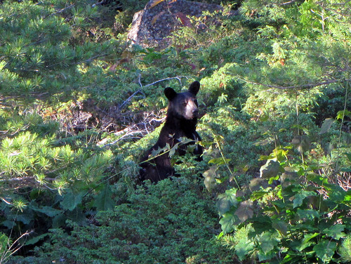
When we were entering into ‘our’ bay, on the right, just opposite our campsite, a small black bear appeared on the shore. I managed to take a couple of photos, but it soon disappeared in the bush. We saw it again in a couple of days, but otherwise it did not bother us and ostensibly didn’t desire our company—or rather our food; well, the latter we religiously packed in a barrel and hung on a tree overnight and each time we left our campsite.


It was our intention to return to Toronto on Saturday, July 11, 2009, yet the winds picked up and it was simply impossible to paddle across those long open stretches of water. So, here we were, stuck on an island, with at least one black bear, a bunch of water snakes and a school of lurking garpikes! Fortunately, the weather still allowed us to paddle around and near the island. On the south-west end of the island there was the 1.5 km. Wreck Island hiking trial. The trail was short—but the scenery was just amazing! I’m not a geologist, but let me quote a few passages from “Wreck Island Trail” by Ontario Parks:

Geologists believe that the rocks in this area have experienced a mid-continental collision beginning some 1.1 billion years ago. Mountain building was followed by millions of years of erosion. Some 450 million years ago a marine sea flooded this area leaving deposits of limestone, yet non of these thick deposits have survived the subsequent erosion on Wreck Island.


Glaciation has also contributed to sculpting the park’s landscape. Continental glaciation finished the job of removing the last traces of soft limestone. The last sheet covered the Wreck Island area approximately 60,000 years ago, however, it was 14,000 years ago that an event far to the north of Hudson Bay would leave a lasing record on the island. A catastrophic release of glacial meltwater occurred, releasing a huge quantity of debris-laden water with “nowhere to go”. Ice still covered this part of Georgian Bay, including Wreck Island, as the water rushed southward. It traveled beneath the ice under tremendous pressure. The water was able to push up the base of the glacier and travel along the ground. The rushing torrents was filled with sharp grit, cobbles and boulders. This torrent attacked the rock surfaces of Wreck Island much like a giant sand blaster, resulting in the erosional processes evident today. Percussion Boulders Fourteen thousand years ago a catastrophic release of glacial meltwater occurred, releasing a huge quantity of debris-laden water with “nowhere to go”. Ice still covered this part of Georgian Bay, including Wreck Island, as the water rushed southward. It traveled beneath the ice under tremendous pressure.

The percussion boulder

The water was able to push up the base of the glacier and travel along the ground. The rushing torrents was filled with sharp grit, cobbles and boulders. This torrent attacked the rock surfaces of Wreck Island much like a giant sand blaster, resulting in the erosional processes evident today. The large, black boulders is one of those rocks which were bouncing along under the ice hammering the rock surfaces. These rocks are known as percussion boulders, they were swept along in a high speed sheet of water under tremendous pressure. Geologists think this incredible flow may have been short lived, lasting anywhere from only a number of hours to several days. We know that these percussion boulders have traveled a long distance; this black boulder looks very different than the bedrock on which it sits. The boulder is gabbro from far north of here and contains green epidote.


For me, that part of Wreck Island was a photographer’s paradise! If only I were able to take better photos... Waiting for the weather to improve, we paddled north-east to Doll Island and Bowery Bay. However, while paddling back to the campsite, the weather suddenly changed, catching us by surprise and we had to paddle very steadfastly to make it to the safety of the sheltered bays near our island. Another day we paddled around Wreck Island, just south of Bradden Island (where the Waubuno wreck could be seen). Everything was fine in the protected waterway between the islands, but once we entered the open and windy waters of Georgian Bay, our canoe was tossed left and right, up and down so much that at one point it was getting difficult to keep it from capsizing. We realized it would be impossible to continue circumventing Wreck Island and we decided to turn left, go around Bradden Island and paddle back to our campsite. Even turning the canoe 180 degrees was a little risky, as at one point the canoe became parallel to the waves, swaying left and right. Eventually we made it to shore of Bradden Island and decided to portage over a very narrow and bushy part of the island instead of paddling around it. The portage was short and once we were on the south side of Bradden Island, it became calm and peaceful and we slowly made our way back to the campsite.


Even though Wreck Island belongs to the Massasauga Provincial Park, some of its land remains private and cottages are a common sight. From our campsite we could see two islands with cottages. Once we paddled around one of them and had a chat with a very nice gentlemen, originally from Czechoslovakia. It turned out that his cottage (and presumably other cottages as well) had electricity thanks to an underwater cable, so he even offered us ice! Considering that cellular towers were everywhere and cell reception excellent, living on one of such islands was not such a lonely prospect!


It was only on Monday, July 13, 2009, that the weather forecast called for a better and calmer weather the following day. However, it was so windy at night that we had to tie the tent to several big rocks; otherwise it could have been blown away! Indeed, on July 14 the wind subsided. Within 2 hours we were packed and hit the water. On our way back we even explored some other islands in the are and visited Carlson Bay. Once we got to Blackstone Harbour, the wind picked up again and paddling the last couple of hundreds of meters, just before Pete’s Point, was exhausting. 

Blackstone Harbour & Moon River Falls, September 25-28, 2009

The July trip must have been—indeed, it was—very enjoyable, because we, along with another couple, went there again on September 25, 2009. This time we stayed on campsite # 509, just a 30 minute paddle from Pete’ Place. The September weather turned out to be above average, at least in terms of temperatures. We had seen this campsite during our July trip and we liked it—without a doubt, it was a nice spot, with three tent pads, plenty of trees to string tarps and unobstructed view of Blackstone Harbour. 


After setting up our tent and a very small tarp, we canoed for a while. I tried my fishing skills—alas, in vain, but at least I was in a good company, judging upon the number of other anglers, enjoying the same success, or rather lack of it. Since we were warned that the area had been frequented by some cheeky bears, we had to hang our food on a tree. It’s easier said than done—I tried for over an hour to throw the rope over many tree branches, but eventually gave up and hung the barrel on the tree just on the water. Nothing ever disturbed it, so it was probably sufficient.

Campsite 509: Lynn, Wayne and Catherine. We would camp on this very campsite many times in following years

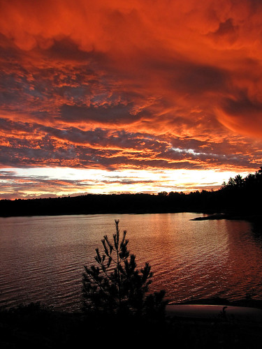
Considering that I love sitting around the campfire till past midnight, I’m not usually an early riser (and thus probably miss out on plenty of photo opportunities). Yet for some reasons I was up at sunrise the next day, September 26—and saw this amazing sky, full of absolutely reddish clouds! I quickly grabbed my camera and took a number of memorable photos... and went back to my tent to sleep for another several hours! Later that day we paddled around Blackstone Harbour, checking out other campsites for a possible group camping trip next year. Most of the campsites along the shores (# 508, 506, 505, 511, 510) were quite nice, although some might be too open to the elements. Usually those campsites are quite popular due to their proximity to Pete’s Place and thus advance reservations are recommended. In the meantime our friends Wayne and Lynn arrived and set up their tent—as well as a much bigger tarp! The four of us paddled on Blackstone Harbour to abandoned Calhoun Lodge. We spent some time exploring its many buildings; apparently a youth group occupied it several years ago and certainly had a great time! Unfortunately, it started raining and our paddle back to the campsite was a very wet one! The skies cleared, so needless to say, we still had a nice campfire and traditional grilled steaks and my favorite red wine. We got really lucky the next day, September 27, as we were planning to paddle to the Moon River Falls. I had visited the Moon River Falls in 2003 and loved the scenery! In the summer it is a popular place for people to gather and jump off the cliffs. Sadly, just over one month before, a tragedy struck when seven people had been swept by the falls and three of them lost their life. It took us over 2 hours and about 8 km. to reach the Falls, but it was certainly worth it! Nobody else was there and we could admire the granite rock formation; although the name of the river is not derived from the Lunar landscape, it could easily have! The water in the falls was not as fast-flowing as in August, when that accident occurred, but still the falls were impressive.

The Moon Falls

A small white cross marked the place where the victims had made their last jumps... After having lunch on the top of the falls, we started paddling back and reached our campsite just before 7 pm.

Moon Falls: Wayne, Lynn, Catherine and Jack

Last day welcomed us with wind, rain. lighting and thunder. Lynn and Wayne, who were up early, bid us farewell and paddled back to Pete’s Place, but we missed the break in the weather and had to wait out very strong winds and lighting, huddled under our too small tarp. Eventually we did get on the water, strenuously paddling towards our destination. A few hundred meters from the docks the wind picked up significantly and it became quite a challenge to keep the canoe moving forward! Yet we did make it without any problems.


While returning the canoe, we met a park warden who said he had just seen a bear in the parking lot. Not only that—he had seen a black bear on our campsite the previous day, when we were paddling to the Moon River Falls!

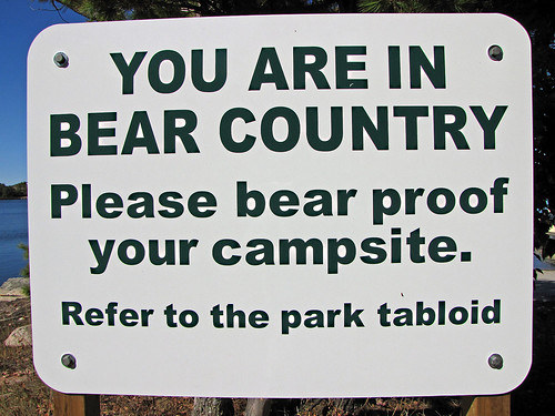
Each time I see this sign, for some reasons I think it says, "You are in BEER country"!

He told us that bears had been very active at all those campsites along Blackstone Harbour—whereas they did not attack anyone, they did a lot of damage to tens of coolers and tents, stole plenty of food and caused people to make a lot of “911” phone calls. Last, but not least, he said that our campsite # 509 had the worst reputation in terms of bear activity this summer! I’m kind of glad we didn’t know that before arriving at the park... 


P.S.

In June/July, 2010, we again visited the Massasauga and stayed for several days on campsite #509! And then we visited the Massasauga Park many times-please take a look at my blogs if you'd like to find out more about the park and our trips.