During our last visit to the Temagami area (in 2012), we were quite
enchanted by its beauty and wilderness—and we promised to come back. Although
we had paddled on Lake Temagami in 2012 and even reached the famous Bear
Island, we realized that Lake Temagami was much too big for a longer canoe
trip; strong winds could seriously affect our trip and jeopardize our safety.
We had purchased several excellent maps of Temagami; they were very useful and
after studying them and spending several hours online, I had decided that we
should go to Lady Evelyn Lake. Looking at the map, I could see that to reach
Lady Evelyn Lake from Mowat Landing, we had to paddle on the Montreal River—yet
there was one problem: namely, a sizable dam, Mattawapika Dam, along the way.
 |
| Mattawapika Dam |
There was no way we were going to portage, yet we really wanted to get to the
lake! Although we knew there were some unmarked logging roads around the lake, we
did not see any on the map and it appeared that there was no road access to
Lady Evelyn Lake. Nevertheless, there was a number of lodges on Lady Evelyn
Lake (not to mention private cottages) and I quickly found out that they
transport their guests' gear (and even the guests) in a truck-pulled trailer—no
traditional portaging required! Catherine and I contacted several lodges by
email and by phone, hoping to get more information on using this mode of
transportation around the dam or coordinating our arrival with their guests' so
that we could also take advantage of the availability of their
trailer/flatbed/truck—needless to say, not for free. Unfortunately, the replies
we received were quite disappointing. One lodge even sent me a polite reply
saying that it only provided this service to its guests and it was sorry it
could not help me—it also asked me how I found about the lodge as the got three
other inquiries in the last week of similar nature from canoeists. However,
eventually Catherine called Island Lodge and it informed her about a gentleman
living at the dam, Mitchell, who transported boats around the dam every day—it
was his job! We were quite disappointed by the fact that the other lodges did
not mention Mitchell's services to us, as if he did not exist and made us think
that the only available transportation over the dam was theirs.
 |
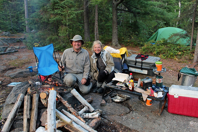
| Finlayson Point Provincial Park-our campsite no. 8 |
We left Toronto on August 10, 2014; it was very hot (+30C) and sunny. We
stopped in Gravenhurst where we were treated to free bratwurst at the
supermarket's parking lot and later had a break in a small town of Katrine off
highway 11. We decided to spend a few nights in Finlayson Point Provincial
Park, where we had camped previously. At the park's office we met Emily, who
worked for the park. She lived in the area and we chatted with her for a
while—she also confirmed that Mitchell provided transportation services over
the Mattawapika Dam. She took her time to mark the sites that were not
available so that we could select the most suitable campsite. We also spoke to
a park warden, a very nice fellow too. After slowly driving in the park for a
while, we picked site number 8. The hilly campsite was made up of open rock
with partial view of the lake. There were many chipmunks running everywhere and
it was fun watching them, sometimes they carried big pine cones or even sizable
pieces of bread that they probably stole off campers and pushed them into their
holes in the ground. Two years ago we had stayed on the adjacent campsite,
number 10, but it was taken. In addition to our campsite, we also got a
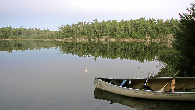
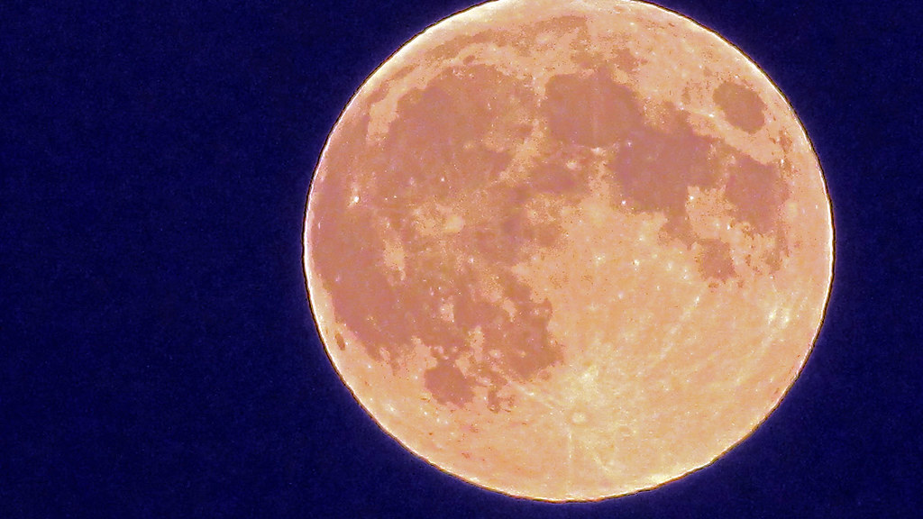
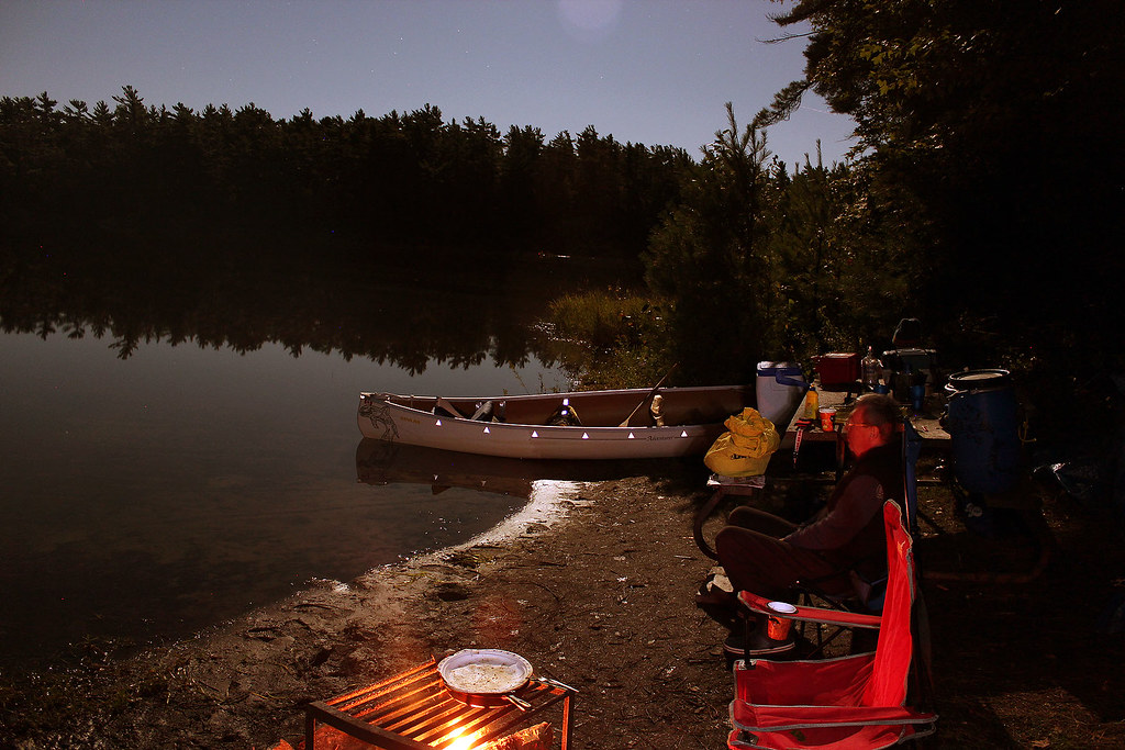
'private' dock where we kept our canoe overnight. We settled in and went for a
late-evening paddle as it was a warm, windless evening. We saw a few loons on
the lake and enjoyed their unforgettable calling. But what really caught our attention
was the beautiful, reddish moon—not only was it full, but it was also 'super
moon,' biggest full moon of 2014!
 |
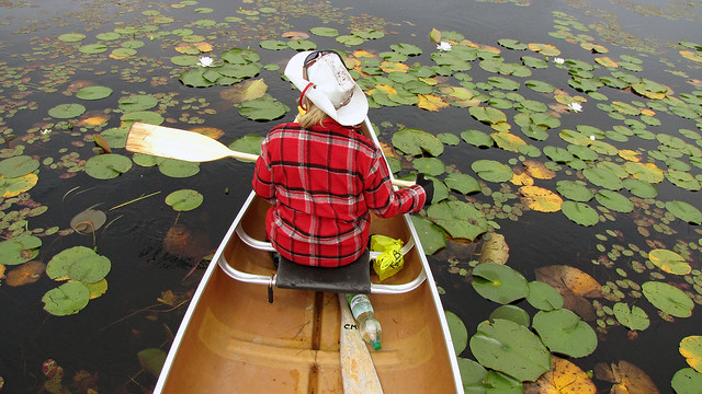
| Paddling on Temagami Lake |
Next day was hot and sunny. Our campsite was so exposed to the sun that
we even considered switching a campsite—but all the good sites had been taken
or booked. In the evening we canoed to the town of Temagami and walked around
the main buildings, but everything was closed. We enjoyed strolling along the
shores and admired wooden structures, garden sheds and fish houses. Catherine
also went to the Chinese restaurant and got the menu, just in case it rained
and we wanted to have dinner. It was getting dark and we headed back to the
campsite for a late-night campfire and a rib fest.
 |
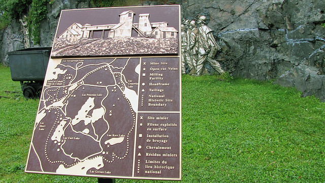
| Cobalt mine |
On Tuesday, August 12, 2014, we got up and it was pouring rain; it kept
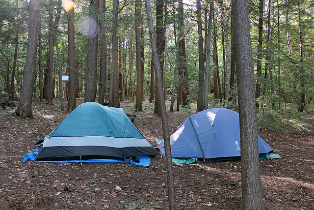
raining every day until Friday morning. Our new Eureka El Capitan 3 tent was
perfectly keeping us dry and cozy inside. Of course, we did not even think
about commencing the second part of our trip on Lady Evelyn Lake; instead, we
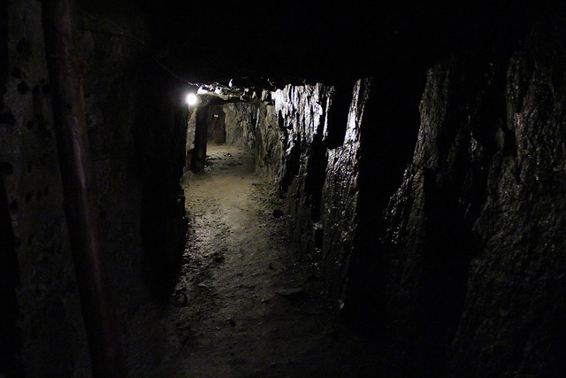
visited adjoining towns. We drove to Cobalt, the legendary mining town; after
the discovery of silver in 1903 in the area, it became one of the largest
silver producing areas in the world, people arrived in doves by train and the
next day were looking for silver (the original train station still stood
there). There are no operating mines in the area, but plenty of old mines and
mining artifacts.
 |
| Old railway station, now museum. It was here that throngs of prospectors arrived from North America, hoping to become millionaires. |
We went to the mining museum and then were transported to explore a
real, albeit long closed, silver mine! It was one of the most interesting tours
I had—I believe the only other mine I had visited was the famous Salt Mine in
Wieliczka, Poland, over 40+ years ago—which was very different from the one in
Cobalt! The tour guides, young local students, did a very good job telling us
about how hard people had to work there and describing the perils of mining.
The mine was damp and the temperature quite low—it did not vary during the
year.
 |
| At the old silver mine in Cobalt |
Miners had their own non-electric light and if by accident it was blown
out, they were suddenly surround by total—and I mean total—darkness; if they
were unable to re-start the light, they had to stay put either until somebody
padding by saw them or to the end of their 12 hour shift—once it was determined
that somebody was missing, the management sent a search party. After the tour
of the silver mine, we were about to watch a movie in the museum, but the power
was down. Due to the rain I was unable to take too many photos. We visited a
few stores and also went to a local Flea Market which was indoors and had
plenty of selection of everything you could think of.
 |
| Cobalt, Ontario |
The town of New Liskeard was different—there were lots of grocery
stores, even Canadian Tire and Staples. In fact, our awesome Scott
canoe was made by Mid Canada Fiberglass Company, located in New Liskeard.
Unfortunately, the previous year it had gone out of business... Since the
border with Quebec was nearby, we bravely crossed it (no passports
required—yet) and drove to Notre Dame du Norte. Everything was closed (after
5:00 pm) and we turned back. In Latchford we saw a memorial plaque dedicated to
Aubrey Cosens.
Sergeant Aubrey Cosens, V.C.
1921-1945
Born in Latchford
and raised near Porquis Junction, Cosens enlisted in the Argyll and Sutherland
Regiment, Canadian Active Service Force, in 1940 and transferred to the Queen's
Own Rifles of Canada in 1944. Early on February 26, 1945, his unit attacked
German forces at Mooshof, Holland, a strategic position vital to the success of
future operations. His platoon suffered heavy casualties and Cosens assumed
command. Supported by a tank, he led another attack against three enemy strong
points, which he captured single-handed. He later was killed by a sniper. For
his "outstanding gallantry, initiative and determined leadership" he
was posthumously awarded the Commonwealth's highest decoration for valour, the
Victoria Cross.
There is also the Sgt. Aubrey Cosens VC Memorial Bridge on highway 11 in
Latchford, where it crosses the Montreal River. In 2003 there was a partial
failure of the bridge, caused by fatigue fracture of three steel hanger rods.
 |
| View from our campsite at Finlayson Point Provincial Park-we could see boats, house boats and float planes |
On Tuesday morning we heard emergency vehicles sirens, which was
something uncommon. Later we found out there was a motor vehicle accident at
Marten River, an 80 year old woman was killed. Incidentally, we did get used to
hearing the passing trains' whistles, float planes taking off close to our
campsite and huge tractors trailers' passing through town—not to mention big
motor boats. It almost seemed wasteful to haul all those loads by trucks
instead trains—and we were told that there were only two trains per day; the
passenger train (Toronto-Cochrane) was discontinued not long ago. Well,
Finlayson Point is a nice park, BUT if you want to experience peace and
solitude, it is certainly NOT the PARK to stay in!
One day we were having coffee and reading newspaper in Temagami's Coffee
Time; we were just reading about some labour problems at Bombardier's plant in
Thunder Bay and about hauling subway cars to Toronto—and at that very moment we
saw a few huge trucks carrying... the very same subway cars to Toronto!
 |
| Memorial plaque at Finlayson Point Provincial Park dedicated to Grey Owl |
Because of the weather, we stayed in the tent (not very comfortable), in
the van (more comfortable, but not much space) or in the Temagami library—which
was the best place to be—and we did spend several hours there, reading
magazines & newspapers, perusing books or browsing the Internet. We also
chatted with lovely library employees, who were so nice to talk to! There was a
shelf of discontinued books for sale or donation which was a godsend. We got an
audiotape and sat in the van in the rain one evening listening to
French-Canadian police tales.
There was a very interesting woodworking shop in the center of Temagami,
just around the grocery store. We wish our van had not been packed to the hilt
so that we could buy and take with us some of the beautiful handmade wooden
ware. But we only wanted to buy wood scraps for kindling for our campfire. The
shop was closed, but the owner, a.k.a. Chief Carpenter just happened to be
driving by and told us to follow him to his main workshop, located on a side
road. He said that often bears wander around his workshop—well, the local
garbage dump was nearby and in the past I spent many an hour there, observing
tens of black bears! He made all kinds of furniture, sheds, birdhouses and
anything made of wood! He was a very nice gentleman.
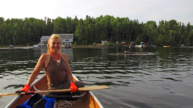 |
| On Lake Temagami |
The Temagami grocery store, “Our Daily Bread”, was, thankfully, still
running and very well stocked. I had met the owners, a couple, in 2012 and I
chatted with the wife this year too, she was a very charming lady and I wished
her all the success in this undertaking! I have to say that we were almost
surprised that everyone we met in Temagami was so pleasant and helpful!
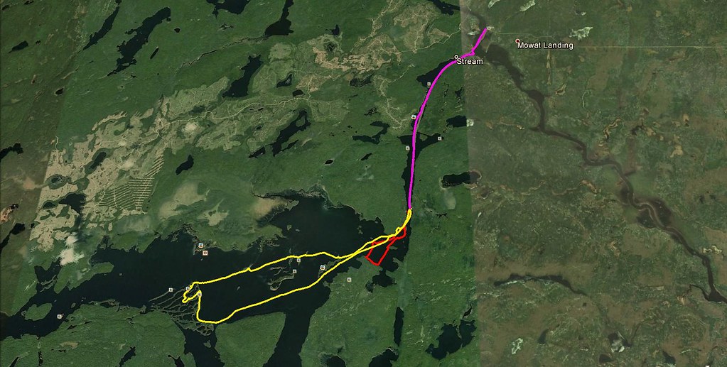 |
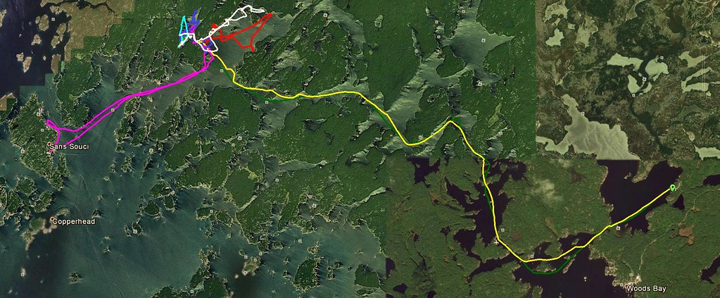
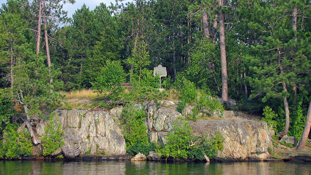
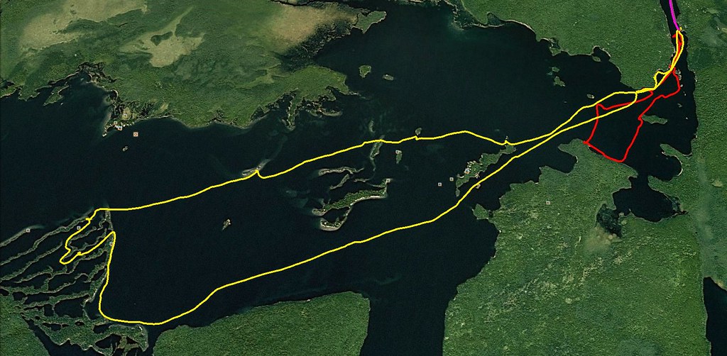
| Our paddling route according to my GPS |
The weather was still bad and it was only +9C, cold! At least we found
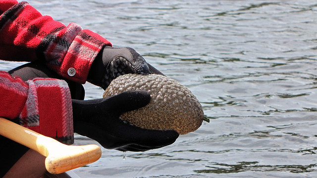
some wild mushrooms which love rain—and there was plenty of it! Funny, but when
we were camping at this park two years ago, it was so hot that one day a warden
showed up at our campsite and informed us that a fire ban had just been
implemented in the area! This time we were almost ready to abandon the second
leg of our trip—after all, we were not such die-hard canoeists to disregard the
weather and reach our destination! But on Friday (15/08/2014) the weather was
supposed to improve; it was still raining in the morning, so we packed up the
still wet tent, left the park and drove up north on highway 11 and then turned
left on Mowat Landing Road.
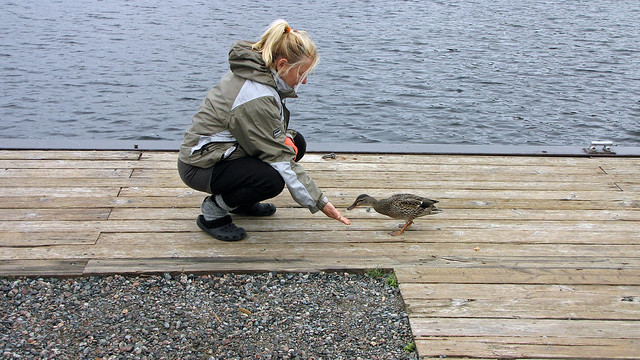 |
| Catherine feeding a friendly duck |
A group of canoeists have just finished their trip and were packing
up—they looked cold and crabby—no wonder, 4 days of cold, wet weather! I spent
some time playing with a tame, friendly duck, very eager to get some food.
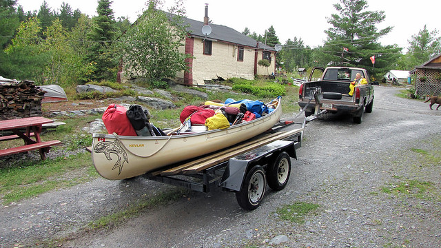 |
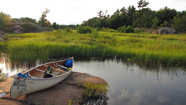
| I loved this kind of portage! |
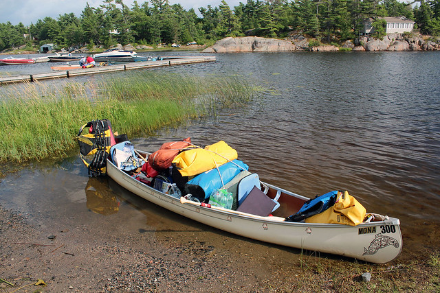
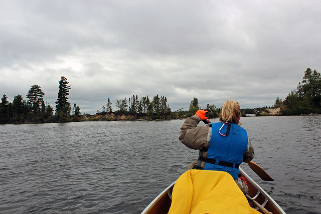
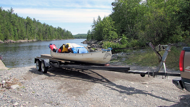
We were on the water at 03:00 pm and after a short paddle we reached the
Mattawapika Dam. A portage of about 400 meters was required, but thanks to Mr.
Mitchell, who lived there, it was not necessary if you were willing to shell
out $25.00 (the fee included the transportation on the way back, too!). While
Catherine was getting Mr. Mitchell, I was talking to four canoeists from
Hamilton, who were just going home—wet and cold. One of them showed me on the
map the campsite they stayed on and said it was very nice, with plenty of wet
wood. After a short time Mr. Mitchell arrived with his truck and a special boat
trailer. To my astonishment, our fully packed canoe floated onto the trailer,
we got into the back of the truck and slowly proceeded to the ramp on the Lady
Evelyn River. We did not even have to pay him now, but on the way back—“after all, you have to come back this way,”
he said.
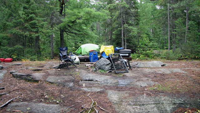 |
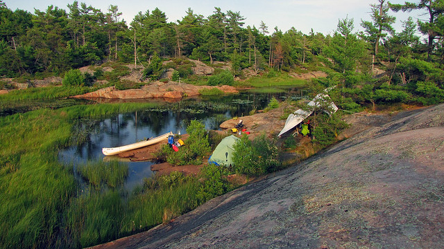
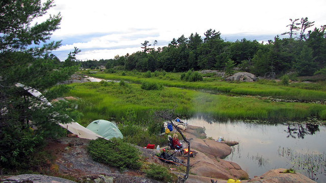
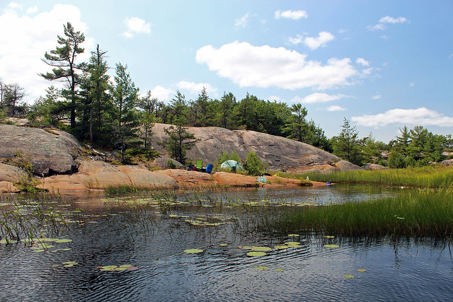
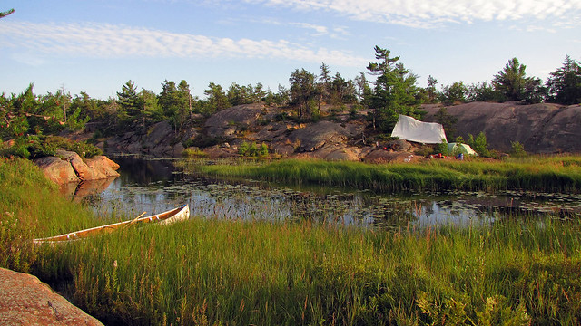
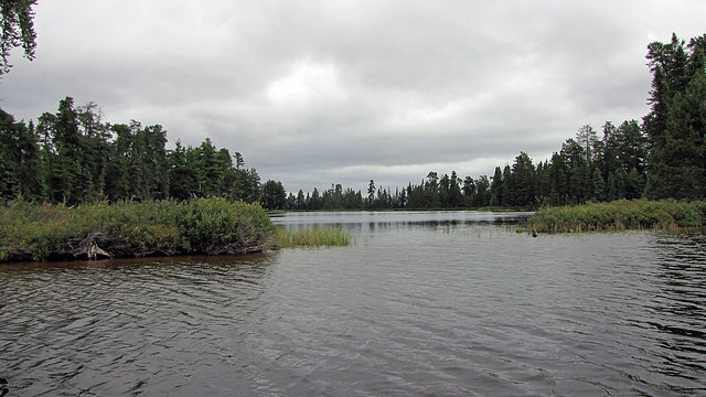
| Our perfect campsite, very close to Lady Evelyn Lake |
Since we wanted to get to the suggested campsite, both of us paddled our
hearts out. After all, there was competition on the lake and Catherine had her
sight set on that campsite. We saw a few campsites here and there, but
eventually reached the campsite just vacated by that group of four canoeists.
It was very lovely, rocky, spacious, with lots of trails to follow, lots of
wood, and a thunder box a distance away. In no time we set up the tent and
tarp, in case it rained. I sawed some wood and in the evening we had a very nice
campfire. The loons serenated us for quite a long time. I would like to add
that this area was not part of the park (i.e., Lady Evelyn Smoothwater
Provincial Park); even though there were campsites marked on the map, they were
not legally designate and we could have camped anywhere—not that it would make
much sense!
 |
| Our campsite |
On Saturday, August 16, 2014 it (again!) rained a lot and it was cold.
We read books and listened the radio about Russian ‘humanitarian’ convoys to
Ukraine and America’s involvement in Iraq in taking back the dam near Mosul. In
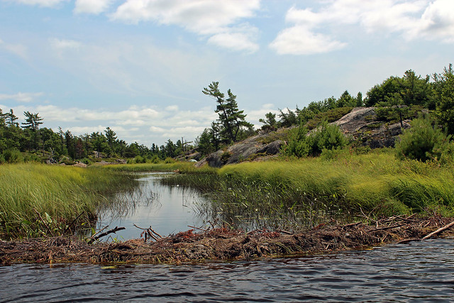
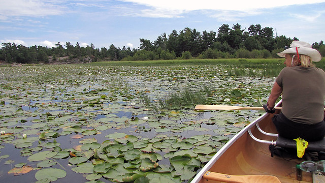
the evening we managed to go canoeing on Lady Evelyn lake; we visited a few
islands and campsites as well as went ashore in a very dense forest, with
plenty of fallen and rotting trees. It was very difficult to move around; we
saw plenty of Moose droppings and evidence of tree nibbling. Back at the
campsite, with some difficulty, we managed to start the fire, as the wood was
wet.
 |
| At our campsite-towards Lady Evelyn Lake |
Sunday was cloudy, windy and cool, yet the prognosis did not call for
rain. So, we packed up a lunch and headed to see the ‘famous’ sandbanks or sand
spits—I had spotted them on Google’s satellite map and became rather intrigued
by their peculiar contours.
 |
| Sandbanks on Lady Evelyn Lake |
Once we left the mouth of the river, we encountered a head wind and
sizable waves—Catherine was getting wet in front of the canoe. Since we had to
position the canoe at a certain angle to the waves, we were not able to take
the shortest route. Despite the waves, the canoe was very stable and we were
paddling on open waters of the lake, far from its shores. We did not see any
other canoes or kayaks on the lake, just a few determined fishermen, who were
curiously looking at our struggling canoe. A motorboat passed nearby and the
boat operator shouted,
“I admire your tenacity to paddle in such rough weather!”
“We admire ourselves, too,” we shouted back and under our breath we
added, “our stupidity, too.”
According to my GPS, we were paddling at a speed of 4 km/h. Considering
that we were paddling at our maximum, our speed should have been at least 6
km/h—meaning that we were ‘losing’ at least 2 km/h due to the head wind. Of
course, had we had a tailwind, it would have increased our speed by 2 km/h—yet,
as I have mentioned so many times in my blogs, for some totally inexplicable
reasons, at least 80% of the time were forced to paddle against the wind.
 |
| Sandbanks on Lady Evelyn Lake |
As we were paddling, I thought I saw low-lying clouds—but after a while
I realized it was a mountain range. Indeed, the area contained several
conspicuous mountains, including Maple Mountain (elevation 671 m) and Ishpatina
Ridge; that latter, with elevation 701 m, is the highest point in Ontario.
 |
| Our day trip to the dunes |
Some stretches of the lake become rather shallow—probably water levels
depended not only on the rainfall, but the Mattawapika Dam. At one point I thought
my GPS broke down—it was showing that we were paddling…. overland! Well, the
topographical map was showing the area as 'intermittent water' and that was why
I got a little confused.
 |
| Dunes-finally, we were sheltered from the wind and could have our lunch |
After almost 3 hours we reached the dunes, located in the south-central
shoreline of Lady Evelyn Lake. The maze of partially submerged forested sand
dunes developed through post-glacial wind action. The finger-like clusters of
sand dunes have been flooded, but still protrude above the waters of the lake.
The dues were formed long before the water in this lake was raised 10 m or more
as a result of hydroelectric development and wave erosion is rapidly destroying
them.
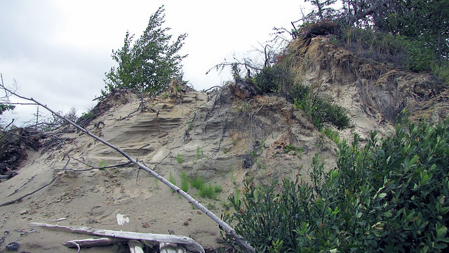 |
| Dunes |
We could see that the dunes were covered with long pine forests and
vegetation. They formed very quaint channels and inlets, which perfectly
sheltered us from the wind. We went ashore and had our lunch—Catherine brought
the stove so that we could enjoy hot pasta and soup. Since we were feeling
chilled, it hit the spot. We explored some of the ‘channels’ separating the
dunes and turned back, heading to our campsite. Again, for unfathomable
reasons, we wither paddled against the wind or had a side wind and a few times
water got inside the canoe. It was a slow and laborious journey. We passed
Ellen Island Lodge (with a small floatplane moored) and several islands, and
finally we could enjoy the calm waters near the mouth of the Lake Evelyn River;
minutes later, we were at our campsite. Altogether we paddled 18 km; with the
wind factor, that was probably close to 30 km. Wow, what an awesome excursion!
 |
| Finally back at our campsite! |
The first thing I did after arriving at the campsite was starting the
fire and I dried my wet shoes and socks; Catherine headed to th tent, jumped
into the sleeping bag and stayed the for a while to get warm. Afterwards both
of us sat around the fire, enjoying red wine and grilled ribs.
We packed up and left the next day. After reaching the Mattawapika Dam,
Mr. Mitchell again transported our canoe (and us) over the 400 m road, thus
saving us not only portaging, but many trips, as we would have to carry
innumerable pieces of our equipment! I have to say it that the $25 we paid for
both 'motorized portages' was one of the best investment I had ever made!
 |
| Once again, my favourite portage! |
There was a familiar looking float plane at Mowat Landing—yes, the one
from Temagami, that made so much noise while taking off! This time it circled
on the water for a while and finally took off.
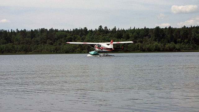 |
| Float plane with a canoe, taking off |
Once we were packed, we drove to the town of Hailebury, on the shores of
Lake Timiskaming. This was a big lake; its eastern shores, some 7 km across,
were in the province of Quebec. We drove north along the western shores of this
lake, reached highway 65, circled the lake's northern shores and soon entered
Quebec. In Notre Dame du Nort we crossed a bridge on the Ottawa River and after
a few minutes started driving south, on highway 101, again along the shores of
Lake Timiskaming. We could immediately see that Quebec was different—apart from
the fact that all signs were in French, architecture of buildings somehow
differed from that in Ontario. The scenery changed too—it was not as rugged as
that on the other shores of the lake, in Ontario. Unfortunately, we did not
have much time to stop and take a close look at whatever we wanted to see—we
wished we could come here for several days! Eventually the lake started to
become narrower and turned into the Ottawa River. In the town of Temiscaming we
crossed the Ottawa River and again entered Ontario. For a while we drove on
road number 63, then left to road 533 which eventually took us to the town of
Mattawa. From there highway 17 took us to Samuel de Champlain Provincial Park,
where we were going to spend the night.
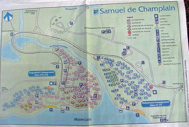 |
| Map of Samuel de Champlain Park and our campsite, #145 |
We managed to get a nice campsite
number 145, very close to the historic Mattawa River—the park was named after
the famous explorer, who travelled on this river in 399 years ago, in 1615. Of
course, Catherine wanted to go for a swim and even though the current was quite
strong, she did go into the water and slowly walked to the middle of the river.
 |
| One of the exhibits at the Mattawa River Visitor Center |
The next day we explored the park and went to Mattawa River Visitor
Center. We were the only visitors and the park employee did a great job
answering our questions. The Center had plenty of very interesting exhibits on
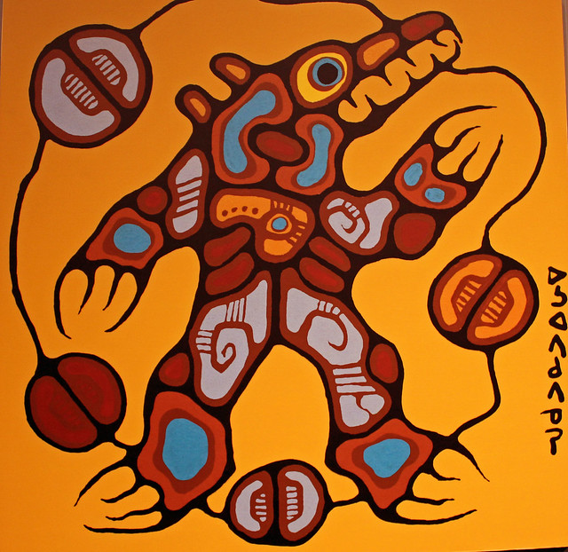
the history of the area, early explorers and voyageurs, native paintings and a
real Voyageur canoe! We were absolutely thrilled and even got a map of the
Mattawa River, hoping that one day we would
 |
| Another exhibit at the Visitor Centre |
go there canoeing!
It was an excellent trip; despite the bad weather, we managed to camp at
two parks and explore Lady Evelyn Lake—as well as visit a number of towns. No
doubt that we will again return to this area!
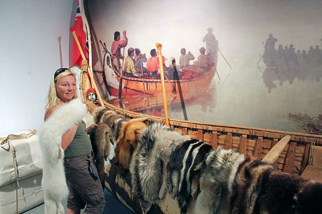 |
Catherine at the Visitor Center trying on various furs
|