Monday, November 2, 2015

CAMPING ON AND CANOEING AROUND FRANKLIN ISLAND, ONTARIO, JULY 13-19, 2014

Ten days ago (in July, 2014), while driving to Toronto back from our trip to Killarney Provincial Park over the Canada Day holiday weekend , we had stopped near Pointe au Baril at Payne Marina on Georgian Bay and struck up a conversation with a couple (Mr. Rob Harris and his wife) who had just been getting their boat ready to depart. We had asked them about canoeing and camping possibilities in the adjacent bays—and to make the story short, they had invited us for a 30 minute boat ride on their pontoon boat, along with their two adorable wheaten terriers! The area was very scenic and had plenty of rocky islands perfect for camping, yet I had been a little concerned about vast stretches of open water we would have to paddle on. We had been very grateful to them for this excursion and once we had arrived home, I spent several hours studying various maps and reading books; my research soon bore fruit and on July 13, 2014, we were on our way to a new destination, Franklin Island, located on Georgian Bay, just north of Parry Sound.
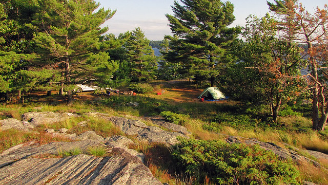
Campsite number 1039 at Killbear Provincial Park--it was amazing!

We stopped for coffee at Tim Horton’s off highway 400, in King City. Once I left the car, I immediately smelled something burning, like a metallic odor. It was one of Catherine’s Dodge Caravan tire rim—it had become very hot and we thought Catherine might have left her parking brake on, so we waited for a while to let it cool off. Several weeks later her van experienced the same problem-no, it was not due to leaving the parking brake on—she was told by the dealer that the calipers on that model were a little small and extenders were installed to solve the problem. Our second stop was at Parry Sound’s No Frills and Hart Store—they had become ‘de rigueur’ places to visit while driving up north—where we made food purchases. At Hart I bought two books that appeared to be quite interesting: “Child 44” by Tom Rob Smith and “Enrique's Journey” by Sonia Nazario.
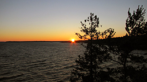
We could admire an amazing sunset-right from our campsite!

After driving for 8 kilometers, we took exit #241 to road #559, which led to many marinas along the coast and ended in Killbear Provincial Park. We turned right into Snug Harbour Road and shortly after arrived at Snug Harbour. The place was not very busy, yet once we stood on the dock, we realized it was too windy to attempt to paddle to the island. We went to the unique restaurant (Gilly’s Restaurant and Marina) for coffee; there was a group of kayakers who had apparently just completed their trip. We decided to spend the night at nearby Killbear Provincial Park and come here early next morning.

I had visited this park for the first time in August, 1991 and stayed with a friend on campsite #1030 for one week—I still remember that the August 1991 Soviet coup against Gorbachev took place while I was there. Seventeen years later I camped at Killarney over the Canada Day Long Weekend in 2008—it was a Meet-Up event which I co-organized, we booked 4 campsites and had 24 people.

Killbear has hundreds of campsites, some absolutely breathtaking, and they must be reserved months in advance. Since it was Sunday and we were only spending one night at the park, we wanted to get one of the nicer campsites.
Our campsite at Killbear Provincial Park

As we were driving around the park and looking for a campsite, we were shocked to see that hundreds of trees had been cut down! The devastation was appalling, it looked as if a tornado and hurricane had gone through this area! The reason was more prosaic—namely, it was Beech Bark Disease, which weakens American Beech trees and causes them to die and/or snap unexpectedly. Since the park has a population of up to 5,000 campers and many campgrounds were located in beach forest, the trees were in danger of falling on campsites, park roads and trails, thus creating a huge liability for the park. So, in the fall of 2012 the park began cutting down thousands of beech trees infected with the disease and in many campsites tree stumps outnumbered trees.

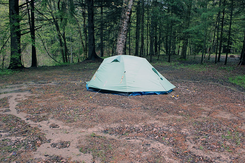
After driving for about 30 minutes, we decided to stay on campsite #1039, which, amazingly, was vacant. We quickly went to the park office to get a permit—at that very moment the last goal of the 2014 FIFA World Cup was scored and Germany defeated Argentina 1–0 to win the tournament and secure the country's fourth world title. The site was on the water and offered a breathtaking view of Georgian Bay and several islands. It was quite exposed and since it was still very windy, it took me a while to pitch the tent, but eventually I managed to set it up and in no time we were sitting on the rocks, just meters from the campsite, enjoying red wine and watching a spectacular sunset as well as a very determined windsurfer who, despite several falls, kept climbing back onto the board and continued surfing. Within minutes many campers began to congregate around us in order to watch the sunset—unquestionably, we had the best ‘seats’! From afar we saw Harold’s Point, which was a very popular spot to admire sunsets. Once the sun disappeared, I got the campfire going and we had delicious steaks. Since we had to get up early in the morning, we went to bed and quickly fell asleep, listening to the soothing sounds of the blowing wind.
Ready to depart towards the Snug Harbour Lighthouse!

On Monday, July 14, 2014, we were up at 6:00 am. As I was packing up, a tame woodpecker was relentlessly hammering a nearby tree, totally untroubled by our presence. We also saw a few deer on the road. At the Snug Harbour dock we quickly unpacked the van, put the canoe on the water and parked the van in a nearby designated lot—the parking was still free (unlike the following year).

Franklin Island was named after a famous British explorer of the Arctic, Rear Admiral Sir John Franklin (1786-1847), who passed through Georgian Bay during his second expedition to the Arctic in 1825. In 1845 Franklin set upon his last expedition to find the Northwest Passage. The icebound ships were abandoned and the entire crew of 128 perished from starvation, hypothermia, tuberculosis, lead poisoning and scurvy. In 2015 researchers from the University of Alberta and the UK concluded, upon examining the remains from cracked bones found on King William Island, that the tales of cannibalism on John Franklin’s last expedition shared among Intuit were true.
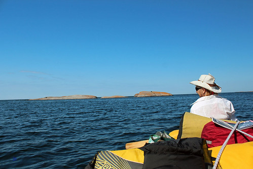
We're on the open waters of Georgian Bay

The island is egg-shaped, with jagged shoreline, approximately 5.5 km by 3 km and there is a channel (Shebeshekong Channel) between its east shore and the mainland, whose width varies from just over 100 m to 2 km. Thus, getting to the island is not difficult; considering that the prevailing winds usually blow from the west, the east side of the island and the channel are quite protected. It is made up of rocks, its shores are dotted with rocks, rocky islands, inlets and bays and there are several lakes inside the island. However, the most beautiful part of the island is facing west—i.e., the boundless waters of Georgian Bay and the Mink Islands—and it was where we were trying to bivouac! Last, but not least, it was still crown land and there were no fees of any kind.
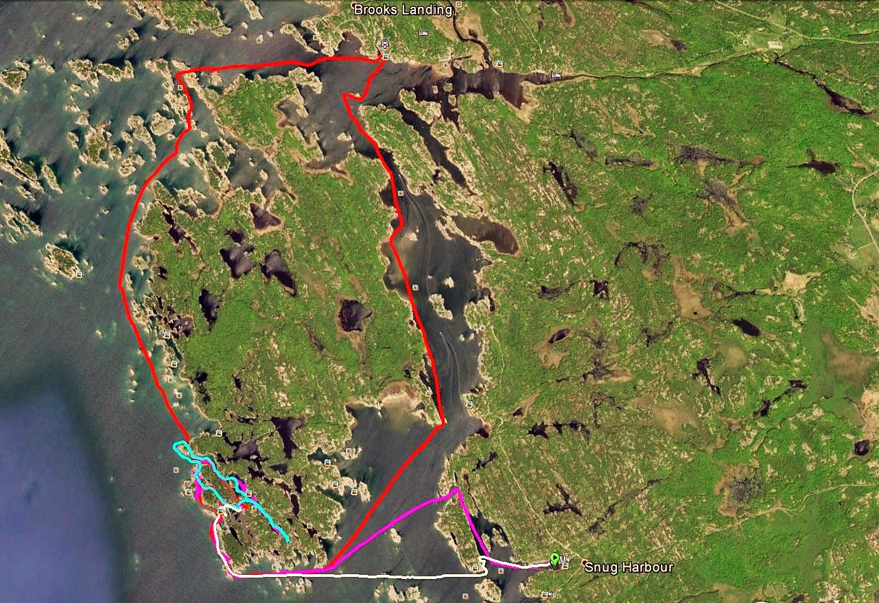
Paddling around Franklin Island

Instead of padding straight towards the island, I decided to take a longer, yet more picturesque route—before reaching the Snug Harbour Lighthouse, we turned north and paddled along the shores of Snug Island, through a scenic channel, and once we cleared the channel, we turned left and proceeded in the direction of Franklin Island. Here and there were a few rocky islands, some with private cottages. After paddling about 3 kilometers, we reached the south shore of Franklin Island and continued between several massive rocks ominously called Savage Rocks and the island’s shore, strewn with numerous rock formations and inlets. Even though there was hardly any wind, we could see—and feel—powerful tides, slowly moving up and down, probably the remnants of the recent strong winds, as if Georgian Bay were just snoozing, always ready to wake up and show its hidden mightiness. We reached the south-west tip of the island, Henrietta Point, and turned right, paddling north along its west shore, manoeuvring among massive rocky island, smaller rocks sticking out of the water as well as barely submerged sharp rocks. We had read that many canoeists camped at Henrietta Point; Catherine got out of the canoe and went to check it out. There were fire pits and the place was quite big, allowing for a sizable group to set up a camp—too big for us, we decided, and kept paddling further north. 
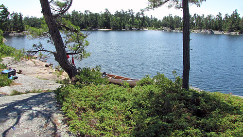
Our campsite

Less than ten minutes later we spotted an entrance to a scenic bay, then we went through a passage to yet another bay, where we reached a rocky shore. The site was idyllic and quaint: there were a few sheltered bays between the campsite and Georgian Bay, where we could paddle even in very windy conditions; on the other (eastern) side there were other inlets, separated from the other bays by a very narrow rock (over which we later portaged the canoe) and they were also accessible through a channel from Georgian Bay. Several yachts and cruisers moored there overnight, but we did not even see them from the campsite. In addition, there were plenty of blueberry bushes everywhere and fantastic rocky formations! The next day I spotted a thunder-box (i.e., an outhouse without the house), but it was located in a low area full of water and unusable.
We could see the Red Rock Lighthouse from our campsite

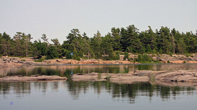
So, we were sandwiched between two bays; sitting around the fire, we had a fantastic view of the bays and the boundless waters of Georgian Bay. Just across from our campsite, some 5.5 km. away, emerged the massive shape of the Red Rock Lighthouse (equipped with a helipad), which emitted light every 10 seconds. In the north we saw the Mink Islands, stretching for about 10 kilometres—they were very gorgeous and often kayakers camped there, some islands were private and had cottages. We mulled over paddling there, but were afraid of unanticipated changes in the weather—there was nothing between our island and the Mink Islands and we would have to paddle for 5-6 km on totally open and unsheltered waters of Georgian Bay—even a relatively light wind could jeopardize our canoe and/or make it impossible for us to return to the campsite.
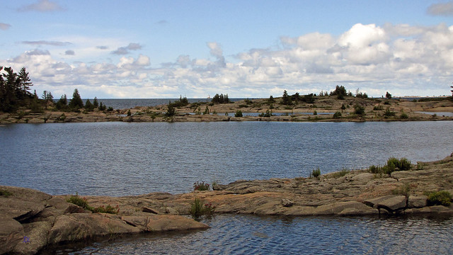
Amazing view from our campiste!

Since it was sometimes raining, I was reading the two books I had picked up at Hart. They were absolutely awesome and I got so engrossed in them that I seemed to forget where I was. “Child 44” masterfully recreated the intricacies of the barbarous, idiotic and senseless Soviet system in the 1950s, just before and after Stalin's death. “Enrique's Journey” was about a 17 year old boy from Honduras who travelled from his country via Mexico to the United States to be reunited with his mother. Both books received various awards and they certainly lived up to their glowing reviews!
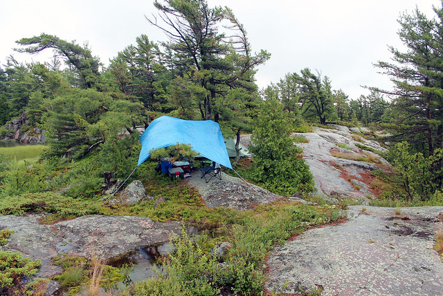
The tarp and the tent

Frustrating for Catherine, several yachts were moored in our area with incessantly barking dogs and noisy zodiacs which liked to zoom around our campsite.
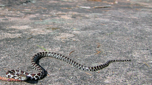
Rattlesnake or Fox Snake

One morning Catherine left the tent, barefoot, and as I was about to follow, I saw a small snake; she must have missed it by a hair! At that time we thought it was a 'baby' rattlesnake (Eastern Massasauga Rattlesnake), but once I came home and examined various photographs of snakes, I was not so sure, it might have been a small non-venomous Eastern Fox Snake as well. Interestingly, small rattlesnakes are more dangerous than adult ones as they are unable to control to amount of venom they inject! The snake was very small and if it was a rattlesnake, it had not even developed a second ring. Although it was incessantly shaking its tail (fox snakes do the same), it produced no noise. I gently put it into a paper coffee cup—then we could hear the rattling against the cup’s walls—and released it away from the tent. I also saw another snake near the fire pit, quite big, but it was only a harmless and common Garter Snake—and while canoeing, we spotted a big water snake, sun tanning on a rock, as well as a few families of goose and ducks with clumsy goslings and ducklings. Even though black bears could easily swim to the island, we did not see any. At night I set up a motion video camera near our cooler, but the only animal that I caught on tape was a benign mouse. One evening, while sitting around the fire, I heard something and shone the light in that direction—all I could see was a pair of glowing eyes. From time to time we observed a lonely muskrat in the bay, it must have had his home nearby. One day, while canoeing, we saw something absolutely exceptional—a bald eagle! It was flying relatively low over our canoe. I do not think I had seen a bald eagle in the wild before.
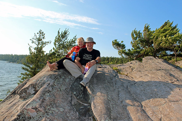
At our campsite-the view was awesome!

There was one thing we really wanted to do—namely, to circumnavigate the island! I was religiously monitoring marine weather forecasts (which were mostly correct, with one exception). Unfortunately, it was quite windy during our stay and we could only paddle in the bays; when  one day we ventured to paddle just several meters into Georgian Bay, the waves tossed our canoe left and right so much that we immediately turned back and we happy that nothing happened to us. Finally the wind subsided and in the morning and we embarked on this day-long jaunt. I was glad I had my GPS unit—there were so many islands and rocks! 
Everywhere rocks!

We saw a few cottages here and there, even spoke to some cottagers on Dick Island—then we paddled through an opening between rocks and proceeded to Dillon’s Cove Marina and Resort, where we had ice cream from the cute 1950s retro style soda shop and fries from the chip wagon on site. The view from the restaurant was spectacular! After one hour we left the marine and paddled south in the straits between Franklin Island and Narrows Island; there were quite a few motorboats and of course, we could see many building on the mainland, we were glad we were camping on the other side of the island, where we hardly saw anybody! Altogether we paddled 18 kilometers and were very glad we were able to accomplish this!
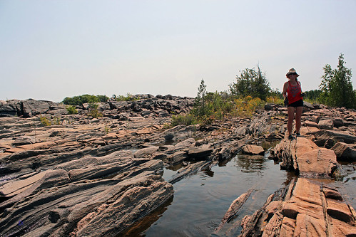
Our campsite

On Friday, July 19, 2014, we packed up and bid farewell to the island and our wonderful campsite. It was calm and we slowly reached the picturesque Snug Harbour Lighthouse and then the dock. Thank goodness, it was not a madhouse of loading and unloading…at least not yet. On our way back to Toronto we stopped at Parry Sound near the train trestle, where we had lunch near the lake. It was a beautiful evening; we drove to the impressive Charles W. Stockey Centre for the Performing Arts. It housed a 480 seat Festival Performance Hall and the Bobby Orr Hall of Fame. It sits on a waterfront site overlooking Georgian Bay. There was a performance going on, yet we were able to walk in the lobby as well as admire the sunset. Reluctantly, we then drove back to Toronto, promising to return the next year!
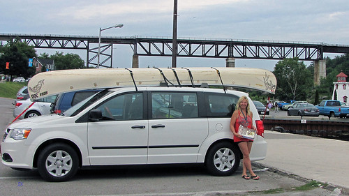
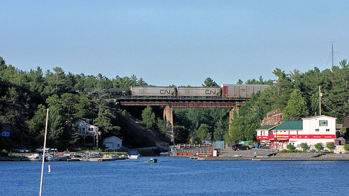
Catherine, her van and our canoe in Perry Sound


Saturday, October 31, 2015

Killarney Provincial Park, Ontario—Canoeing & Camping on Carlyle & Terry Lake, June 26-July 03, 2014

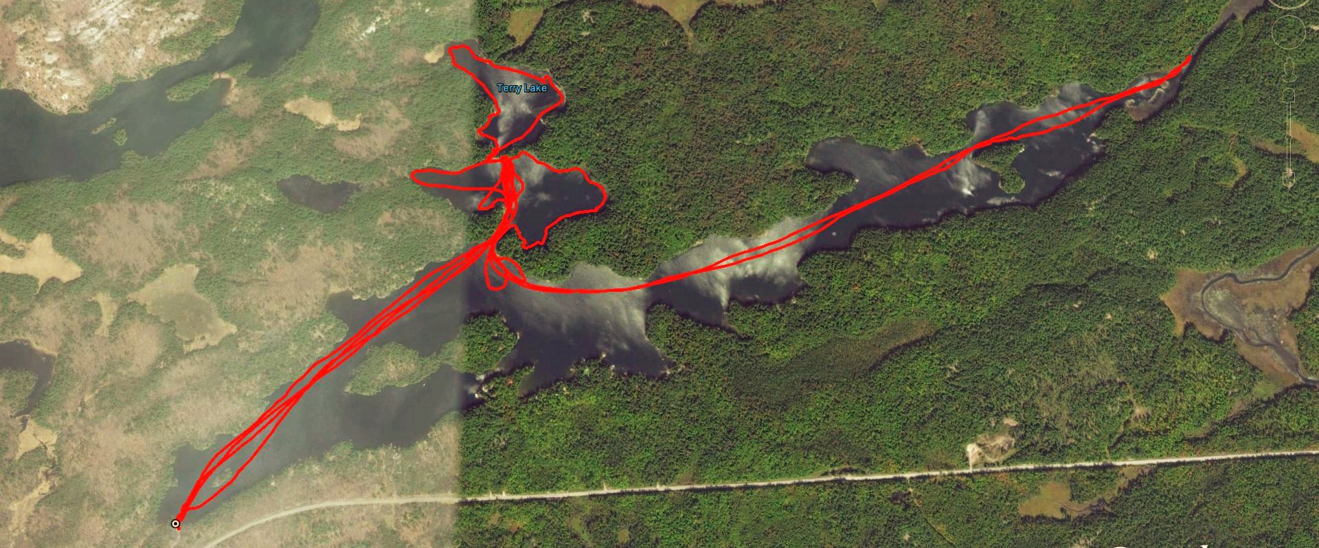
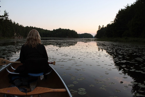
Paddling on Lake Carlyle and Terry Lake

Catherine and I spent over one week camping on Carlyle Lake in June/July of last year and we thought that it would be a wonderful idea to visit the same lake again this year. Of course, we had to make a reservation many months before — after all, Killarney is one of the most popular parks in Ontario.
 
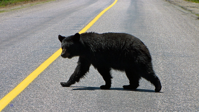
A very disoriented bear
The drive from Toronto took over 6 hours, but as always, it was very pleasant. Soon we exited highway 69 and turned into road 637 leading to the park and the town of Killarney. Not long after we spotted a smallish black bear, walking erratically along the road. We stopped and were watching it for a while. The bear appeared a little disoriented — it was walking on the right side of the road, then for a while in the middle, crossed over to the left, then again to the right and finally ran to the left, disappearing in the forest. Probably it had too much to drink the previous night…
 
Our campsite between Carlyle Lake and Terry Lake
After arriving at the Lake George office at 2:30 pm o’clock, we quickly obtained a permit, drove back to the Carlyle Lake access point, unloaded the car and at 3:30 pm started paddling. Last year we had been hoping to get campsite no. 55, yet were beaten to it by a group of young people and ended up on campsite #56, which turned out to be awesome! This time all the campsites were vacant and we were deciding between campsites no. 55 and 56. Although campsite #56 was, in all probability, better, we decided to try the other one, #55 — we had never camped there as well as it had a small waterfall and another lake, Terry Lake—as well as we could see our 'old' campsite #56. The access was a little difficult and we had to drag our stuff up the steep and rugged hill, but once we were done, we enjoyed this campsite very much.
 
On the way to the thunderbox
The thunder box (i.e. an outhouse without the house) required walking for 1 minute through a very beautiful area, but some campers were not using it, as evidenced by scattered toiled paper. Black flies, which should have vanished by then, were still active and biting. Later we had a nice campfire and went to our tent quite early.
 
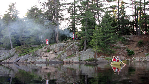
Sue and Ian (and their dog) portaging from Carlyle Lake to Terry Lake
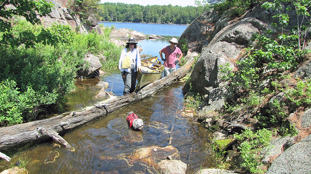
Our friends, Sue and Ian, arrived the next day at noon and all of us portaged over the waterfalls (15 meters) to the adjacent Terry Lake, where we paddled for one hour in hot sunlight. While portaging back to Carlyle Lake, Catherine fell into the water — well, at least she did not have to take a shower! While we were having lunch, Andrea and her daughter, Barbara (who had just written her bar exam) arrived. It turned out that Killarney Canoe had not delivered their canoes on time and despite 2 phone calls, they still waited for 2 hours. 
Beaver dam on Carlyle Lake

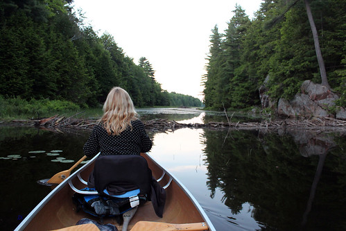
In the evening Catherine, Andrea, Barbara and I went for a paddle on Carlyle Lake. After reaching a beaver dam in the narrows leading to Johnnie Lake, we paddled back to the campsite under the glow of stars and the firelight of the campfire that Ian & Sue had built. Mosquitoes were bad and all of us had to spray. Earlier that day Barbara pointed out to a big water snake on our campsite — I was surprised to see it so far from the water!
 
Sue and Ian deparing
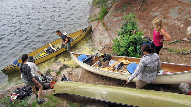
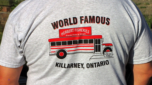
The next day Sue & Ian left mid-morning. We spent a few hours just relaxing and talking. Later Andrea and Barbara packed up and all of us paddled together, then bid them goodbye, paddled to the parking lot, chained the canoe to the tree and drove to the town of Killarney. The first thing that we noticed was that the famous red school bus, from which Herbert Fisheries Restaurant had operated, was gone! There was a new restaurant building under construction and Herbert Fisheries operated from a temporary trailer. A few days later we heard a news item on the radio about Herbert Fisheries — the owner said that when the old red school bus was being towed away, she felt like crying! 
Herbert Fisheries-indeed, very famous!

After having French fries and cold beer (the LCBO store is just a stone’s throw from there), we went to the town’s main store, Pitfield’s. Suddenly we noticed a sudden drop in temperature, the dark sky was crisscrossed by lighting and pouring rain followed. We sat at the back of Pitfield’s and watched passing boats in the channel. Once it stopped raining, we strolled along the channel and as I looked in the south-eastern direction, I could see  the outlines of Martins Island, Centre Island and West Fox Island, where we camped several years ago. Then drove to the lighthouse, but the road was washed out and we did not want to take any chances. We visited the local ‘self-serve’ airport — it was possible for pilots to turn on lights along the landing strip with their radio. It was getting dark, so we quickly drove back to the parking lot, unchained the canoe and in darkness paddled to the campsite.
 
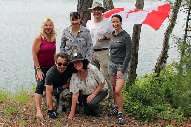
Catherine, Andrea, Jack, Barbara, Ian and Sue
Since we love having grilled steaks over the campfire, I had purchased plenty of beef steaks from Value Mart and marinated them. Unfortunately, they turned out so bad (tough, tasteless) that instead of grilling them, we stewed them, yet they were still very mediocre. It was not the first time we had such a bad experience — sometimes beef steaks are excellent, sometimes they are terrible (several months later we grilled a couple of T-bone steaks at Catherine’s house, yet they were so tasteless and tough that the next day we returned them to Value Mart). That was why from then on we decided to bring pork steaks or ribs, which are not only less expensive, but always turn out scrumptious.


During the remaining few days we paddled on Carlyle Lake — sometimes it was quite windy — and visited the town of Killarney once more, this time going to the church (that looked like a lighthouse) and the graveyard, located a few km north, along road number 637. There were plenty of familiar names — after all, most of the residents of Killarney are descendants of original pioneers who married Native women, so they were related and many possessed a Certificate of Indian Status. Such certificate exempted them from paying certain taxes, especially when they purchased goods on a reserve or the goods were delivered to a reserve. And since there was an Indian reserve close by (Point Grondine Indian Reserve — once we had camped there overnight) which straddled road 637, a new store and a gas station had just been built there. It was run by a native woman and she said that a lot of people from the town of Killarney came and bought gas there since they did not have to pay tax.
 
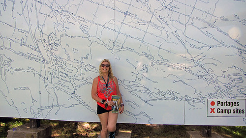
Catherine in front of the French River map near the French River Trading Post & the Hungry
Bear Restaurant
On July 3, 2014, we packed up, paddled to the parking lot and drove straight to the park, where we took a refreshing shower and changed our clothes. Then we headed towards Toronto, stopping for an hour at the Hungry Bear restaurant and visiting the amazing Trading Post, which had plenty of fascinating books, albums and videos on local history, innovative pottery (some featured paintings of the “Group of Seven” and Benjamin Chee Chee), Native Craft, postcards, clothing, shoes, colorful t-shirts, fishing equipment, knives, maps, carvings and food items. Granted, some of them are quite pricey, but are also quite distinctive.
 
Pointe au Baril
The second stop was at Pointe au Baril. We drove on road 644 and stopped at a lovely church. We kept driving until we reached Payne Marina. A couple (Mr. Rob Harris and his wife) with two very friendly dogs were just preparing to depart on their boat and while I was playing with the dogs, Catherine struck up a conversation with them: we were interested in canoeing in the area one day and were curious if there were any public islands/shores (i.e., crown land) where we could camp. Well, not only did they tell us a lot of things, but invited us for a 30 minute boat ride! Indeed, the area was very nice, although I was a little concerned about the open water we would have to paddle on. We thanked them for the tour. Incidentally, that encounter soon bore fruits. Once I got home, I spent a few hours studying the map of Georgian Bay and we ended up going to Franklin Island, where we camped for almost one week.
 
At our campsite on Carlyle Lake

Of course, I wish I could, one day, explore the interior of Killarney Park, yet it would involve plenty of often long portages. Nevertheless, we always enjoy paddling on portage-less lakes in Killarney!


Cayo Largo, Cuba—One Week at the Hotel Pelicano, January, 2014

Cuba, of course, is a (big) island—well, maybe too big for us… and we wanted to try something smaller and cozier. After some research we had our mind set on Cayo Largo del Sur, an island off the south coast of Cuba. It is approximately 25 km long an 3 km wide, has just several hotels (in its western part), an international airport and one of the best beaches in the world! Supposedly Columbus visited the island during his second voyage.

Just a week or so before our departure one of my clients called me and wanted to see me, but said that since he was soon going for vacation, we could meet at the end of January, 2014.

            “Where are you going?” I asked him.
            “We’re going to Cuba”, he said.
            “Whereabouts?”
            “Well, to a small island called Cayo Largo”
            “And when are you leaving?”
            “On January 17, 2014,” he said

I was quite astonished—what a coincidence!

            “Well, let’s then meet at the airport or on the plane,” I suggested.

He became a little confused at my rather strange proposition.

            “Why?”
            “Well,” I said, “we’ll be flying on the same plane—as well as I will be staying on the same island!”
 
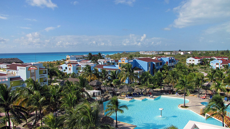
View of the Sol Pelicano form the lookout Tower
And indeed, on January 17, 2014, we did meet him and his wife at the Toronto Airport, soon boarded a comfortable Airbus 310 and left just after 6:00 pm—no deicing was necessary. We had a very good food, average wine and I could see the full moon through the window. After exactly 3 hours and 33 minutes up in the air, we had a perfect landing. By the way—I did not conduct any business with my clients at that time!

We quickly cleared the customs, but had to wait for a long time to get the bags; a very nice, energetic and playful ‘working dog’ was sniffing at the bags, spending on some bags up to 10 seconds, but apparently did not find anything. The bus ride to the hotel took just 10 minutes—the shortest bus ride from the airport to the hotel in Cuba! Our luggage was unloaded from the bus while we were checking in. We were assigned room number 4319 (“Magnolia”) and also decided to pay 2 peso per day for the room safe. At the same time we exchanged $200 into Cuban pesos (got about 176 pesos).
 
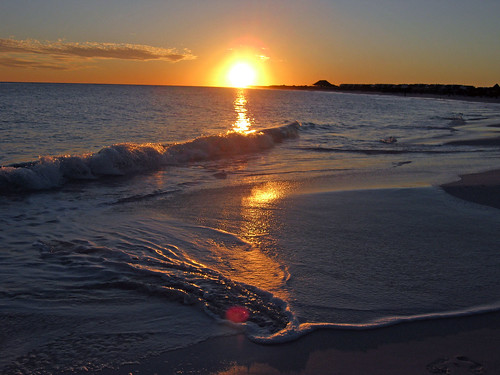
The beach in front of the hotel
The room was on the second floor and faced the ocean. It was very spacious and had a telephone, TV, even a small fridge; the best thing was a big balcony with a generous overhand to protect us from rain. We could sit there, watch the ocean, listen to the soothing sound of the waves and admire sunsets.

Next day we were up at 8:00 am, showered and went to the buffet-style restaurant for breakfast—I had 3 eggs, piece of bread, yogurt, sausage, some fruits. The orientation took place at 11:00 am in the theater by our rep, Samir. He mentioned a recent accident: according to his version, a Canadian tourist, after having several drinks, got on the scooter along with her very small baby and had an accident in which her child was killed. She was detained in Cuba for some time, but eventually released and left for Canada. He also told us about the daily train that could take us to other hotels/beaches and other activities.

Every day we were playing with the three adorable puppies; their mother did not mind!
After the presentation we went to the beach and got a type of A-frame palapa, close to the beach caretaker’s hut. After a while we noticed that he had a dog… with three small, one-month old puppies! Sometimes we played with them and even took them to the palapa! The caretaker told us about the level 4 hurricane Michelle that occurred in November, 2001: before the hurricane, all the tourists had been evacuated and only a handful of Cuban employees stayed behind on the island. The island was hit badly and in no time was flooded due to a 6 meter storm surge. Even though most hotels have been rebuilt, one, I believe has not. Also, the caretaker told us that the beach had been much nicer and it had not had any rocks that we saw—apparently the hurricane had also devastated beaches, which used to be wider and more sandy.


There was a beach bar (Beach Ranchon) just on the beach that, in addition to serving snacks and drinks, served lunch—I love various salads! One evening we had a tasty a'la carte dinner there.

In the center of the resort was a viewing tower and we claimed to the top a few times, the view was quite impressive!
 
Catherine under the palapa with one of the three puppies
We also visited the adjacent hotels: to the east it was the Villa Lindamar and it catered almost exclusively to Italian tourists; to the left the Hotel Sol Cayo Largo, which we also visited—according to TripAdvisor, it was rated number 1 hotel on Cayo Largo; ours was number 2. Indeed, it was a bit posher hotel (had 4 stars, ours only 3), with nicer décor—but we liked ours very much! My clients stayed at the Sol Cayo Largo; one day we met up went snorkeling in front of their hotel.

The local 'train' took us to the Playa Paradiso, we waded in the shallow water and walked towards Playa Sirena. Both were quite pristine and wild; once we walked farther from the beach bar, there were very few people around. I spent almost an hour wading in very shallow water whereas Catherine kept going much farther, exploring other parts of the beach.
 
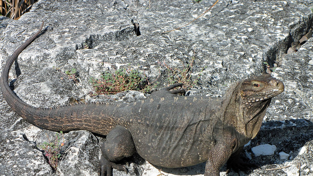
Iguana
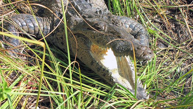
Unfortunately, the hotel did not have any bikes for rent, so we decided to go for a walk along the road near the hotel. Soon we reached the Tower Gardens (near an old water tower)—probably it had been damaged by the hurricane and now appeared to be quite abandoned. There were two ladies caring for a garden and one showed us an iguana that was suntanning near the garden. Later she told us to follow her and took us to a pond, where she pointed to crocodile sunbathing! We were observing it for a while and then he suddenly opened his mouth, giving us a good scare! We saw another iguana as well as an egret.
 
Real crocodile!
By bus we went to the village of Cayo Largo (called “Pueblito”), which is probably inhabited exclusively by Cubans employed at the tourist industry. We were told they work at the resort for several weeks and then have time off and go home; most of them live on “Isla de la Juventud”, Isle of Youth. All supplies to the island are brought by a barge and once we saw it, being towed towards the island.


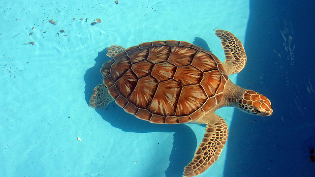
We went to a restaurant, to a dock under which we saw plenty of exotic looking fish and to the turtle farm, “Centro de Rescate de Tortugas Marinas.” We saw a bunch of colorful turtles swimming in a pool. Turtle eggs are collected from the island and brought to the farm for incubation; once they hatch, baby turtles spend some time at the farm and later are released to the ocean.

Since the airport was located close to the hotel, we could see (and her) planes arriving and departing; some were smaller Cuban planes, going to and from Havana and their pilots often had meals at the restaurant, I chatted with the a couple of times.
 
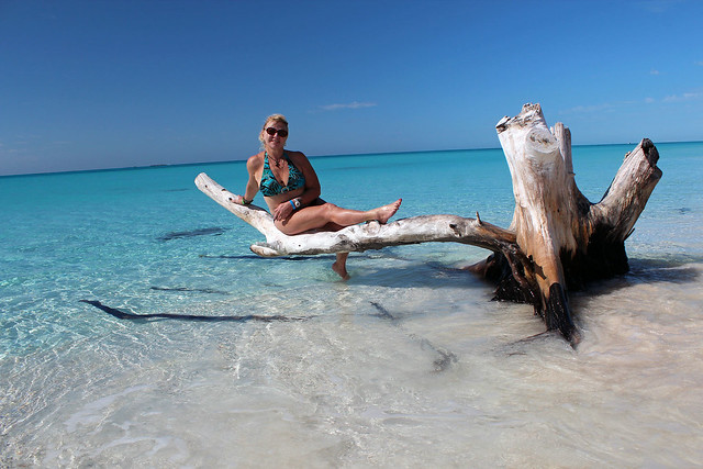
Catherina at the Sirena Beach
On the day of departure instead of taking the free bus, we hired a taxi for the short ride to the airport; this way we got them before everyone else did and could find a great table in the restaurant. Later my clients jointed us and we spent over one hour chatting before heading to the plane. As always, I made all my shopping at the airport; I was glad I had cash, as the store did not accept credit cards due to technical problems. The flight was relaxing and we arrived in Toronto around 2 am.

Normally, when we travel to Cuba, we try to explore nearby towns, see local attractions and mingle with the locals. But we came to Cayo Largo to mostly relax on the beach—and we had a great trip!


Port Burwell Provincial Park, Ontario, May, 2014

In May, 2013, we went canoeing & camping to Algonquin Park, hoping to relax, enjoy Ontario’s wilderness and serenity and especially take hundreds of photographs of ubiquitous moose wandering all over the park at that time. Well, we did not take one thing into account: black flies! There were huge swarms of those tiny insects which, along with mosquitoes, were incessantly attacking us. We were forced to cut our trip short and left the park after just two nights. Not wanting to have a similar experience, we decided to go south this time, to Port Burwell Provincial Park, where black flies are non-existent. Although the area is totally different from the northern shield country, we were looking forward to visiting this park.

Our campsite

We left Toronto on May 19, 2014, on Victoria Day—the first long weekend of the season. After driving for an hour or so on Highway 401, we eventually took country roads and soon arrived at the town of Delhi (pronounced ‘dell high’), pulled into a pleasant town park next to the Tobacco Museum and parked across a small waterfall. Delhi has been known as the Heart of the Tobacco Country—it was here that basically 100% of Canadian tobacco is grown. Yet its production has declined over the past decades due to the dwindling of the number of smokers, thus leading to the weakening of the tobacco industry. Although there are still plenty of tobacco fields, we also saw a new, exotic crop—ginseng; it takes several years for it to mature and be harvested, but there is a great demand, especially from the Chinese community and its prices are very high.

Lake Erie Beach at the park-misty and mysterious...
A lot of immigrants from different countries have settled in Delhi and thus it is a very multicultural city. We saw a Polish, German, Belgian and Hungarian halls/community centers; we were told there used to be a Portuguese and Italian center as well. When we stopped at a garage sale (Catherine’s de rigeur stops), the vendors were of Dutch origin. We noticed a black flag in front of the Polish Hall; later I found out it was due to the death of Bazyli Piekarski, who used to be the manager of the Polish Hall.

Trinity Anglican Church in Port Burwell

Our next stop was the town of Vienna. When Catherine had been doing her research, somehow she got the impression that the town resembled the capital of Austria (she was told this in a phone conversation by a park office employee). I did not want to put her right and instead told her that indeed, there was an impressive Opera building and even Bizet’s “Carmen” was on. Catherine got quite excited about attending this performance.

“Why did not you tell me that in Toronto?” she asked, “I’d have brought more formal clothes.”

Once we got to Vienna, I had a great laugh! It was a very small, farming community, with just a few dozen stores. Pointing to a bigger, barn-like dilapidated building, I asked her,

“Perhaps this is the opera house?”

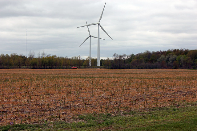
Plenty of wind turbines!

Yet there was another thing that might have put this town on the map: the Edison family once had lived there. Thomas Alva Edison’s father, Samuel Edison, had to escape to the United States after the Mackenzie Rebellion of 1837; otherwise Thomas Alva Edison might have been born in Canada! The young Thomas Edison spent many summers in Vienna with his grandfather. Interestingly, the original Edison homestead was moved to the USA by Henry Ford in the 1930s!

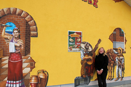
We also dropped in on a grocery store located at in intersection of two country roads. The store was doing a brisk business and it was also selling Mexican food and fabrics, mainly to the Mennonites living in the area. We were fairly surprised to see that they were using credit cards and driving all-wheel vehicles, not horse-drawn wagons!

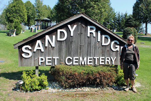
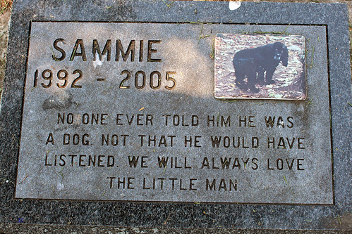
Pet Cemetery
We also stopped at a unique cemetery for pets only (Sandy Ridge Pet Cemetery, south of Tillsonburg). There were plenty of nice headstones and tributes to the Rovers and Fidos of the world and a few fitting remembrances to the feline crowd. There were even inscriptions in Polish, Jewish, Russian, Chinese and other languages. While reading those poignant words, you could immediately feel that they were so genuine, flowing from the heart.

Upon arriving at Port Burwell Provincial Park, we went to the empty registration office. According to the posted information, we were supposed to pick a campsite and self-register. The park was virtually empty and we drove to campsite #118, covered with trillium flowers, but it backed on a factory nearby. So, we continued to search for the perfect non-reserveable site and finally found a very good site no. 36.


As I said before, the park was almost deserted (5 sites taken out of 356) and even though there were plenty of campsites around, we had been enjoying total privacy… until three college-age girls arrived and set up their tent at the adjacent campsite and proceeded to play nonstop talk radio on site even when they were off site! Honestly, sometimes I do not understand people…

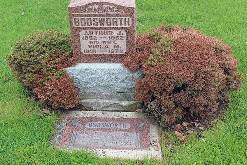
Fred Bodsworth's grave in Port Burwell

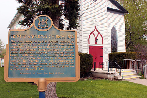
The town of Port Burwell had a very distinct lighthouse (one of Canada’s oldest), Trinity Anglican Church and a cemetery where many descendants of the town’s founder, Mahlon Burwell, were buried. While camping in Port Burwell in 2006, I had seen an announcement at the local library about Fred Bodsworth, a well-known author, journalist and naturalist who was born in Port Burwell in 1918 and who was going to visit his birthplace and sign his books. Although I was not going to be in Port Burwell at that time, I managed to buy one of his most famous books, “The Last of the Curlews” (with his autograph!). Fred Bodsworth passed away in 2012 and we visited his grave at the cemetery.

The Trinity Anglican Church was the gift of Colonel Mahlon Burwell. After John Strachan’s inaugural service at Trinity on May 22nd, 1836, the church was officially opened. Unfortunately, it was closed and we were unable see its interior.

In the nineteenth century Port Burwell was well-known for its shipbuilding; in additions, a number of fisheries operated from Port Burwell, albeit their success fluctuated, depending upon the fish stocks, which eventually declined and in 2014 only one fishing tug operated from Port Burwell—it was still possible to buy fresh fish directly from fishermen.


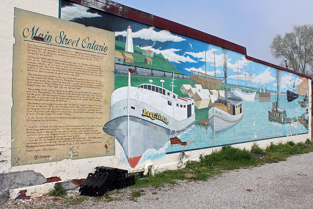
However, one of the most memorable industries in Port Burwell was coal shipping. From 1906 to 1950 a car ferry called The Ashtabula (the name is derived from ashtepihəle, which means 'always enough fish to be shared around' in the Lenape language), with built in track to transport railcars across the lake, made round trips from Ashtabula, Ohio to Port Burwell, shipping coal across Lake Erie to Canada and carrying newsprint and limestone from Canada to the United States. The coal was then transported by rail to such areas as Tillsonburg and Woodstock and often used in kilns to dry tobacco leaves. By 1955, the Ashtabula made 12,000 round trips, up to 250 trips per year in the postwar period. Eventually coal shipping stopped when diesel engines became popular. On September 18, 1958, the Ashtabula collided with the Ben Moreell, a bulk freighter, near its port in Ohio. Although there was no loss of live, her damage was so extensive that she was scrapped. At the time of the collision she was captained by Louis Sabo, who had spent 31 years, half of his life, on the Ashtabula. The preliminary inquiry by the Coast Guard accused Sabo of various infractions that led to the accident. The night before the full inquiry for disciplinary action was to be held, Capitan Sabo went to his garage, turned on his car and was found on the floor in the morning, asphyxiated. In addition, an insurance inspector, while examining the Ashtabula, fell through a hole to his death. Thus, two deaths were indirectly caused by the accident.

Mural in Port Burwell, depicting the port and the Ashtabula 

Today it is still possible to see rotted ties at the mouth of the Big Otter Creek, where the railway terminal used to be located. The rail tracks had been lifted long ago and a narrow path marks the old train route. About ten years ago I went to Port Stanley; there was a train operated by volunteers that took tourists to St. Thomas and back. One of the train’s engineers told me that he had driven the last train from Port Burwell.

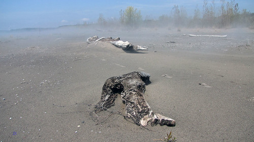
We also went to the beach (on Lake Erie). Since it had rained previously, thick mist was enveloping the dunes and driftwood — the whole area resembled a scene from a horror movie! Catherine decided to go for a walk and soon vanished in the dense mist, only to re-appear after thirty minutes.

In front of a Mennonite store in Aylmer
The next day it was raining and we drove to the town of Aylmer, where we spent a few hours at a farmers’ market a.k.a. flea market, where we bought some vegetables and sausage. Quite a few of the vendors were Mennonites. Then we drove to a nearby Ontario Police College; every police officer in Ontario must spent 13 weeks training there. We received visitors’ passes and wandered around the building. There was a small police museum and a memorial dedicated to policemen killed in the line of duty—some of them I remembered as their shootings were on the cover pages of newspapers for many days. We also saw a lot of students—all were uniformed and even carried guns, albeit not real (as I suspected—I would not like to be a teacher arguing with armed students over their grades!). Outside there was a fake mall, firing range and driving training facilities. The college was erected on the grounds of the former Royal Canadian Air Force Station, constructed during the Second World War.

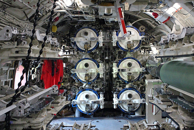
Torpedo room
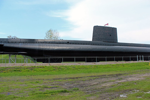
Yet the absolute highlight of this trip was a new attraction that awaited us in Port Burwell—namely, a real submarine! It was the HMSC Ojibwa, an Oberon-class submarine that served in the Royal Canadian Navy, mainly spying on the Warsaw Pact navy. After being decommissioned, in 2012 it arrived in Port Burwell and is open for visitors.

The Submarine in Port Burwell
We started in the forward torpedo room and our very knowledgeable guides told us a lot of fascinating details about torpedoes and the firing procedures. It was only possible to take photographs in that room. Then we proceeded to the Control Room, Engine Room, Motor Room and the Stern Torpedo Room. It was an absolutely captivating tour—finally I was able to personally see what I had only watched on TV! It was unbelievable how little privacy the crew had. There were six-foot bunks and there were more people on-board than regular bunks —after all, there was never time when everyone was asleep, so you slipped into any bunk that was unoccupied. Only the captain had a private stateroom—if you can call that a room, as it resembled a tiny cubbyhole-I am sure that inmates in Canadian penitentiary institutions enjoy bigger cells! The washrooms cubicles were so small that it was impossible to fit in without leaving the door open. Even though the submarine was decommissioned in 1998, the whole interior was permeated with the smell of diesel (which made Catherine feel nauseous). And then there was the motor room—according to the tour guide, the noise there was comparable to that of a jet taking off; those working there invariably suffered serious hearing loss. I could go on and on… the whole tour lasted just over 1 hour and cost just under $20, but other, more comprehensive tours are offered, which I would love to take in the future. In any case, I do not think I would be able to serve on a submarine, especially living there for months… I still prefer my canoe!

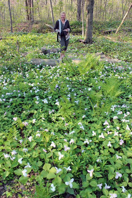
At Port Burwell Provincial Park--among Trillium grandiflorum, the
official flower of the Province of Ontario
We also drove along the shores of Lake Erie and arrived at Long Point—a very long peninsula, which is famous for bird migration and habitat—and checked out Long Point Provincial park. The open area, used mainly by RVs, was not very impressive, yet Catherine absolutely fell in love with much more cozy campsites close to the lake—they were sandy and much more secluded. Well, I know where we are going camping next May! Later we went to Turkey Point Provincial Park, with a long beach, albeit totally empty.

Overall, it was a very nice camping trip which allowed us to discover a new part of Ontario—and explore a real submarine! Although we still prefer the rugged Canadian Shield, we will certainly visit the shores of Lake Erie in the following years, especially in May or June.


More photos: https://www.flickr.com/photos/jack_1962/albums/72157660215430430