Showing posts with label canoe. Show all posts

Sunday, January 5, 2014

CANOEING AND CAMPING AT CHUTES, MATINENDA, MISSISAGI AND OASTLER LAKE PROVINCIAL PARKS & MANITOULIN ISLAND, ONTARIO. JULY 15-25, 2013


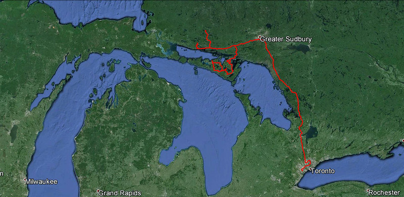
Our route from Toronto, to Chutes and Matinenda Provincial Parks, to Elliot Lake & Missisagi Provincial Park, then to Manitoulin Island, Oastler Lake Park and back to Toronto
During our trips over the past 5 years, we have visited almost every provincial park or region located relatively close to Toronto (up to 5 hours of driving) which are suitable for camping and especially canoeing and many a times have returned to the same place more than once.  Not that we were running out of locations to visit: Ontario has thousands of lakes or rivers to explore and canoe on, yet many of them are located quite far from Toronto, are only accessible by tough 4x4 Utility Vehicles or by planes, are quite remote and often require plenty of extensive and arduous portages.  Yet the good Lord, or rather the Ontario Government (or, even more precisely, the Ontario Ministry of Natural Resources) works in mysterious ways: after examining a map of Ontario, I spotted a rather new park called Matinenda Provincial Park, located 15 kilometers north of the town of Blind River.  This park, 29,417 hectares in size, was established 10 years ago (in 2003) and it offers such recreational activities as fishing, hunting, cottaging, camping, boating, canoeing, hiking, snowmobiling and swimming.  Since currently there are no developed camping facilities within the park (only unmanaged campsites), no fees of any kind are required.  There are numerous lakes in the park, Matinenda Lake being the largest.  I also contacted Ontario Parks and received a few emails from Ms. Tamara Flannigan, Park Superintendent, Missisagi & Spanish River Provincial Park Cluster.  Without doubt, the park appeared quite attractive & secluded; since Catherine never visited that area, we decided to visit it.

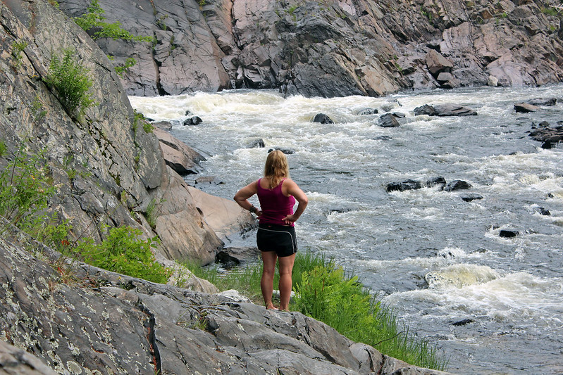
At Chutes Provincial Park, near the waterfall

We left Toronto on July 15, 2013 and headed north on highway 400.  It was a very hot and humid day and we stopped a few times to rest, did some shopping in Parry Sound, stopped for coffee & gas outside Sudbury and arrived to a small town of Massey, from where we drove a few kilometres to Chutes Provincial Park where we were going to camp overnight, as driving to Matinenda in one day and then paddling to a campsite would have been too exhausting.

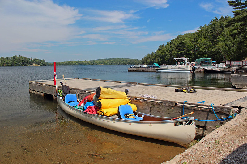
Departing from the Matinenda Lake Parking Lot
Chutes gets its name from a log chute that once diverted logs around the main waterfall during the days of river drives and horse logging.  As per the park staff recommendation, we chose campsite no. 95, just across from the scenic rapids and waterfalls and we were very happy.  Half hour later the campsite beside us was taken.  There was at least one hiking trail, but we only had time to walk down a long staircase to see the falls.  By the time we got the fire going and grilling our T-Bone steaks, the mosquitoes were in full attack, biting us horribly.  We could hardly enjoy the dinner and the cold beer and quickly retired to the tent, soon falling sleep, listening to the soothing sound of the waterfalls.

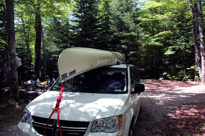
In the morning we packed up and drove to LCBO in town to buy cold beer; while parking close to the LCBO building, Catherine almost hit the wall of the building with the canoe on the roof and for some unexplained reasons was very upset when I pointed this out to her.  After driving around the town, we took highway 17, stopped in the town of Blind River at KFC (Tuesday’s Toonie Special!) and tried to find the road leading to Matinenda.  We asked a local guy how to get to the park, but he said he had never heard of it, but finally found another fellow who gave us good directions.  After driving on road 557 for less than 30 minutes, we reached its end, with a huge, busy and free parking lot.  There were cars (and boats) coming and going; while unloading the canoe, I chatted with a few people who had cottages on the lake.  Funny, but they learned from me that it was a provincial park!

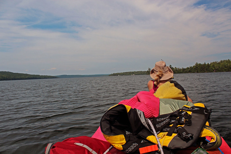
Canoeing on Lake Matinenda towards Graveyard Island

We departed at 15:30, as always grabbing onlookers’ and other boaters’ attention due to our above-average number of bulky bags piling up in our canoe (we told them we were going for a few months).  I had no clue where we were going to camp, yet according to the map the area near Graveyard Island, on Lake Matinenda, appeared to be quite appealing.  Thus, we proceeded north, moving quite leisurely in the hot and sticky weather.  We kept close to the shore on our left and after an hour a large bay opened up on the left.  We were quite tired and instead of continuing to paddle north, towards Graveyard Island, we decided to explore the bay and possibly find a spot suitable for a campsite.  Indeed, Catherine soon caught sight of a prospective campsite on the shore, but I did not like it and insisted on paddling farther into the bay. 
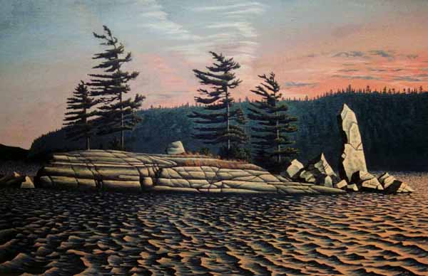
Monument Island on Lake Matinenda by Dave Moir. Yes, we were lucky to camp on this island for several days!  Reproduced by permission.  This image may be purchased from the author at  http://www.viewcanada.com
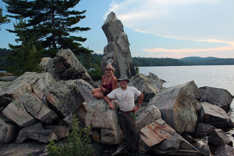
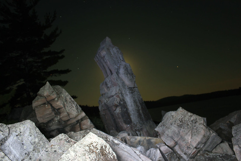
There were two islands in front of us; the one on the right was probably private, but no structure was visible on the other one.  When we reached that island, we immediately fell in love with it: it was round and rocky, approximately 100 x 60 meters, with some tall pine trees and plenty of blueberry bushes.  Its center was mostly flat and barren rock, where an old fire pit was built.  Yet the most amazing characteristic of this island was a massive, vertical rock sculpture, which looked like a giant gun, it remained us of the Monolith from the movie “2001: A Space Odyssey” (all we needed was a tribe of shrieking and jumping man-apes and I could have made an alternate beginning of this celebrated movie!).  Only when I looked at my GPS’ topographical map, I realized that the name of this tiny island was, very fittingly “ Monument Island”.

Finally we arrived at Monument Island!
We left most of our kitchen equipment along the rocky shore, several meters from the rocky monument, set up the tent nearby and continued using the existing fire pit.  A few times we saw motorboats and fishing boats, but otherwise no one disturbed our privacy.  That first night a rather peculiar phenomenon took place.  I was lying down in my tent, and since there was no wind and everything was so still and quiet, I was slowly drifting off.  Suddenly, I heard a very distinct sound of waves crashing against the island’s shores, as if a motorboat had just passed by and created such waves — however, I was certain I did not hear any boat!  The reverberations lasted for about a minute and they ceased as abruptly as they had begun.
The fire pit and our tent on Monument Island

On July 18, 2013, we paddled to south-west of the island, where the bay became narrow, meandering and eventually turned into the Blind River.  We hoped to get to another big lake, Chiblow Lake.  We kept paddling until we reached a small dam; too lazy to portage, we turned back.  It was raining for a while, but since it was hot, we did not mind getting a little wet.  Once we left the ‘mouth’ of the river, we were again on Lake Matinenda.  It was noon; there was no wind and even the birds hid in the forest, avoiding the heat and humidity.  A log was sticking out of the water; we paddled up to it.  It was the end of a much longer log submerged in the water.  As I pushed it, it slowly gave way... and then something quite remarkable happened: all of a sudden, we heard a very conspicuous sound of running water, as if a dam came open!  Since this mysterious noise started almost the instant I dislodged the tree log, I almost suspected that I inadvertently unlocked some kind of plug or obstruction, thus causing the release of the water from the lake.  

Our campsite on Monument Island
Both Catherine and I heard that sound and we were looking everywhere to see the source of this clatter, but did not spot anything suspicious.  Soon, it stopped and again nothing was disturbing our sally.  We paddled north, leaving our island on the right, then passed a rocky island full of sea gulls and cormorants.  Some of the gulls became quite agitated and swooped and dive-bombed up to scare us away — quite spooky!  We paddled through Butterfield Narrows — there were several cottages, forming a small cottage community — and saw Graveyard Island as well as many other imposing rocky hills and rugged shores.  From afar we saw the Winter Portage.  We turned back, again passing through the narrows, near Paradise Point, marked with a white cross with the following inscription:  “Paradise Point.  Lift up your eyes on HIGH, and BEHOLD who hath created these things.  Isaiah 40:26”.  On our way back we were again ‘attacked’ by some frantic birds, but once they realized we were going the other way, they ended their harassing us.

Near the rocky island full of birds on Lake Matinenda.
The birds were trying to attack us!
On July 18, 2013, as we were having our supper around the fire, we saw that the weather was not looking very promising — there were plenty of black, massive clouds, yet no rain and even some fishermen in a small motor boat were circling our island, hoping to catch a fish.  I turned on my marine radio and listened to the weather channel.  There was a weather alert, indicated by a sharp, piercing sound coming out of my radio and we heard that a severe storm was on its way into the area, with gusts of wind of almost 100 km/h.  We hurriedly finished our supper and secured the canoe and camping equipment along the shore.  Less than 15 minutes later the first drops of rain fell... and in no time a hell broke lose!  Although we were safely inside the tent, we could hear the pouring rain and soon felt very strong wind which literally pushed one side of the tent’s wall halfway inside the tent!  We had no idea if the tent would withstand such tensions. Before long, we heard thunder and saw such intense lighting that I was blinded by it, even though I was observing the lighting through the tent’s walls and fly!  At one point the thunder and lighting occurred almost at the same time — I would not be surprised if the monolith had been struck by lighting!  In spite of the rain, wind and lighting, I donned my rain gear and got out of the tent in order to check on the canoe and other stuff left on the shore.  The canoe was OK, although partially in the water (of course, it was tied to a tree, as two years ago, while we were camping in the Massasauga Park, it had floated away) and our barrels were also safe.  The lake resembled a miniature ocean: the water looked as though it was boiling, its surface seething with white caps, fierce waves savagely battering the shores.  I shuddered, thinking what if we had been caught in such a storm while canoeing!  The storm lasted for about one hour and I can honestly say that I do not remember ever experiencing such a violent tempest while camping!  The tent passed its test with flying colors; not only did it hold out, but everything inside the tent also remained dry.

Around the Monument on Monument Island!
On Saturday we got up in the morning and started packing.  During our stay on the island we noticed that there were plenty of cockroaches of various sizes; most of them congregated either around the campfire or along the shore, where we kept our kitchen equipment.

Monument Island at night
While packing, Catherine suddenly screamed — as she took the knife out of its sheath, four cockroaches dropped out!  We decided to carefully go through all of our belongings, to ensure we were not going to bring any of them home!  We did find some bugs in the box as well as several in the base of the stove; fortunately, none managed to get into our waterproof bags and barrels.  This cockroach inspection delayed our departure by almost 2 hours, but we did not mind taking all those precautions; afterwards, Catharine wanted to re-christen the island “The Cockroach Island”.

Our canoeing trips in Matinenda Provincial Park
The paddle back to the parking lot was nice and quick (7 km, 1.5 hours).  Since it was Saturday, there were many people, including a great deal of Americans.  A dog constantly barking drove everybody crazy and caused me to pack the car in a record time.  We drove to Blind River where we visited LCBO and the Bargain Shop, then took highway 17 east and turned north into road 118, leading to Elliot Lake, thus ending the first part of our trip.

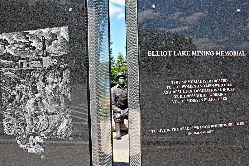
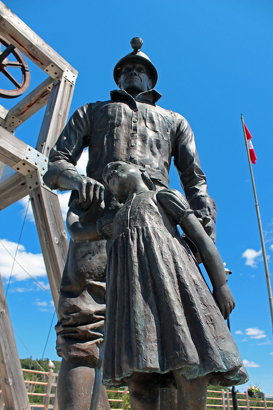
Elliot Lake Mining Memorial
Elliot Lake was established as a planned community for the mining industry in 1955, after the discovery of uranium in that area and at its peak the population reached 26,000, when the town was the world’s capital of uranium mining.  In the 1990s the last uranium mine closed and some predicted it would become a ghost town, one of many in Ontario.  However, a lot of retired people started moving in, attracted by cheap homes and the area’s beauty.  Today, the town has a hospital, malls, stores and even public transportation.

Elliot Lake Mining Memorial
I had visited this city for the first time in 1993 and I still remember a tour that I was given by a real estate salesmen.  Townhouses were priced from $20,000 to $30,000 and a house could be purchased for about $50,000!  That was why a lot of retired people, after selling their residences in Toronto for a substantial (and usually tax-free) profit, moved to Elliot Lake where they lived from approximately May till October and then drove to Florida and other southern states to spend the winter.

In 2003 I spent a week camping with a friend in the nearby Missisagi Provincial Park, located just north of the town.  One day morning my friend saw a small black bear near the campsite.  Barefoot, I bolted out of the tent, jumped in my car and started following the bear.  Eventually the car ended up in a ditch (and the poor, scared bear, vanished in the forest).  My friend Chris flagged a passing car and asked the driver to take him to the park superintendent office, who later came, attached a chain to my car and quickly pulled it from the ditch.  As I later went to thank the lady-driver for helping us (she was camping not that far from us), I realized that in 1995 she and I had participated in a canoeing trip in Florida’s Everglades and I even had a photo with her in a restaurant, having fried... alligator!  Because of her respiratory problems, she needed fresh air and she camped in the park from May till October.

Campsite no. 15 at Missisagi Provincial Park near Elliot Lake
Since Catherine had never visited this park, we decided to spent a night or so there.  Missisagi Provincial Park was supposed to be changed to non-operating status the Ontario government (along with 9 other parks), yet the city of Elliot Lake managed to reach an agreement with the Ontario government and in the 2013 season the park was still operational.  I was surprised to find plenty of campers in the park — something quite unusual for a park that supposedly did not have enough visitors and was to be closed!  Even though we were planning to stay just one night in the park, we still wanted to get a nice campsite and spent an hour, driving on meandering roads before picking campsite no. 15.  We set up the tent and talked to the couple next door waling their dog, then to a guy camping across from us and also to a family from Switzerland that rented a Travel America camper.  Catherine went for a walk and met an 80-something fellow who had had 2 hip replacements by a very bad surgeon, he experienced plenty of problems.

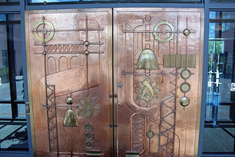
Door leading to the building where the Mining Museum
and the Canadian Mining Hall of Fame were
located.  The door originally belonged to one of
the leading mining companies in the area
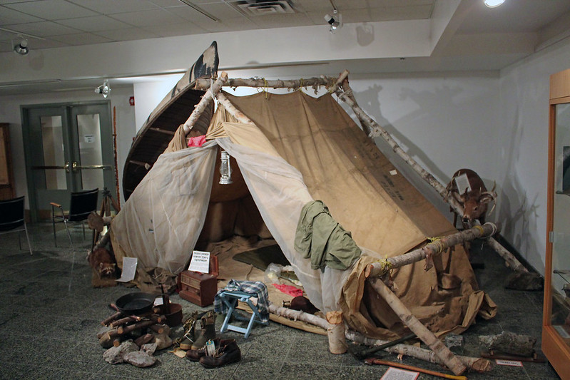
Later that evening and the next day we drove back to town where Catherine took a shower at the RV grounds and then we set out to explore the town.  I noticed a new mining monument, erected along the lake.  There was also a granite wall that listed names of miners who succumbed to various work-related diseases while working in the area’s mines.  We visited the site of the Algo Centre Mall: in June, 2012, part of a roof collapsed at Algo Centre Mall and two people were killed.  Almost every day we could listen to the news of the ongoing inquiry regarding this tragedy.  We also visited the Mining Museum, located in the Lester B. Pearson Civic Center, which I found very interesting and informative, it showed the history of the mining industry and there was the Canadian Mining Hall of Fame, showing  photographs of many prominent individuals who contributed to the mining industry in Canada as well as plenty of other historical artefacts.  Pity we did not have more time to explore this place!

W Muzeum Górnictwa w Elliot Lake
One of the most prominent mining engineers responsible for the area’s development was Stephen Boleslav Roman, a Slovak immigrant.  In the 1980s he had an impressive Cathedral of the Transfiguration in Markham built (just north of Toronto).  He died in 1988, before the Cathedral’s completion, and his was the first funeral service held in the Cathedral.  Unfortunately, due to various problems, the Cathedral was closed in 2006 and is no longer considered to be a Catholic Church.

Our route on Manitoulin Island
The next day we packed up and headed towards Manitoulin Island.  This island, with the area of 2,766 square km, is the largest lake island in the world, as well as one of its 108 freshwater lakes, Lake Manitou, is the largest lake on a freshwater island in the world!  It is possible to access the island via a one-lane Little Current swing bridge (which used to be a railway bridge, but it has not seen a train in many decades) or, in the summer, via a daily passenger-vehicle ferry, the MS Chi-Cheemaun (meaning, in Ojibwe, “Big Canoe”), which travels between Tobermory on Bruce Peninsula and South Baymouth on the island.  At the beginning of the season in 2013 the water level was too low for the ferry to dock, so for the first few weeks it was unable to operate, thus negatively affecting the local economy.  Some locals also complained that whereas the news about the inability of the MS Chi-Cheemaun to run between Tobermory and Manitoulin Island was widely publicized in the mass media, once the ferry commenced its operations, that fact was not really advertised that much and thus many potential visitors to the island incorrectly assumed the ferry was still grounded and decided to go somewhere else.

Welcome to Little Current!
A historical plaque at Swift Current Channel provided some interesting information on the importance of this channel in during past centuries, when many prominent people use this waterway:

THE ROUTE OF THE VOYAGEURS

Through this channel at Swift Current passed the canoes of the explorers, missionaries and fur traders who opened up the interior of this continent. Their route followed the Ottawa River to its junction with the Mattawa and thence via Lake Nipissing, the French River, Georgian Bay and the North Channel to Lakes Michigan or Superior. This waterway was traversed by Jean Nicolet, 1634, Pierre Esprit Radisson and Médart Chouart des Groseilliers, 1659, Father Claude Allouez, 1665, Daniel Greysolon, Sieur Dulhut, 1678, Pierre de la Vérendrye, 1727, Alexander Henry, 1761, Simon McTavish and William McGillivray, 1784, David Thompson, 1812, and Sir George Simpson, 1841.

Our campsite at Batman's Cottages and Campground
After briefly stopping in Espanola, we drove on the Little Current swing bridge and went to the Visitors’ Center, where we picked up some brochures on local accommodations and attractions.  Since almost 40% of Manitoulin’s population consists of Native People, we were quite excited when we found a brochure advertising a native campground and immediately headed there.  When we arrived, there were several native campers, ceremonial grounds, open space and nobody in the office... we did not really know where we could camp without committing any disrespect to those sacred grounds and we decided to check out another place, called Batman’s.  I entered its coordinates in my GPS unit and foolishly followed its directions.  Wow, did it take us for a ride!  We were driving on some dirt, potholed roads, passing farmlands or pastures, hardly spotting a home or barn.  We had to turn around twice as the road became impassable for the van.  At one point we drove down a very steep hill — fortunately, the canoe was securely attached to the van’s roof, otherwise it would have probably slid off!  We saw numerous wind turbines popping up on the horizon.  I knew that GPS units were not perfect, but I could not believe that they were so brainless!

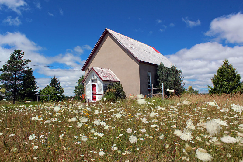
(Probably) abandoned church
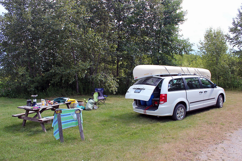
Eventually we did get on the main road (which we should have taken in the first place) and soon reached ‘Batman’s Cottages and Campground’.  There were plenty of semi-permanent structures (i.e., RV campers and mobile homes), creating a small, dynamic community, as well as several campsites.  We picked campsite no. 142, with a view of the lake.  Well, after camping on remote islands, pristine lakes and desolate shores, this place certainly did not appeal to us, but since there were not any provincial parks on Manitoulin Island, we had no choice but to stay there for at least one night.  I quickly started a campfire and once it became dark, we enjoyed the stay, going to bed before midnight.  At about 4:00 am we were awoken by some noise; Catherine got out of the tent and then quickly came back, saying that there was not a bear, but an even worse creature at our campsite: a skunk, who got into our garbage bag!  We were very quiet, although it would be extremely unlikely for a skunk to spray without any provocation.  When we got up in the morning, it had been gone and the only evidence of its earlier presence was a few pieces of scattered garbage.

At the Kicking Mule Ranch, playing with kittens!
Then we headed to a very remarkable place called Gordon’s Park, near the town of  Tehkummahk.  It offered camping, tipi tenting (which especially appealed to Catherine!), stargazing cabin, wilderness campsite, educational hiking trails, solar heated swimming pool and dark star preserve, among other attractions.  The friendly staff showed us around and even drove us several hundreds meters up the road, where the dark star preserve was located, along with a few cabins.  We liked this place and thought it would be great to one day visit it with some other couples and stay in a cabin, but since a very large group (75) of young people were just about to arrive, we were afraid this place would become too busy and noisy for us and decided to continue looking for another place; as per Gordon’s Park employee recommendation, we drove a few kilometres up the road to a place called “Kicking Mule Ranch”.

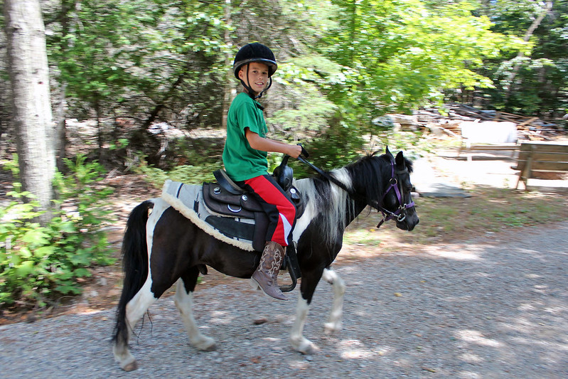
At the Kicking Mule Ranch, ponies
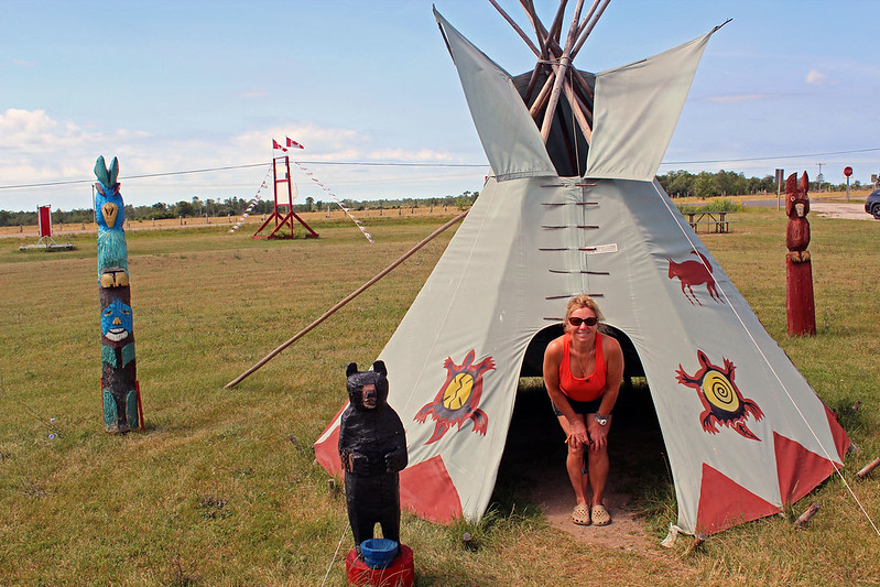
We found a ranch with 4 tiny campsites and 2 bunkers — in addition to a ranch full of horses & mules, there was a petting zoo (with rabbits, chicken, goats and lama-like animals), ponies, a very friendly Rottweiler which, as the sign warned, ‘may lick you to death’ and four lovely kittens!  We picked a campsite next to a tepee and an antique Cadillac; except for occasional horse riders, we were the only ones staying there overnight.  For some reasons, it was a magical place!  The owner’s 8 year old grandson came over to chat and later he was riding one of the ponies.
At the Kicking Mule Ranch
We drove to the post office in Tehkummahk and tried to find a public phone, but to no avail; eventually somebody let Catherine use his cell phone so that she could call her daughter in the US.  We got back to the ranch around 6:00 pm and nobody else was there.  We walked to the petting area, took a bunch of photos and played with the kitties, having so much fun!  Kitties kept trying to get in our tent.  Catherine let one sleep with her, but took it back to his igloo house around 2:00 am.  Big Rottweiler Diesel was jealous of the kitties and eventually came over to our tent, looking for our attention!  Of course, we also had a campfire.

Gore Bay 
Next day we drove across the island.  There were lots of lakes on Manitoulin, many Indian reserves as well as the Wikwemikong Unceded Indian Reserve.  By the way, ten years ago I had driven to Wikwemikong, where I visited a catholic church and the ruins of an old, burned down church.  Since I had known the Jesuit pastor of this church, Father Doug McCarthy, I hoped to pay him a brief visit, but he was away. 

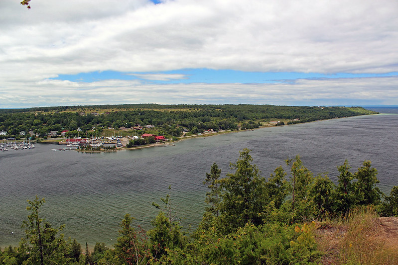
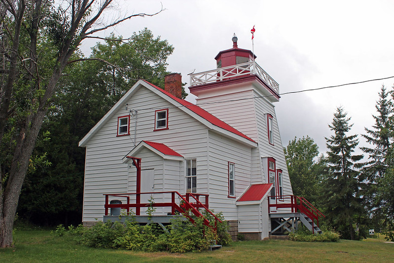
We drove on road 542 and eventually reached Gore Bay.  There was a lookout point from which we could admire the whole bay and the town, watching boats slowly coming into the bay and float planes landing and taking off.  It was quite windy, cool and rainy, yet we still drove to the Janet Head Lighthouse and then back to the Kicking Mule Ranch on road no. 540.  Fortunately, our campsite was dry, the bad weather had not managed to get hold of it.  The next morning we packed up (accompanied by one inquisitive kitty who was walking on the car and hiding under the canoe on the roof).  Before we left, we talked to the owner of the ranch, who took us to the corral and explained the difference between horses and mules.

Lighthouse near Gore Bay
We drove back to Little Current, where we looked at a Native Pow Wow site and a beautiful wooden church, with amazing architecture.  We also stopped at 10 Mile Point, from where a breathtaking view of Georgian Bay towards the town of Killarney stretched out; possibly I could even see the Fox Islands, where we had camped in 2011 and 2012.  There was a Trading Post with plenty of very unique and interesting books, Native art, paintings, carvings and original T-shirts.  The following historical plaque gave more details about the history of this area:

JESUIT MISSION TO MANITOULIN
1648 – 50

In 1648 Father Joseph Poncet, then serving at St. Marie in Huronia, was placed in charge of the Jesuit mission of St. Pierre by his superior Father Paul Ragueneau. This newly created mission was formed to serve the Algonkian-speaking Indians of Manitoulin Island and the north shore of Lake Huron. Poncet, the first known European resident of Manitoulin (called Ile de Ste. Marie by the missionaries and Ekaentoton by the Hurons), served on this island from October, 1648, to May, 1649. He returned to Manitoulin before the end of the latter year, but was compelled to abandon the mission in 1650, following the defeat and dispersal of the Hurons by the Iroquois.

At the 10 Mile Point Trading Post
After parking the van in Little Current, we walked along a waterfront, observing plenty of motorboats, cruisers and sailing boats.  We stroke up a conversation with one gentleman from Detroit whose big cruiser was docked nearby.  He enthusiastically answered my questions about his impressive craft (which, incidentally, was a new one, as the old one had perished in a marina fire in the USA, along with tens of other similar boats).  It turned out that the yacht could accommodate up to 12 people, it had two 300 or 400 hp engines, was using enormous amount of gas, costing probably well over $1 per kilometre, had all the latest electronic & GPS equipment so that once programmed, it basically navigated itself.  The more information I was finding out about this boat, the more I was glad we had our simple, light, inexpensive, paddle-powered and virtually maintenance-free canoe!
Dock in Little Current, Manitoulin Island
Later we had a cup of coffee in a nearby coffee shop and then spent over one hour in a discount shop which offered some amazing bargains!  Finally we drove over the Little Current bridge, thus officially leaving Manitoulin Island and stopped in a mall in Espanola, where we did some shopping and cold beer, and drove all the way to Parry Sound, where we arrived at Oastler Lake Provincial Park.  This is a nice park, just several km south of Parry Sound.  We had stayed a few times at this park, mostly for one night, while going to or coming from our vacation.  We got a nice campsite (no. 132), facing west and after quickly setting up the tent, we could still sit and, sipping cold beer, enjoy the sunset.  Next day we spend a few hours leisurely paddling on Oastler Lake and in the evening drove back home to Toronto.

Friday, August 31, 2012

Canoeing on Georgian Bay, South of Philip Edward Island, Ontario--August, 2012 (Part II of the Trip)

More photos from this trip: http://www.flickr.com/photos/jack_1962/sets/72157631846528711/
Blog po polsku/in Polish: http://ontario-nature-polish.blogspot.ca/2012/08/na-kanu-na-zatoce-georgian-bay-kolo.html


GEORGIAN BAY NEAR PHILIP
EDWARD ISLAND AND THE FOX ISLANDS, ONTARIO, CANADA.
Ready to commence the second leg of our trip--at the Chikanishing River put-in access point

Having just completed our 6-day long canoe trip on the Key River, Georgian Bay and in French River Provincial Park (see blog http://ontario-nature.blogspot.ca/2012/08/canoeing-on-key-river-and-georgian-bay.html), we drove to the parking at the Chikanishing Creek.  The weather was not very good, it seemed like it might rain—as well as it was windy, yet it was getting a little late (04:00 pm) and we did not have time to wait it out.  There were a few kayakers (day-trippers) and later we had a chat with a nice gentleman who took a couple of photos of us.  We departed at 04:30 pm, thus starting a new leg of our excursion!    Just before our departure, it started raining.  Undeterred, we donned our rain suits and set out.

GEORGIAN BAY NEAR PHILIP
EDWARD ISLAND AND THE FOX ISLANDS, ONTARIO, CANADA.
Our route from the Chikanishing River to our campsite on Jill Island
The weather was our main concern, yet while paddling on the Chikanishing Creek, we felt neither the wind nor the waves.  Once we exited the creek and began paddling on the more and more open waters of Georgian Bay, we started having second doubts as to whether or not we had made the right decision: it was windy, the waves were quite high and the sky looked as if it could keep raining for a while.  First of all, we had to get across the rather exposed channel between the mouth of the Chikanishing Creek and the western tip of Philip Edward Island (about 700 m).  After paddling for about 150 meters we realized that the waves became quite high; not only did we have to paddle very hard, but also had to keep the canoe at a 45 to 90 degree angle, more-less perpendicular to the waves.  We almost wished we had not gone out… but we did and now we were past the point of no return, we had to keep paddling on and hope for the best.  Each time the canoe rose and descended without taking any water, we sighed with relief.  Finally we reached South Point, went into a narrow channel (where we camped last year) and finally were paddling on much calmer and sheltered waters.  We kept as close to the shore as possible, but it was not that easy—often we did not know if the cozy bays turn out to be one-way ‘streets’—the water level was lower than that last year—or prevent us from proceeding due to underwater rocks or shoals.  However, for the first time we had an opportunity to explore the shoreline—usually we ended up paddling far from shore.  We were not out of woods yet—each time we had to cross an even short stretch of open water, the waves immediately became rough and turbulent; what was worse, numerous underwater rocks and sharp rocky reefs caused the waves to rapidly surface as they were constantly battering the rocks and our canoe, which had to proceed just meters from them.  We paddled north of Jaws Island—in the past we always paddled south of it in order to look at a very peculiar, triangular rock, which we had christened “The Kissing Rock”, as Catherine once kissed it! (It looked like a giant Hershey Kiss, but according to Catherine, did not taste like one).  This time, totally absorbed with keeping the canoe safe, we totally forgot the Kissing Rock.


GEORGIAN BAY NEAR PHILIP
EDWARD ISLAND AND THE FOX ISLANDS, ONTARIO, CANADA.
The weather was our main concern...
Soon we arrived at the entrance of Winakaching Bay.  We thought it would be nice to camp in the sheltered bay, but even though we were surrounded by various rocky islands and very elaborate rocky shores, we did not see any suitable camping space.  We paddled on the east side of Crab Island (indeed, it did look like a crab—on the other hand, most of the islands, with their rocky peninsulas and capes resemble some fantastic, multi-legged animals).  It kept raining all the time.  Looking at my GPS and the map, I hoped to find a campsite on the other side of Crab Island, but once we reached its south end, the relentless wind and choppy waves quickly made us go back.  We were happy that we managed to keep the canoe from hitting rocks that poked out of the water everywhere.  Catherine, on the other hand, seemed somewhat oblivious to present danger.

GEORGIAN BAY NEAR PHILIP
EDWARD ISLAND AND THE FOX ISLANDS, ONTARIO, CANADA.
It was raining, windy and the waves made it very difficult for us to paddle
Just across from Crab Island was Le Hayes Island and beside it, Solomon Island, where we camped last year during our trip to the Foxes (http://ontario-nature.blogspot.ca/2011/08/philip-edward-island-and-foxes.html).  We knew there were plenty of nice campsites in that area—but in order to reach Le Hayes Island, we would have to cross yet another 600 m ‘channel’, totally exposed to the winds blowing from the west.  From our vantage point, i.e., Crab Island and Severance Island, the waves did not appear to be that bad… and we decided to make the crossing.  Initially we were doing OK, but suddenly we found ourselves struggling with waves that were higher than those encountered about one hour ago after leaving the Chikanishing Creek.  Because of the direction of the waves, we were unable to paddle straight to the other shore—by doing so we would have been paddling parallel to the waves and in no time our canoe would have capsized.  So, again we had to paddle in an almost opposite direction, just to keep the canoe properly positioned towards the waves.  Instead of paddling to Le Hayes Island, we were paddling towards the open waters of Georgian Bay and close to the Heron Islands, which were incessantly whipped by the foaming waves that rolled over semi-submerged rocks around them.  We had to make a rapid 180 degree turn and ultimately paddle in the direction of Le Hayes Island.  It was not an easy task—the waves were so high that I was afraid once the canoe would be positioned parallel to the waves, even for a few seconds, it could easily be swamped or even overturned.  In fact, two years ago, while paddling around Philip Edward Island, we did such a maneuver and suddenly a big wave washed over the canoe, almost tipping it over.  Yet we had no choice—I tried to find a moment when the waves were relatively low and calm—and upon my signal, we started paddling as hard as possible.  Fortuitously, we succeeded and now were paddling eastward, towards the island.  Moreover, the canoe was now also being pushed by the waves—as the stern wave pushed it, the canoe ascended and then rapidly descended, sliding down on the wave, as if it had an invisible motor.  Later Catherine told me that each time the canoe plummeted, she thought its bow would become submerged and would take on a lot of water.  It did not, but it was a very scary ride for both of us.  We continued paddling as hard as possible and soon were canoeing alongside the shores of Le Hayes Island.  There was a small cove and Catherine wanted to stop there, but I decided to keep paddling for another 200 meters or so and finally we arrived at a small bay at the east side of Le Hayes Island.  I can honestly say that it was the worst paddling experience of my life and we were as close to capsizing as never before.


GEORGIAN BAY NEAR PHILIP
EDWARD ISLAND AND THE FOX ISLANDS, ONTARIO, CANADA.
Looking for a campsite

There was a campsite on this island, accessible from the bay: last year, when we were camping on Solomon Island, a bunch of guys had camped on that very campsite and we could see them from afar.  Catherine went ashore to examine the site, but said it was too far from the shore and it would require us to carry our stuff relatively far.  Since it was raining again—and Catherine was getting cold—we were very eager to find a decent campsite.  We even considered staying on our last year’s spot on Solomon Island (it was an awesome campsite!), yet a group of girls were already camping there.  Catherine talked to them for a while and we paddled off in search of a campsite.


GEORGIAN BAY NEAR PHILIP
EDWARD ISLAND AND THE FOX ISLANDS, ONTARIO, CANADA.
Finally, a double rainbow appeared in the sky
We paddled among numerous islands and rocks and finally reached a large hilly island, with a shore made of flat rock, perfect for a campsite.  According to my map, it was Jill Island, although I do not think it was an island anymore—the existing isthmus was probably very shallow and overgrown by now.  We saw plenty of small, picturesque rocky islands popping up from the water; Solomon Island and the distinctive pine that appeared in many of my photos last year loomed not far from us, as well as we could observe Blockbuster Island, Lowe Island and even some Fox Islands.  Although it stopped raining and a beautiful, double rainbow appeared in the sky, there were also black clouds here and there, with distinctive ‘descending’ rain patterns.  Very quickly I set up the tent on the barren rock, using plenty of rocks as pegs—it was windy and we had to secure it so that it would not be blown away!  Later I built a fire pit—due to the unrelenting wind, I had to make sure it was as sheltered as possible; luckily, there were plenty of flat rocks which made perfect shields.  Later we went for a short jaunt around the campsite and climbed the hill.  The view was striking, we even saw part of West Fox Island where we camped last year.  There were several fire pits, but they were in areas so exposed to the wind that it was impossible to use them.


GEORGIAN BAY NEAR PHILIP
EDWARD ISLAND AND THE FOX ISLANDS, ONTARIO, CANADA.
Our awesome campsite on Jill Island! (N45 57.980 W81 21.005)
That evening we genuinely enjoyed the campfire—after all, altogether we paddled 29 km and survived very bad weather.  When it got dark, the sky became very clear and I took several night photos—the moon, in its waxing crescent phase, appeared for a short time after the sunset and then was gone, so the stars and the Milky Way were perfectly visible.  Several times we saw satellites, quickly crisscrossing the sky—one of those objects was extraordinarily bright—I suspected it was the International Space Station.  The girls on the Solomon Island campsite were shooting fireworks as well as released a bright lantern that slowly floated up in the air and finally vanished beyond the forest canopy.

GEORGIAN BAY NEAR PHILIP
EDWARD ISLAND AND THE FOX ISLANDS, ONTARIO, CANADA.
View from the top of Jill Island.  Very distinctive pine tree located vis-a-vis the Solomon Island campsite we stayed on in 2011--we could see it from our campsite on Jill Island too!
Of course, we were planning to do several canoeing excursions, but as before, the weather not always cooperated.  Thus, the next day we stayed on our campsite, reading, sun tanning, swimming and exploring our island; we also took a bunch of photograph from the top of the hill.  In the evening we heard motor boats and lake cruisers, but hardly ever saw them.  One night, after the darkness fell, I heard a motorboat and soon saw its flickering lights as it was swiftly maneuvering among the islands.  Since our canoe, in spite of our attentiveness, occasionally bumped into an invisible, underwater rock, I was quite surprised by the boat’s speed.

“They must be local fishermen”, I said to Catherine, “and must know the area quite well. But even if I knew it very well, I’d be afraid to go so fast, there are so many rocks everywhere.”


In literally two or three seconds after I uttered those prophetic words, we heard a dull thump, the sound of the engine suddenly died off—and only after a few minutes the boat started to move, albeit very slowly and quietly (maybe this time it was using a small electric trolling motor).

GEORGIAN BAY NEAR PHILIP
EDWARD ISLAND AND THE FOX ISLANDS, ONTARIO, CANADA.
Catherine on the top of Jill Island
A few weeks before our trip I got interested in “Geocaching”, an outdoor recreational activity in which the participants use a Global Positioning System (GPS) receiver or mobile device and other navigational techniques to hide and seek containers, called “geocaches” or “caches”, anywhere in the world.  Initially I wanted to hide a few caches around the Key River and Philip Edward Island, but when I realized that once I did it, I would have an obligation to maintain my caches, I decided against it.  However, there were two geocaches hidden ‘just around the corner’—one on Solomon Island, another one on Martins Island (one of the Fox Islands).  Catherina also got curious about this activity and we decided to go to Solomon Island and find it.
GEORGIAN BAY NEAR PHILIP
EDWARD ISLAND AND THE FOX ISLANDS, ONTARIO, CANADA.
Our 2011 campsite on Solomon Island
First of all, we paddled to a small bay just across Solomon Island where a few days ago we had seen a house boat docked there.  Indeed, it was still there and it was certainly not going anywhere!  It was not a typical houseboat—somebody (probably he also owned property there) made a simple house on aluminum floats and moved it to the bay when the water level was much higher—now it was almost resting on the rocks.  We took a few photos of this inventive creation and paddled to Solomon Island.  The girls had been gone, leaving behind a Canadian flag.  So, we re-visited our old campsite and took a few photos.  We also noticed a few people camping on Le Hayes Island.

GEORGIAN BAY NEAR PHILIP
EDWARD ISLAND AND THE FOX ISLANDS, ONTARIO, CANADA.
Spectacular view from the summit of Solomon Island!
According to my GPS unit, the geocache (called ‘Georgian Bay Delight’) was located in the middle of the island, on its highest point.  We slowly made our way up, carefully hiking on rocks and finally reached the summit.  WOW, what a magnificent, spectacular 360 degree view!!!  I started to take a lot of photographs and had almost forgotten about finding the geocache.  Anyway, it was supposed to be in the island’s highest location, where a few pine trees were growing (we could see them from our campsite).  Catherine and I kept looking and looking… and finally I found it!  It was a perfect location to place a geocache—even if I had not found it, the view was priceless—it was like being in some kind of fantasy land, surrounded by multitudes of pinkish rocks and islands, with wind-swept pines everywhere.  Not only did we see our campsite, but also the Foxes, Philip Edward Island, the majestic La Cloche Mountains with their characteristic white quartz resembling snow and the mountains’ most prominent peaks, the Crack and Silver Peak; the town of Killarney, Manitoulin Island and probably the shores along the mouth(s) of the French River.  Just meters from the geocache location we found a poignant monument dedicated to “Rocky, the canoe dog”.

GEORGIAN BAY NEAR PHILIP
EDWARD ISLAND AND THE FOX ISLANDS, ONTARIO, CANADA.
View from the top of Solomon Island--we could even see our campsite on Jill Island!
When we circumnavigated Philip Edward Island 2 years ago, in August, 2010, in my blog about that trip (http://ontario-nature.blogspot.ca/2010/08/canoeing-around-philip-edward-island.html) I quoted passages from a book by Anna Brownell Jameson (1794-1860), a British writer, who in 1837 travelled, mainly in a canoe, from Sault Ste. Marie to Toronto, visiting such places as Manitoulin Island and the site of the town of Killarney, as well as along the shores of Georgian Bay, just south of Philip Edward Island and near the mouth of the French River.  During her extensive travels she was thrown “into scenes and regions hitherto undescribed by any traveler and into relations with the Indian tribes such as few European women of refined and civilized habits have ever risked and none have recorded”.

The result was her book titled “Winter Studies and Summer Rambles in Canada”, published after her return to England.  This book gives a very vivid picture of the area, people and customs of the time.

GEORGIAN BAY NEAR PHILIP
EDWARD ISLAND AND THE FOX ISLANDS, ONTARIO, CANADA.
On the top of Solomon Island, after finding the geocache
While travelling south of Philip Edward Island towards the south, Anna Jameson also appreciated the beauty of the area:

“This day we had a most delightful run among hundreds of islands; sometimes darting through narrow rocky channels, so narrow that I could not see the water on either side of the canoe; and then emerging, we glided through vast fields of white water-lilies; it was perpetual variety, perpetual beauty, perpetual delight and enchantment, from hour to hour. The men sang their gay French songs, the other canoe joining in the chorus”.


And later, she wrote:


“We landed at sunset on a flat ledge of rock, free from bushes, which we avoided as much as possible for fear of mosquitoes and rattle-snakes; and while the men pitched the marquees and cooked supper, I walked and mused. I wish I could give you the least idea of the beauty of this evening; but while I try to put in words what was before me, the sense of its ineffable loveliness overpowers me now, even as it did then. (...) The lake lay weltering under the western sky like a bath of molten gold; the rocky islands which studded its surface were of a dense purple, except where their edges seemed fringed with fire. They assumed to the visionary eye, strange forms; some were like great horned beetles, some like turtles, some like crocodiles, and some like sleeping whales and winged fishes; the foliage upon them resembled dorsal fins, and sometimes tufts of feathers. Then, as the purple shadows came darkening from the east, the young crescent moon showed herself, flinging a paly splendor over the water. I remember standing on the shore, ‘my spirits as in a dream were all bound up’—overcome by such an intense feeling of the beautiful—such a deep adoration for the power that had created it, I must have suffocated if
But why tell you this?

Sketches by Anna B.
Jameson
Sketch by Anna B. Jameson "Night Encampment"  made on August 6, 1837
Even though those words were written over 170 years ago, the splendor and beauty of the area, as well as the emotions they stir have not changed!

While admiring the spectacular beauty of the surrounding area, we spotted a few black clouds with distinctive descending rain patters—yes, it was raining over Manitoulin Island and we were not sure if that dark mass would not move over here.  So we commenced our descent on the steep rocks.  At one point Catherine got scared by a large, albeit harmless garter snake, our third snake during the whole trip.  We got into the canoe and paddled to the campsite, but it did not rain that day.

GEORGIAN BAY NEAR PHILIP
EDWARD ISLAND AND THE FOX ISLANDS, ONTARIO, CANADA.
View from Solomon Island towards Manitoulin Island--it was raining there!
The next day we were up early in the morning and before 10:00 am hopped into the canoe and paddled back to the car—no, it was not the end of our trip yet; we left the tent and most of our belongings on the campsite—we just wanted to visit the town of Killarney, go to the famous Herbert Fisheries Restaurant, buy fish and chips and get cold beer.  It took us under 2 hours to reach the Chikanishing parking lot—we briefly stopped at the Kissing Rock and took a few photos around it.  At the parking lot we chained the canoe to the dock and first of all, drove to Killarney Park where we had a very refreshing shower!  Later we drove to the town of Killarney where we got an excellent (and expensive) fish and chip dinner, bought two cans of cold beer and sitting at the LCBO dock, enjoyed our food and drinks while observing passing boats in Killarney Channel.  I wrote a little about the history of this town in my 2010 Philip Edward Island Blog, but let me once again mention it here.

GEORGIAN BAY NEAR PHILIP
EDWARD ISLAND AND THE FOX ISLANDS, ONTARIO, CANADA.
Catherine and the Kissing Rock

Because of its natural channel between Killarney Island and the mainland and because it was located on the main canoe route to the west, this location was known and used by both Natives and white explorers as a shelter.  Such men as LaSalle, Marquette, Etienne Brule as well as many fur trades and explores passed through the channel.  That was why Killarney’s earliest name, in the Ojibwa language, was Shebahonaning, meaning “safe canoe passage”.  In 1820 Etienne Augustin de la Morandiere established a small trading post there.  His wife, Josephte Sai-sai-go-no-kwe, ‘Woman of the falling snow’, was from the Odawa (Ottawa) Nation and a close relative of the famous Chief Tecumseh.  In 1854 a post office was opened.  The town had only been accessible by water—and later by air—until 1962, when the present highway no. 637 was built.

Life in this isolated town must have often been tough and difficult, yet a lot of ships visited Killarney, picking up fish and later, bringing tourists.  In the winter it was possible to reach towns and communities on Manitoulin Island as well as traverse south to Byng Inlet.


GEORGIAN BAY NEAR PHILIP
EDWARD ISLAND AND THE FOX ISLANDS, ONTARIO, CANADA.
Old fishing shed in Killarney, built at the end of the 19th century
A website about Killarney’s history created by Adele Loosemore (http://www.killarneyhistory.com/) recounts one interesting story about mail delivery to Killarney:

“Killarney was on the mail route from Penetanguishene to Sault Ste. Marie...on the 25th of November 1872, John Egan, contractor for carrying the mail, despatched two Wikwemikong Indians with the Soo mail for Penetang. They were Beaubien and his son-in-law, Moses Ganewebi. They fell in a storm and made very slow headway. On the return trip, on the 18th of December following, Moses arrived here from Byng Inlet with Alexandre Proulx and Pierre Pilon. He had the following story to tell:


I and my father-in-law were walking on the new ice, a few miles past Byng Inlet, intending to get ashore at a point a little further on. The wind was increasing from the northwest. We noticed that the ice was fast drifting from shore. We both ran towards the shore, but the ice had already moved several feet away and we could not get back to the land. I jumped into the water and swam ashore to a small island about an acre in size.


My father-in-law laid the mail bags on the ice, sat down on them, and waving his hands to me, bid me good-bye forever, with compliments for his friends of Shebwaonaning (Killarney) and Wikwemikong. As the ice was drifting fast, poor Beaubien was soon lost out of sight.


I remained on the island for two days and two nights without food or fire, tramping and running all this time to keep from freezing. At last some new ice formed, and with the help of two poles, I crawled on my hands and knees to the mainland and reached Byng Inlet, where I was well taken care of for a few days, and here I am.


In August, 1837, during her canoe journey from Sault Ste. Marie to Toronto, Anna B. Jameson passed through the narrow channel between George Island and the mainland, where the present day town of Killarney is located.   This is how she described this event:


Sketches by Anna B.
Jameson
"The chief Yellowhead Encampment on Lake Huron"--sketch by Anna B. Jameson depicting Killarney Channel and the encampment she described in her book
“About sunset, we came to the hut of a fur-trader, whose name I think, was Lemorondiere. It was on the shore of a beautiful channel running between the mainland and a large island. On a neighboring point, Wai,sow,win,de,bay (the Yellow-head) and his people were building their wigwams for the night. The appearance was most picturesque, particularly when the camp fires were lighted and the night came on.”

And so 175 years later we were now sitting on the shores of this channel and enjoying its beauty!  Later we went to a museum in Killarney (located vis-à-vis the Post Office and next to an old jail) and spent almost an hour there, looking at many artifacts, photos and historical records.  Later that day we visited the cemetery, located at the back of an impressive Roman Catholic Church resembling a lighthouse.  A lot of people buried there were the descendants of the founder of Killarney and had the surname “La Morandiere” (we were told that the town’s founder, Etienne Augustin de la Morandiere, was also buried there, but we could not locate his grave; later I read that he was buried in Wikwemikong on Manitoulin Island).  We found a grave of Nancy Solomon Pitfield—there was a small park named after her (which last year we used to launch our canoe), with the following inscription on a plaque attached to a boulder in the park:

GEORGIAN BAY NEAR PHILIP
EDWARD ISLAND AND THE FOX ISLANDS, ONTARIO, CANADA.
Killarney Channel
Nancy Solomon Pitfield, October 21, 1885—August 11, 1965.  For nearly half a century, “Aunt” Nancy Pitfield was Killarney’s angel of mercy. Born in this community, she studied nursing in Winnipeg and Montreal, where she graduated from Hotel Dieu Hospital.  She returned to this then isolated village and married George Pitfield in 1919.  She dealt with grave illnesses and accidents without the aid of a doctor, sometimes reaching outlying patients by dogsled or snowshoes.  She expertly set dislocated hips and knees, delivered 512 babies, and once performed an emergency appendectomy, always with an encouraging word and a smile. Remembered always for her dedication and love for people.

There were many Solomons buried in the cemetery and most likely Solomon Island was named after one of them.  According to the website about the history of Killarney, http://www.killarneyhistory.com/, the forefather of all the Solomons of Killarney was Ezekiel Solomon, the first Jewish immigrant to settle in what is now the U.S. state of Michigan.  He was born around 1735 in Berlin, Germany and arrived at Mackinac Island, in the narrows between Lakes Michigan and Huron, in 1761 and quickly established himself as a fur trader.  By 1765, he and his partner were operating the Solomon-Levy Trading House at Fort Michilimackinac, then a British military post. In 1779, he joined a group of businessmen to open a general store there.  Ezekiel married Louise Dubois, also called Okimabinesikwe, a Roman Catholic, and they had six children.  As the Americans and British battled over various lands at the head of the Lakes, Ezekiel re-established his business, first at St. Joseph Island, then Drummond Island, to avoid coming under American rule.  Ezekiel died around 1808.  All of the locations at which he had operated his businesses were eventually turned over to the Americans.  In 1828, the Solomons still living at Drummond Island migrated to Penetanguishene when the British garrison transferred there.  The Killarney Solomons are all descended from William (third son of Ezekiel and Louise) and Agibicocona.


GEORGIAN BAY NEAR PHILIP
EDWARD ISLAND AND THE FOX ISLANDS, ONTARIO, CANADA.
Town of Killarney


We also went to Pitfield’s, the town’s only general store and later to Killarney Mountain Lodge (originally built as a trucking magnate retreat, it saw a lot of famous guests, Jimmy Hoffa of Teamsters fame being one of them).  As I was waiting for Catherine in the restaurant lounge, I noticed a bulky (260 pages), hardcover book on history of Killarney area, “Georgian Bay Jewel: The Killarney Story” by Margaret E. Derry.  After having a browse through it, I found it so fascinating that later Catherine bought it for me as my birthday gift (and I was not disappointed—I spent hours perusing this fascinating book and admiring many captivating photographs, paintings and sketches that greatly enriched my reading experience; it can be ordered from http://www.poplarlane.net/).

We drove back to the Chikanishing Creek, loaded the canoe and in no time were paddling back to our campsite—this time the wind was rather light and we did not have to worry about anything happening to the canoe!

GEORGIAN BAY NEAR PHILIP
EDWARD ISLAND AND THE FOX ISLANDS, ONTARIO, CANADA.
Paddling from our Jill Island campsite to Martin Island and back

The next day (August 22, 2012) we were planning to go to Martins Island in the evening to look for the geocache, but the wind was too strong—the trip would require paddling on a few stretches of open water.  We decided to go to bed early, get up in the morning the next day and go paddling.

GEORGIAN BAY NEAR PHILIP
EDWARD ISLAND AND THE FOX ISLANDS, ONTARIO, CANADA.
View from our campsite on Jill Island in the morning
Indeed, we were up before 06:00 am.  There was no wind whatsoever and we sat on the rock for a while, having breakfast and enjoying the sunrise, the mirror-like water surface and the surrounding landscape.  Again, I remembered how Anna Brownell Jameson described having breakfast on the morning after leaving Killarney and canoeing somewhere close to the area we were staying in:

Sketches by Anna B.
Jameson
Sketch by Anna B. Jameson "Dinning". It was made on August 8, 1837, just after she left the site of Killarney Channel
“We breakfasted this morning on a little island of exceeding beauty, rising precipitately from the water. In front we had the open lake, lying blue, and bright, and serene, under the morning sky, and the eastern extremity of the Manitoolin Island; and islands all around as far as we could see. The feeling of remoteness, of the profound solitude, added to the sentiment of beauty: it was nature in her first freshness and innocence, as she came from the hand of her Maker, and before she had been sighed upon by humanity—defiled at once, and sanctified by the contact. Our little island abounded with beautiful shrubs, flowers, green mosses, and scarlet lichens. I found a tiny recess, where I made my bath and toilette very comfortably. On returning, I found breakfast laid on a piece of rock; my seat, with my pillow and cloak all nicely arranged, and a bouquet of flowers lying on it. This was a never-failing ‘galanterie’, sometimes from one, sometimes from another of my numerous cavaliers’”.

Who knows, maybe it was the island we were staying on?


Before 07:00 am we were on the water and commenced paddling towards Lowe Island, which was 10 minutes from our campsite.  On this island, as well as on another island just south-west of it, stood some dwellings.  We tried to paddle across the channel between the islands, but it was too shallow, so we went around the small island and entered the ‘narrows’ from the other direction.  There was a beaver lodge—and a beaver lazily swimming nearby.  The building on Lowe Island resembled a small resort, yet nobody was there.  Perhaps it was a private fishing/hunting club, which member can use whenever they want.


GEORGIAN BAY NEAR PHILIP
EDWARD ISLAND AND THE FOX ISLANDS, ONTARIO, CANADA.
Martins Island
Next we paddled to East Fox Island and then towards Martins Island.  Last year, having spent a couple of nights on Solomon Island due to the windy weather, we finally paddled early in the morning to West Fox Island and took almost exactly the same route as we were taking today.  It is difficult to describe the beauty of those small, round islands, popping out of the water as if pushed by volcanic explosions, polished and smooth, resembling water slides.  There were a few campers at several location of Martins Island.  We got into a big bay on the east side of Martins Island; there were plenty of stones and rocks along the shore, as well as it was very slippery, so we had to be careful getting out of the canoe and pulling the canoe on land.  Once it was secured (well, we did lose it twice before, it simply floated away!), we walked up a steep but short incline where the geocache was located.  The view was awesome—we saw West Fox Island and our last year’s campsite, as well as Green Island and many other rocky islands.  The geocache, called “The Spider Tree”, was supposed to be (according to the GPS coordinates) at the location of a pine tree whose branches resembled a spider.  There were plenty of cracks and crevices around the tree, so I thought the cache was located somewhere there.  Since there were two campers nearby, we did not want to disturb them—undoubtedly they were wondering what the heck we were doing!  Anyway, we spent over one hour searching every nook, crevice, crack and cranny around the tree, but to no avail.  We checked the tree itself—as well as examined adjoining trees and crevices, but found no trace of anything resembling a geocache.  Unfortunately, I forgot to bring a printout of the geocache’s description (which actually said “white pine”), but I do not know if it would have helped me—after all, I searched the area in the 5-10 meters from the GPS coordinates.  Well, eventually we did not find it, but it was absolutely worth to make this jaunt on such a beautiful morning!  We descended the hill to the canoe and paddled around Martins Island, stopping for a moment near a good spot for a campsite (Catherine had surveyed it last year) and then leisurely paddled back to the campsite.

GEORGIAN BAY NEAR PHILIP
EDWARD ISLAND AND THE FOX ISLANDS, ONTARIO, CANADA.
Relaxing on Jill Island... simply Paradise!
We decided to pack up later today and paddle to another campsite in the evening (the same one we stayed on two years ago in 2010) on Philip Edward Island, just across from the mouth of the Chikanishing Creek.  We left our charming campsite at about 05:00 and arrived at the new campsite at about 06:30 pm.  The water level was visibly lower—there were two big rocks sticking out of the water—I remember that two years ago they were underwater.  I was very disappointed when I saw the big fire pit—there was plenty of refuse, broken beer bottles and other garbage inside; it was in such a bad shape that another fire pit was built meters from the big one.  Yet even the ‘new’ one already had plenty of glass inside, which we carefully removed.  It reminded me of one of “The Simpsons” episodes (“Trash of the Titans”).  Homer became the Sanitation Commissioner and of course, soon the results of his disastrous reign were evident!  To make the story short, in a little while the city of Springfield was wallowing in the trash.  Since no one was willing to clean up the trash, the mayor simply decided to move the entire town a few miles down the road.  Prophetically, Lisa predicted that once Springfield moved to the new location, its residents would begin littering all over again.

GEORGIAN BAY NEAR PHILIP
EDWARD ISLAND AND THE FOX ISLANDS, ONTARIO, CANADA.
Our last campsite on Philip Edward Island.  We camped here at the end of our trip around Philip Edward Island in August, 2010
We quickly set up the small, emergency tent, put our mattresses and sleeping bags inside, hopped into the canoe, paddled to the car and drove to the town of Killarney.  Again we had fish and chips at Herbert Fisheries as well as I reserved 2 lb. of smoked fish, to be picked up tomorrow.  I spoke to the restaurant’s owner’s brother who told me that commercial fishermen had to buy special ‘quotas’ which allowed them to catch a certain quantity of fish every year—but the restaurant’s owner had plenty of quotas, he assured me—the restaurant was not going to run out of fish!  In fact, it was the only commercial fishing operation in Killarney—difficult to believe, as fishing was the main business in this town in the past!  Normally the fishermen were catching White Fish (which was served in the restaurant), but sometimes they accidentally caught such fish as pike or even sturgeon—pikes were released as they were game fish; sturgeon fishing, even for recreational fishermen, was banned in Ontario several years ago and thus they had to be released (not that I know anyone who has ever caught a sturgeon or actively tried to catch one).  Incidentally, sturgeon fishing was very popular in Ontario in the 19th and early 20th century, some specimens reached many meters in length and weighted hundreds of kilograms.  According to several witnesses, not long ago there were sightings of the so-called “Mazinaw Lake Monster” in Lake Mazinaw in Bon Echo Provincial Park in Ontario.  Some biologists think that the sightings might have been genuine—Lake Mazinaw is one of the deepest lakes in southern Ontario (about 180 meters deep) and it is possible for a huge sturgeon to still live there.

GEORGIAN BAY NEAR PHILIP
EDWARD ISLAND AND THE FOX ISLANDS, ONTARIO, CANADA.
Herbert Fisheries

When I was in Killarney two days ago, I saw a few huge otters, playing around the fishing boat—they a little tame (yet still wild—it was just enough for me to take a look at their teeth) and no doubt, fed on the discarded fish parts!  This time the fishing boat, docked at the back of the restaurant, was thoroughly cleaned and empty, ready to set out on Georgian Bay in the morning.

It was almost 08:00 pm and everything in Killarney was closing.  We walked down the main street and then drove a little on several side streets.  Apparently, most businesses close down for the winter and their owners leave town, either going to bigger Canadian cities, or migrating to the southern, warmer parts of the USA, as hundreds of thousands of Canadians, so called ‘snow birds’, do every year.

GEORGIAN BAY NEAR PHILIP
EDWARD ISLAND AND THE FOX ISLANDS, ONTARIO, CANADA.
View from Jill Island at nigh


When we arrived at the parking lot, it was almost dark and nobody else was around.  As we were loading the canoe, using our headlights, we heard a sound of a motorboat engine and finally discerned in the darkness a motorboat slowly moving towards the dock on the Chikanishing Creek; apparently neither the boat nor its several occupants had any flashlights (???) and they seemingly had problems with getting it from the water and placing on a truck trailer.  When we finally parked the car and got into the canoe, it was 09:15 pm and completely dark.  The wind was negligible and we did not see or hear any boat lights around, only some navigational lights kept flashing at regular intervals.  Nevertheless we wore our lit headlights, just in case, and paddled towards the location of the campsite (I was glad I had a lit GPS unit—normally we leave a cheap flashing LED light on the campsite which guides us to the right location).  Eventually we reached the campsite, but not before the canoe hit one of the two rocks sticking out of the water!  In no time I started a fire and we grilled a bunch of sausages purchased the other day from Pitfield’s!  It was our last night and we really enjoyed sitting around the fire.

GEORGIAN BAY NEAR PHILIP
EDWARD ISLAND AND THE FOX ISLANDS, ONTARIO, CANADA.
Old ring at our campsite on Philip Edward Island--such rings were used over 100 years ago by logging companies
Next day we were up in the late morning and since most of our stuff had already been loaded into the car, there was not that much to pack up.  We departed after noon and paddled along the other shore for a while, where the Chikanishing Trail ran.  Catherine had wanted several times to hike the trail, but never had the time to do it.  At the parking lot there were a lot of people launching their boats or taking them out.  Once we loaded the car (which is never easy—for some inexplicable reasons, we always seem to have more stuff at the end of our trip than we do at the beginning), we drove to Killarney.  I picked up my smoked fish from Hebert Fisheries, Catherine bought one portion of French fries and cold beer which we had while sitting on the dock.  On our way back we stopped at Killarney Park, had a shower and changed our clothes.  Catherine also bought me the book about Killarney, “Georgian Bay Jewel: The Killarney Story” by Margaret E. Derry and later wrote a nice dedication for my 50th birthday.

GEORGIAN BAY NEAR PHILIP
EDWARD ISLAND AND THE FOX ISLANDS, ONTARIO, CANADA.
The new map of the French River area near the Hungry Bear Restaurant
We stopped (again!) at the Hungry Bear Restaurant, where we met the Hungry Bear and Blueberry Hound.  I had just soup with bun and a cup of coffee.  We also went to the Trading Post—indeed, some of the items it had were absolutely amazing (like cups/plates/ties with Benjamin Chee Chee paintings, carvings, original T-shirts, books, videos), but in my opinion they were hugely overpriced.  The ride home was quite good—however, we saw a very old bus (which was more fit to be in a museum than driving on a main road) which was using the 90 km/h highway and crawling at a speed of maybe 20 km/h, some drivers had to do a lot of breaking in order not to hit it—and then on highway #400, just before the King Road exit, we ran into a traffic jam caused by road construction.  I remember seeing a truck towing a boat with an outboard motor, it slowly passed me on the left and I was looking at the boat for a while.  Just minutes later, as everybody was slowing down due to the traffic congestion, evidently somebody did not manage to bring his (or her?) car to the stop and rear-ended the trailer with the boat.  I had no idea if there was any serious damage, but I did see some people getting from their cars and assessing the situation… since the accident occurred just as the King Street exit lane commenced, I decided to exit and took King Street which eventually got us home.

GEORGIAN BAY NEAR PHILIP
EDWARD ISLAND AND THE FOX ISLANDS, ONTARIO, CANADA.
Enjoying ice-cream at the parking lot of the Hungry Bear Restaurant and French River Trading Post
It was one of our longest excursions, comprised of two separate trips, in one of the most beautiful regions of Ontario.  We will certainly paddle on the French River and Georgian Bay again-who knows, if the weather is good, maybe even this year?