Day One, September 04, 2008.
Paddling time: 3 hours 05 minutes.
Trip Length: 13.7 km.
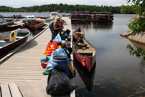
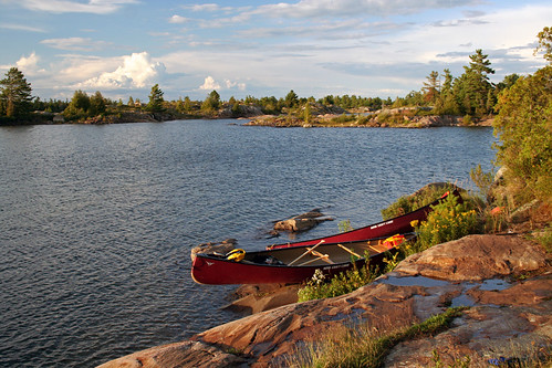
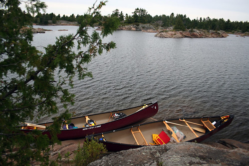
We left Toronto at 7:20 am and stopped only once for coffee. Arrived at 11:00 am at the Hungry Bear Restaurant; Mike and Morgan had already been there waiting for us. After a traditional lunch (excellent flame-grilled burger), we drove for about 25 minutes to Hartley Bay House and Marina, where we rented the canoes and purchase park permits. As planned, we were on the water on 01:00 pm. Our goal was to reach a campsite just before the Dalles Rapids. We headed south on Wanapitei Bay, passed the entrance to the Western Channel and took the Main Channel.
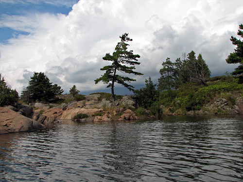
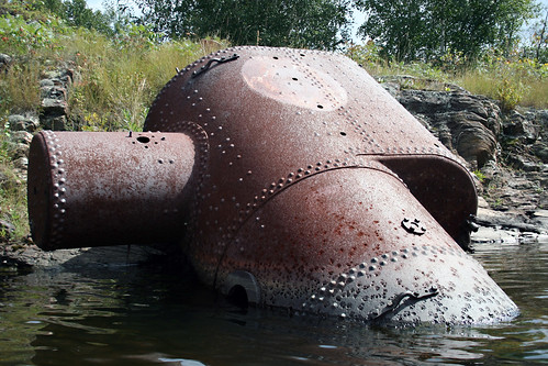
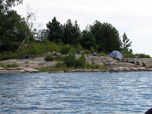
At the Elbow we turned right and soon began looking for a campsite. All campsites were vacant, we checked out campsite #624 and the next one (which did not even appear on the map)—they were quite nice, yet we could not find space to set up even one tent. Eventually, we selected campsite # 625, (N45 58 16.2 W80 52 10.3) which had a beach, plenty of space for many tents and enough trees for hammocks. Not far from the campsite were rusty remnants of old machinery, apparently an alligator.
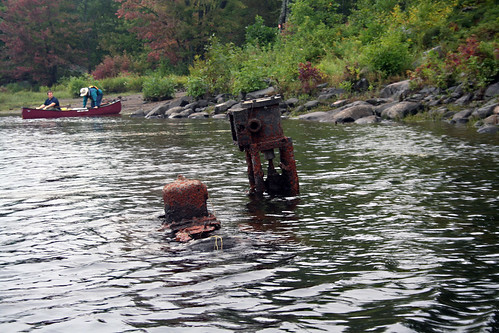
Alligators were shallow draft boats, with side-mounted paddle wheels, powered by a 20 horsepower steam engine and provided with a cable winch and large anchor. By using the winch they could pull themselves over land, around portages and up as much as a 20 degree incline at the rate of 1 to 2 1/2 miles per day. And they could haul a boom of some 60,000 logs across water against all but the strongest winds. They were heavily but simply built, making rebuilding and repair easy. We would see several of old shells of such alligators from now on—once they must have been a very popular sight in this area.
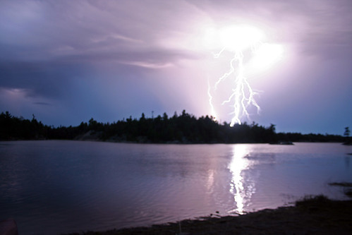
In the evening I went paddling solo and caught one pike and one bass, which we promptly grilled over the fire (I might add right now that these were the only fish I caught during the whole trip). In the evening it started to rain, then we saw lighting and eventually had to sit under a tarp to finish our supper.
Day Two, September 05, 2008.
Paddling time: 4 hours 46 minutes.
Trip Length: 5.4 km.
After breakfast we packed and were on the water; minutes later we reached the beginning of the Dalles Rapids Portage. According to the information on the map, the portage was supposed to be 180 km. long, but we soon realized it was much longer (according to my GPS, at least 310 m.). Apparently it must have been changed since 1995, when I was there for the first time, because I certainly remember it was much shorter then!


Day Three, September 06, 2008.
Paddling time: 4 hours 04 minutes.
Trip Length: 6.9 km.
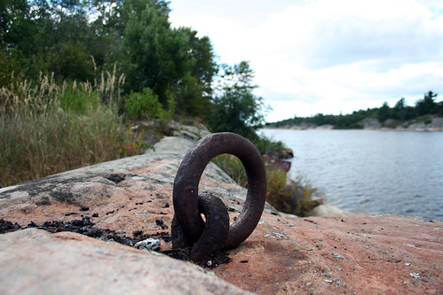
The weather was excellent, not a drop of rain! We chose to spend two nights on this campsite, so did not have to go through the packing/unpacking ritual again. After breakfast we paddled to the site of French River Village. Along the rocky shores we spotted a couple of old rings and hooks as well as old, rusty metal parts, hardly identifiable by now. The first structure, still visible from the river, is the ruins of the old mill.
When we walked further, we saw more ruins, a big metal wheel (probably part of the mill) and some old machinery equipment. Using a map, I tried to find the main street of French River Village. After walking for about 15 minutes on rocky ridges, I finally was standing in a ‘channel’ between two long rocks; apparently, the area between those long rocks used to be the main street and the houses stood
Unfortunately, due to very dense growth, I was unable to see anything interesting, nevertheless this area was very similar to an old photograph of French River Village, apparently showing this very location—after all, the building were gone, yet the rocks remain. Here and there I saw the unmistakable black bear poop and had to watch for the venomous Massasauga Rattlesnake which is relatively common in that area—not to mention the ubiquitous poison ivy, about which I had totally forgotten!
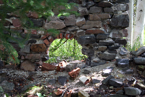
Later I saw solid foundations of a structure (prison?), several metal pipes, rusty implements, bricks… It was difficult to believe at this place had up to 600 permanent residents and swelled to up to 1,500 in the summer! Since the map also showed a cemetery on the opposite bank of the river, I decided to paddle there and find it. We found a small bay, full of logs, most likely around 100 years old and could see the lighthouse (apparently it’s the original French River Village Lighthouse, yet nowadays fully automatic). After spending well over one hour looking for the cemetery, I gave up—the area was very swampy, had two big bear droppings and some of the rocks were difficult to climb. So, I still don’t know if the cemetery is somewhere else or since it’s not marked, it’s easy to overlook it. While standing on top of the rock, on my right I could see the mouth of the Main Channel, with our campsite, on the right… I took a look at a copy of an old photograph from a book on the area and bingo!—it turned out it had been taken from the very same spot I was standing now! I could clearly see the characteristic outline of the bay (where I left my canoe) as well as the opposite shore. The photograph showed that very same shore, albeit with a row of houses along it; today the only visible structure was the lighthouse and the ruins of the mill…The funny thing is that on that old photo the small bay is also cluttered with logs, like these days!
We paddled back to the campsite. Afterward I paddled solo on Georgian Bay, exploring the bays and channels just behind our campsite, trying, in vain, my luck in fishing, and simply enjoying the beautiful weather! Later I found out that Morgan had seen a rattlesnake on our campsite. I spent some time at that very spot with my camera, but never spotted one.
Day Four, September 07, 2008.
Paddling time: 3 hours 20 minutes.
Trip Length: 8.9 km.
Our plan was to find a nice campsite east of the entrance to the Eastern Outlet; for the first time we were going to paddle on Georgian Bay, often being exposed to strong winds. However, the weather appeared to be OK and the only problem was navigating among numerous islands and rocks that dot that area; again, the GPS turned out to be invaluable. Once more we passed abundant relics from the days of logging in the delta, including some machinery up on a rock (another alligator, I presume).
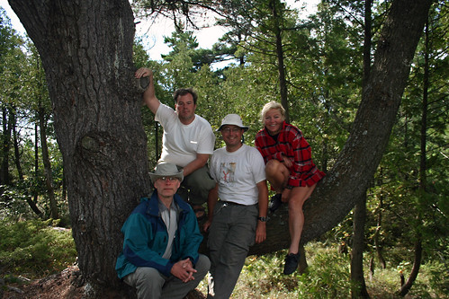
We spotted a small bay to our left and promptly paddled there; as were entering it, a small black bear cub appeared on the left shore, but had been gone by the time some of us could even see us. Out of caution, we decided to stop on the opposite rock (N45 55 34.0 W80 51 53.9). I covered my canoe with a tarp and walk up the rock, where the four of were sitting under a spread tarp, supported by our paddles (courtesy of Mike and Morgan).
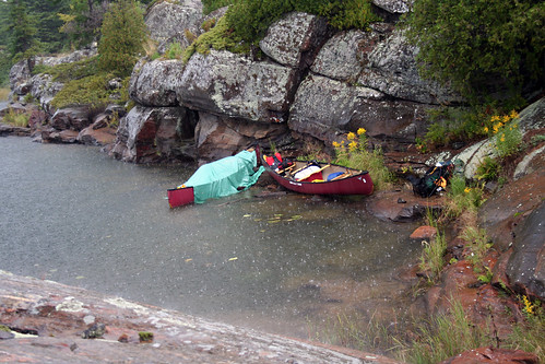
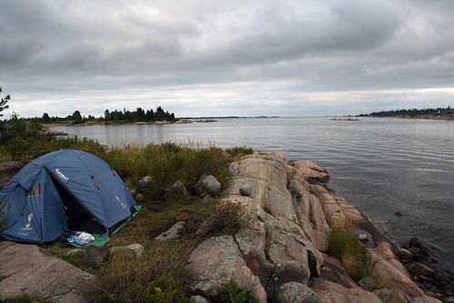
It was raining hard, we saw lightings indicating the storm was very close to us. Thirty minutes later the weather cleared, it even became sunny and after bailing the water, we were ready to continue on. Finally we found campsite # 920 (N45 55 05.6 W80 49 50.1) on an island just north of Finger Island.
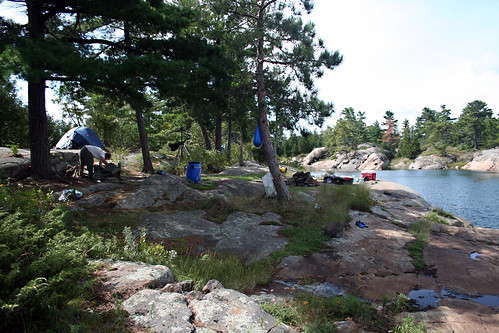
What a fantastic campsite! The view was just spectacular, we had total privacy, did not see any boats or canoes, the tent was set up on a flat rock and even the nearby privy offered an amazing view of the area! We wished we could have stayed two nights on this campsite, but since it was becoming windy—and we had to paddle back on Georgian Bay—we decided to leave this campsite next morning.
Day Five, September 08, 2008.
Paddling time: 1 hour 46 minutes.
Trip Length: 4.9 km.
Since the scenery around the campsite was so magnificent, I was up before 06:00 am and took a number of photographs in the morning. Some of the rocks exhibited very interesting patters, similar to those on Wreck Island in the Massasauga Park.
The wind was gradually getting stronger, yet we decided depart and paddle to a campsite somewhere before the Bass Lake portage (Tramway). This was one of our heaviest paddle days, as the wind made paddling very strenuous and we had to keep our canoes at the 45-90 degree angle towards the waves to avoid capsizing the canoe. We rested a short time sheltered by Dock Island and while paddling to another sheltered channel, we passed a group of kayakers. A black bear appeared on the shore, but it was gone before I was able to take a good photo.
It took us another 30 minutes to go through the Parting Channel and to Obstacle Island where we found our last campsite of this trip, # 718 (N45 55 52.2 W80 52 27.0). This rocky island was very scenic and the view magnificent. There were plenty of blueberry bushes with ripe berries—a good sign, we concluded, as it meant there were no bears on the island (actually, I don’t know how we would feel if, after setting up our tents, we’d realize we share the island with a black bear…). After our daily rituals—starting the fire and having supper—we sat around the fire for an hour or tow and went to our tents & hammocks just past midnight.
Day Six, September 08, 2008.
Paddling time: 6 hours 07 minutes.
Trip Length: 20.4 km.
We were up at 6:00 am, just in case we encounter strong head winds. By 8:20 am we were on the water and in several minutes reached the Bass Lake Portage, the so-called “Tramway”. The tramway was constructed in the early 20th century so logging companies could transport heavy equipment and machinery, then abandoned, then rebuilt and is now maintained by the Friends of the French River and the Ministry of Natural Resources. There was a wheelbarrow and a cart to carry the canoe, yet it was inoperable, so Mike and Morgan gratefully volunteered to carry the canoe in the traditional way.

The area around the portage is very pictographic.
We continued on Bass Lake and then north on the Eastern Channel, where on campsite # 623 had a quick lunch and turned right, passed an old cottage, then turned left into the Canoe Channel. The scenery was very serene, we did not see too many boats and slowly approached Canal Island, paddled south of it and in no time were on Wanapitei Bay, keeping to close to the right shore to avoid the wind. We arrived back at Hartley Bay House and Marina at 02:30 pm. Wow, we made it! Later we drove to the Hungry Bear Restaurant where we had our ‘civilized’ lunch and said goodbye. On our way back to Toronto I stopped to take several photographs of an interesting abandoned gas & service station as well as visited an Indian reserve. We arrived in Toronto about 10 pm.
More photos from this trip: http://www.flickr.com/photos/jack_1962/sets/72157607384417613/