Blog in
Polish/w języku polskim: http://ontario-nature-polish.blogspot.com/2018/08/wycieczka-samochodowo-kepmpngowa-parki.html
More photos from this trip: https://www.flickr.com/photos/jack_1962/albums/72157699705142605
More photos from this trip: https://www.flickr.com/photos/jack_1962/albums/72157699705142605
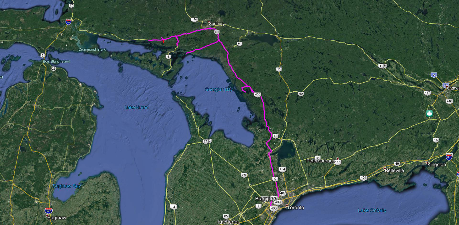 |
| Our trip in Ontario |
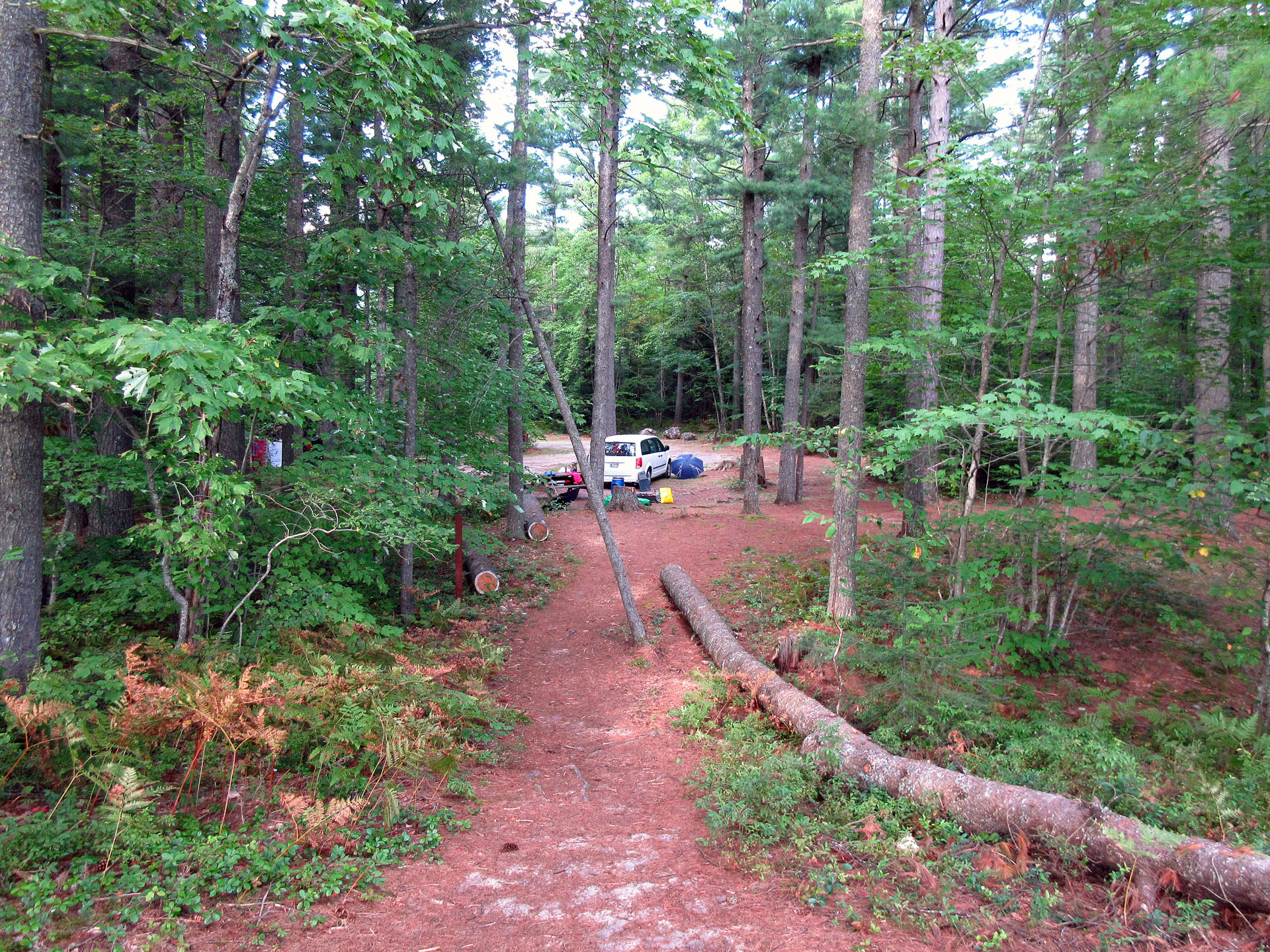
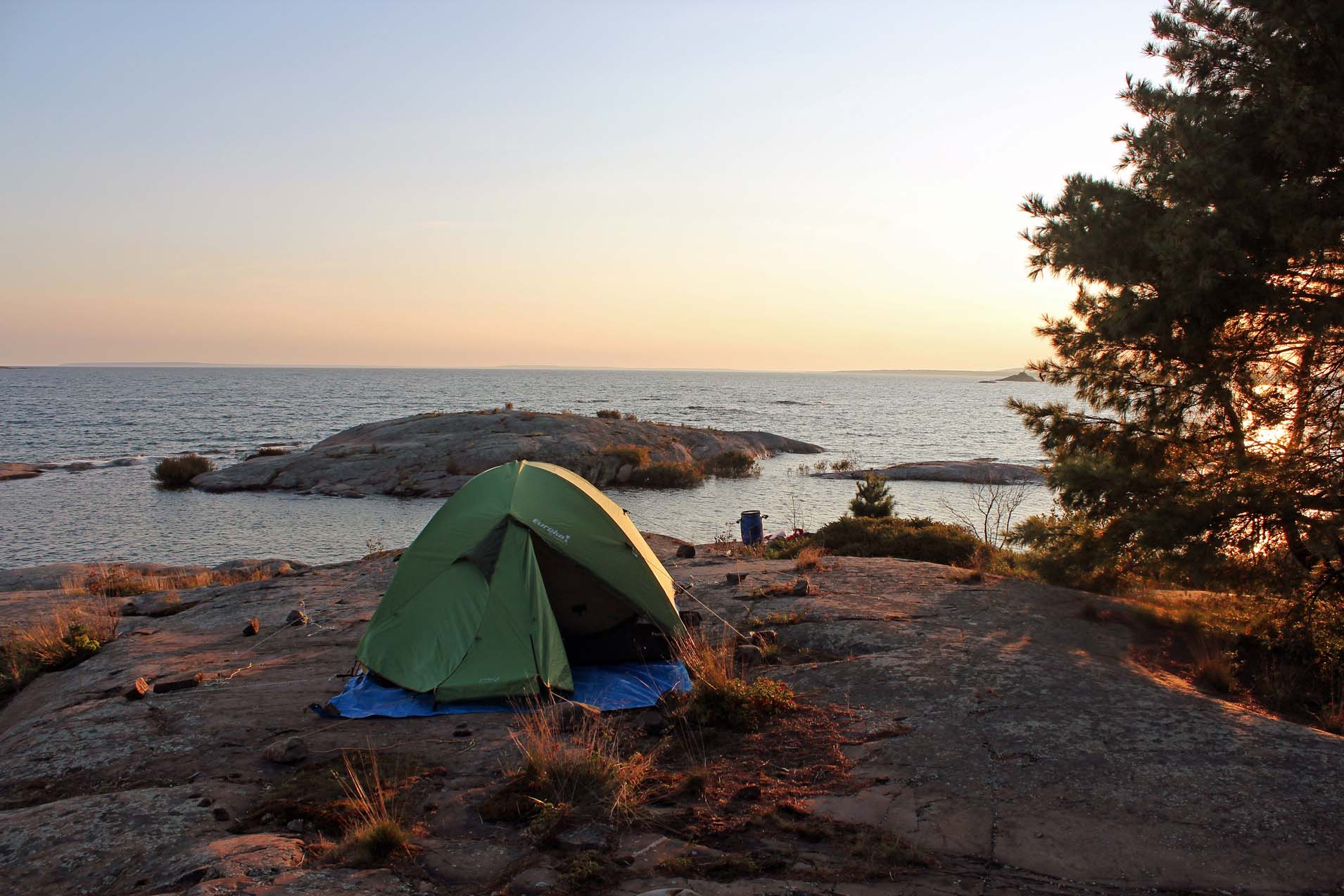
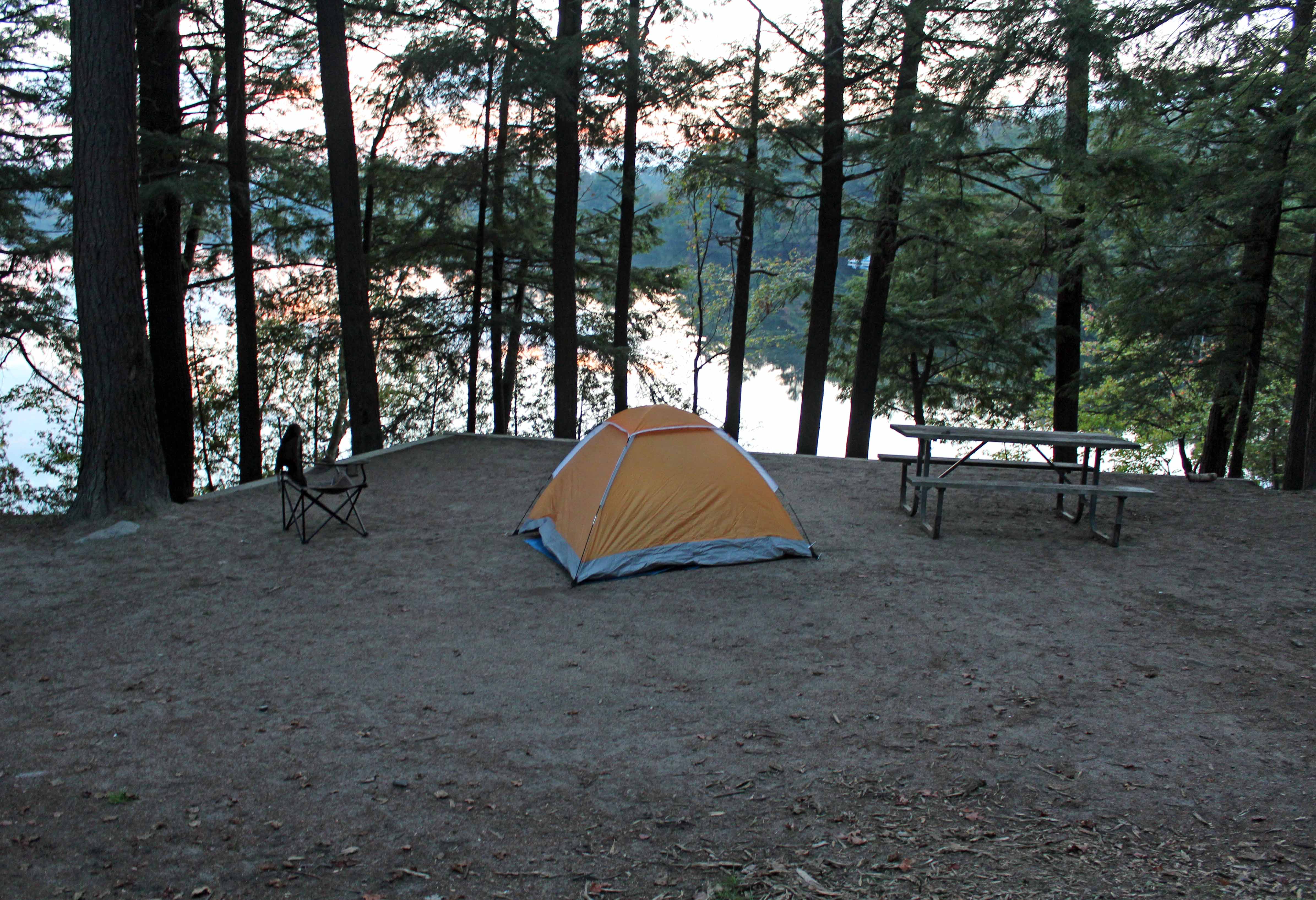
After coming back 5 days ago from our camping trip in the USA and Ontario (http://ontario-nature.blogspot.com/2018/07/car-camping-trip-across-minnesota.html), we were again ready for another autumn adventure, just in Ontario—both of us drove separately and of course, we took the canoe with us. We had a reservation coming up in Killarney Park in several days and decided to spend this time in Grundy Lake Provincial Park. We left Mississauga early in the morning and our first stop was Parry Sound—we visited our favorite bookstore, “Bearly Used Books”. In the bookstore the radio was on and while Catherine was listening to the weather forecast, it mentioned Killbear Provincial Park—what an excellent idea, we had completely forgotten about this park! After a quick visit to No Frills & Heart Store, we had a traditional lunch under the railway trestle over the Seguin River and proceeded to Killbear. The park employee gave us a list of vacant campsites and we loved one of them, number 1042, it was gorgeous, overlooking the beach and rocks and allowing us to admire spectacular sunsets from our campsites. For some reasons it looked very familiar to me… As Catherine was backing up from the site’s parking, the van’s tailpipe got stuck in the gravel… and then I had the déjà vu moment: in 2014 we had spent one night at this park, camping on a nearby campsite number 1139 (just over the rocky hill from #1042)—but we had also checked out this campsite then and as Catherine had been backing up, exactly the same thing had taken place—her tailpipe had gotten stuck in the gravel!
We
drove as fast as we could to the park office, paid for the campsite and soon I
was setting up the tent. Usually I can easily do it by myself, but because of
strong (and cool) wind, I had to ask Catherine to help me—as well as used the
guy lines attached to the fly.
 |
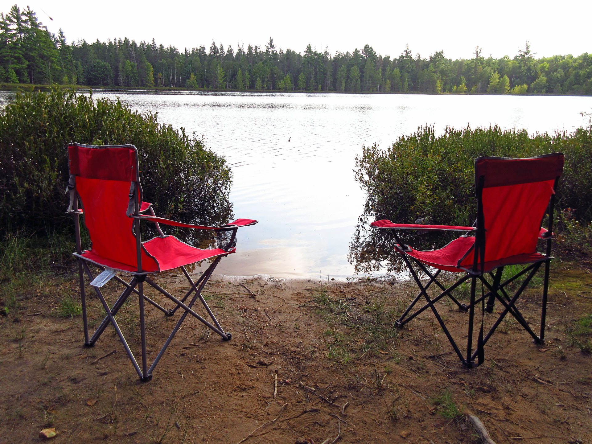
| The view from our campsite. Amazing! |
This
time I brought with me a very absorbing book by Michael Weisskopf “Blood
Brothers. Among the Soldiers of Ward 54”. The author, a senior correspondent
for Time magazine and a Pulitzer Prize finalist, lost his hand while riding
through Bagdad in the back of a U.S. s Army Humvee in 2003. He was sent for
treatment to Ward 57 at Walter Reed Medical Center, the wing of the armed
forces hospital reserved for amputees, where he met a lot of soldiers who had
lost limbs in the war. It was a very powerful book, showing the usually unknown
side of any war. Being wounded is one thing—but the recovery process, in many
cases, was very long, torturous, painful and frustrating. It certainly
presented that part of war we hardly ever think about. At 300 pages, it took me
just a few nights to finish the whole book. It was very poignant and emotional.
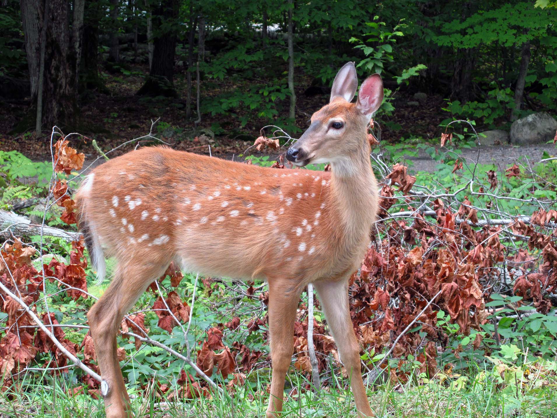
We
stayed at this park for 3 days (until Sunday) and every day went for a hike (a
hiking path paralleled the road), saw plenty of deer, I took photographs of
interesting-looking mushrooms as well as we spoke with a couple who had just
purchased a new small silver camper. The Visitor Center was very nice, too—we
chatted with a young employee for a while and she told us that in previous
years the park had had plenty of issues with black bears: some had managed to
break into locked cars (certainly without using the car keys!) and one bear
alone had supposedly been responsible for over 20 such break-ins—it had to be
euthanized and now we could see it on display in the Visitor’s Center. Every
afternoon we admired sunsets from our campsite and later had a campfire. The
campground filled up on Friday, but it was still quiet.

On
Saturday we drove back to Parry Sound to do shopping at No Frills and Hart
Store, as well as went again the “Bearly Used Books” bookstore, where we spent
at least one hour. Catherine bough several autobiographies of Canadian comedy
actors and audio disks to listen to on her drive back to the U.S.A. I spotted
“The Secret Speech” by Tom Rob Smith, the author of “Child 44” and immediately
bought it. Interestingly, but it was in Parry Sound where I had purchased
“Child 44” in 2014 and devoured it while we were camping on Franking Island!
This was the second part of the trilogy. Although probably not as good as the
first one, I kept reading it every night while camping in Killarney and on
Philip Edward Island. I also bought Leon Uris’ “Mila 18” and “Holocaust
Journey. Travelling in Search of the Past” by Martin Gilbert—both books
depicted many places which I knew or was familiar with. We talked to the
bookstore’s owner for a while, who told us a lot of fascinating things about
Parry Sound and her bookstore. I also spotted a few books authored by Terry
Boyle (whom I had met twice, last time at “Gilly’s Restaurant” after the
Franklin Island canoeing trip in 2015) and found out that he had passed away on
July 11, 2016. He was just 63 years old. So sad-I loved his books about
Ontario!
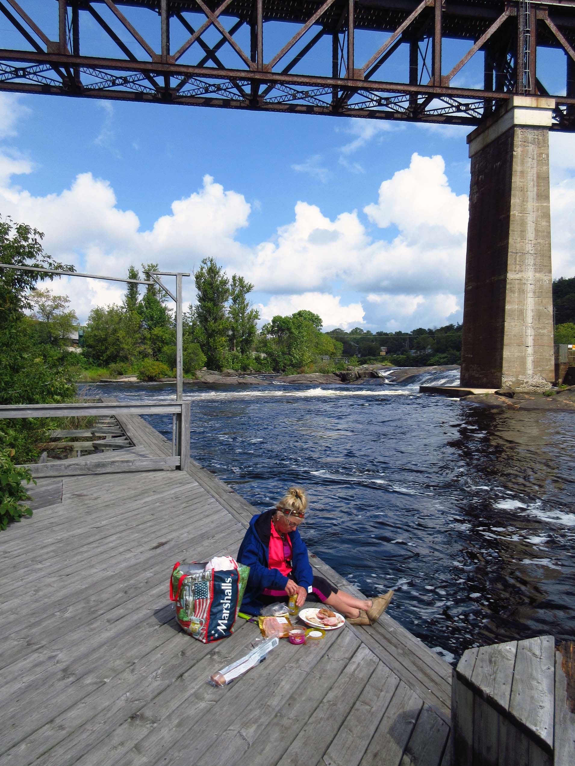 |
| Parry Sound. Our traditional site, under the trestle, where we always have our lunch |
We
also checked out the abandoned hospital in Parry Sound (a new one had been
built since) and a train station. It was closed—nowadays there were just
several trains stopping there, going to Toronto and Sudbury.
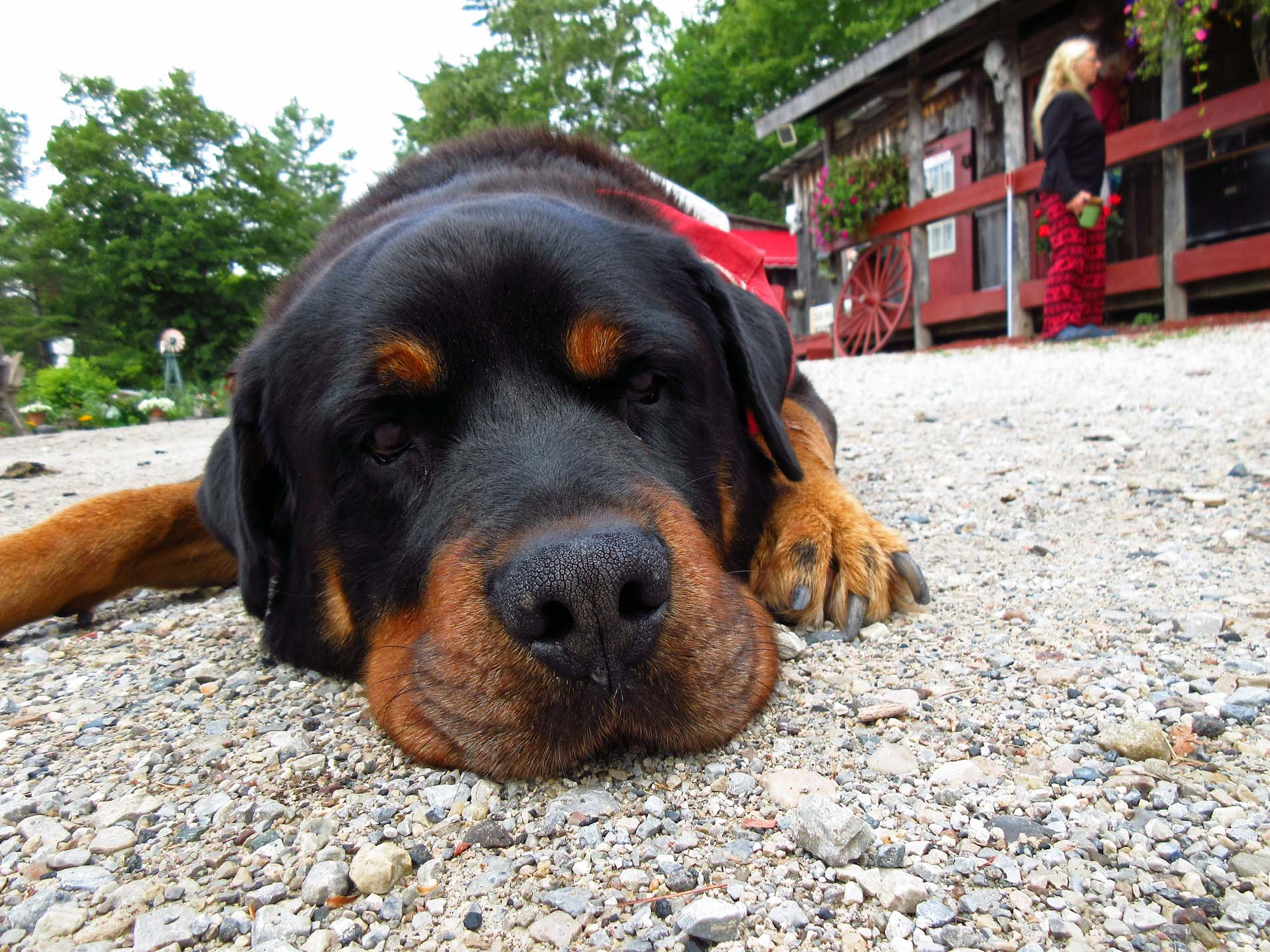
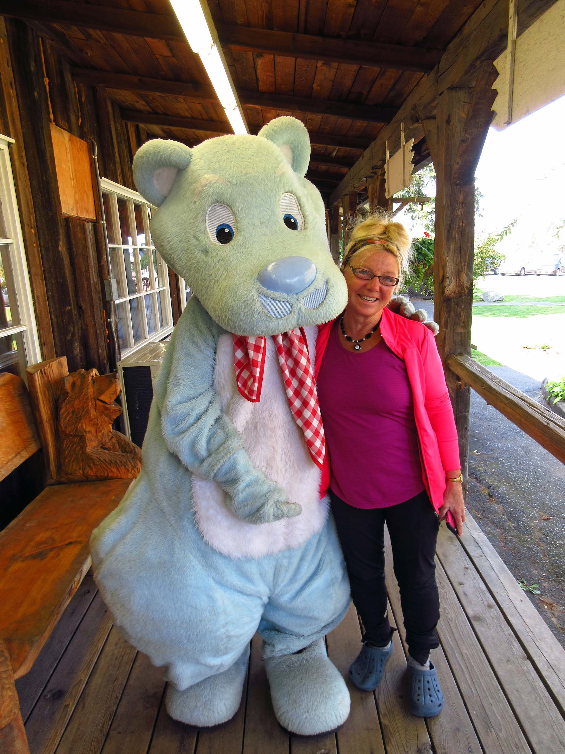 |
| Catherine just made a new friend, "The Hungry Bear"! |
On
Sunday, September 10, 2017, we left our splendid campsite at Killbear and drove
up north on highway 400 to the Hungry Bear Restaurant, one of our de rigueur stops whenever we were in the
area. It was still accessible from the highway, but there was major road
construction taking place and when the two-lane road is turned into a freeway,
there would be an off-ramp from the freeway leading to the restaurant and the
Trading Post. I sincerely hoped that they would still remain in business for
many decades!
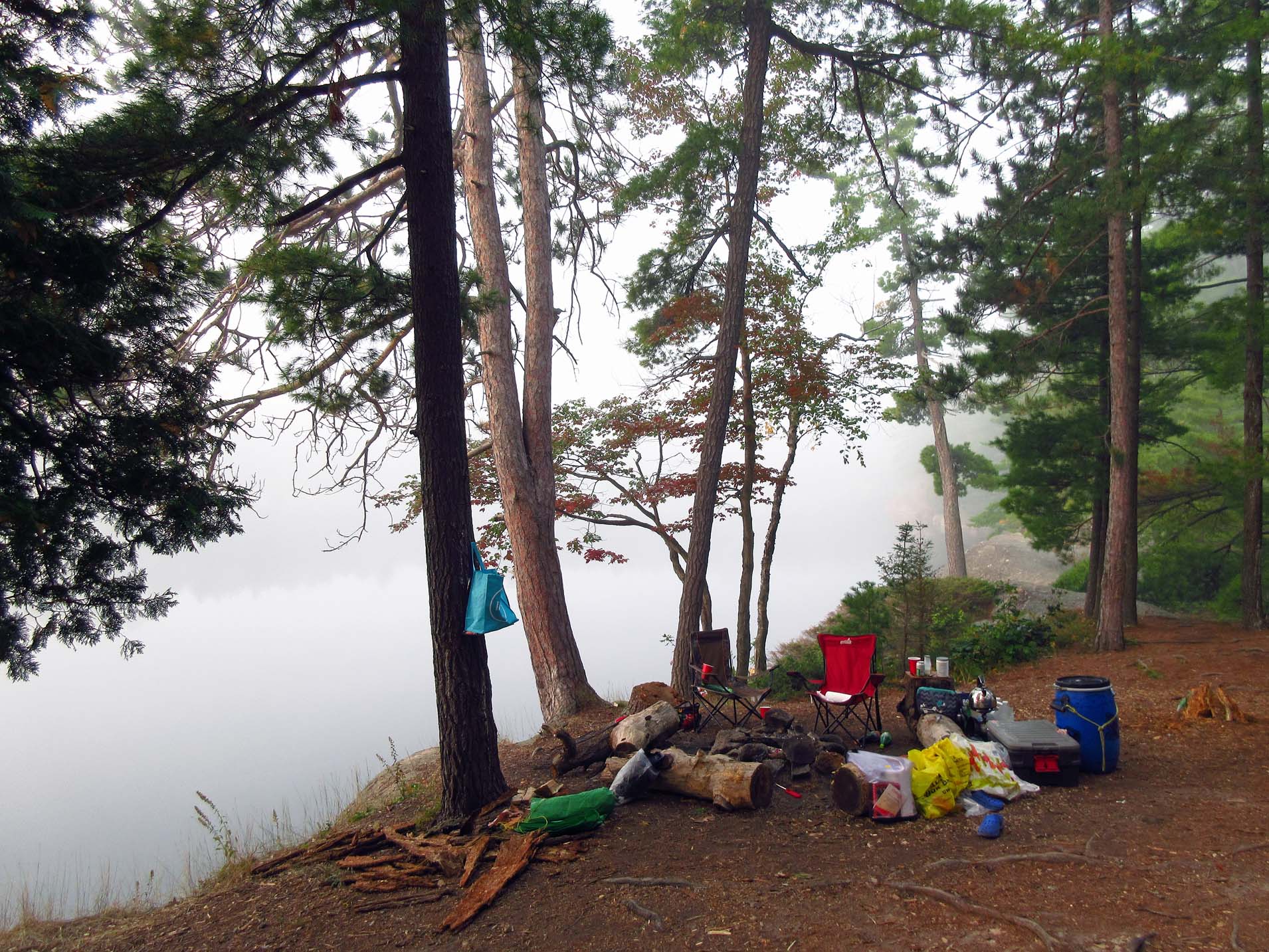 |
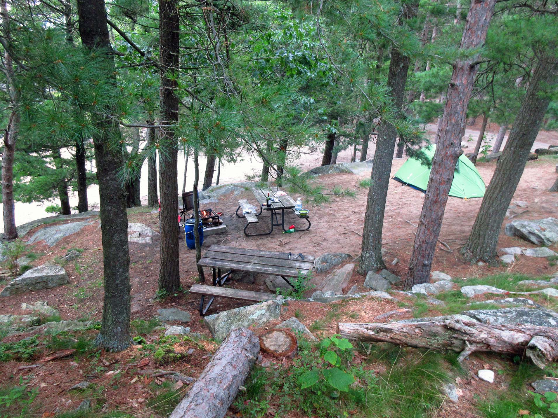
| Our campsite between Lake Carlyle and Terry Lake |
Eventually
we arrived at Killarney Park’s George Office. Even though we had a reservation,
there was a big screw-up with the bill, they kept overcharging us and could not
figure out how much we should pay (we had 2 vehicles), but at the end we left
the office quite satisfied. I think that all provincial parks should simplify
the reservation system so that we did not have to spend so much time lining up
in the office—after all, in our case the whole reservation had already been
made online months ago.
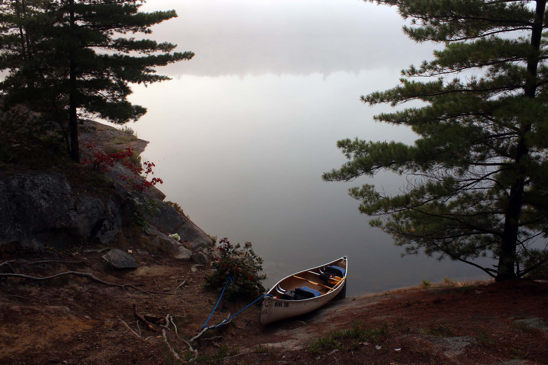 |
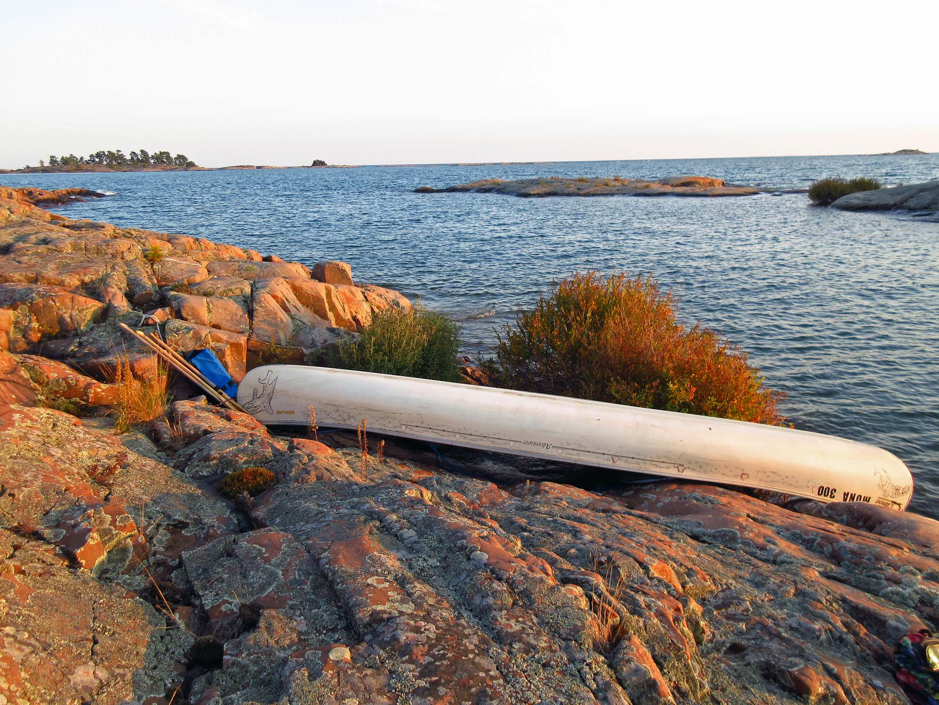
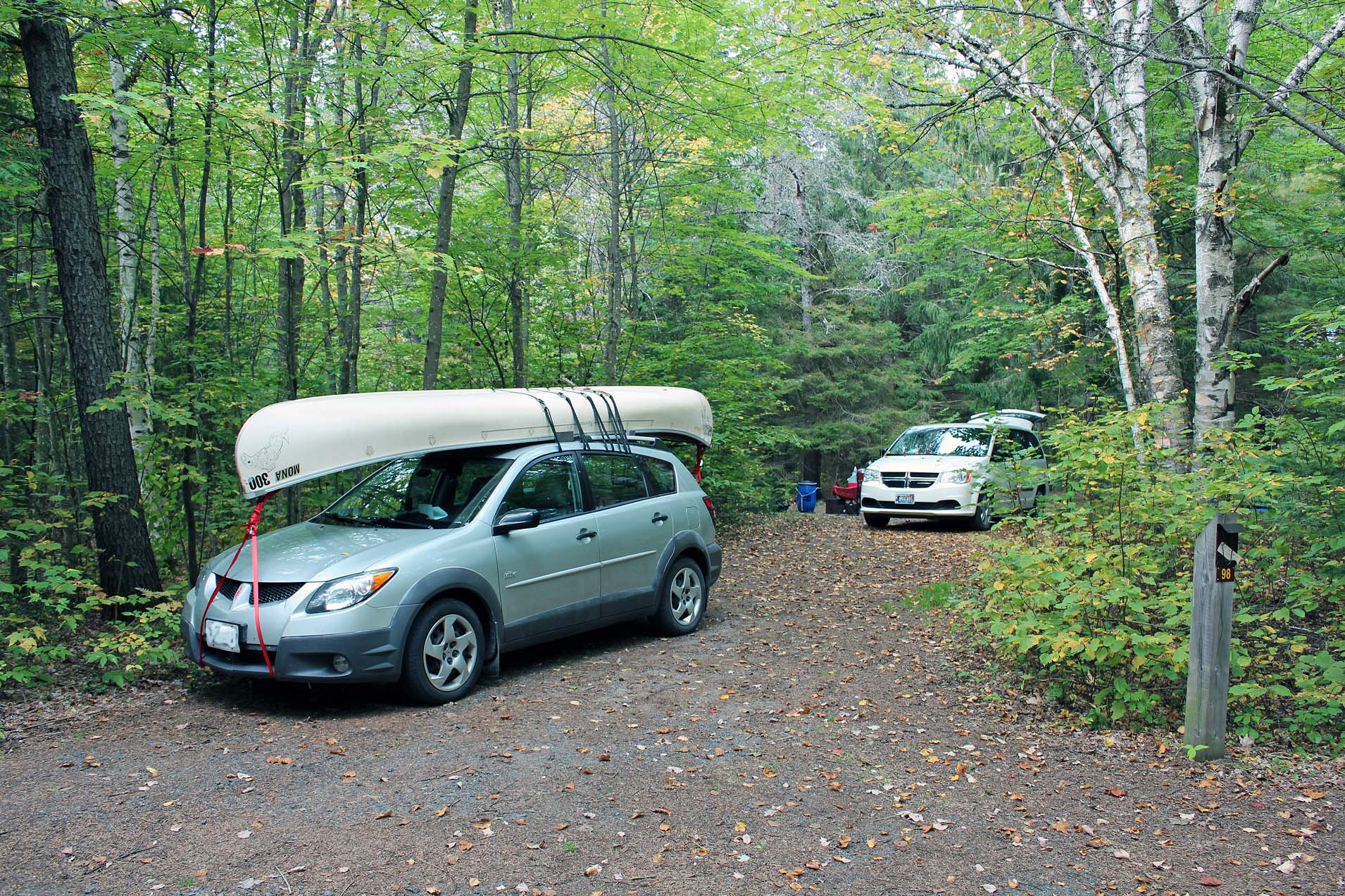
| Our 'canoe parking' |
It was
very difficult to reserve a site in this park and of course, I had done it a
few months prior. Interior camping does not allow to reserve a particular
campsite—there were a number of campsites on each lake and in our case, we just
booked a campsite on Carlyle & Terry Lake—once we came to the park, we
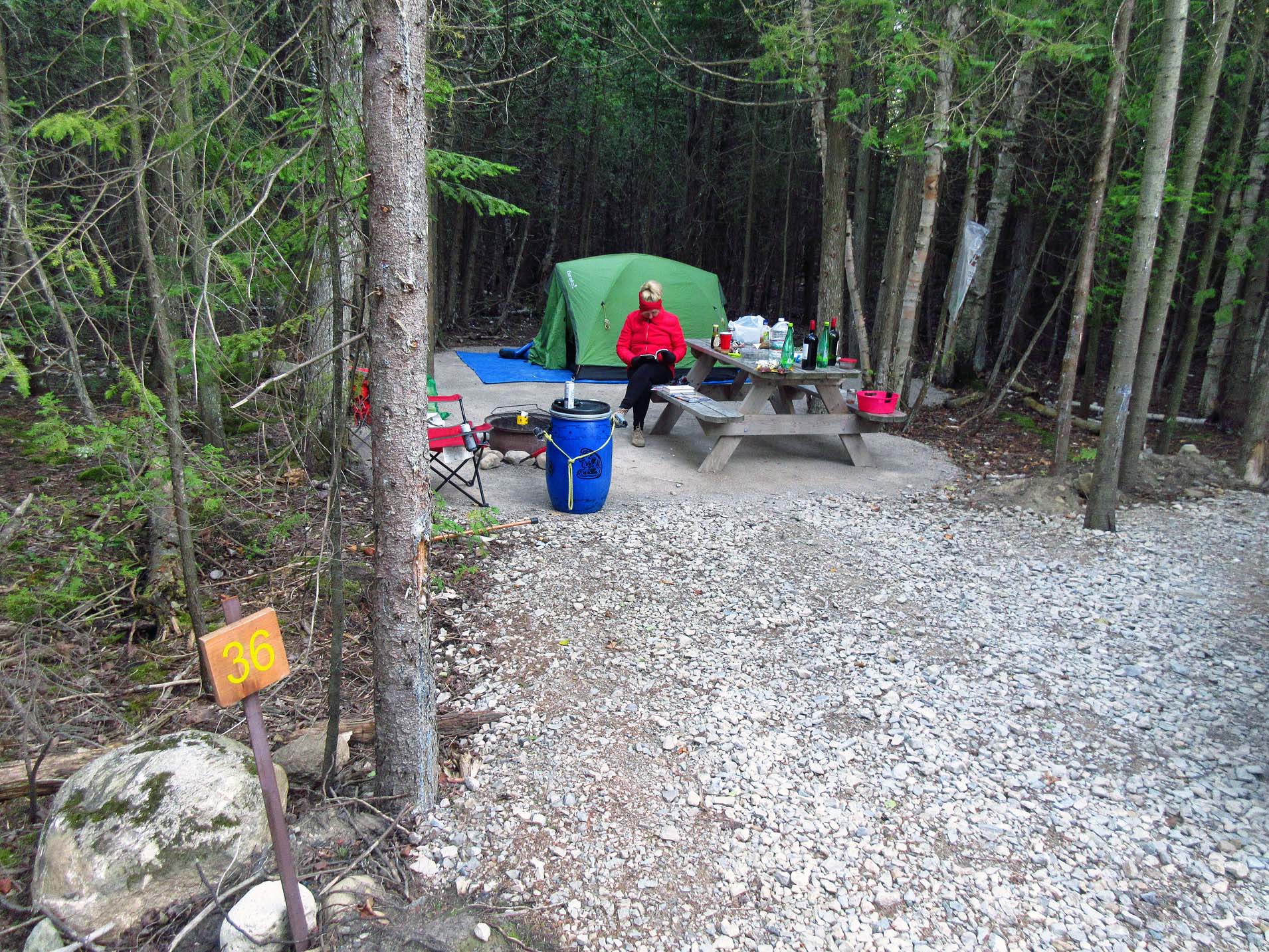
could stay on any campsite that was not occupied. It was our fourth visit to
this particular area and we knew which campsite we wanted (altogether, there
were a total of 6 campsites). Luckily, all the campsites were vacant, so we got
site #55. It was very nice, offering the view of both lakes (Carlyle and Terry)
and there was a small waterfall, but whereas those camping on the opposite campsite
could see (and especially hear) it, we could not. The only drawback was the
very precipitous hill leading up to the campsite. We had to carefully attach
the canoe to the rocks & roots and then carry all our equipment up the
rugged ridge. I felt ‘at home’ and in no time the tent was up and ready for our
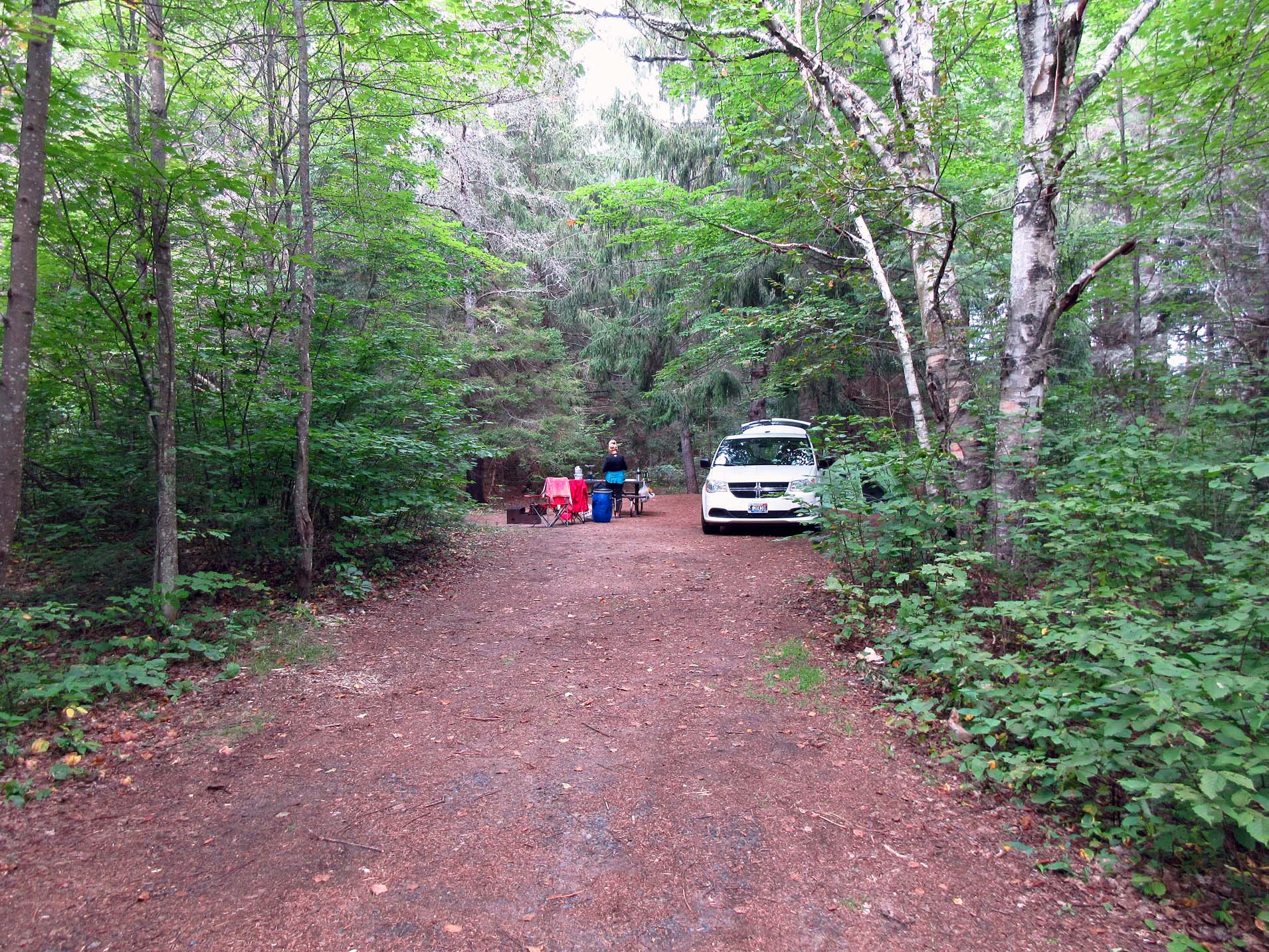
habitation and Catherine set up a great kitchen, ready for our gourmet meals!
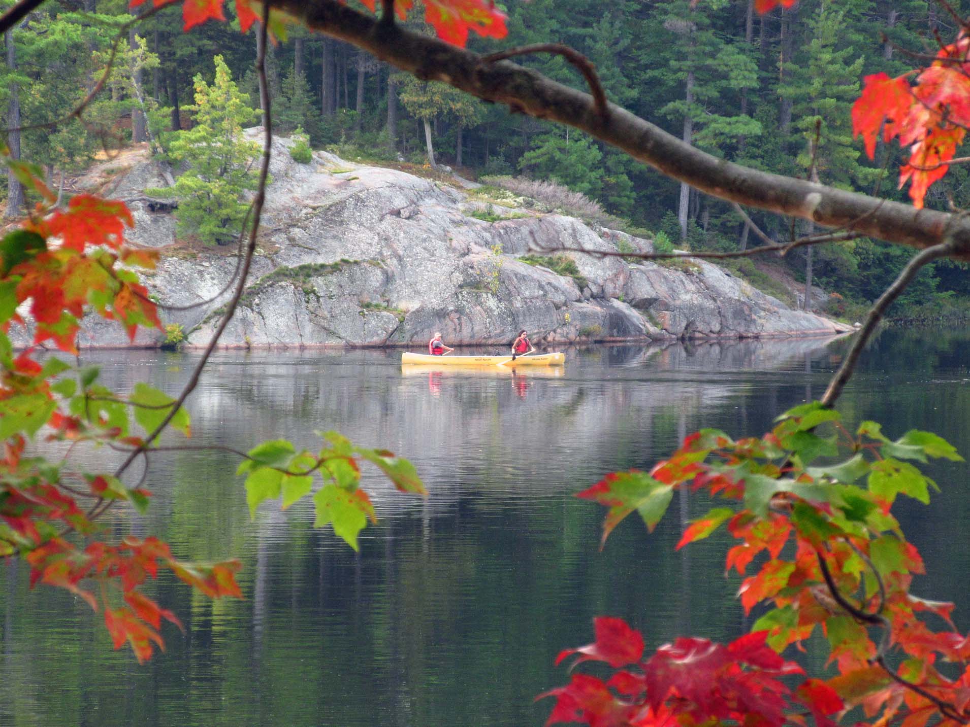 |
| View from our campsite-from time to time we saw canoes |
During
our stay we had an excellent weather—it was sunny, not one drop of rain, warm
and we did not see too many campers on the lake. Once we talked to an Irish
paddler who had sprained her leg and was unable to follow her group on a hiking
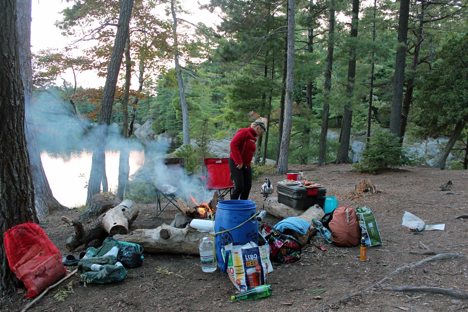
sally. From the outset Catherine refused to hang the food, but I insisted and
after several attempts succeeded in throwing the rope over the branch. Although
the food hanging area was relatively close to our tent and fire pit, it was
certainly better than just leaving the barrel with food on the ground. We never
saw any bears anyway, although twice we heard a very noisy thump or crash—Catherine
thought it might have been a bear, but since no other noises followed, we
assumed that perhaps a tree or a branch fell to the ground.
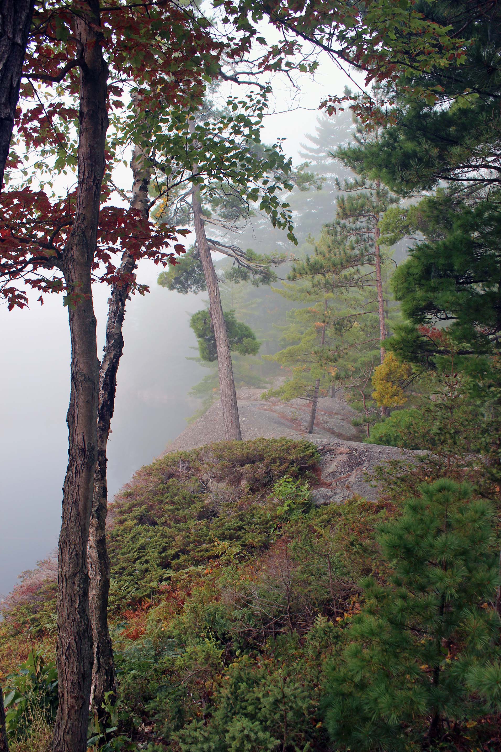
Some
mornings were very foggy and I was glad Catherine woke me up; I took a lot of
lovely photographs. In the evening we paddled towards Johnnie Lake, through a
narrow channel, where beavers had made a dam (yet it was not very sturdy and we
did not have to lift over the canoe) and we also saw a couple of beaver lodges.

Almost
daily we paddled from our campsite to the parking lot (about 30 minutes) and
drove to the town of Killarney, where we had fish & chips in the Herbert
Fisheries Restaurant. It looked so differently now, as the small school bus
(which had become almost a symbol of Killarney) had been gone and a new building
had been erected. The food was good, but the décor in the new place was so-so…
I think that more old, historical photographs from the area and fishing
artifacts would make the place much more original—and it would not take a lot
of money. In any case, each time we consumed the food outside, sitting on the
dock. We also went to the LCBO store (which sold liquor and beer) and
Pittfield’s (the only grocery store in town).
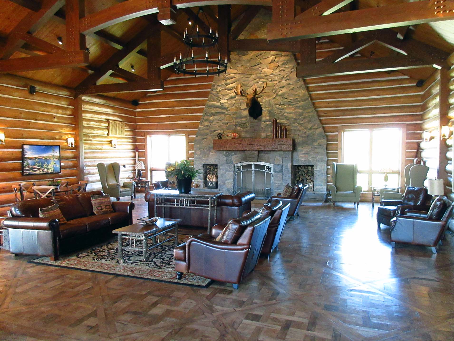
One
evening we walked to the Killarney Mountain Lodge, which had just undergone
very major & expensive renovations. We ran into Mr. Kelly McAree, General
Manager, a very nice, no-nonsense man, with many years of experience in the
hospitality industry. Considering that he must have constantly dealt with
employees and guests, he certainly had to possess very exceptional qualities to
successfully run such a place. He immediately offered to show us the whole
property. He even took us to the chalet which used to be the residence of the
original owner/builder and his family. The view from the Chalets was
breathtaking and they offered very luxurious, yet still rustic experience.
From
the hotel’s balcony we spotted a van towing a kayak. He told us it belonged to
Traci Lynn Martin (http://www.justaroundthepointe.com/), a brave and extremely
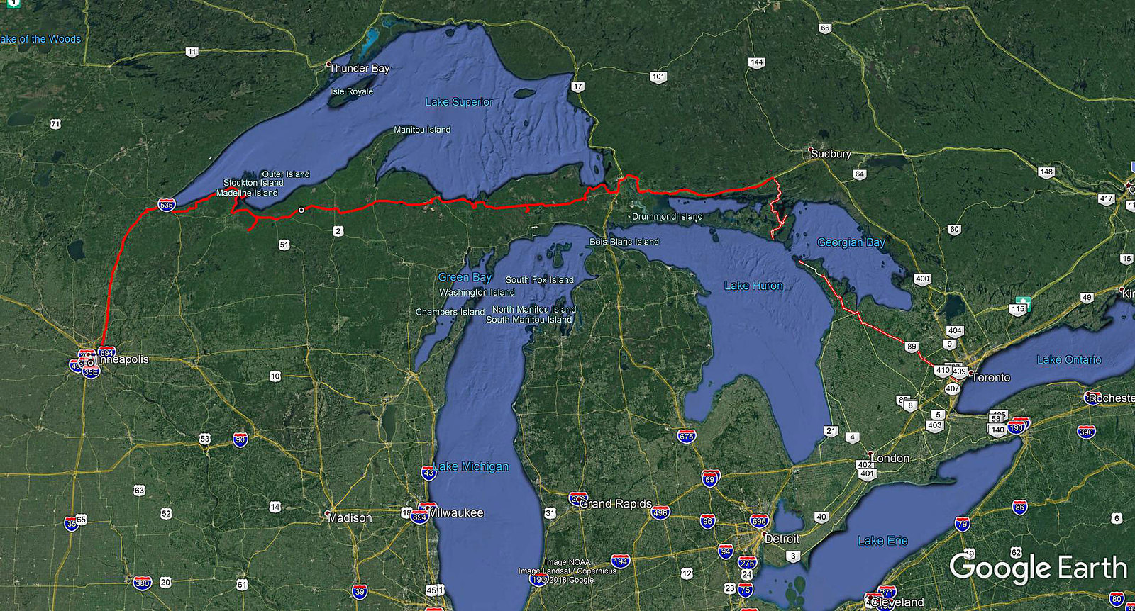
adventurous Missouri woman, who had embarked on an 8,600-mile Great Lakes
odyssey in March, 2017, hoping to complete it in 2017. According to the
“Detroit News”, she stopped her journey in late 2017 because of the rigors of
wintry weather on Lake Ontario. Still, she paddled 3,582 miles from March and
completed lakes Superior, Huron and Michigan. On October 15, 2017 she became
the first person to circumnavigate the three lakes in one calendar year. She
said she would try again in 2019. What a spirit!
The
next night we went to Killarney Mountain Lodge and had a tasty dinner, sitting
outside on the porch.
We
also drove to the park and had a hot shower (what a luxury!). Then we did the 4
km Cranberry Bog Trail, which was very picturesque, meandering among bogs,
wetlands, marshes and lakes. At one point we had to hike up and then down a
very steep, rocky hill. We saw plenty of pretty looking mushrooms. I was quite
sure I saw the most deadly mushroom, the Amanita Ocreata, a.k.a. the death
angel, destroying angel or angel of death. Once eaten, it causes only a mild
gastrointestinal and include abdominal pain, diarrhea and vomiting. They go
away after 2–3 days, but all the while the damage to the internal organs us is
taking place during this time, leading to a coma, liver & kidney failure,
and eventually death. While hiking, we saw the La Cloche Silhouette Trail—there
was a sign warning that once you started it, you had to walk for the next 78
km. Even usually courageous Catherine was not interested in following this
trail…
 |
| We spotted this snapping turtle on the main road as it was trying to cross it. I made a U-turn and helped it safely get to its destination |
On two
occasions, when we were coming back to the Carlyle Lake access point parking
from the town of Killarney, we saw two ladies, who were setting up their
cameras on tripods in order to take photographs of the Northern Lights. They
were quite surprised that we were going to paddle to our campsite in total
darkness! While canoeing back to our campsite, we told the campers staying on
campsite #56 about this phenomenon. However, I believe no aurora became visible
that night—well, it is a hit or miss.
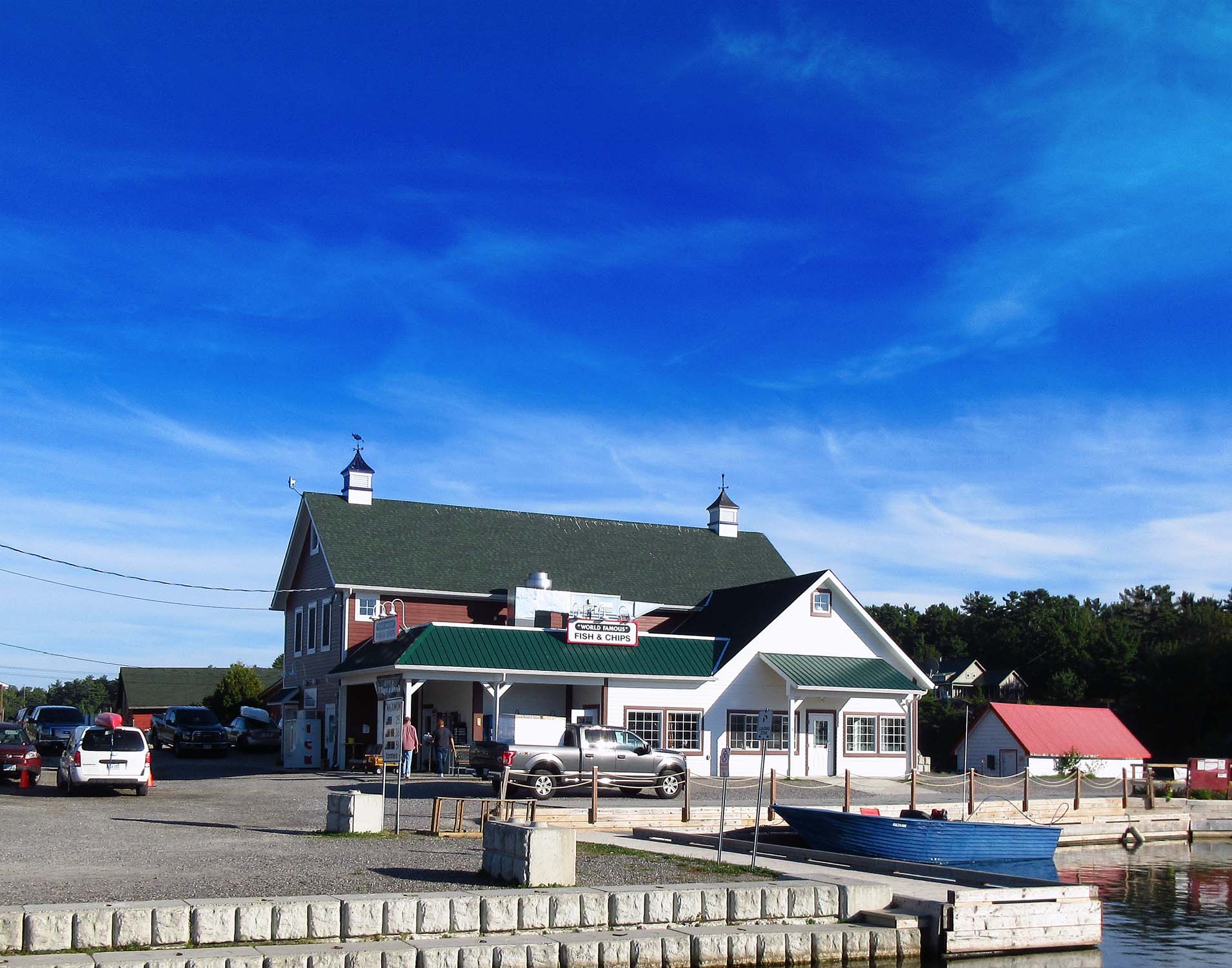 |
| The new Herbert Fisheries Restaurant in Killarney |
September
16/17, 2017 (Saturday/Sunday) was our last night at Killarney. We did want to
extend our stay and each day went to the park office, inquiring if any
campsites on Carlyle/Terry Lakes had become vacant, but none had, all had been
solidly booked-up. On Saturday we left for the town of Killarney late
afternoon—there was a lone camper on the site across from ours. When we
returned to the Carlyle access point, it was about 9:45 p.m. and we headed to
our campsite in total darkness. Although the route was easy and
straightforward, as we were approaching the location of the campsite, we had to
use my powerful 1,000 lumen flashlight to pinpoint our campsite—we had
forgotten to attach a blinking light to a tree, which we usually did and it was
always a great idea.
When
we were disembarking from the canoe (which was tricky, as the rocks were
slippery and it was dark) and unloading our bags, suddenly Catherine gave a
shirking, very loud cry, as she spotted one or two water snakes, perfectly
visible in the flashlights’ shining light, swimming near the canoe—and she was
quite certain that at any moment they would try to jump into the canoe and
attack her! I did not much care about the snakes, so I slowly lifted the canoe
and pulled it up the sloping, rugged ridge and then tied it to the roots and
rocks. Just seconds later I was startled by a very thunderous noise
(considering it was so still and quiet around, it sounded absolutely
deafening). The canoe simply slid down the ridge, ended up in the water and was
slowly, but surely, floating away! It turned out that in the darkness I had not
properly attached the rope to the canoe. We had to make a very quick decision.
Catherine instantaneously took the initiative, unwaveringly stating,
“I’m
not going into the water, no way!”
 |
| What a mess! Fortunately, Catherine is responsible for the kitchen |
Fortunately, we still had the rope and a few powerful flashlights & headlights. Besides, long ago we had attached reflective stickers on the canoe, so even though it was drifting farther and farther away, we could still see it. I was a little reluctant to swim in total darkness and thought about wearing a lifejacket, but it was impossible: we always left lifejackets in the canoe, so I did not have one—but before I could even contemplate this predicament any further, I took my clothes off and got immersed in the water (forgetting about the water snakes and the legendary Killarney lake monster, if there was one). My headlight shining bright, the rope in one hand, I commenced swimming towards the canoe as Catherine kept shining the 1,000 lumen flashlight, using only 1/3 of its maximum output. I did not know how long it took me to reach the canoe, but once I did, I fastened the rope to the canoe (this time, correctly!) and swam back, pulling the canoe behind. Although the water was quite cool, it was warm outside. Within 10 minutes I was dry, dressed up and sitting near the warm campfire! I felt sorry for the camper at the campsite vis-à-vis ours… he must have thought of us as some total neophytes, with no canoe & camping skills and no outdoors etiquette!
The
next several nights we were planning to spend on Philip Edward Island, which
still constituted Crown Land. However, first we had to buy from the park office
two vehicle stickers to park my car and her van at the Chikanishing access
point. There was another major screw-up in the park office and it took us a
while to finally make the proper payment.
At
4:00 p.m. we paddled on the Chikanishing creek, but once we reached its mouth,
we saw it was windy and the water was relatively rough. Although we were going
to set up our tent on the western tip of the island (South Point Island), we
still had to paddle across the open water, some 700-800 meters. I kept trying,
but each time we were on the open water, we felt the somewhat powerful waves. I
still had fresh memories of our paddling the same stretch of the water, when
the waves had been so big that from time to time the water had been flowing
into the canoe.
We
stopped near the mouth of the creek and even considered camping there, not sure
if it was the park’s land or Crown Land (later I determined it was the park’s),
but I did not like that spot. I pulled out my marine radio and listened to the
most recent marine weather forecast—which fortunately said that the wind would
subside in the late afternoon! So we waited for a while and in less than one
hour ventured out again. I kept the canoe perpendicular to the waves, paddling
not towards the island, but towards the open water of Georgian Bay, since the
waves were coming from that direction. Eventually we made a sharp left turn,
paddled very fast and entered a small narrows between South Point Island and
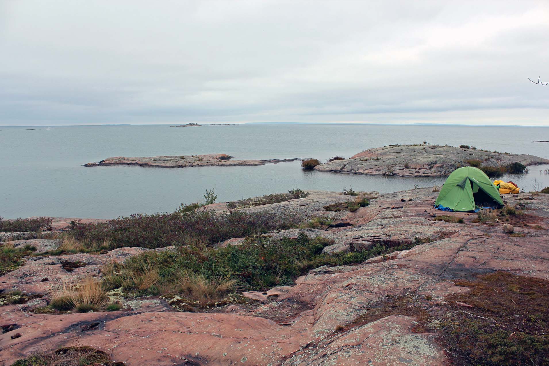
some rocks. After exploring the area, we disembarked on the rocky shore and
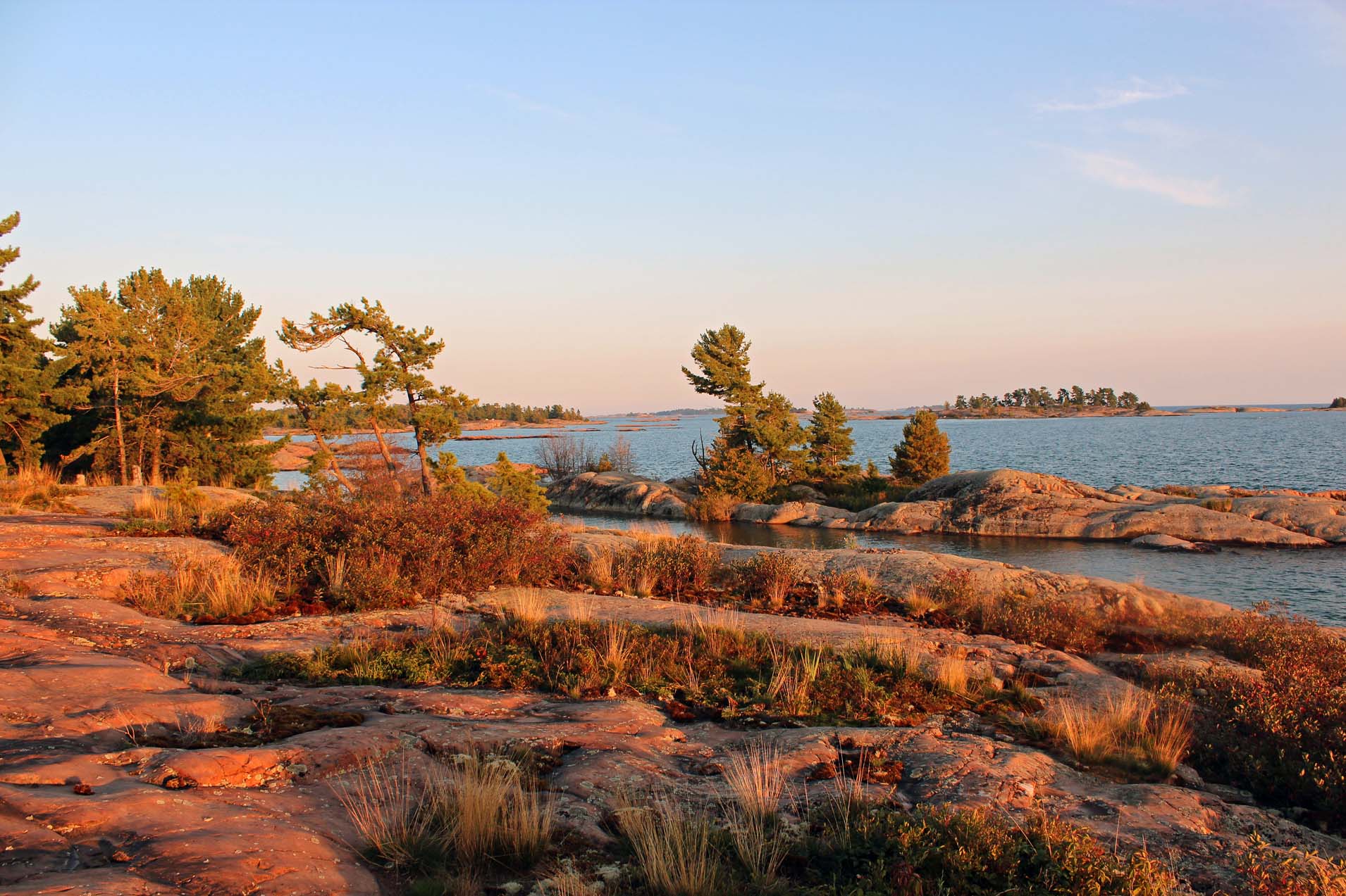
decided to stay in that pristine spot. On the other side was a family of 2
adults & 2 girls, with 2 golden labs, which came over to our side to say
‘hi’. They were very quiet and we hardly noticed them.
The
view was spectacular—whenever I am paddling in that area, I just love the
scenery! We set up the tent, but did not have the fire that night. We could
admire blinking lighthouses and buoys in front of us. The family left the next
day and we wandered at their former campsite and explored the island. We had
stayed on a ‘campsite’ located just 50 or so meters in 2012, but this spot was
much better. There were plenty of fire pits here and there, as well as broken
layers of rocks, indicating that somebody had had a fire there long time ago.
We chose one of the existing fire pits because it was large and there was also
a primitive table.
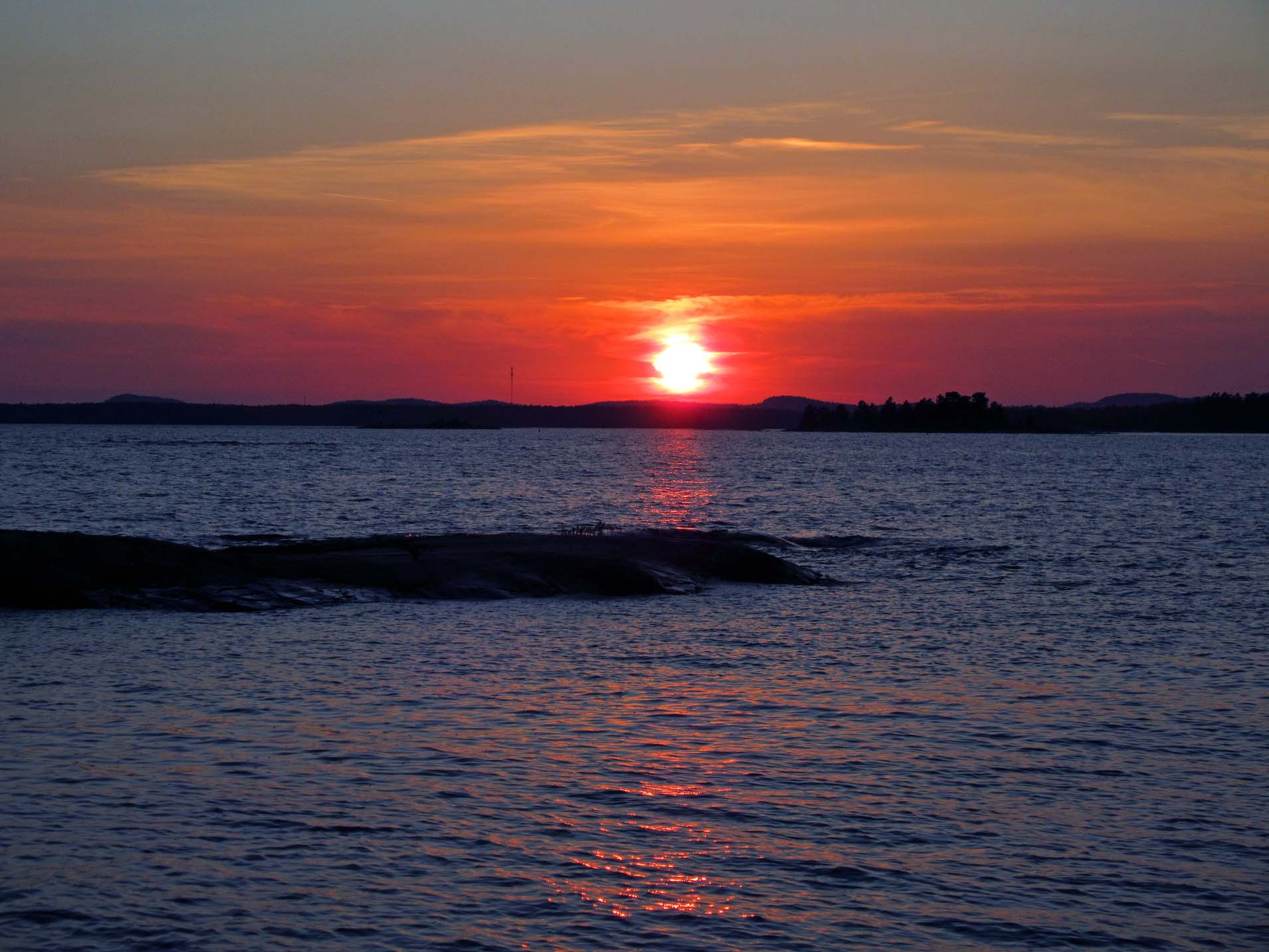
The
first morning, at about 4:00 a.m., we were awakened by some voices. We looked
out the tent and saw a flotilla of canoes, moving towards the parking lot. Each
canoe had a glow stick attached and it looked marvelously from our campsite! Of
course, the canoers must have left very early to avoid potential winds and
waves, which could have made their return journey impossible.
We
were planning to stay longer, but the next morning (Tuesday) the weather was
iffy—it did not rain, but the sky was cloudy and eventually it did rain a
little. I was not concerned about the rain, but rather about the rocks becoming
slippery and immediately we decided to pack up and paddle back. At least there
was no wind, so we did not have to worry about the non-existent waves.
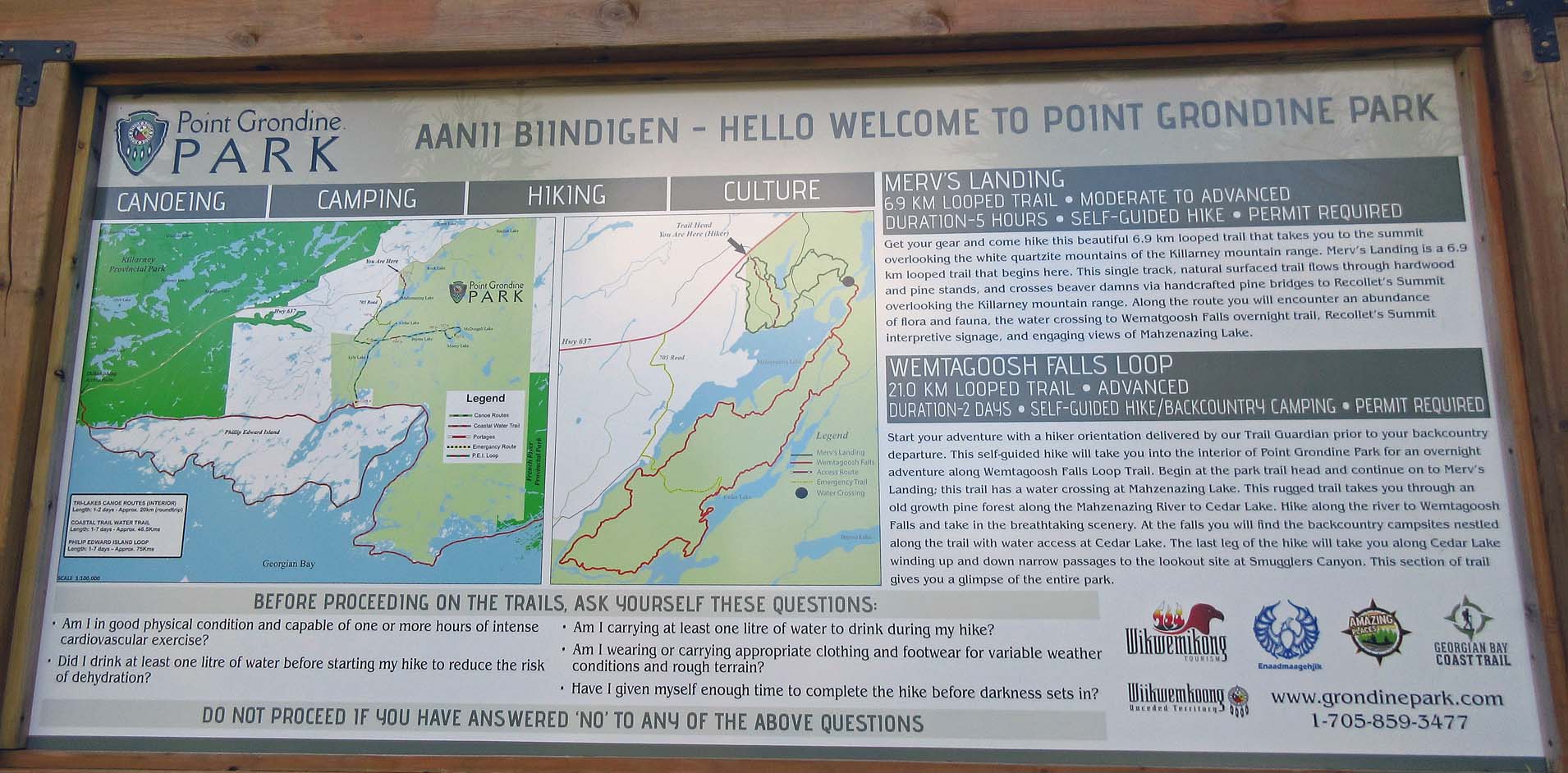
We
went to Herbert Fisheries in Killarney for chips & fish and drove to Point
Grondine Park. We had found out about this new park from a brochure, located on
Native Land and run by First Nations, and called the number given in the
brochure, but there was a recording directing us to their… website! Well,
considering that there was no cell coverage in most of the park, it would have
been quite difficult to follow their instructions! There was a map and self-serve
payment station. We talked to a young guy with a big dog who was about to
embark on a long hike—he had encountered problems while trying to make the
payment, the machine did not want to accept his money and when we changed some
bills for him, he was finally able to pay. There was a guest book and according
to recent entries, some tourists, unable to make the payment, left the park. I
hope that the management will eliminate those issues which discouraged many
potential visitors. I think that there are only hiking trails and a water
trail, which includes a 3 km portage—or the ‘portage-less’ loop around Philip
Edward Island. Nevertheless, I though it was a great idea to have established
the park and I sincerely hope that next year all the glitches would be
resolved.
 |
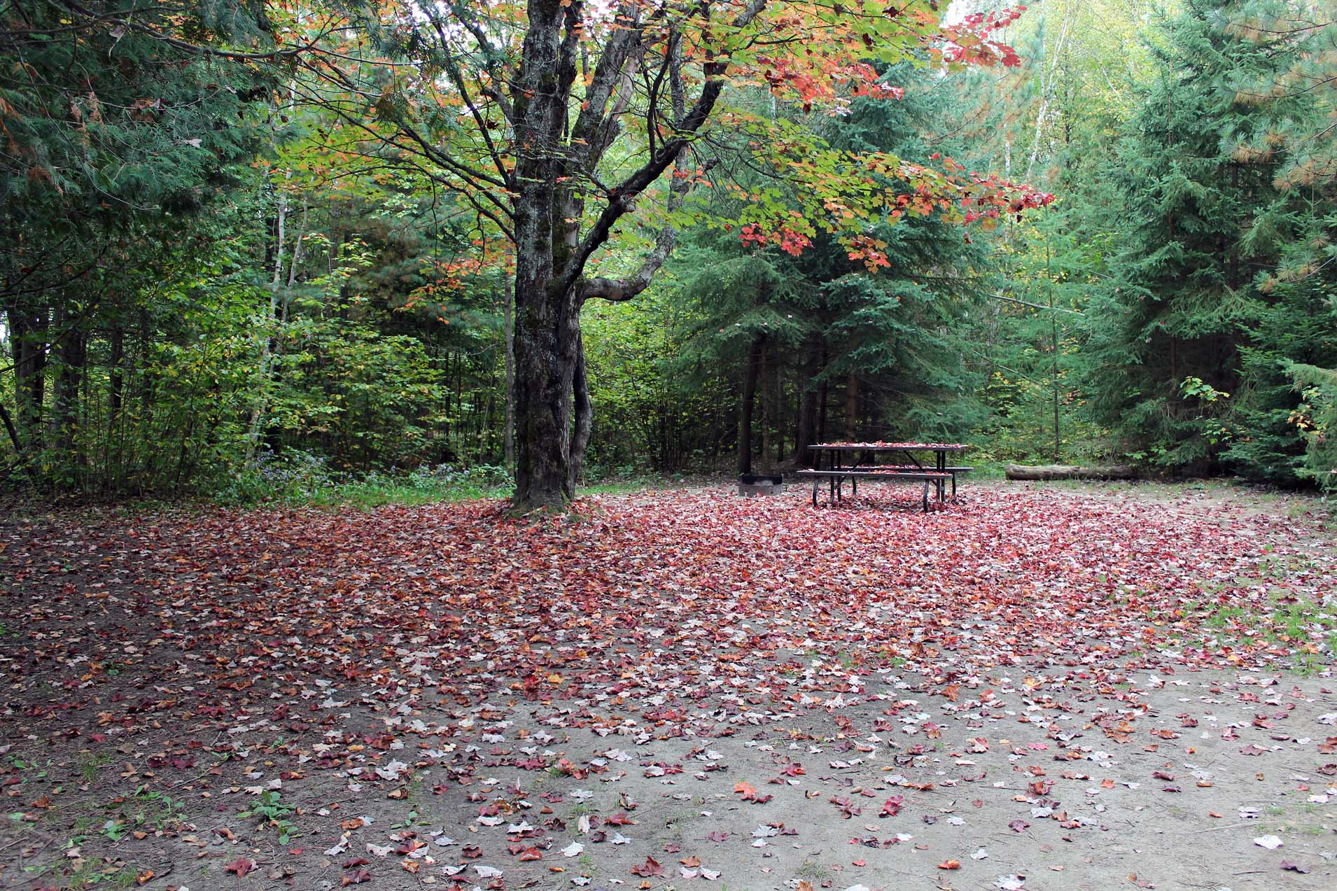
| In Chutes Provincial Park, we got the same campsite we had stayed on just one month ago! |
We
drove to Sudbury, where Catherine went to the TD Bank regarding a money order:
unfortunately, she had experienced so many problems with this bank and spent so
much time on the phone that the quality of her vacations certainly suffered.
And it was a clear fault of a TD Bank employee in Mississauga, who did not
enter just one number on the money transfer!
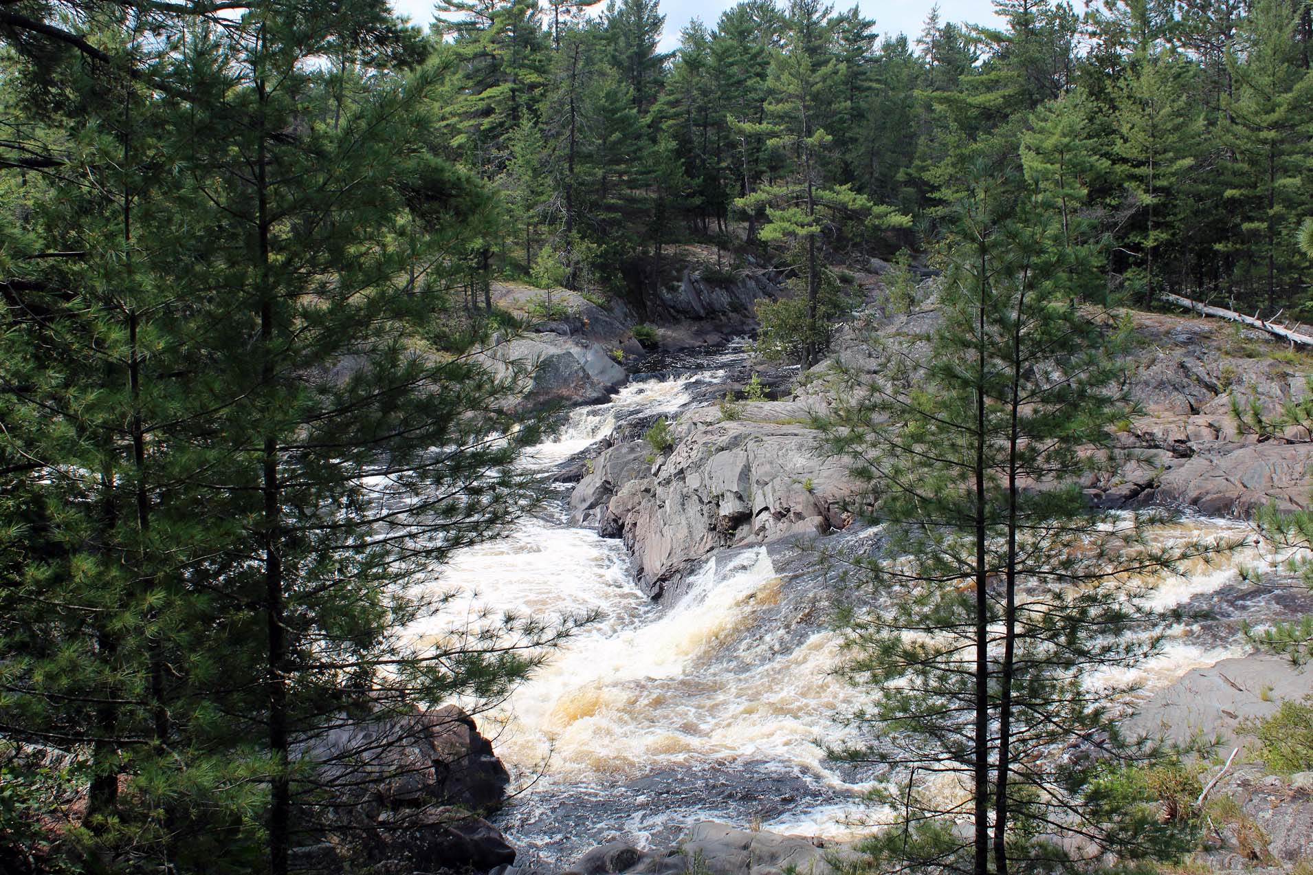 |
| There were plenty of falls and rapids in the park |
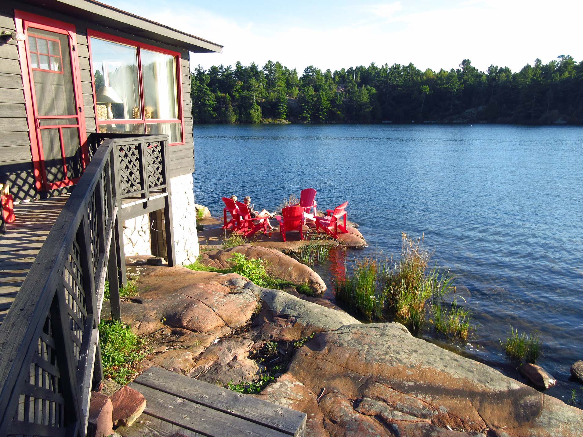
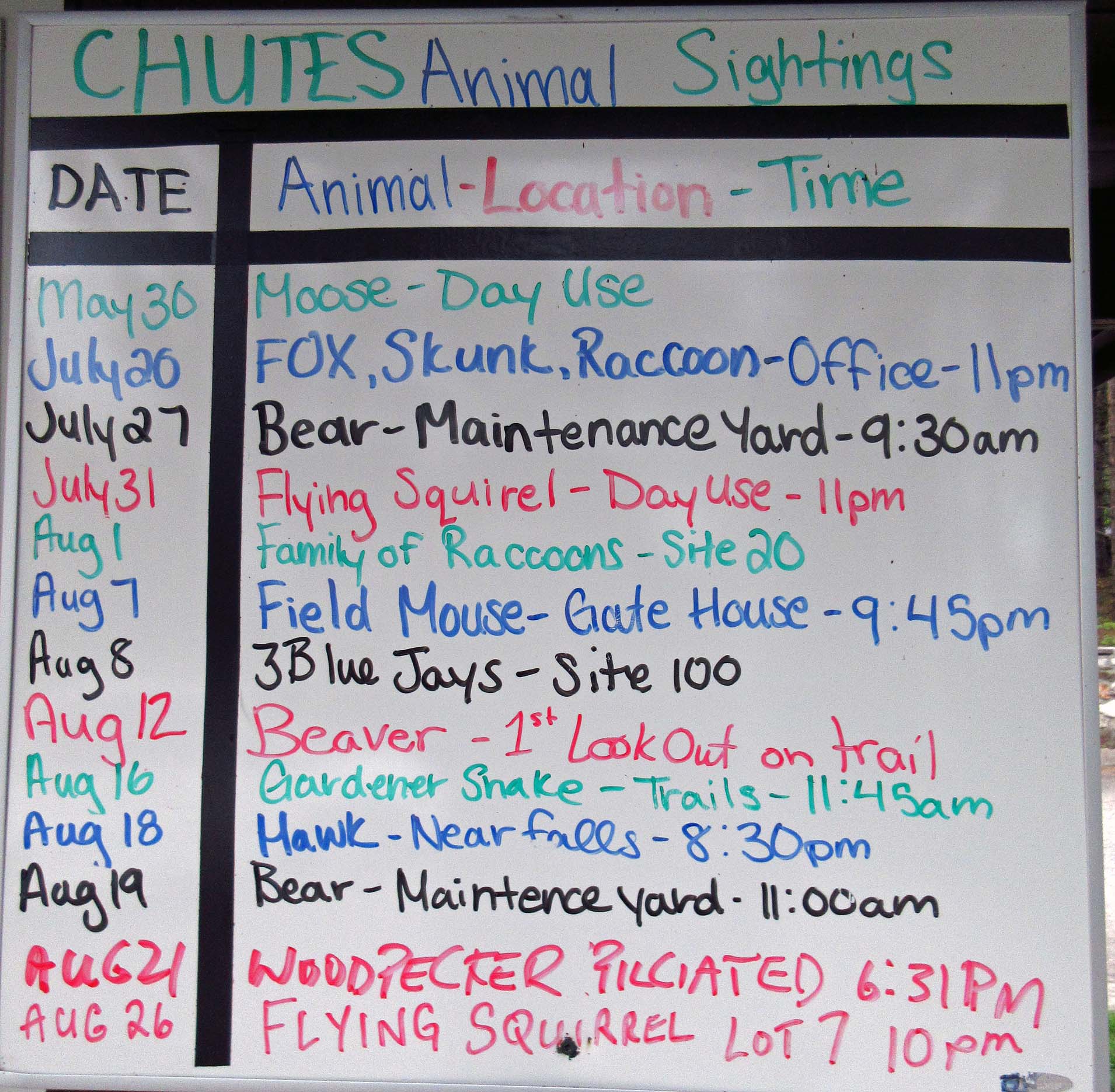
We also went to Independent (a big grocery store), where we bought plenty of food items bearing the sign of quality (i.e., a pink sticker staying “50% OFF”). Then we drove to Massey, to Chutes Provincial Park—yes, the same park we had camped at just over 2 weeks ago and we even got the same campsite! The park was quite empty—very few people expected that the summer was going to start a couple of months later! Later, we spoke to a park employee, Amanda, who grew up in Massey.
 |
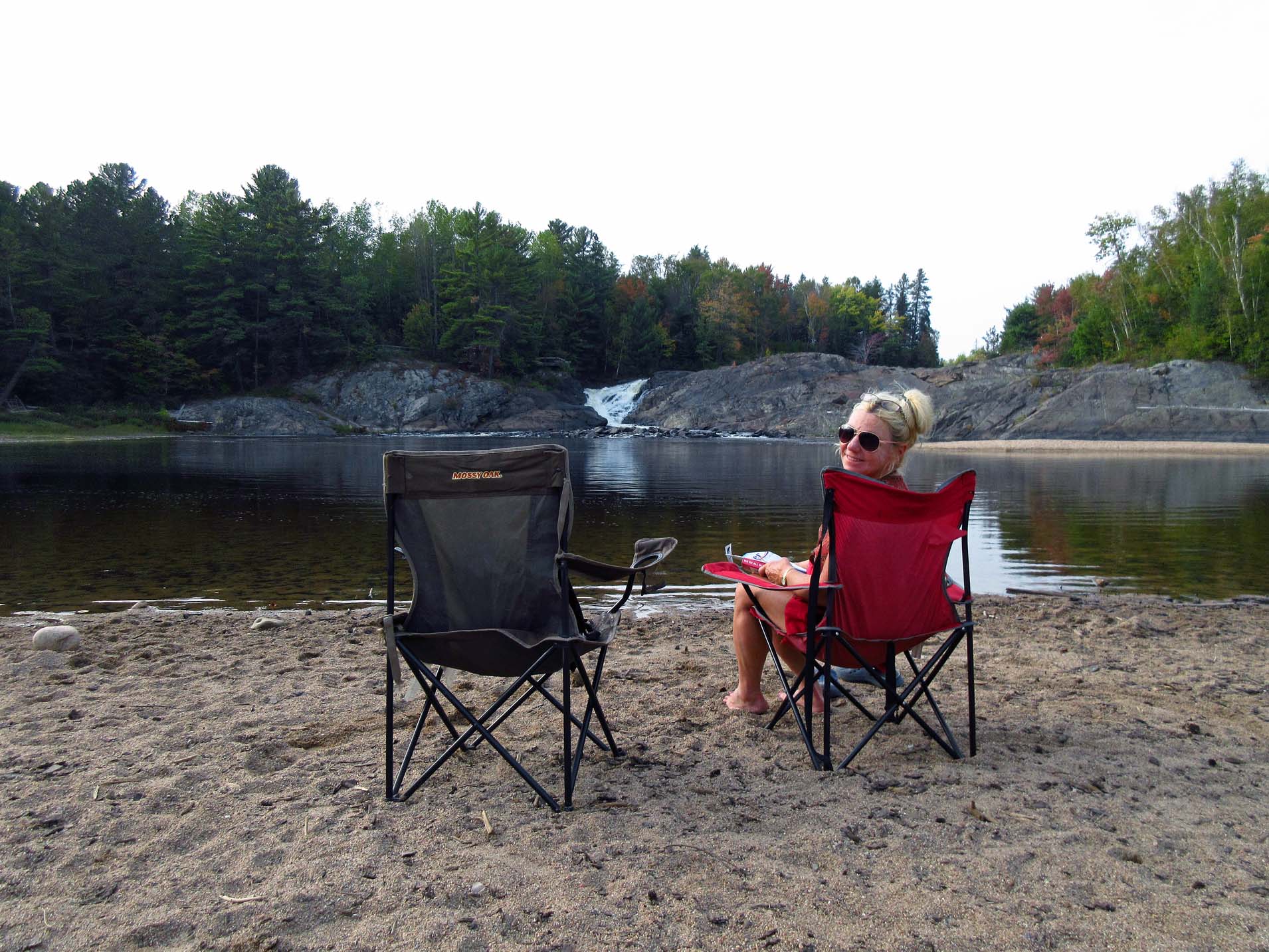
| We liked sitting at this scenic campsite, which was just vis-a-vis our |
Catherine
often went over to the other campsite, which was covered with falling leaves,
to have her coffee, listen to the radio or just listen to the nearby falls and
meditate. One day we met a young Thai lady with a 13 week old miniature dog
(Chow/Australian Sheep Herder), she got it from a breeder and it was ADORABLE!
I loved stroking it—its fur so soft! She caught a salmon in the river and
wrapped it up to take home. Then her husband came and we chatted with him too.
A few days later we again ran into them on the beach, talked to her husband’s
father from Sudbury (he was wearing a pink ‘prison suit’’), quite an
interesting chap in his 80s.
 |
| And this was another spot where we loved sitting, watching the falls and listening to sound of the water |
My
last book that I started reading at Chutes was “Red Heat: Conspiracy, Murder,
and the Cold War in the Caribbean” by Alex von Tunzelmann, which I had picked
from a second-hand book store in Toronto. I immediately found the book totally
fascinating and captivating—after all, I had been going to Cuba for many years
and even in my teens I had been interested in that region and its politics. The
book was about the Caribbean (Cuba, Haiti, and the Dominican Republic) and its
leaders (Fidel Castro, Che Guevara, Rafael Trujillo and François "Papa
Doc") during the presidencies of Eisenhower, Kennedy, and Johnson. The
superpowers thought they could use those countries as puppets during the cold
war, but what neither bargained on was that their puppets would come to life. I
could not put this book down, it was remarkable! By the way, I thought that the
author was an older, distinguished looking gentleman, coming from an
aristocratic German family. Nothing could be further from the truth: Alex von
Tunzelmann was actually a British, Oxford-educated woman historian, born in
1977. And she wrote this exceptional book when she was just 34 years old!

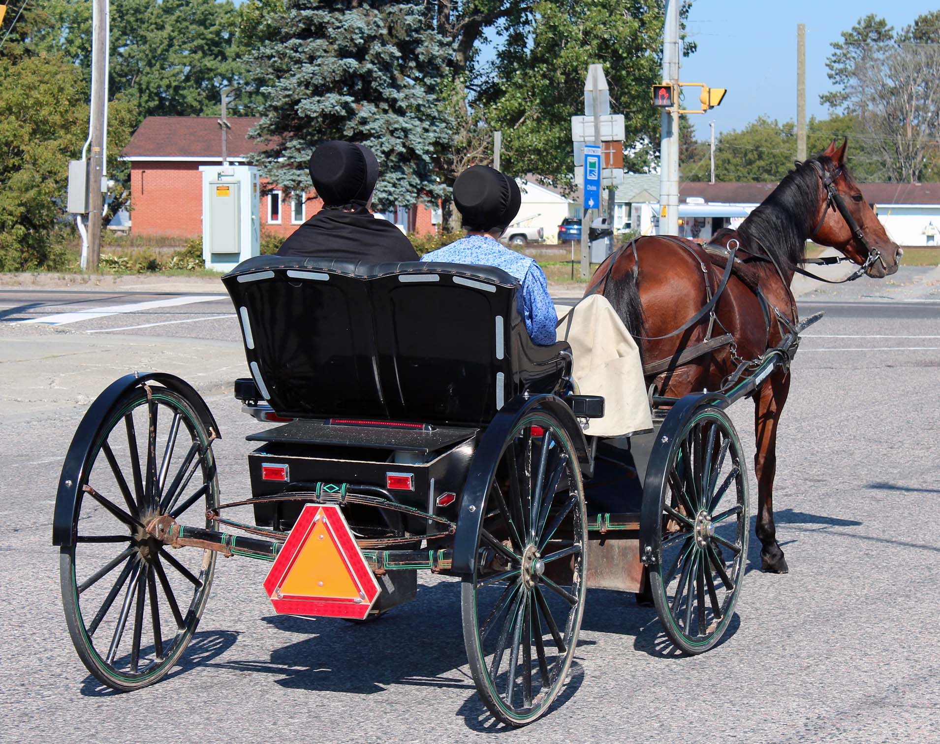
On
Sunday, as we were leaving the LCBO store in Massey, we saw about 10 Mennonite
horse-drawn carriages on the road leading towards the park. There were plenty
of Mennonites in the area—some were even selling home-made pastries at the
corner of highways 17 & 553—and on the other corner there was a… how can I
call it… a second-hand store with thousands of items, including furniture. The
Home Hardware store had a special parking designed for the horse-drawn buggies!
We
again walked part of the Twin Bridge trail. The weather, as I said before,
gradually kept becoming summer-like, it was sunny and humid and the mercury in
Sudbury hit a record of +35C. Several times we drove to Espanola and once
Catherine went to the TD Bank there, sat with a consultant, trying to setup
cross-border account—for some inexplicable reasons it was NOT possible!
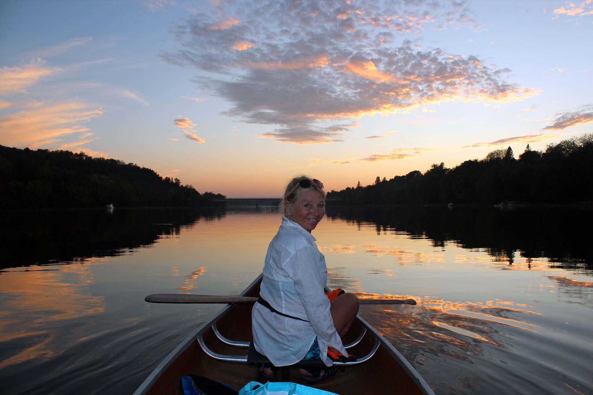 |
| Paddling on the Spanish River in Massey, ON |
While
in Chutes, we did a number of canoeing trips—it was a great base for paddling
on lakes in the vicinity. We drove to Espanola, took Panache Lake Road and
parked near the bridge. First we paddled on the Darkies Creek, which soon
merged with the Spanish River. It was a lovely, quiet paddle; we did not see
any other people around. The ridges along the shores were sandy. From afar we
saw the Domtar Paper Mill in Espanola. We still managed to go to Hart,
Independent, Canadian Tire and Dollarama for more deals.
 |
| Very picturesque road to Willisville |
On
Thursday we drove to Espanola, then took road number 6 (leading to Manitoulin
Island) and turned left, to a small settlement of Willisville. By the way, the
road was quite steep, but it was also very scenic and offered awesome views of
the area. Once I reached the town, I kept driving on what I though was a
regular road, but when that “road” became very narrow and rough, I realized
that I was driving on the abandoned railway! So, I had to back up and finally
reached Bearskin Resort.
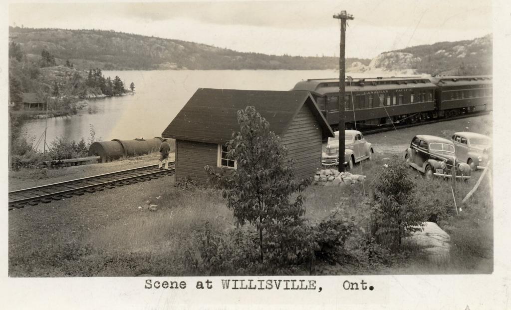 |
| Old train station in Willisville. By permission. Source: http://www.willisville.ca |
Willisville
was settled over 100 years ago and at that time the Algoma Eastern Railway was
opened from Sudbury to Little Current (on Manitoulin Island). Passenger service
to Little Current ended by 1963 and the line itself beyond Espanola went into
disuse and abandoned. Nowadays, much of the former right-of-way remains visible
and is used in certain areas as a road or path—we spotted a few motorcyclists
using it. Many Group of Seven members painted in the area.
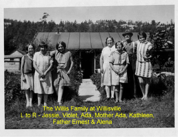 |
| The Willis family, from whom the town derives its name. By permission. Source: http://www.willisville.ca |
We
parked at Bearskin Lodge & Outfitters and talked for a while with Darcy,
who regaled us with many interesting stories from the area and told us that
Franklin Carmichael’s (one of the Group of Seven’s members) cabin was on the
lake nearby. The Lodge was situated on both sides of the narrows and a small
ferry transported tourists to their cabins on the other side of the narrows. It
cost us $5 to park the car.
 |
| Canoeing near Willisville |
We
paddled on Frood Lake—there were a lot of rolling, white quartz mountains. Then
we paddled on the lake north Bearskin Lodge, reaching a small channel leading
to Charloton Lake. There were lots of islands with nice cottages, otherwise
known as “camps” up north here. The other day we paddled along the shores of
Frood Lake towards the Lawson Quarry, there we saw the former right-of way of
the Algoma Eastern Railway. We reached the dam—there were some small, abandoned
buildings—and walked a little. I spotted a nice, albeit abandoned and
dilapidated house—somebody had sprayed on the door, “Come In”, so we did. It
must have been occupied not long ago, but now was deserted and covered with
graffiti. I wonder why nobody had bought it—after all, there was a road leading
to highway 6. Near the house I walked for a while on the former railway path
and there were still some decayed railway ties deep in the ground.
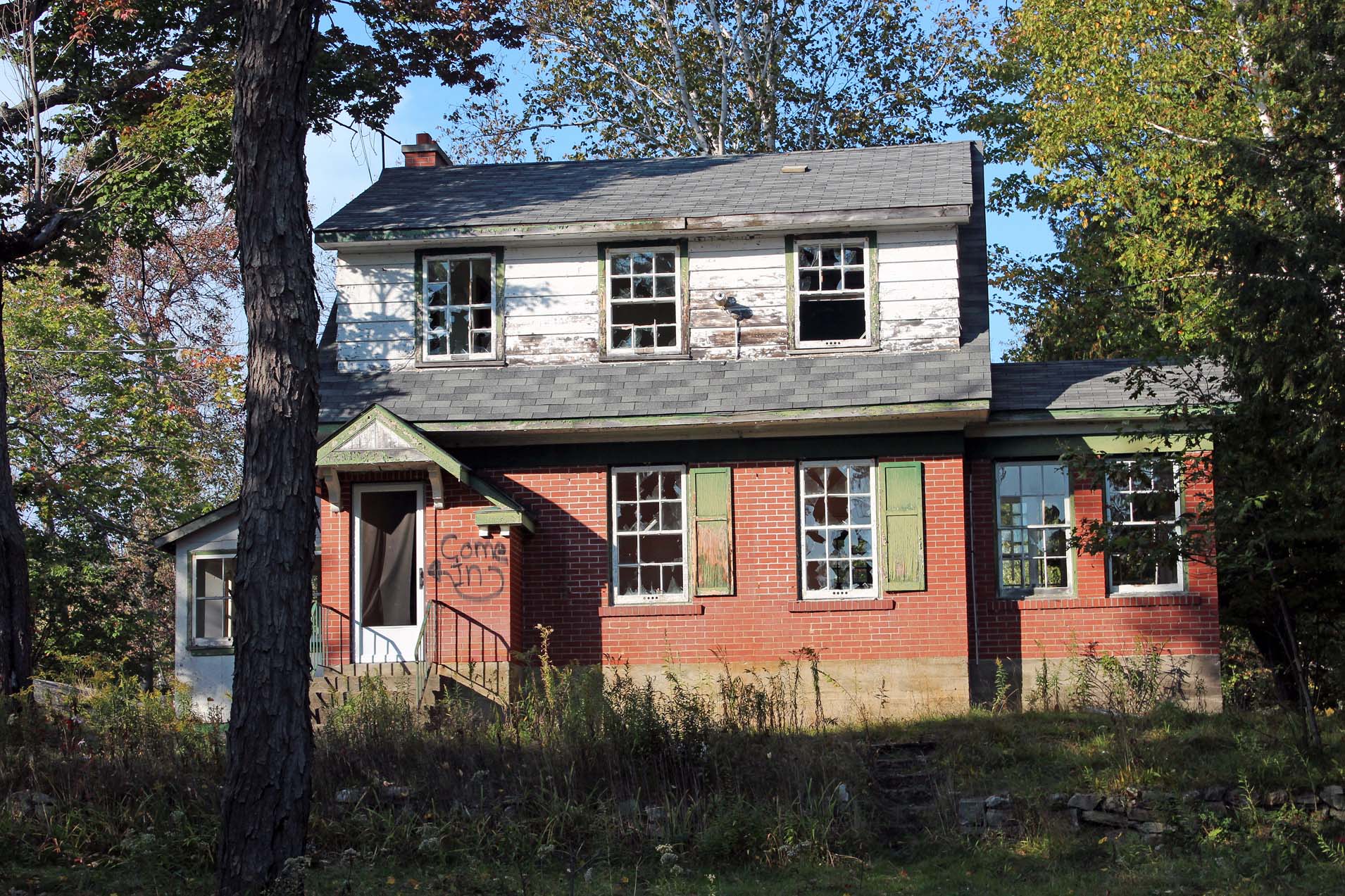 |
| Abandoned house near highway 6 |
We
also drove to Espanola and then to Widgawa Lodge & Outfitters, where were wanted
to put in the canoe, but it turned out that the lady charged $20 for parking
(vs. $5 at Bearskin Lodge) and there was no accessible dock—we had to carry the
canoe over a hill. Besides, I realized that we could reach exactly the same
lakes from Bearskin Lodge, so we went there again.
 |
| La Cloche Provincial Park |
Another
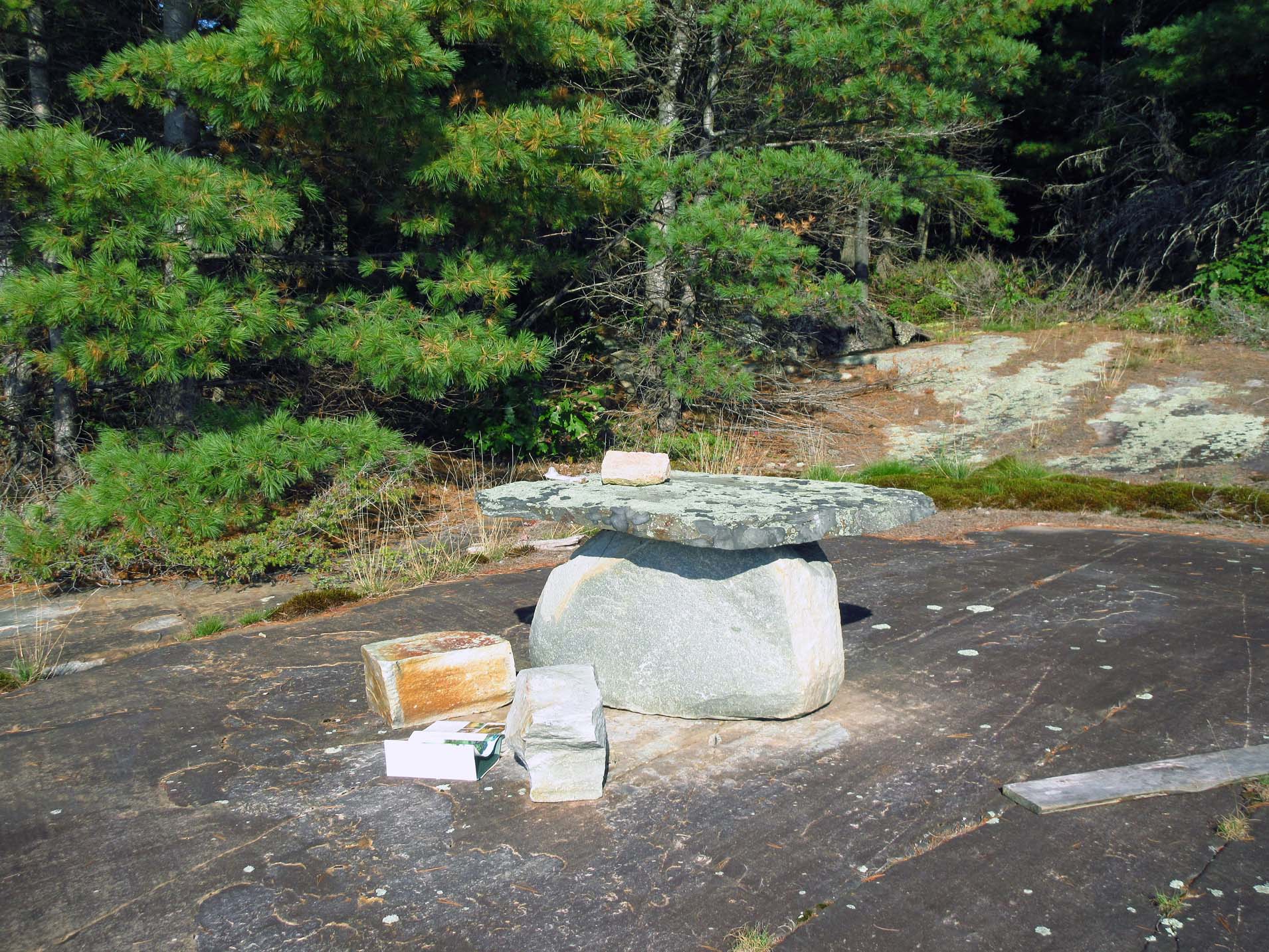
day we took La Cloche Lake Road to the very end (upon the park warden’s
suggestion) and reached La Cloche Lake—part of this lake was crown land, park a
provincial park, part belonged to Sagamok Indian Reserve. It was very hot and
sunny and it was very difficult to paddle on the open water, so we headed
towards a rocky clearing with a rock table. There was a shady spot where we
spent a few hours reading, drinking and then went for an invigorating swim.
Our
last paddle was in Massey on the Spanish River, we put in near the old bridge
(just the abutments remained). We were told that it used to be a very narrow
bridge and had been abandoned decades ago, when the new bridge was built. We
turned left into the Sables-Spanish River and paddled to the very end—i.e.,
three bridges—a train bridge, highway 17 bridge and an old, abandoned arched
bridge, now used for foot traffic. As we were paddling back, we started
chatting with a fisherman; he was, if my memory serves me well, from Hamilton
and retired here with his wife. He loved this area. He said that his wife was
volunteering in the Massey Museum—indeed, when we went there the next day, she
instantly recognized us (or, to be precise, me) from her husband’s account of
his meeting us the day before. We enjoyed a wonderful sunset on the river and I
took a lot of photos. Once we arrived at the launch site and were loading the
canoe on the car, a big truck drove up and we also saw a 24” pontoon boat on
the river—both were waiting for us to drive away. The lady from the truck was
Native and we spoke with her for a while—she was getting her Master’s degree at
Queen’s University in Entrepreneurship. They just had a fishing tournament with
big prizes! I told her that over 10 years ago my friend had won the 1st
price at such a tournament—a car—but he had not been able to even come close to
repeating this feat since then. I think that luck always has A LOT to do with
succeeding—especially catching a big fish!
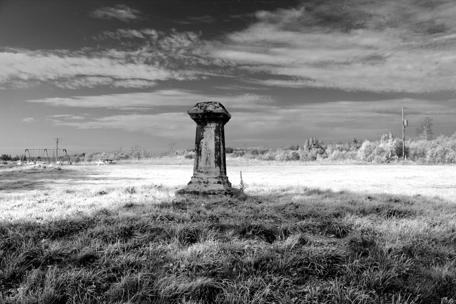 |
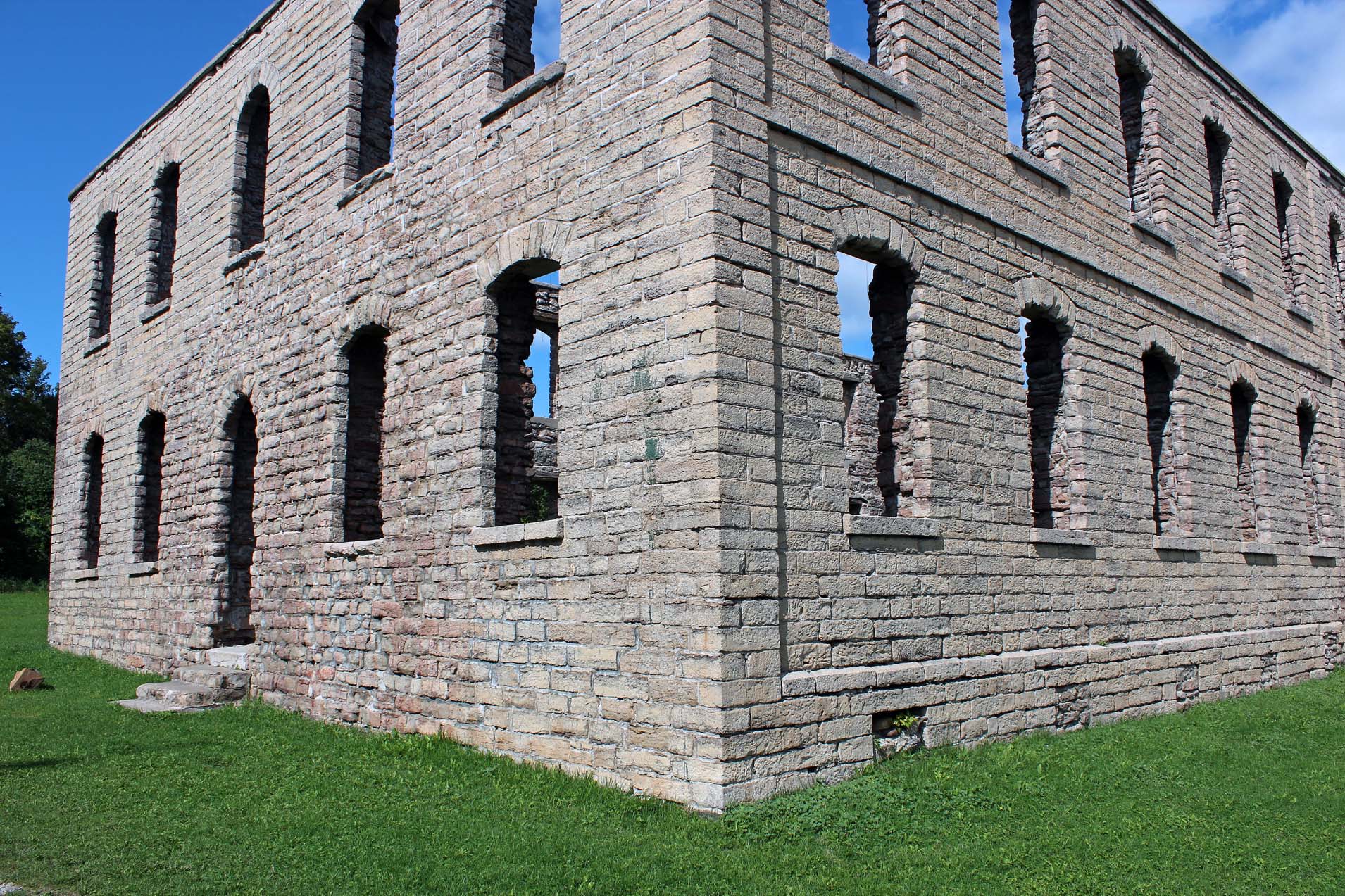
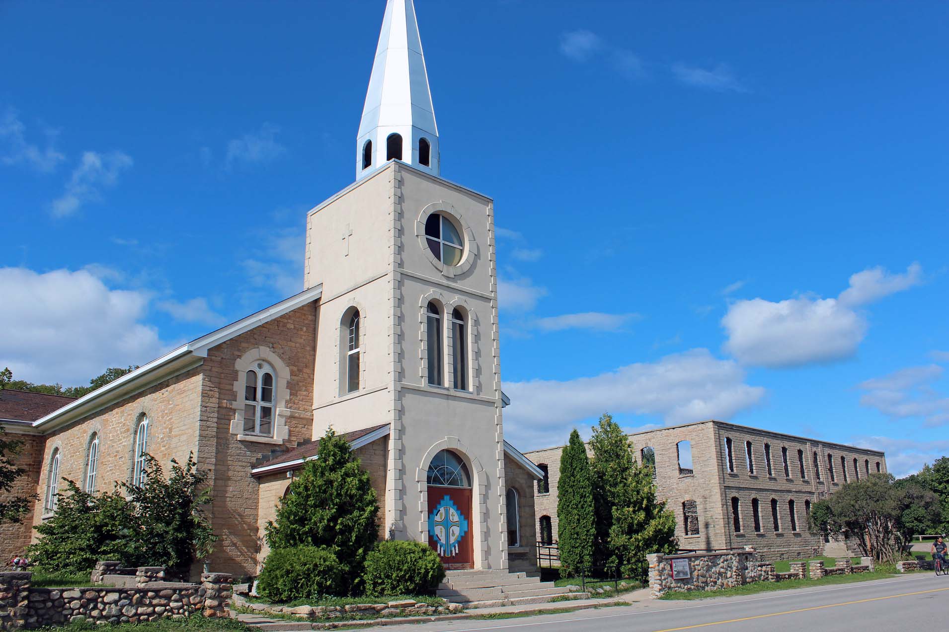
| The site of the Garnier High School. Only the pedestal remains, on which a statue of Jesus once stood in front of the school's entrance |
The
day before leaving the park we drove to the town of Spanish, called “the
gateway to the north channel”. We drove on Garnier Road to the Spanish
Municipal Marina. There was a modern building with fitness facilities as well
as a trail which Catherine decided to do—I was waiting for her in the car and
had to find a shaded location because it was extremely hot (September
25-unbelievable-over +30C!).
 |
| The Garnier High School for Boys, as it looked many years ago. The pedestal, with the statue of Jesus, is visible. |
Very
close to the marina there used to be two Residential Schools. One was for boys
(The St. Peter Claver School and the Garnier High School, operated out of the
boys school) and run by Jesuits. The other school, St. Joseph's School for
Girls, was run by the Daughters of the Heart of Mary. The Garnier High School
(also referred to as “Garnier College”) was closed by 1965 and the Garnier
building was demolished in 2004. The St. Joseph's School for Girls closed in
1962 and the building sustained a fire in 1981.
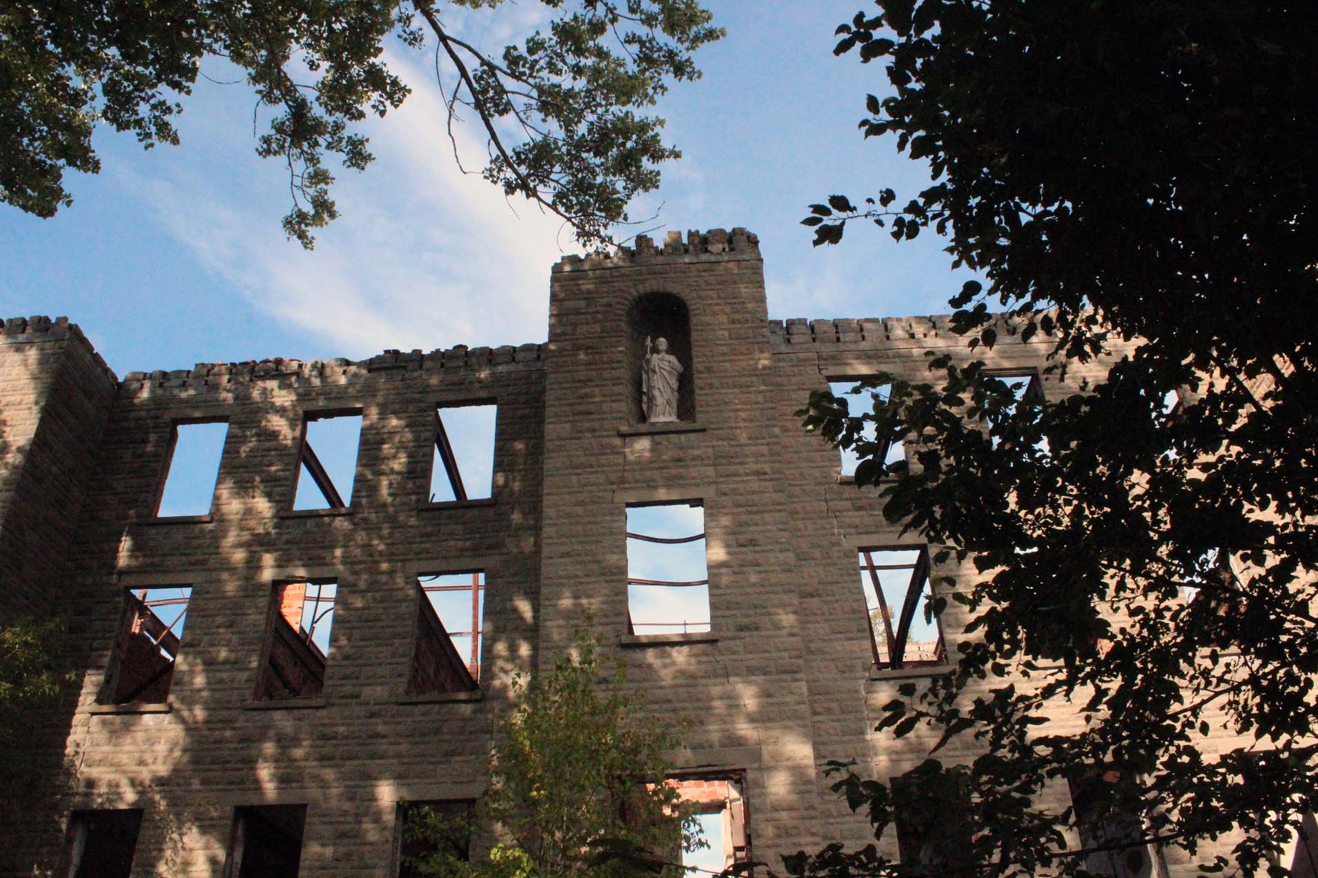 |
| The ruins of St. Joseph's School for Girls |
When I
had visited that very same area in 1994, I still remember the ruins of the
Garnier School, along with the pedestal, albeit empty. According to old
photographs of the school, the statue of Jesus, his arms outstretched, used to
be there. When we were there in 2017, the school building was gone and the only
remnant was that lonesome pedestal. There was also a new granite monument, on
which both schools were depicted, with the following inscription:
 |
| The Granite Monument |
“Dreams flash across the minds of many,
gratifying, satisfying, unrelenting, but dreams pass and we find peace at
last.” Mae Evelyn Smith, Buswa, a student. “This memorial is in honour of all
children who attended these schools.”
 |
| An old photo of the two schools-the Garnier High School for Boys and St. Joseph's School for Girls |
The
building, or rather its shell, that used to house St. Joseph's School for
Girls, still stood a few hundred meters from the site of the other school. The
statue of St. Joseph was still there. The gate was open, so we entered the
premises—I think that somebody was next to the building, the place was quite
interesting and we wished we could have talked to the owner.
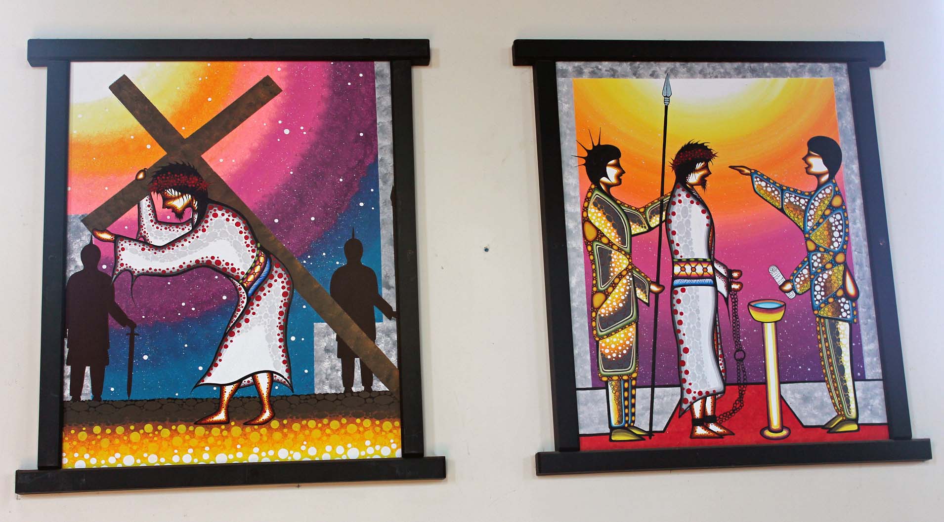
The
residential schools had left a painful legacy and for many years those who
attended the schools had often been publicly reminiscing about the years spent
there.
Incidentally,
since 1994 I have been attending annual Jesuit retreats at Manresa, Pickering,
Ontario. Adjacent to the Retreat House is the Jesuit Infirmary (René Goupil
House), where most older and infirm Jesuits come there to retire—and eventually
die. Over the years I had read their obituaries and from time to time they
mentioned that a given Jesuit brother or father used to teach or work at the
Spanish Residential School. During my last retreat, at the end of 2017, I was
told that only one Jesuit associated with the Residential School in Spanish was
still alive and resided in the Jesuit Infirmary.
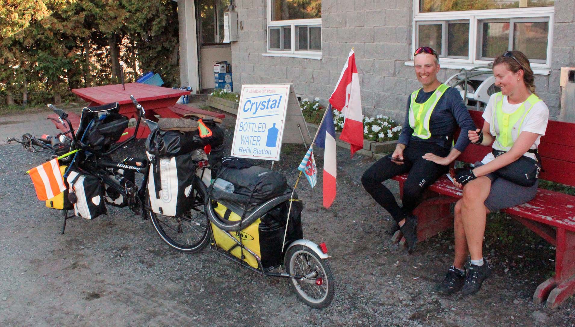
On our
way back to the park, we stopped at Variety Store for ice cream and talked with
a French couple who were tandem riding from Vancouver to Quebec City—they
started in July. I always have a high regard for such adventurous individuals!
And
then inevitably came September 26, 2017, our last day at the park and our last
day together, period! After packing up, we went to the Massey Museum, but only
spent 10 minutes there, getting low-priced books and videos. Just before noon,
after 36 days travelling together, we bid farewell! Catherine drove west to
Minnesota; I was on my way to Mississauga. I still stopped at Espanola as
Catherine had asked me to buy her some headlights. I also went to The Giant
Tiger to buy a simple t-shirt: it was very hot, +32 C, and I had run out of
t-shirts, not expecting it would be so hot at that time! Next to the store
there were rail tracks, leading from the Domtar Paper Mill towards the south. I
believe it was the only existing and seldom used spur of the Algoma Eastern
Railway.

I made
a quick stop at the Hungry Bear Restaurant and went to the Trading Post and
next I arrived at the intersection of highway 69 & road 522, where the
Grundy Supply Post used to be located—and where we had purchased our canoe in
2010. Now it was gone, only the rusty shells of the gas dispensers remained.
Fortunately, it had just relocated to the entrance of Grundy Lake Provincial
Park—most likely the new highway would pass through its former location.
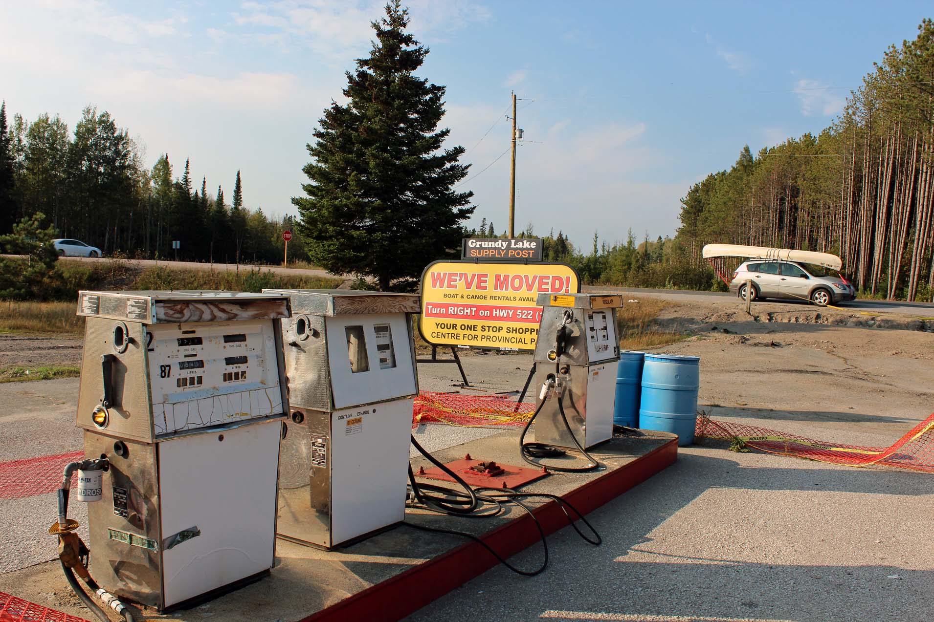 |
| The former location of Grundy Lake Supply Post, at the intersection of Highway 69 & Road 522. In 2010 we bought our canoe here! Fortunately, it moved just 1 km and now is located in front of of the entrance to Grundy Lake Provincial Park |
I was
planning on spending the night at Six Mile Lake Provincial Park, but soon
realized that I would not make it there on time. Instead, I drove to Oastler
Lake Provincial Park, several kilometers south of Parry Sound. The park was
almost deserted, the park offices were closed and I quickly drove to campsite
number 132, where we had stayed once. Since I only had Catherine’s very small
‘emergency tent’, my inflatable matters did not even fit in, but well, it was
for only one night, so I kind of made it fit! To make the tent waterproof, I
covered it with a tarp. It was still very hot and humid, but the weather
forecast called for a much cooler weather from then on—it was a perfect timing
to end our vacation where we did.
 |
| Campsite #131 in Oastler Lake Provincial Park and my 'emergency' tent, much too small, but OK for just one night |
I
drove to the park’s office and made a call from the pay phone outside. Then for
the first time I heard the train. OMG, it was so noisy! Without any
exaggeration, I thought the train would suddenly materialize on the road and
run me over, like in some horror movies! I had to postpone the call because it
was impossible to hear anything. Then I drove back to the campsite and spent
some time reading and sipping wine. Several times I heard the trains (there
were two railway tracks very close to the park, one for eastbound, the other
one for westbound trains). Whenever the train approached, first I hear the
train whistle blowing, it became lauder and lauder and finally I could hear the
rhythmic sounds of the train, so acute that sometimes I had a feeling that
trains were crisscrossing the park, just next to my tent! I did manage to fall
asleep after 1:00 a.m., yet at least once during the night I was awakened by
the train. Just before 6:00 a.m. I woke up due to a shrieking train
whistles—falling back asleep was pointless, as in no time I heard another train
and yet another. I had stayed in this park several times before and honestly, I
had no idea why those trains had not bothered me then! I quickly packed up the
tent—which was a good idea as it started raining a little—and left the park
just after 7:00 am. After making one quick stop at MEC in Barrie, I arrived at
home before 11 a.m.
Blog in
Polish/w języku polskim: http://ontario-nature-polish.blogspot.com/2018/08/wycieczka-samochodowo-kepmpngowa-parki.html
More photos from this trip: https://www.flickr.com/photos/jack_1962/albums/72157699705142605
More photos from this trip: https://www.flickr.com/photos/jack_1962/albums/72157699705142605