Blog po polsku/in Polish: http://ontario-nature-polish.blogspot.ca/2014/07/rzeka-francuska-french-riverna-kanu-na.html
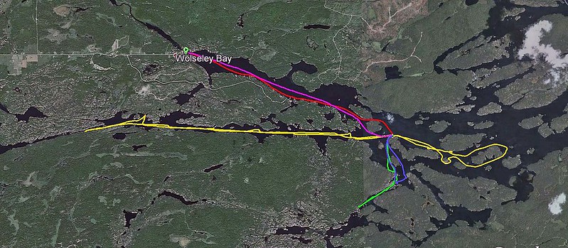 |
| GPS tracks |
We were planning to
launch the canoe from Wolseley Lodge, but we took a wrong turn and ended up at Pine
Cove Lodge. Unfortunately, it did not have a ramp and we were supposed to carry
our belongings to the water and, on top of that, pay for that privilege $7.00 launch
fee plus $8.00 per day for parking the car at a remote parking lot. So, we
turned around and drove to Wolseley Lodge.
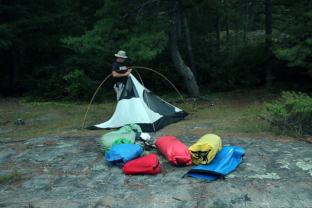 |
| Setting up the tent |
The put-in was free
and parking was just $2.00 per day—much cheaper and we could literally drive
the car into the water—as well as the parking was next to the water and the
lodge. The lodge owner said they kept an eye on the parked vehicles—and
Catherine believed her since she was German—maybe because Catherine has a
German name too.
After paddling for
over one hour—and hearing a few stinging comments from passing boaters about
how much stuff we were carrying (to which we had already gotten accustomed), we
arrived at our beautiful campsite—hallelujah, nobody was on it! Since we had
camped on the very same campsite in 2011, we realized it was probably one of
the best campsites in the area. Quickly, we claimed it. It had not changed
significantly over the past two years. A primitive plywood table was quite
convenient; there were several white bones kicking around, probably belonging
to previous campers, who might have had a nasty encounter with a hungry black
bear… OK, I am kidding… the bones were probably deer’s or moose’s and they were
neatly laid out on the rock. The campsite was very spacious, with many
potential tent sites, two thunder boxes (i.e.,
outhouse sans the house) and
beautiful view of sunsets. At night we did not see anything around, just an
occasional boat showed up here and there, with some fishermen, who kept
fishing, but in most cases, to no avail. Because the shape of the island
resembled a boomerang, I had always been calling it Boomerang Island.
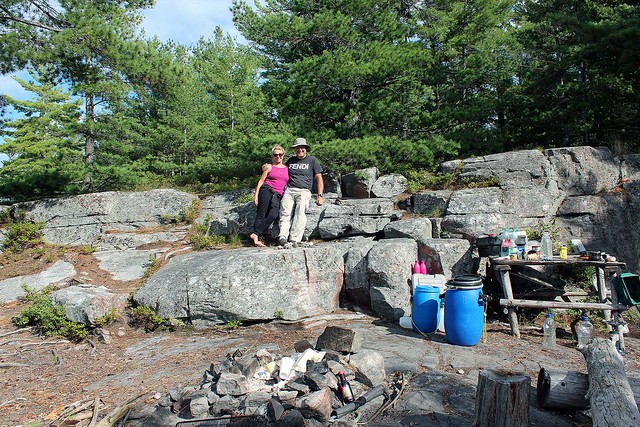 |
| At our awesome campsite! |
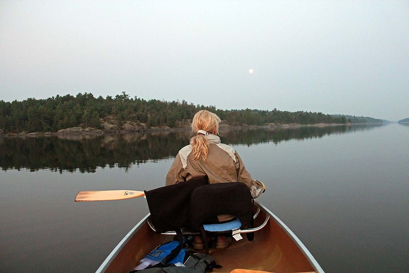
It was full moon (blue
moon) and in the evening we went for a paddle to other islands with several
campsites—all of them were unoccupied. The moon was soon up and indeed, it was
very bright, round and yellow-golden. While paddling, I was also trolling and
finally caught a 63 cm pike. Alas, according to the Fishing Regulations, it had
to be released; being a good, law-abiding citizen, release it I did, albeit
half-heartedly. So long, our supper!
 |
| View from our campsite |
Whereas evening
paddles are relaxing, so are morning jaunts. Thus, one day we awoke early in
the morning, at 5:00 am, got into the canoe and went for a sally on the lake in
North Channel. The moon was still visible, everything was so quiet and we did
not see any motorboats on the river. There was a tent pitched on the north
shore of the channel, which was crown land, no park fee required. The campers
were apparently asleep, yet their dog quietly ran down to the shore to check us
out. On we went, finally reaching the characteristic pine we had seen from our campsite
while sitting at the rock and admiring sunsets. There was a cottage on the
other shore, at the park boundary. We loved paddling along the rocks and at one
point came ashore—there was a fire pit made of rocks as well as a table:
apparently somebody (or a group of people) frequented this camp.
 |
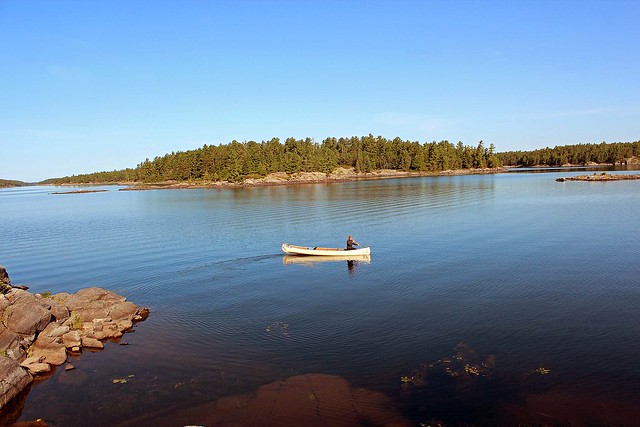
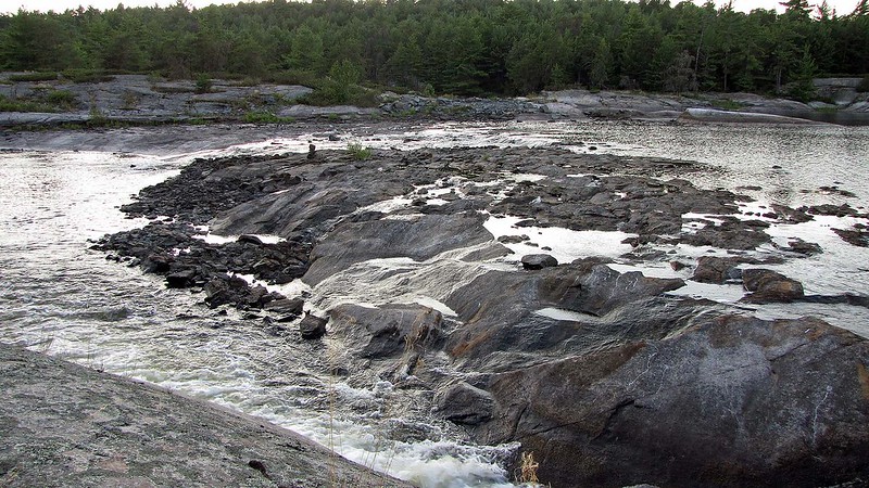
| Morning paddle in North Channel to the Cedar Rapids |
Eventually we reached
the Cedar Rapids. The water level was quite low, judging upon the water lines
on the trees and rocks. We secured the canoe to a tree and took a nap, being
lulled to sleep by the sound of the rushing water.
The paddle back to the
campsite took us at least 2 hours. We also took other trips. Once we paddled to
the Five Mile Rapids, just across from Crane’s Lochaven Wilderness Lodge. After
carried the canoe through a shallow and rocky stretch of the river, we were
able to again paddle for a while, until we reached another obstacle requiring a
(longer) portage, the Little Pine Rapids (which obviously we did not attempt to
portage). The area was very scenic and beautiful and we spent about one hour
walking around.
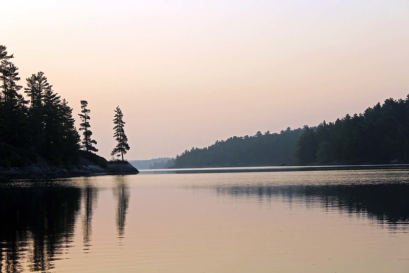 |
| North Channel-we saw this distinctive pine from our campsite |
That evening I caught
a 5-6 kg ugly looking catfish which I cleaned and later fried. It was the only
fish I caught and ate this whole summer! Well, I can proudly boast that I
rarely exceed the daily catch limit—in the whole year!
As I mentioned before,
we had stayed on the very same campsite 2 years ago and of course, I wrote an
extensive blog, in which I extolled virtues of this campsite. The next day
after our arrival a few canoes paddled by and one of the canoeists shouted
towards us:
“Is this the famous campsite number
XXX?”
“Why was it famous?”, I asked.
“It was featured in a very well-known
blog”, she said.
I was almost flabbergasted
at her words and would not say anything. Should I have told her that it was I
who wrote that blog? During our stay at the campsite, we saw at least 3 other
groups of canoeists who apparently were looking forwards to stay at this site
and some were extremely disillusioned to find out that it had already been
occupied. Well, it seems that people do read my blog and even act upon its
recommendations!
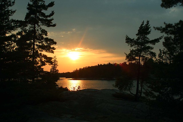
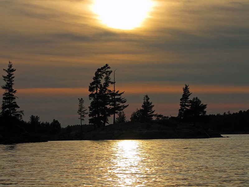 |
| Sunset |
While we were sitting
on the rock at the campsite, we saw two loons performing a mating dance ritual,
which ended in hopefully a new baby loon gracing this earth.
On Sunday we got up
early, packed up and headed to the car. Our plan was to drive to Oastler Lake
Provincial Park, located 6 km south of Parry Sound. No sooner did we get all
our gear packed into the van when it began thundering, lighting and heavy rain
pelted down. We drove to the Hungry Bear Restaurant on highway 69 (just north
of the French River bridge) to have a traditional grilled hamburger. The place
was packed; moreover, the cream soup, which Catherine wanted so badly, was not
available. So we drove next door to the truck stop, had a very good salad and
chatted with the owner for some time.
 |
| Near the Little Pine Rapids |
Catherine had a
burning desire to once again drive through Shawanaga Indian Reserve, so she
made a detour off highway 69 into the reserve and looped back out onto highway
69.
When we arrived in
Parry Sound, it was still raining. We visited a few stores and then went to
Walmart, probably the only store open after 6 pm. While inside, we could hear
the rain pounding the metal roof of the store and very loud claps of thunder.
At one point the store lost its power (as we were about to pay), but the
generator kicked in and we were able to complete our payment. Some of the
shoppers were buying plenty of tarps—they were camping in the nearby provincial
parks (Killbear, Oastler) and their presumably cheap tents were already
leaking.
 |
| We enjoyed watching such beautiful sunsets from our campsite |
Considering the
weather, we realized it would be impossible to set up a tent in the park. So,
we made the wise choice and drove straight to Toronto, arriving about midnight.
Because the weather was very crappy the next few days, this decision certainly
saved us from a camping nightmare experience.
Overall, we enjoyed
this trip very much. And although Catherine was always trying to visit an area
we had not visited yet, I was discreetly planning our next trip to another
stretch of the French River!
Blog po polsku/in Polish: http://ontario-nature-polish.blogspot.ca/2014/07/rzeka-francuska-french-riverna-kanu-na.html
Although, probably I'll have little chances to act upon your recommencations, I like your sense of humour, Jack and descriptions of your canoe trips. Beautiful photos!. Regards
ReplyDeleteDaniel: Thanks for your comments. Well, if you come to Canada, you might act upon my recommendations!
ReplyDeletealways liked your trip reports and photos! Boomerang island is actually called Banana Island. I know you paddled the east outlet of the French and the Pickerel River but I would like to suggest the west outlet of the Delta. My personal favorite! Happy paddling!
ReplyDeleteHi Ingo,
DeleteI appreciate your comment. Actually, the island's shape resembles a banana as well, so it's a very appropriate name-alas, not listed on my map. West outlet of the Delta-do you mean the one on Georgian Bay?
All the best,
Jack