Blog po polsku/in Polish: http://ontario-nature-polish.blogspot.ca/2015/12/biwakowanie-i-pywanie-na-kanu-na-wyspie.html
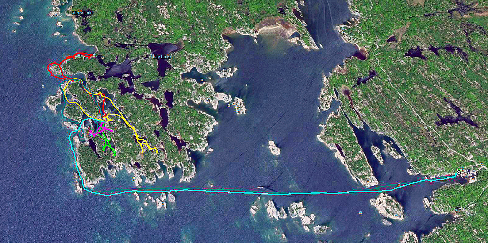 |
| Our routes on Franklin Island according to our GPS |
We visited Franklin Island for the first time in July,
2014 and we liked it so much that we decided to go there again the following
year. The island is Crown Land and no camping permits are required, at least
not for Canadian residents
Franklin Island
was named after a famous British explorer of the Arctic, Rear Admiral Sir John
Franklin (1786-1847), who passed through Georgian Bay during his second
expedition to the Arctic in 1825. In 1845 Franklin set upon his last expedition
to find the Northwest Passage. The icebound ships were abandoned and the entire
crew of 128 perished from starvation, hypothermia, tuberculosis, lead poisoning
and scurvy. In 2015 researchers from the University of Alberta and the UK concluded,
upon examining the remains from cracked bones found on King William Island,
that the tales of cannibalism on John Franklin’s last expedition shared among
Intuit were true.
The island is
egg-shaped, with jagged shoreline, approximately 5.5 km by 3 km and there is a
channel (Shebeshekong Channel) between its east shore and the mainland, whose width
varies from just over 100 m to 2 km. Thus, getting to the island is not
difficult; considering that the prevailing winds usually blow from the west,
the east side of the island and the channel are quite protected. It is made up
of rocks, its shores are dotted with rocks, rocky islands, inlets and bays and
there are several lakes inside the island. However, the most beautiful part of
the island is facing west—i.e., the boundless waters of Georgian Bay and
the Mink Islands—and it was where we camped last year and were trying to
bivouac this year, too!
On Sunday, June
21, 2015, after a 3 hour drive, we reached Snug Harbour. Last year it was
possible to park the car for free; this year the parking war reserved for local
residents only and we were forced to park at the pay parking belonging to the
nearby restaurant, Gilly’s Snug Harbour Restaurant & Marina, which was
probably happy to see this extra business! The signs
at the ‘residents only’ lot were very misleading and Catherine asked a resident
nearby to decipher them. He said that indeed, the parking policy was new for
2015 and lots of vehicles were being ticketed at $70.00. The weather was perfect and after one hour our fully loaded canoe war
ready to depart. According to the GPS unit, reaching the campsite should have
taken us one hour.
Soon we left
Snug Harbour, passed the picturesque Snug Habrour Lighthouse on Snug Harbour
Island and were paddling on the open waters of Georgian Bay. Because prevailing
winds are from the west to the east—and we were paddling towards the west and
were still sheltered by the island—the waves were small and without any
problems we were scudding forward.
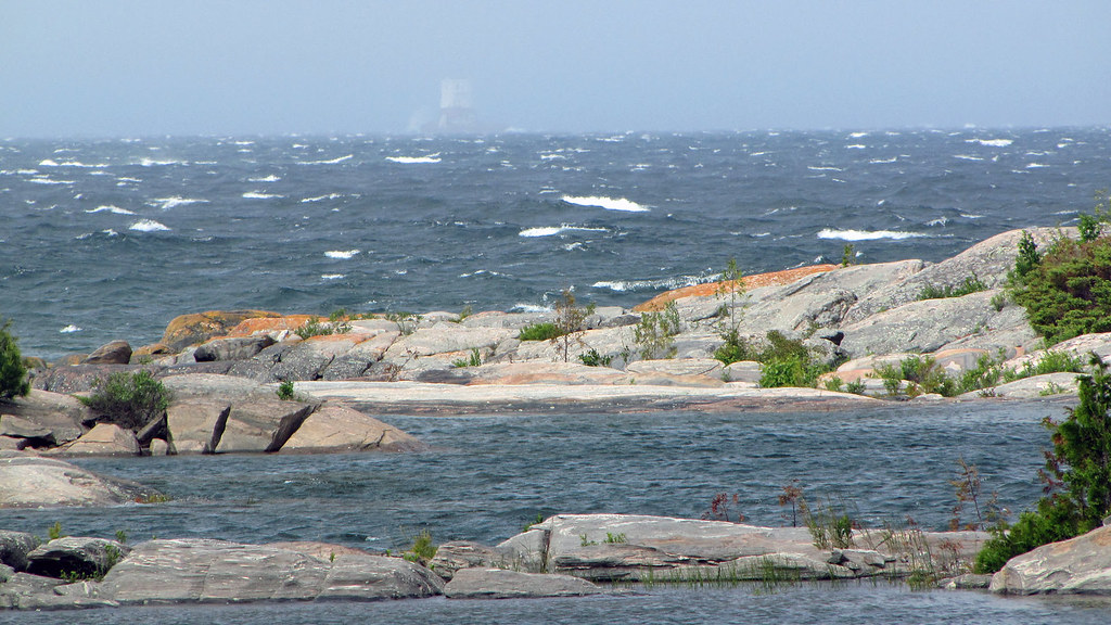 |
| View from our campsite and the Red Rock Lighthouse. It was very windy and even in our sheltered bays it would be difficult for us to paddle |
After paddling
about 3 kilometers, we reached the south shore of Franklin Island and continued
between several massive rocks ominously called Savage Rocks and the island’s
shore, strewn with numerous rock formations and inlets. Because our campsite
was located on the west part of the island, which was totally exposed to the
elements, the relatively short stretch of our trip along the western shores of
the island could potentially turn out to be the most difficult. When we saw on
our right the south-west tip of the island, Henrietta point, we made a right
turn (north) and paddled close to the western shore of the island, manoeuvring
among massive rocky island, smaller rocks sticking out of the water as well as
barely submerged sharp rocks. Immediately we realized that the wind, blowing
from the west, was strong enough to cause sizable waves; besides, in the area
close to the shores, strewn with rocks and shallows, the waves were pushed up
and suddenly were becoming quite high, even threatening our canoe. As a result,
we were in a rather unenviable predicament—the blowing wind made paddling quite
difficult, we had to constantly steer the canoe away from the rocks—and the
waves were high enough to overturn the canoe. Both of us paddled as hard as
possible and I kept navigating the canoe so that it was facing the waves
perpendicularly, but the waves were still tossing the canoe left and right. On
the right we saw a tent on a rocky hill, but engrossed in paddling, I hardly
paid any attention. The entrance to the calm bay was less than 80 meters away;
due to the direction of the waves we could not simply turn towards it—then we
would have been paddling parallel to the waves and the canoe could have
capsized quite easily. So, we kept paddling in the opposite direction, facing
the waves, which, depending on the nearby rocks or shallows, were sometimes so
high that Catherine started screaming that water was getting into the canoe! I
knelt on the floor to make the canoe stabler and kept paddling. After
struggling for a few minutes, we decided to make a 180 degree turn—we managed
to time it between two waves—and now being pushed by the waves and the wind, we
slid into the bay, which immediately sheltered us from all the perils. Then we
entered the second bay and were glad to see that our last year campsite was not
occupied. A few strokes later we reached the rocky shore.
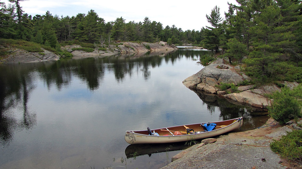
There was some wood around the fire pit, apparently left be
the previous campers. We were wondering where to set up the tent—last year’s
site on the rock was not that bad, yet I did not sleep too well and we selected
another one, closer to the fire pit. While I was setting up the tent and
mattresses, Catherine brought our belongings, setting them on the rock, under a
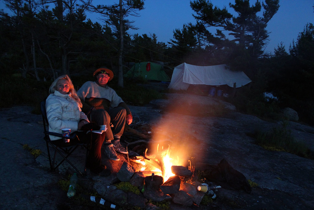
wide-stretching pine tree. The same evening we set up a gigantic rain tarp and
then went on an hour long paddle on our bay. A group of canoeists camped on the
other side of the bay, but we did not see them. We also gathered some dry wood
from the shores, it was much easier than to collect wood from around our site.
The blueberry bushes were plentiful, but it was much too early for blueberries
yet.
Our campsite was sandwiched between two sheltered bays,
where we could paddle even during strong winds, as well as there were a number
of other bays on the other side (a one meter long carry over was required)—the
other bays could be reached through a channel from Georgian Bay and some
motorboats and cruisers moored there, yet this year we spotted only a couple of
them. Thank goodness the occupants were quietly fishing or drinking (or
whatever they normally do on such yachts) and not zipping around on their
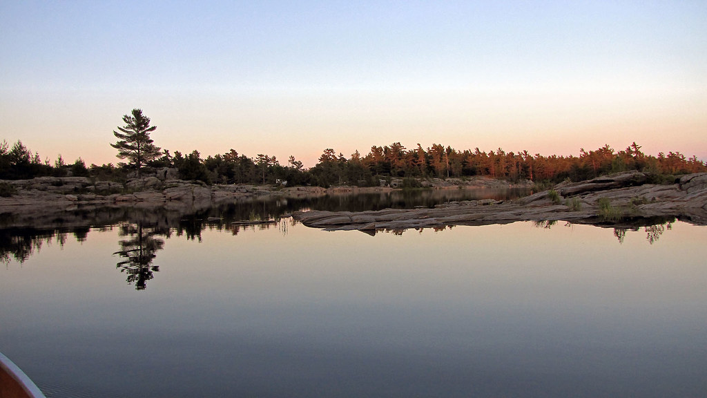
zodiacs disturbing the peace. Sitting around the fire, we had a fantastic view
of the bays and the boundless waters of Georgian Bay. Just across from our
campsite, some 5.5 km. away, emerged the massive shape of the Red Rock
Lighthouse (equipped with a helipad), which emitted light every 10 seconds. In
the north we saw the Mink Islands, stretching for about 10 kilometres—they were
very gorgeous and often kayakers camped there, yet some islands were private
and had cottages. Like last year, we mulled over paddling there, but were
afraid of unanticipated changes in the weather—there was nothing between our
island and the Mink Islands and we would have to paddle for 5-6 km on totally
open and un-sheltered waters of Georgian Bay—even a relatively light wind could
jeopardize our canoe and/or make it impossible for us to return to the
campsite.
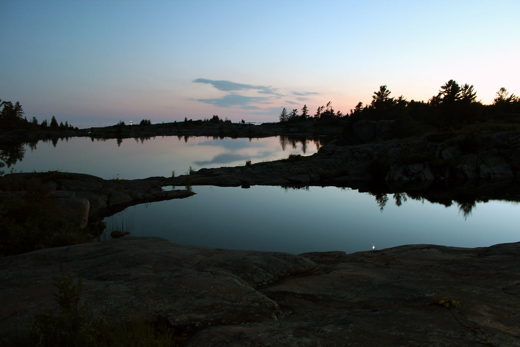
 |
| We loved paddling in the evening on the open waters of Georgian Bay! |
The plastic tarp over our ‘kitchen’ enabled us to sit there
and wait out rain—and weather forecasts did call for rain. Indeed, on Monday we
barely managed to have our grilled ribs over the campfire when it started
raining and it poured cats and dogs the whole night. Moreover, the wind was
very strong (up to 60 km/h). The rain stopped in the morning, but it was so
windy that Georgian Bay was foaming and its surface coated with white caps, we
could see plumes of water as the waves slapped forcefully against the rocks.
Well, there were even waves on our bay—of course, they were too small to affect
our canoe, but the strong wind would certainly make paddling very strenuous, so
we did not canoe anywhere that day, spending most of the time under the tarp.
I had brought several magazines, mainly “The Economist,” as
well as two books: “The Day Trader” by Stephen Frey and “The Passage” by Justin
Cronin. I hoped to start reading the former first, but unfortunately, Catherine
got her hands on it first, so I proceeded with reading the latter one, “The
Passage”. According to the excerpts of glowing and extremely positive reviews
reproduced on several pages, I expected to become totally engrossed in this
book. Well, the first 200 pages were quite good, but after reading the next 100
pages I put it aside and I did not intend to finish it, the book was not what I
had expected. Fortunately, Catherine finished reading “The Day Trader”—of
course, it was much less ambitious than “The Passage,” a typical page turner,
yet I even managed to enjoy reading it.
The weather
somehow cleared, but it was still cool, especially at night, as well as it
rained sometimes. However each evening we went canoeing, often paddling on the
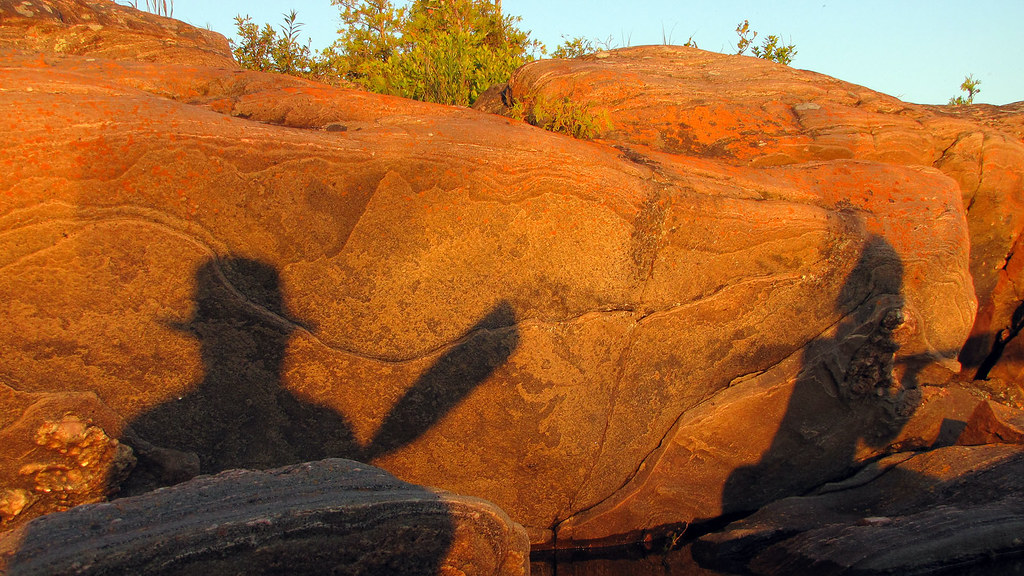
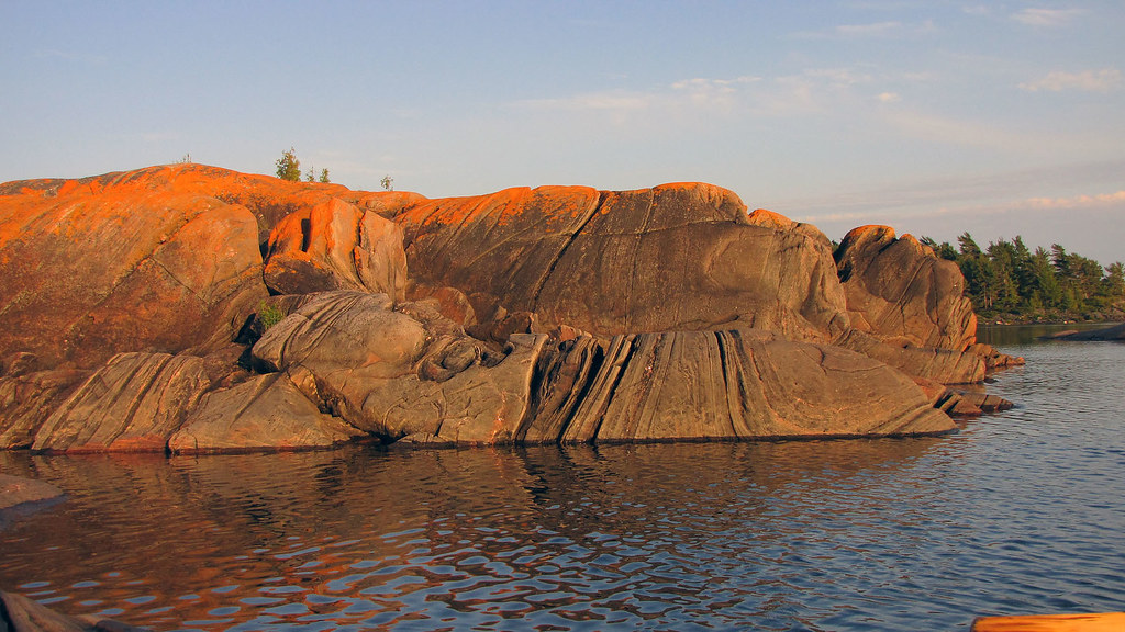
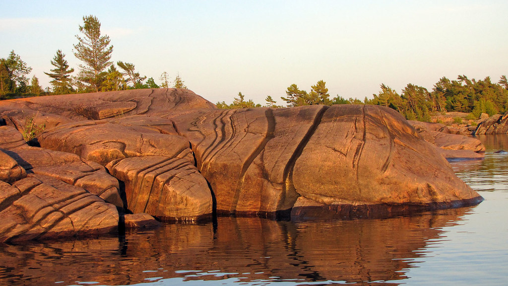
open waters of Georgian Bay, observing unforgettable sunsets. Some of the rock
formations acquired a pinkish tint at sunset as well as they resembled Mexican/Aztec
sculptures; one rock looked like an Egyptian sarcophagus!
I thought I
would be able to see some snakes or other critters (last year Catherine almost
stomped on a small rattlesnake or fox snake, as well we had seen a water snake,
garter snake and white eagle), yet we only saw a mink, probably the same one we
had seen last year.
We were
planning to return to Toronto on Monday or Tuesday, but when I was listening to
the weather forecast on Thursday, the weather was supposed to be perfect on
Friday, but then over the weekend very wet and windy—and even the long term
forecast did not sound very optimistic. Catherine was somehow reluctant to cut
our trip short, but I convinced her to do so (and we were glad, as the weekend
turned out to be abnormally rainy, windy and cold). Indeed, Friday was a lovely
day, it was sunny and warm and we slowly packed up and left the island exactly
at noon. On our way back we had no problems with the wind or waves. We passed a
group of kayakers, going the opposite direction. Exactly one hour later we
reached the dock. A Meet-up group of women were preparing to depart for the
weekend. We felt sorry for them knowing the upcoming forecast. Catherine
brought the van and half an hour later we drove to the marina, where Catherine
bought ice cream. I noticed that there were a bunch of books on Ontario by
Terry Boyle, a well-known author, who ‘specialized’ in unearthing various
unusual, rare and unknown stories connected to Ontario’s history; some dealt
with ghosts, specters and haunted houses. Pointing to the books, I said to
Catherine,
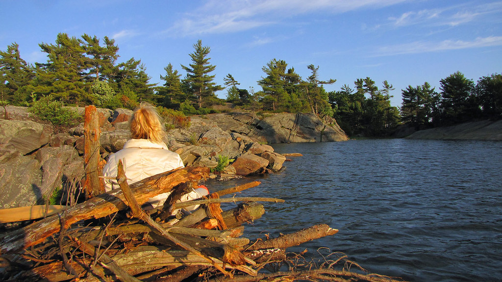 |
| We collected deadwood along the shores, as there was very little firewood at our campsite |
“Look at the books by Terry
Boyle—that’s the man we had met several years ago at the Streetsville
Historical Society!”
Upon hearing
this, the salesperson nodded in agreement and pointed at a man standing next to
me.
“Yes, this is Terry Boyle himself!”
As I found out,
the author had a cottage in the area. I spoke to him for several minutes and
thanked him for his books—they had not only expanded my knowledge about the
province of Ontario, but greatly enriched my trips. He said that perhaps he
would come to the Streetsville Historical Society again this year.
In September, 2017, while visiting the “Bearly Used Books” bookstore in
Parry Sound, we found out that Terry Boyle had died on July 11, 2016. He was
only 63 years old.
Overall, it was
a great tip, although a little too short—besides, the weather was too rainy,
windy and cold. Nevertheless the stunning surrounding scenery made up for
whatever shortcomings we encountered.
Blog po polsku/in Polish: http://ontario-nature-polish.blogspot.ca/2015/12/biwakowanie-i-pywanie-na-kanu-na-wyspie.html
|


I read nearly all the new posts. I like your way of describing al the events, points you stopped at and even emotions felt by you and Kate during paddling, strolling and taking rest. Interesting posts about Cuba, but my favourite ones are canadian ones. Best regards
ReplyDeleteHi Daniel,
ReplyDeleteThanks for your comments!
As much as I like visiting Cuba, Ontario is still my most favorite destination!
Regards,
Jack
Great trip report. This looks like a lovely area. Thanks!
ReplyDeleteThanks! Indeed, it's a very lovely and picturesque area, I hope to visit it again and again!
DeleteThanks for sharing your experiences. We can’t wait for our trip next week.
ReplyDeleteI'm sure you'll enjoy it.
Delete