Blog w języku polski/in the Polish language: http://ontario-nature-polish.blogspot.com/2021/12/biwakowanie-w-prowincjonalnych-parkach.html
More photos: https://www.flickr.com/photos/jack_1962/albums/72157720216499304
 |
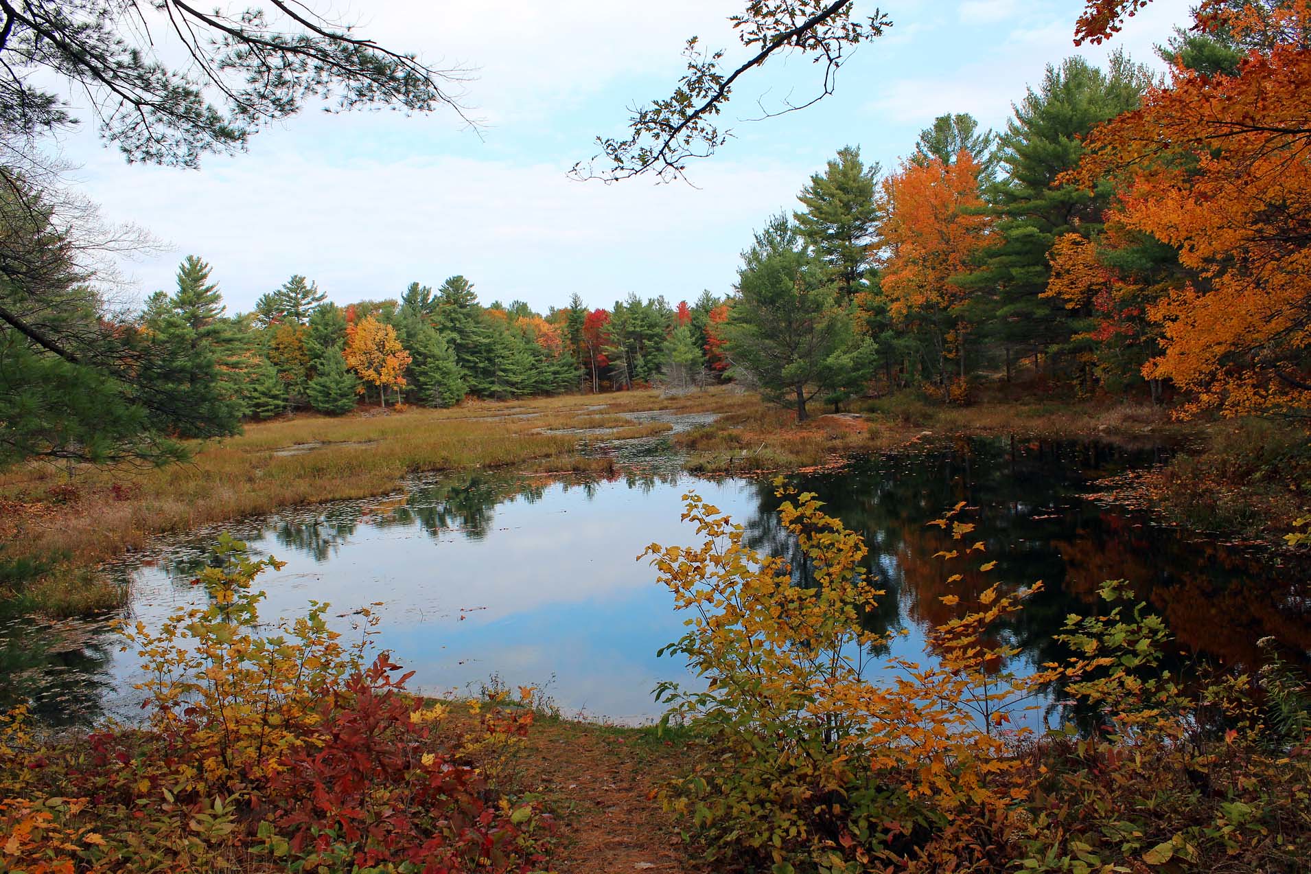
| Darlington Provincial Park, Ontario |
My initial vacation plans for 2020 included spending 10 days in May/June in Indiana Dunes National Park on Lake Michigan and driving across the United States for about 8 weeks in August-October. Of course, the COVID-19 pandemic messed up almost everybody’s vacation plans, including mine: not only was it almost impossible to cross the border between Canada and the USA, but even local outings were hampered by innumerable rules and regulations. Overall, the slogan that used to appear on Ontario’s license plates, “Ontario - Yours to Discover”, became a reality for most Ontarians! Indeed, a lot of people ‘discovered’ provincial parks and soon it was very difficult to find vacant campsites, especially over weekends. However, overall it was not a bad year for me: in January, 2020 I spent 2 weeks in Cuba, arriving back in Toronto on January 22, the same day when a traveler from China arrived in Toronto and became the first documented person to have COVID. In addition, I managed to spend several weeks in 4 provincial parks (and one week canoeing on the French River (please see other blog entries about my vacation in Cuba and the French River trip). The major restriction in provincial parks was the lack of showering facilities. Also, group campsites were closed and thus the 10th Group Camping at Warsaw Caves (organized by my friend Guy), which I planned to attend, did not take place.
Darlington Provincial Park,
Ontario
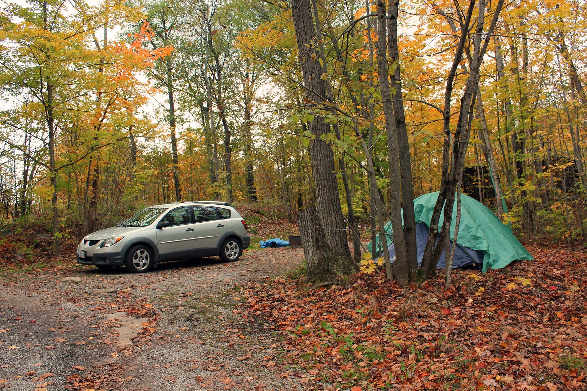
In August I was invited by Guy to spend two days camping in Darlington Provincial Park, and of course I gratefully accepted his invitation. Each campsite could accommodate up to 6 people and 3 tents—as I did not want to share a tent (there were already 3 people on the campsite), I decided to book a separate campsite. Because the arrival was on Sunday, August 16, 2020, it was still possible to find vacant campsites. I got campsite number 173, not far from #158, where the group stayed. Although campsite #158 had poor privacy, it was just meters from Lake Ontario and offered a nice view of the lake, yet the steep cliff prevented us from actually getting to the lake at that spot.
 |
| Darlington Provincial Park, Campsite #158 |
Since I had always gone to provincial parks located several hundred kilometers from Toronto, I was not even aware about this park’s existence. Before my visit I had quickly read about the park’s & area’s history (it used to be the Loyalists’ farmland and when the park was created in 1959, it was devoid of trees, but thanks to the Boy Scouts reforestation 60 years ago, there are many trees everywhere) and I was pleasantly surprised to see that many campsites were surrounded by thick vegetation, which provided good privacy. The Campground Trail, cutting through the middle of the campground, was very convenient, allowing campers taking shortcuts without encroaching on other campsites. From the Cliffside campsites #158 (ours), #159, #160 and #162 it was possible to see Lake Ontario. Once we saw an oil-tanker barge “Norman McLeod”, along with the tug “Everlast”, proceeding east.
 |
| Once we saw an oil-tanker barge “Norman McLeod”, along with the tug “Everlast”, proceeding east. |
I saw a Red Cardinal and a Blue Jay on my campsite, as well as several mischievous squirrels/chipmunks, sometimes carrying big chunks of food, no doubt pilfered from campers. I had read that the park became a home to Piping Plovers, which made their nests on the beach. Unfortunately, it rained each day, sometimes heavily, which prevented us from not only visiting the beach, but also from hiking on one of the many nature trails in the park. Bill brought a sturdy picnic shelter, which turned out to be very useful. We enjoyed campfires every evening and overall had a great time. I hardly saw any mosquitoes, but some of us ended up with plenty of nasty bites all over their legs. When I was leaving the park, I wanted to check out its other sights (fishing nodes, the store, pioneer cemetery, log cabin and the birding information board), but it started pouring and I decided to drive straight home.
 |
| Darlington Provincial Park-my campsite #173 |
There was a pronounced noise coming from the highway (401), but since it was so incessant, after a while I stopped noticing it. Train whistles, on the other hand, were very loud and ear-piercing, and even though I consider myself a heavy sleeper, they awoke me several times during the night, albeit for just a minute or so. Indeed, for some light-sleepers the train’s blaring horn might ruin their stay at this park.
 |
| Silent Lake Provincial Park and Six Mile Lake Provincial Park, Ontario |
 |
| Silent Lake Provincial Park, our campsite #39 |
A lot of campsites which, according to the Ontario Parks reservation website, had been booked during our stay in the park, turned out to be vacant—most likely the rainy weather had resulted in many cancellations (which this year did not incur any penalties).
 |
| There were a lot of swampy areas just meters from campsites |
There was a mountain bike trail as well as three hiking trails, which
unfortunately I did not have a chance to do. However, during my past 2 visits
to the park I canoed on Silent Lake as well as on several lakes in Kawartha
Highlands Provincial Park.
 |
| Silent Lake Provincial Park, campsite #40, on which Guy, I and several other people camped in 2009. I also camped on this campsite in September, 2021. I loved the rock! |
 |
| Bancroft: Firewood for sale-based on an honour system! |
The firewood sold by the park was not very dry, so I decided to look for better firewood in Bancroft. Just before entering Bancroft, I stopped at a place called “The Bike Doctor” that was fixing bikes & ATVs and spent some time chatting with the owner. I also renewed my motor vehicle permit—usually there are long lineups in Toronto and I always try to do it either online, or in smaller towns, where there is no waiting at all. I asked several people where I could obtain firewood and I was told that there was a place just past the town. Indeed, I saw a pile of wood, which was already separated in various sizes. It was a self-service, honour system stand, where buyers were supposed to leave money in provided envelopes in a special box! Each time I see such contraptions I wonder if they could be viable in bigger cities, like Toronto. For some reasons I think that soon all the firewood would be gone—along with the money!
 |
| Arrowhead Provincial Park, Ontario |
Arrowhead Provincial Park, Ontario
 |
| Big Bend Lookout. Whereas it is the shortest ‘trail’ (75 meters from the parking lot!), it leads to the spectacular view of the Big East River. |
I had visited this park the first time in 2001 and this was my 6th
visit. I noticed some changes—there were ten camp cabins and one soft-sided
shelter available for rent (two of the cabins were erected on my favourite
campsites). In addition, a new Visitor Center and Park Store had opened not
long ago. The new Visitor Centre had a warm-up room with a fireplace for
enthusiasts of winter activities offered in the park (skating, tubing,
cross-country skiing and snowshoeing). Huntsville’s Arrowhead Nordic Ski Club
works closely with the park and operates its programs.
 |
| Even though there have been bear sightings in the park, we did not see any, not even usually ubiquitous raccoons! |
 |
Arrowhead Provincial Park. Our campsite #254 was quite good. I took this photo of this campsite one year later, in 2021 and it did not look very nice... Well, we were very lucky in 2020 that it did not rain, otherwise our tents would have been flooded! |
 |
| Wildlife Sighting board in Arrowhead Park. There were 3 bear sightings! |
According to the “Wildlife Sighting” board in the park store, there had
been three black bear sightings recently, but we did not see any of those imposing
creatures. The only animals that we spotted at our campsite were squirrels,
chipmunks, a pair of gorgeous blue jays and a very friendly black capped
chickadee which actually sat on my hand, hoping for a snack! And I saw a
fishing spider in the toilet—it is the largest spider in Canada. I remember
that many years ago we had experienced a lot of problems with raccoons; this
time we did not encounter any of those pesky mammals. The park was very quiet
at night and a park truck regularly drove by the campsites. The campfire wood
sold at the park was wet—eventually we got a few bags of very dry wood at a
store in Huntsville. Since both highway 11 and railway tracks were just over 1
km from the park, we could hear the road traffic and occasional loud train whistles,
but it did not bother us.
 |
| Stubbls Falls Trail: This tree looked like a walking tree with many ‘legs’, albeit it did not go anywhere while we were there (but I will certainly check its location during my next visit). |
The park has a number of hiking trails (some allow cycling), of which we managed to complete three:
• Big Bend Lookout. Whereas it is the shortest ‘trail’ (75 meters from the parking lot!), it leads to the spectacular view of the Big East River. This is a meandering river and there are many theories as to why and how they become sinuous. The flow of the river erodes its banks and changes its course, causing a neck. Eventually the neck becomes very narrow and is breached by the flow of the river. Ultimately the abandoned curve turns into an oxbow lake—the satellite map of Arrowhead Park and the area along the Big East River shows plenty of oxbow lakes and meander scars. Unfortunately, one day the part of the river we now admire will also become an oxbow lake.
 |
| Homesteaders Trail |
• Homesteaders Trail. This 3 km loop trail starts near the main office. According to the park’s tabloid, “there is evidence of an old 1870s farm. All that remains today is the foundation of a stone milk house, wagon parts and cleared land.” The trail is a little hilly, but it cuts through the forest and is absolutely wonderful. At one point we were a little confused which path to take, the signage could have been better. I was also looking forward to actually seeing the remnants of the old farm, but did not find anything. It would be a great idea if the park could post a sign on the trail pointing to the location of the farm.
 |
| Arrowhead Provincial Park, Stubbs Falls |
• Stubb’s Falls Trail (2 km) starts at the parking lot near the bridge and parallels the Little East River. The first part of the trail runs along the road leading to East River campsites and reaches the Stubb’s Falls, a very scenic waterfall with plenty of rock formations. A lot of people spend a couple of hours there, taking photos or just watching the chutes. The second part of the trail winds through a forest path and it much nicer than the first one. Furthermore, I spotted two very interesting trees on the trail: one looked like a walking tree with many ‘legs’, albeit it did not go anywhere while we were there (but I will certainly check its location during my next visit); the second one also had three ‘legs’ and grew over a very old stump of the original tree.
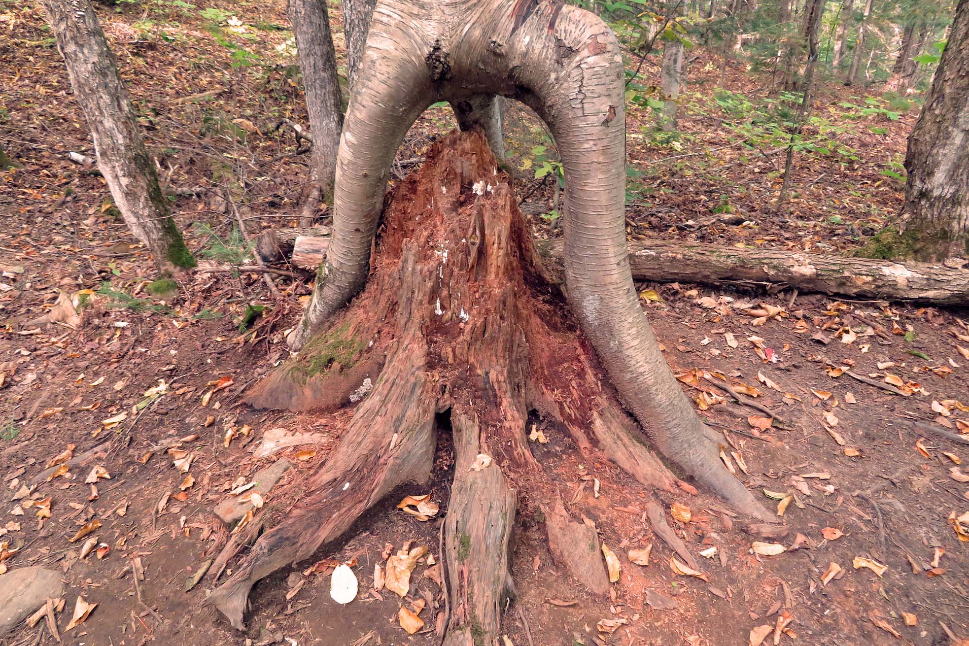 |
| Stubbs Falls Trail: The second three also had three ‘legs’ and grew over a very old stump of the original tree. |
I was surprised that there were very few mushrooms in and around the park. Each day the fall colours were becoming more pronounced and we were surrounded by them on the campsite. I must say that it was a very enjoyable visit. This is a wonderful park, where everybody is going to find some interesting activity year round.
 |
| Our campsite at night! |
While in the park, we drove to the nearby Dyer Memorial. Not too many
people get to see this very original monument, as it is located in the middle
of the forest. In addition, the one-way narrow, potholed dirt road leading to
it may be tricky to find—and then a little challenging to drive on, especially
for smaller vehicles.
 |
| The Dyer Memorial |
 |
| Betsy Brown Dyer and Clifton G. Dyer |
The inscription on the monuments reads:
ERECTED IN FOND MEMORY OF
BETSY BROWN DYER
1884-1956
BY HER HUSBAND
CLIFTON G. DYER
1885-1959
AS A PERMANENT TRIBUTE TO HER FOR THE NEVER-FAILING
AID, ENCOURAGEMENT AND INSPIRATION WHICH SHE
CONTRIBUTED TO THEIR MARRIED CAREER AND AS A
FINAL RESTING PLACE FOR THEIR ASHES.
An Affectionate, Loyal, and Understanding Wife is Life's Greatest Gift.
 |
| The Dyer Memorial |
The monument is surrounded by 2 acres of landscaped land, but the total area of the property is 155 acres. It is a perfect place to meditate, walk, relax and enjoy surrounding nature. We found a trail/dirt road behind the monument (most likely used by ATVs, in spite of the “NO ATVs” sign) and half an hour later we came to another road, which led us back to the parking lot. As expected, we were the only visitors and did not see anybody else.
Six Mile Lake Provincial Park,
Ontario
All the COVID-19 restrictions made it impossible to invite, or visit friends for Thanksgiving Day. Thus, a short camping trip to a park (the last one of the season) was the best alternative. This time I picked very familiar Six Mile Lake Provincial Park.
 |
| The only campsite (#97), which was available in the park over the Thanksgiving Long Weekend. |
It is a beautiful park relatively close to Toronto (165 km), offering plenty of activities, and for this reason it has always been quite busy, particularly during COVID-19. I am glad that a week before my visit I had managed to book the only available campsite in the park (#97, Oak Campground) and thus I enjoyed camping over the Thanksgiving long weekend there. Yes, the park was 100% full!
 |
| Campsites along a park road |
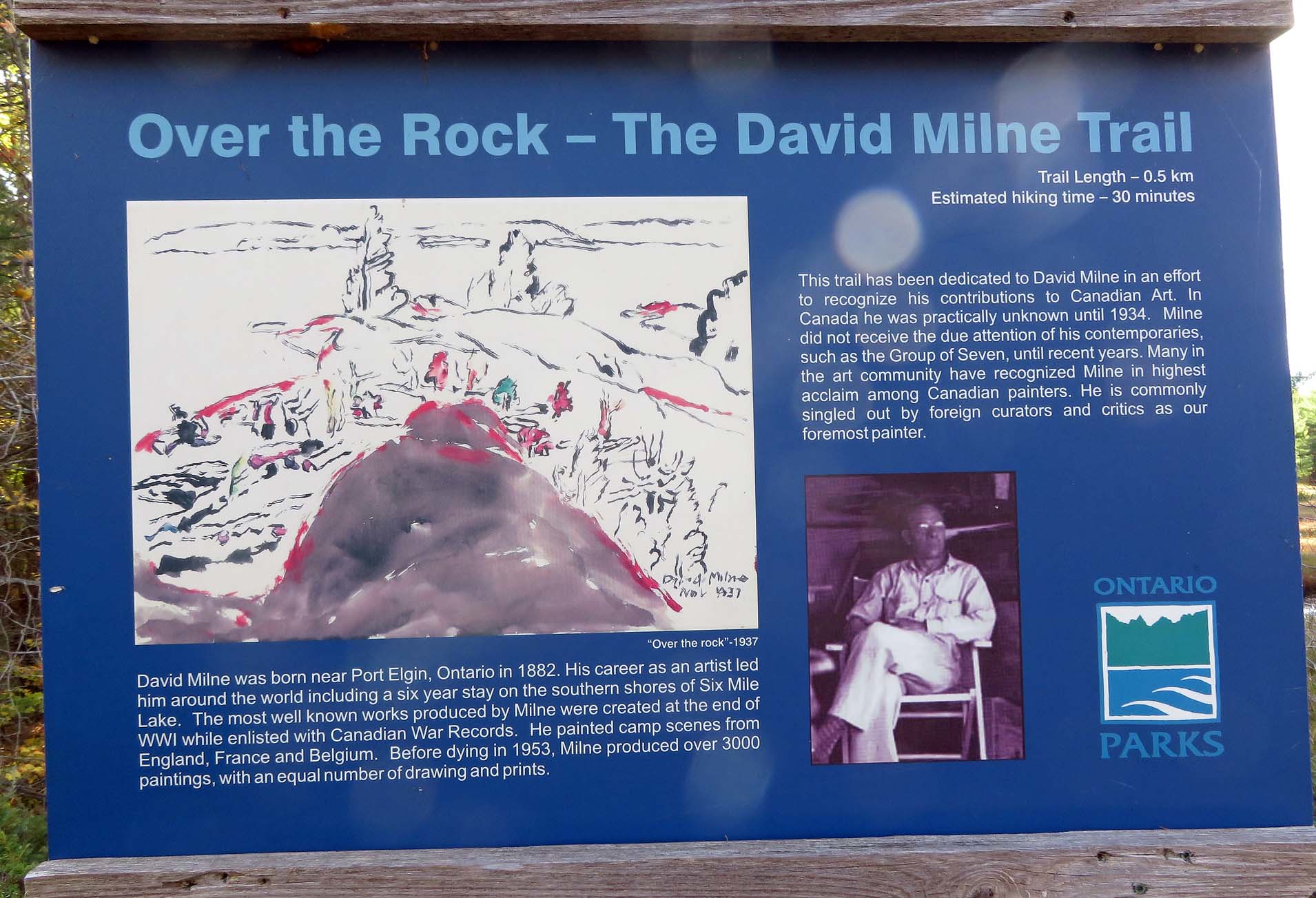
The fall colours were stunning and I took advantage of the parks’
trails. I leisurely walked the Living Edge Trail and the David Milne Trail,
named after David Milne (1882-1953), a Canadian painter, who used to live and
paint on Six Mile Lake. Some of his paintings were clearly inspired by the
prominent rocks of the Canadian Shield. The hikes were quite easy and let me
enjoy the spectacular fall colours even more.
 |
| The David Milne Trail in Six Mile Lake Provincial Park |
One part of the park (Maple Campground) was already closed for camping, but it was possible to walk there and I checked out many campsites. Some were very nice and offered very good privacy and lovely views. I have been coming to this park for about 30 years, since the early 1990s, so many of the campsites I visited looked very familiar—I had camped on them with plenty of friends at least 20 times!
 |
| A friend Blue Jay was not afraid of me-as long as there was food! |
For a while I observed a majestic blue heron on the trail, but all the other animals I saw were on my site. A hungry chipmunk kept visiting me in regular intervals; it did not even hesitate to literally walk all over me in search of food. A relatively tame blue jay was always watching me from the nearby tree and whenever I was not paying attention, it flew over, landed on the table, grabbed whatever food there was and flew away. Of course, there was also the "de rigueur" nightly visit by several raccoons, so accustomed to tourists that they were sniffing at my legs and shoes while totally ignoring my presence. From time to time a very timid squirrel appeared at the campsite; whenever the chipmunk saw it, it immediately chased it away, ostensibly not wanting to have any competition to share its grub with!
 |
| A very friendly and always hungry Chippy the Chipmunk! |
I wanted to take photographs of and collect wild mushrooms, which should
normally be plentiful in October. Unfortunately, I did not see any in and
around the park—yet my friends reported plenty in Killarney and Algonquin
parks. Well, one of nature’s mysteries!
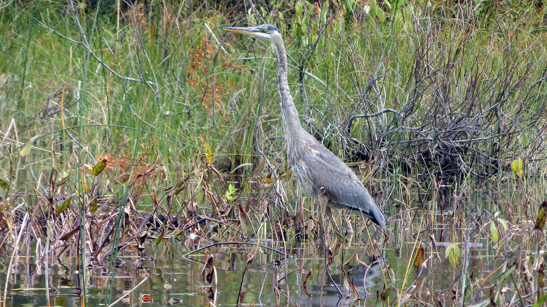 |
| Majestic Blue Heron, often very difficult to spot, as it perfectly blends in the surrounding vegetation |
The park had two charging stations for electric vehicles—incredibly, my friend Patrizia, who visited me on the campsite, happened to have a Tesla vehicle, so she took advantage of this opportunity and charged her car overnight. I also asked her a lot of questions about electric vehicles and after one day I certainly became a “junior expert” on this subject!
 |
| The Living Edge Trail |
Probably the main disadvantage of this park is its proximity to the highway (400). No matter where the campsite is located, you will hear the noise from the highway. However, since it was almost continuous, after a while I stopped noticing it. Also, when I was hiking on one of the trails, suddenly I saw a beautiful lake… and then a busy highway at its end, which definitively spoiled the view. Obviously, these are things that cannot be changed and we have to accept them… or go to a different park.
 |
| View from one of the park's campsites |
While at the park, I drove to McCrae Lake, which is a very popular place for camping and canoeing, as it is still crown land. I managed to hike to the McCrae Lake Bridge & Waterfalls. It was an easy hike and there were a number of other hikers, some carrying backpacks and planning to camp overnight. Again, there were no wild mushrooms anywhere.
 |
| A short portage leading from the parking lot to McCrae Lake |
One day I made a loop trip, driving to the town of Coldwater and back to the park. My first stop was at White Falls. In the past we had often paddled from the park to the falls and spent some time having lunch just meters from the falls. This time I hardly saw any people around.
 |
| View from the Bridge near the McCrae Lake Waterfalls |
My next stop, The Big Chute Marine Railway, is certainly a very unique place and many people spent hours observing boats being carried in a cradle between two lakes.
 |
| A small bridge along the Living Edge Trail in Six Mile Lake Park |
I briefly stopped at Severn Falls. Catherine and I had gone to the Riverhouse Restaurant for Thanksgiving Dinner in 2010 or so and done some canoeing on the Severn River.
 |
| The White Falls, not far from Six Mile Lake Park. |
I also made a brief stop on road #17, Upper Big Chute Road, where in 2012, Catherine and I (and Gabby the dog) had been given a tour by a real estate agent of a 50 acre property for sale. The property had a pond with a beaver lodge and its other border reached the railway tracks. There had been a small cottage, but it was rather designed to be demolished than habituated (and the sale offer said so—however erecting a new dwelling would have adhere to new building rules), as well as two shacks. The agent said that the vendor had initially wanted $189,000 for the property and the price had been reduced to $139,000. I had not planned to make this kind of investments at that time, yet I told the agent that I could buy the property for $100,000. Of course, he never contacted me. To this day I have been thinking whether or not I made a good decision—considering the rising prices of cottages and vacant lots during the COVID pandemic, I am sure the property would be selling for over $200, 000 today.
In the village of Coldwater I did some shopping at the supermarket, got on the highway and drove back to Port Severn, parked my car and walked around a little. It triggered so many memories, which I would like to share here.
 |
| General Store in Port Severn |
Normally, it is possible to drive over the bridge/locks in Port Severn, but the 100 + years old lock (#45), the last lock of the Trent-Severn Waterway, with a swing bridge, was being replaced with another bridge, so I was forced to use the highway 400 to get from one part of Port Severn to the other.
 |
| Construction, road closed! |
Adjacent to the Post Office was the “Lock 45 Restaurant and Supermarket”, now closed, its windows boarded up. For many years I used to come to Port Severn fishing—we would rent a motorboat at the nearby motel and spend the whole day on Georgian Bay, fishing around Green Island and Potato Island. Afterwards, we would sometimes go to the restaurant for a cold drink. In 1997, while camping in Six Mile Lake Park, Chris and I went fishing on Georgian Bay. It was raining, windy and cold; not only did not we catch anything, but also got wet and cold. Subsequently we went to the “Lock 45 Restaurant” for a cup of hot coffee.
 |
| "Lock 45" Restaurant. Unfortunately, it has been shuttered for a while. We often went there for coffee |
There was a distinguished looking older gentleman at the next table, and he was wearing a very original necklace make of bones.
“I admire your necklace”, I said, because the necklace was indeed quite unique.
Herbert (that was his name) asked us to join him at the table and told us that he was an ‘honorary Indian chief’, and this marvelous necklace had been bestowed upon him by Native people. To make the story short—after telling him about our fruitless fishing trip, Herbert invited us to his nearby cottage on a small, private island. We drove to the Narrows Marina, got into his very beautiful boat, powered with a powerful motor, and in no time arrived at his island. He let us use one of his motorboats and we spent several hours trolling and casting around the island. Later we had dinner and engaged in a long, interesting conversation. Originally from Germany, as a teenager he was conscripted into the Hitler Youth (Hitlerjugend), a youth organization of the Nazi Party (and so was the future Pope Benedict XVI—who knows, maybe they met there?). It was totally dark when we arrived by boat to the Narrows Marina and drove back to our campsite. During our following visits to Port Severn, I kept asking local people about Herbert, but nobody seemed to know him. I even went to the Narrows Marina to make inquiries, but the marina was gone, too.
 |
| In the early 1980s. there used to be a small marina, which rented motor boats. In the summer of 1983 we rented a motor boat here and it was my first fishing experience in Canada! |
I also drove via Highway 400 to the north side of
Port Severn and explored a marina/boat storage (?) located between Port Severn
Road North and Highway 400, just south of “Dam G”. It is a very special place for
me: in the summer of 1983, one year after coming to Canada, my friend Josef Sz.
and I rented a motor boat from that very location and it was my first fishing
experience in Canada! The older couple, who lived there and ran the place, were
always very meticulous about checking the boats for scratches. “Any rocks?”,
the gentleman would ask when we came back, shining the flashlight all over the
boat, as there were plenty of rock in the water.
 |
| The old remnants of the old road (road #69) bridge, on which we drove so many times and under which we had to pass to get to Georgian Bay. About 20 years ago it was demolished and replaced with a new bridge, now part of Highway 400 |
One of the buildings had been Josef’s brother-in-law’s cottage. All the structures had been gone for a long time—and so had the old Highway 69, replaced by the modern Highway 400 (the old remnants of the old road bridge, under which we had to pass from the marina to Georgian Bay, were still visible).
Nearby, next to Highway 400, is the Muskey’s Landing Motel. In 1983 it was called “Alcove Motel”, later “Sharkie’s Motel”. The adjacent old Highway 69 had only two lanes before Highway 400 replaced it, encroaching on the motel’s property. The motel had also had a swimming pool, but at one point it was, I believe, just buried. Although I have never stayed overnight in the motel, many a time my friends and I rented a motorboat there: we had called the owner (I think his name was Brian) in advance and arrived before 4:00 am, got into the boat (which had already been prepared for us) and in no time were out on the water, fishing until dusk, usually between Green Island and Potato Island. Sometimes fishing was quite good, sometimes we caught nothing.
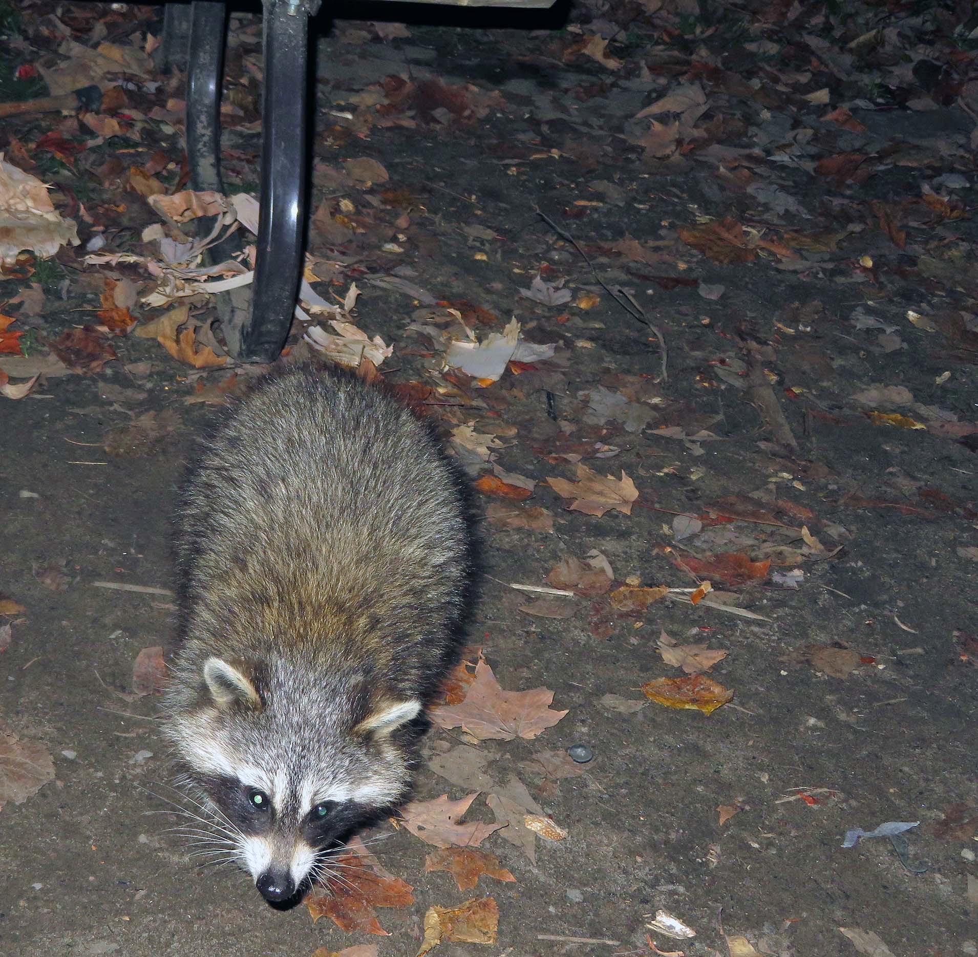 |
| A nightly visitor! |
In the late 1990s a couple of times I went fishing with Mr. Tadeusz Pasek, a well-known Polish yoga pioneer & instructor and author of books and university journals articles. Although he did not fish, he loved being on the water, relaxing and meditating. During one of such trips it was very hot and humid, but nothing indicated a forthcoming storm. Unfortunately, come it did, so swiftly and with hardly any warning that I had scarcely any time to reel in the fishing line and then immediately headed towards a shore. Rapidly the waves became so high that our small boat, with a 6 or 10 HP engine, was tossed left and right. I had to keep it perpendicular to the waves—otherwise the boat could have been overturned! Eventually we found a sheltered bay and waited out the storm. It was a very good lesson for me—I have had plenty of respect for the unpredictable weather on Georgian Bay since then!
 |
| Post Office in Port Severn--still the way I remember it almost 40 years ago! |
In July, 1993, Mr. Tadeusz Pasek, his son Chris and I drove in my just-purchased brand new Toyota Corolla to Six Mile Lake Provincial Park. The next morning, before 4:00 am, we woke up, headed to the motel, got into the waiting motor boat and began fishing. For the next 7 hours we did not catch anything, causing Mr. Pasek to tease us about and question our fishing abilities. And then, from 11:30 am to 12:00 pm, we caught well over 10 pikes, thus saving our honour! I still remember that spot; each time I was boating in the area I went there and spent some time casting, yet I never even came close to replicating our initial success. Incidentally, at the park we met a university professor of physics, Dr. Minoru Fujimoto, who was camping with his family on the adjacent campsite. Since Chris’ major at university was physics, he stroke up a conversation with him. Soon it turned out that Dr. Fujimoto had collaborated with Chris’ university friend from Poland, currently residing in Toronto and teaching at York University! Perhaps it is a cliché, but indeed, the world IS a small place!
The following year Chris and I drove to Six Mile Park on August 1, 1994—I remember that date as it was the 50th anniversary of the Warsaw Uprising [incidentally, a lot of Canadian and American mass-media, as well as some historians (sic!) infamously kept referring to this anniversary as “the 50th anniversary of the Warsaw Ghetto Uprising”—which, of course, took place over 1 year earlier, in 1943]. Even though it was a holiday (the Simcoe Day long weekend), we had not reserved any campsite. When we arrived in the park, the first thing we saw was an assortment of campers, trailers, RVs and cars waiting before the gate: the park was full! However, we were somehow lucky—there was just one campsite available, albeit very small and not suitable for the needs of the waiting tourists. As we only had one tent and one small car, we “qualified” to camp on it. Indeed, it was a rather crappy campsite, but as the saying goes, beggars can’t be choosers! The next day we went fishing and caught a couple of pikes for dinner.
 |
| This squirrel also wanted to get some food from my campsite, but the chipmunk chased it away |
 |
| Fishing spider, I think it is the biggest spider in Canada |
When I was leaving the park on October 13, 2021 (I would have stayed longer, but that day the park was closing for the season), I again stopped in Port Severn and went to the post office to buy stamps and mail letters. Unfortunately, the post office employee was one hour late—due to Thanksgiving Day, she got the days mixed up. There was another gentleman waiting to pick up a parcel and I stuck up a conversation with him. He lived on nearby Yellowhead Island, was a ham radio operator (so was I, but very little radio-active) and we kept talking about a lot of interesting things for about 30 minutes.
Overall, I enjoyed my vacation in the first year of
COVID-19 pandemic and took advantage of the limited travel opportunities to the
fullest!
Blog w języku polski/in the Polish language: http://ontario-nature-polish.blogspot.com/2021/12/biwakowanie-w-prowincjonalnych-parkach.html
More photos: https://www.flickr.com/photos/jack_1962/albums/72157720216499304


