Friday, August 29, 2014

WHITE PINE SHORES RESORT AND CAMPING IN HALIBURTON FOREST IN ONTARIO, OCTOBER, 2013


Old train station in Kinmount, Ontario. The tracks have been gone for many years...
The day we left was rainy, but the forecast called for a perfect weather. Well, it was already October 7 and we would not be surprised if it called for snow! We took highway 48 north, then 49 and stopped in the town of Kinmount, spotting a rail station turned into a museum, just next to a rail bed (the tracks must have been lifted long ago).
Years ago the Victoria Railway connected this town with Lindsay and Haliburton. Passenger service ceased in 1960, freight service ended in 1978 and the line was abandoned in 1981. According to a historical plaque near the station, Kinmount is one of the first sites of Icelanding settlements in Canada. The plaque was erected in 2000 and among 500 people gathered for the dedication was the Foreign Minister of Iceland and the Deputy Prime Minister of Canada:

In the 1870's, economic distress prompted mass emigration from Iceland. On September 25th, 1874, 352 Icelanders, exhausted and weakened by illness arrived at the emigration sheds in Toronto. When the Victoria Railway Company offered work constructing its line from near Kinmount, the provincial government housed the Icelanders in log shanties down river from here. Poor ventilation, sanitation and diet allowed sickness to rage through their cold, over-crowded quarters. Within six weeks, twelve children and a teenager had died. By the spring of 1875, the death toll had doubled and many of the settlers scattered in search of a better life. In the fall, most regrouped in Toronto and travelled west to found the settlement of Gimli, Manitoba.

Paddling to Algonquin Park
After a while we arrived at the White Pine Shore Resort and were assigned room #308. We were surprised at the way this ‘resort’ looked, as it resembled an office building in the middle of nowhere—which we later found it, once it had been. This time we did not bring our canoe and wanted to use the resort’s canoe to go paddling, but it was raining. We drove to the road leading to the beach area (some distance from the hotel) and walked to the beach where the kayaks and one canoe were located. In the evening we had an early dinner and chatted with a resort employee. Since there was a TV set in the room, with hundreds of channels available, we turned it on—after all, neither of us has a TV at home and we thought we would find something interesting to watch. We happened on the TLN channel, showing a documentary on Kenny, whose body ended at his waist and who walked on his hands. It was quite touching—but the commercials (which I had not seen for over 2 years) were just disgusting, in-your-face promotions, marketing crappy, unwholesome junk food. As much as I would like to watch some good documentaries, I was so glad I did not have TV, I could not stand that misleading and indoctrinating advertising, which by far exceeded the communist propaganda that I still remember from the old country.

Old, semi-abandoned bridge

The next morning after breakfast, we drove on Christine Road, parked at its end and walked to the Lodge’s beach. The lone canoe was still available, so we hopped in and paddled north towards Algonquin Park. From the York River we canoed to Benoir Lake and at Peterson Road saw an old, semi-abandoned bridge. We got out of the canoe and saw an abandoned lumber yard & mill called Martin Lumber. Later we found out that its owner, Grenville Martin, built up this business to become one of the most modern mills in the country—and the White Pine Shores Resort where we stayed (previously called MartinWood Resort) was originally built as the company’s office, housing the office staff. Grenville Martin died in a plane crash in 1984 at the age of 48 and perhaps his untimely demise eventually resulted in the demise of his company as well.

Abandoned buildings of W. Martin Lumber Limited

There were plenty of reeds and water vegetation and we truly enjoyed paddling in such a solitude, which was suddenly interrupted: we heard, and then saw, a low-flying big military (transport?) plane. At one point we thought it was going to land on the water, but fortunately (for us and the plane crew) it regained its altitude and soon disappeared. According to posted signs, we entered Algonquin Park. Benoir Lake ended and there were two routes: we took the one to the right, called Mink Creek, which was meandering among reeds and sometimes it was difficult to make turns with the canoe. Finally we reached a log jam; not wanting to carry the canoe, we turned back to Benoir Lake and in turn took the left passage (York River) and paddled up to the High Falls Rapids, where we left the canoe and walked along the river. The path was very muddy and slippery and we had to be very careful not to slip—portaging would have been quite challenging and treacherous! The rapids were quite picturesque and after taking several photos, we went to the canoe. We encountered only one other couple hiking from the opposite direction. We paddled back to the beach and went to the hotel to have dinner.

Paddling in Algonquin Park

Next day we had breakfast, checked out and drove towards Haliburton Forest, stopping at the town of Wilberforce (for some reasons called the Geocaching Capital of Canada). We also stopped at the town of Haliburton for a nice cup of tea. Since we were familiar with the historical/cultural venues of this nice town, we only took time to picnic and shop. Soon, we arrived at Haliburton Forest, where we were going to spend several days camping.

View from our campsite in Haliburton Forest
This forest (its full name being The Haliburton Forest & Wild Life Reserve Ltd.) is privately owned and encompasses an area of 300 square kilometres. It offers plenty of activities—camping, canoeing, boating, hiking, dog sledging, night sky gazing, snowmobiling, biking, fishing as well as canopy tour and a ride in the only freshwater submarine in the world! In addition, there is a wolf centre and it is possible to observe wolves living in an enclosed area through a one-way windows. There are still some forestry operations taking place in the forest. Furthermore, there are a number of trailers with no access to any amenities, yet the waiting list is long and a 10 year waiting time is normal. Incidentally, the Haliburton Forest official website prominently features my photo taken in the forest in 2008, although I do not recall ever being asked for permission to publish it…

Thanks to such signs, it was quite easy to find the right
road in the forest

Most campsites were vacant and we were recommended campsite at a small lake. We drove to check it out and indeed, it was awesome and we decided to take it. We drove back to the office to pay for the site and met the owner’s wife with a hybrid wolf on a leash—wow, a very impressive animal! She assured us it did not run off leash in the forest. Catherine thought it looked very much like her daughter's Siberian husky. Quickly, we drove back to the campsite—twice we had to open and close the gates leading on various roads—the only forest I know of that has actually gates! For a refundable fee, we were given a key to use during your stay. Somewhat of a 'pain' to stop, open and close several times a trip but it serves a purpose of keeping those who did not pay from driving in the forest. The fall colours were past their peak, we enjoyed driving on the forest roads very much.
Our lovely and private campsite
There were six campsites at this lake and ours was probably the best, just on Minnie Lake. Each campsite had a separate outhouses and the first night the other sites were not occupied. I quickly set up the tent and we enjoyed the sunset. There were plenty of chipmunks and squirrels on the campsite, a beaver dam on the lake and at night we heard beavers’ tails splashing against the water surface. We also spotted an otter and a lonely duck that from time to time showed up at the lake. Considering that it was almost mid-October, the weather was just perfect—it was sunny, warm and did not rain, so we could do some hiking in the forest, drove on its many forest roads and also drove on a road leading along Kennisis Lake. to check out a friend's cottage.  He had hand built it 20 years ago. Despite being the centre of attraction, we decided to forgo a visit to the wolf centre as we had toured it extensively a few years back. I must note it is well worth the time and admission fee if you go during one of the scheduled feeding times. We left the forest on October 13, 2013, after a quick use of their pay showers (yes, just like Europe , only loonies instead of euros). It was raining that evening, yet we were safely in the car by then. It was our last camping trip of 2013 and we figured out that in approximately 7 months we might again go camping!

Impressive mushrooms... but not edible!

CANOEING AND CAMPING IN RESTOULE PROVINCIAL PARK IN ONTARIO, SEPTEMBER, 2013


Paddling in Restoule Provincial Park

When in 1999 my friend and I wanted to go camping in September, we ‘discovered’ this not-so-well known park, located south of Nipissing Lake. Although the park’s campsites did not offer as much privacy as those in some other parks, it did not bother us: there were not any other campers around us and we hardly saw anyone else—most of the campers were staying at the hydro section of the park, and most, if not all of them, had trailers or RVs. Unfortunately, the next day the temperature drastically dropped, it was raining and we saw frost in the morning. Since we were not prepared for such adverse weather, after a few nights in the park we packed up and rented a cottage in the area. Nevertheless we did like the park and returned to it the next year, as well as in 2011—each time in September, so that we could enjoy the solitude and the wonderful fall colours. We always stayed on drive-in campsites, not realizing that there were a number of interior campsites as well. In 2011 we saw one of them; I liked it and I hoped to stay there in the future.

At our campsite between two lakes at Restoule Provincial Park

Thus, two years later, Catherine (who had never visited the park) and I decided to go to this park, also in September. According to weather forecast, the next 6 days were supposed to be warm (at least during the day) and sunny, so it did not take much convincing us to visit this park.

We left Toronto on September 23, 2013. On the road to the park office we saw a number of relatively tame deer. As we expected, there were not any other people occupying interior campsite, so we hoped to get the campsite straddled between two lakes. It took us about 15 minutes of paddling from the parking lot to reach this campsite, which was vacant and absolutely beautiful. We could see the sunset (and the parked car which was about 1 km away), there was a small beach and another lake, full of beaver lodges. There was a beaver lodge between the main lake and the small lake; I suspected that at one point the smaller lake was just a bay of the bigger lake, but when the beavers created this huge dam, they also gave rise to another lake.

Morning mist
I quickly set up the tent and started a fire which was a very good idea: the temperature dropped significantly after sunset and it was cold; we stayed as close to the fire as possible, eating delicious grilled ribs. We went to the tent at 11 pm, putting on extra sweaters and socks. The temperature was below freezing at night since we saw frost in the morning. Nevertheless, as long as it was warm, dry and sunny during the day (and it was), we did not complain: we had several very warm sleeping bags and were not bothered by the cold at night. Besides, there were no mosquitos whatsoever and this was the real advantage of camping in the fall!

We counted 7 beaver lodges on this small lake

Next day we were up at 7:00 am; we put on our winter clothes, carried the canoe for about 25 meters and launched it on the smaller lake. Due to the cold there was thick mist rising from the water and we spent over 2 hours paddling on the lake, enjoying it very much! Soon, the sun was up and it was getting warmer, yet the mist enveloped the whole lake all this time. We saw about 7 beaver lodges (but not beavers) and I took plenty of photos and videos. Before 10:00 we were back at the campsite and took a nap. Later we just relaxed, read several recent issued of “The Economist” and just wandered about the campsite. I listened to the news; the hostage crisis in Kenya just ended.

Morning on Stormy Lake

The next day we paddled in the morning on Stormy Lake. There was plenty of mist rising off the water surface, sometimes it looked as if a volcano suddenly erupted in the middle of the lake! We paddled around islands, some with cottages, but we did not see many boats. Well, there were some fishermen on the lake, but I did not think they were very successful in their endeavours.

Stormy Lake in the Morning
In the afternoon we went into the town of Restoule. The ice cream parlor was closed, but the general store was open and it even had an LCBO outlet. In the evening we again paddled on the Restoule River, had to do an easy lift over and reached Restoule Lake—nobody else was around and we absolutely loved the serenity and solitude!

Ghosts... 
There was an excellent sandy beach near our campsite—we canoed there (for 20 meters) and then could sunbath and swim in the lake. There were water snakes and apparently they were attracted by our swimming—at one point I noticed a big water snake swimming just a meter from me. Once it realized I was not a fish, it swam away. We also loved paddling in the evening and in order to find out way back to the campsite (we were often coming back in total darkness), we left a blinking flashlight attached to a tree, which was visible from at least 2 km—it acted as our ‘lighthouse’. While paddling in the evening, we saw a bunch of guys on another interior campsite and checked a number of other campsites. Overall, it was a very nice area; most of all, we enjoyed the fact there were very few motorboats.

At our campsite
On September 28, 2013, we packed up, paddled to the van and drove to the town of Restoule, where we visited the ice cream parlor. Inside, there were plenty of very interesting photographs and information of Restoule’s history and the owner was quite knowledgeable on the town’s past. Catherine had ice cream and I ordered French fries. We also visited the local garbage dump, hoping to see a bear or two, but did not see any. Then we drove to Powassan, did shopping at the local grocery store and headed back to Toronto.


Thursday, August 7, 2014

CANOEING IN CHARLESTON LAKE PROVINCIAL PARK AND CAMPING IN IVY LEA PARK, SEPTEMBER, 2013

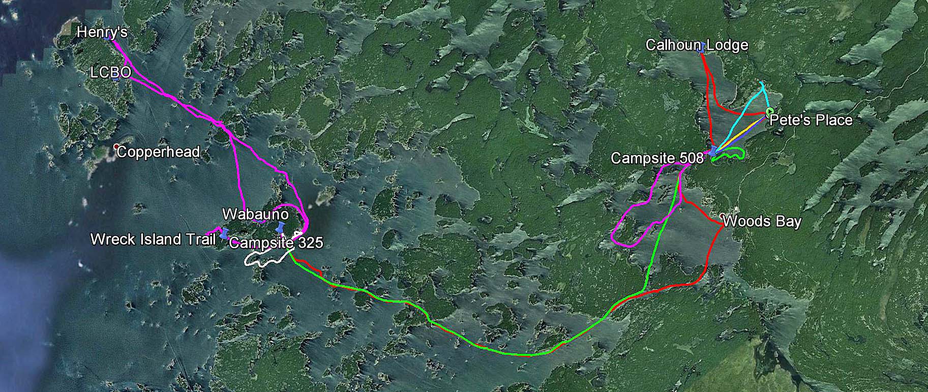
Driving from Toronto to Charleston Provincial Park, Ivy Lea Park and back home
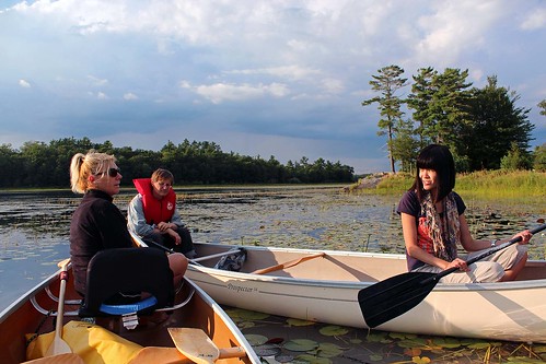
Despite having visited Charleston Lake Provincial Park twice before, I had never done any interior canoeing—and Catherine had never visited the park at all. So, both of us were looking forward to experiencing something new!

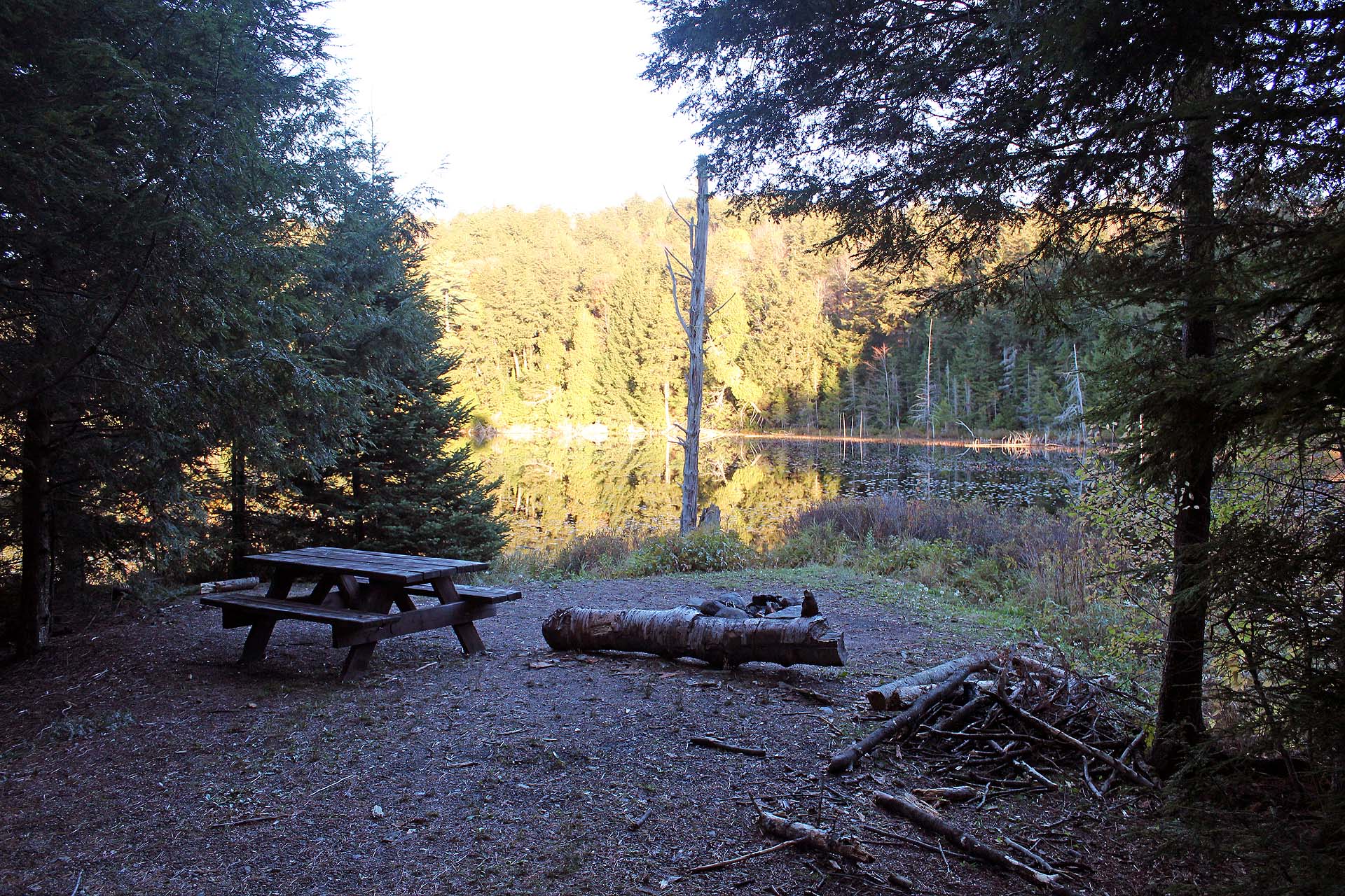
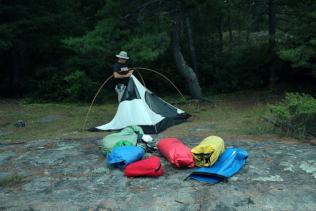
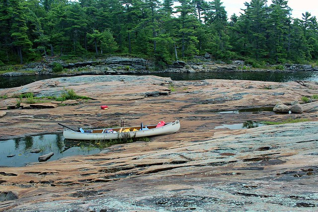
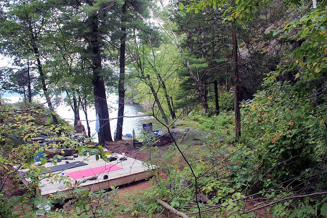
Arriving at the campsite-and it's vacant!

We knew that early fall would be a good time to visit the remote sites as we did not have to make reservations and we knew school groups would not be in full force, using interior campsites for their environmental programs. Besides, mosquitos are in retreat and there is no need to use insect repellents.
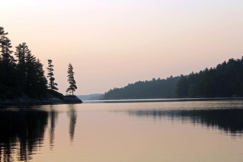
After a leisurely drive we arrived at Charleston Lake Park, registered at the main office and paddled to the best interior campsites in the park—Hidden Cove (#506). It was not occupied (although its previous occupants must have left the same day, as their permit indicated). The site had two wooden tent platforms; we decided to set up the tent on the farther one, near the imposing rock and used the other platform for our equipment and daily stretching exercises. The first night was quite cool, the temperature dropped at night to +5C—what a difference from just a week ago, when the temperature was at least 10C higher! Well, we realized that the fall was upon us… For some reasons, the Labour Day often does mean the end of summer. The night was cold, but our 3 sleeping bags kept us warm.

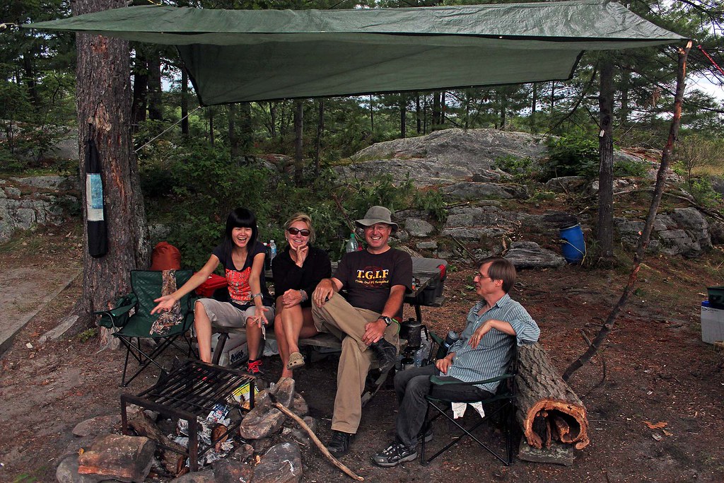
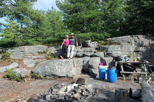
Our campsite at Charleston Lake. Very private, near a huge
boulder and sheltered from the wind
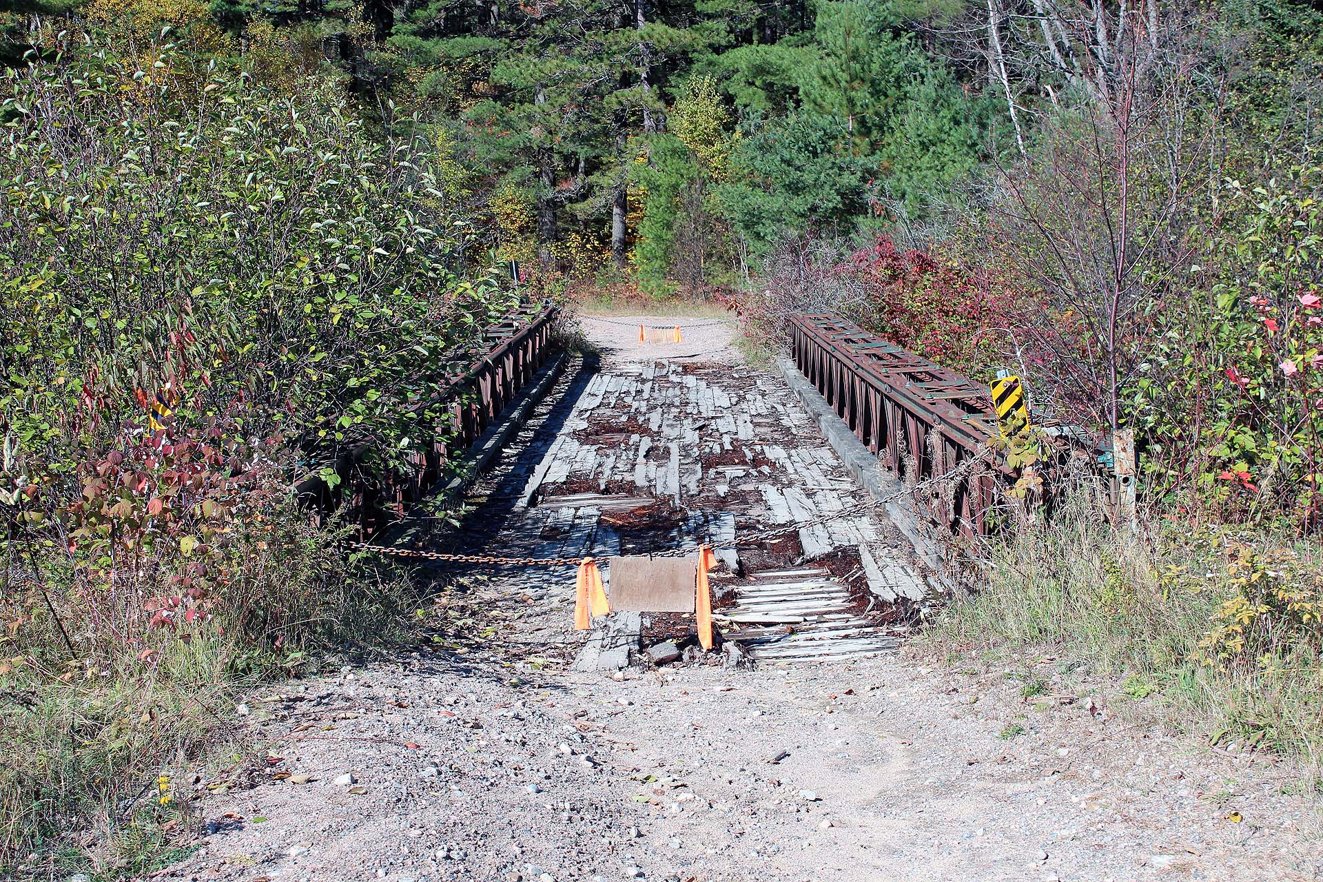

Friday was a beautiful, sunny day and we hiked a little. There was a hiking trail (Tallow Rock Bay East Trail) just on the ridge above our campsite. We headed over to the bridge between Charleston Lake and Slim Bay (the bridge was closed in 2014, hopefully temporarily), passing very interesting rock formations and old growth forest. It was a mystical place. We crossed the bridge and Catherine went on in search of Bob’s Cove campsite, but upon seeing some campers, she did not want to invade their privacy, so she retreated and we headed back to our campsite.

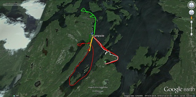
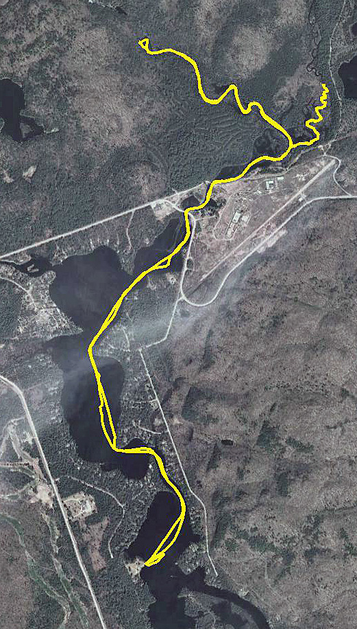
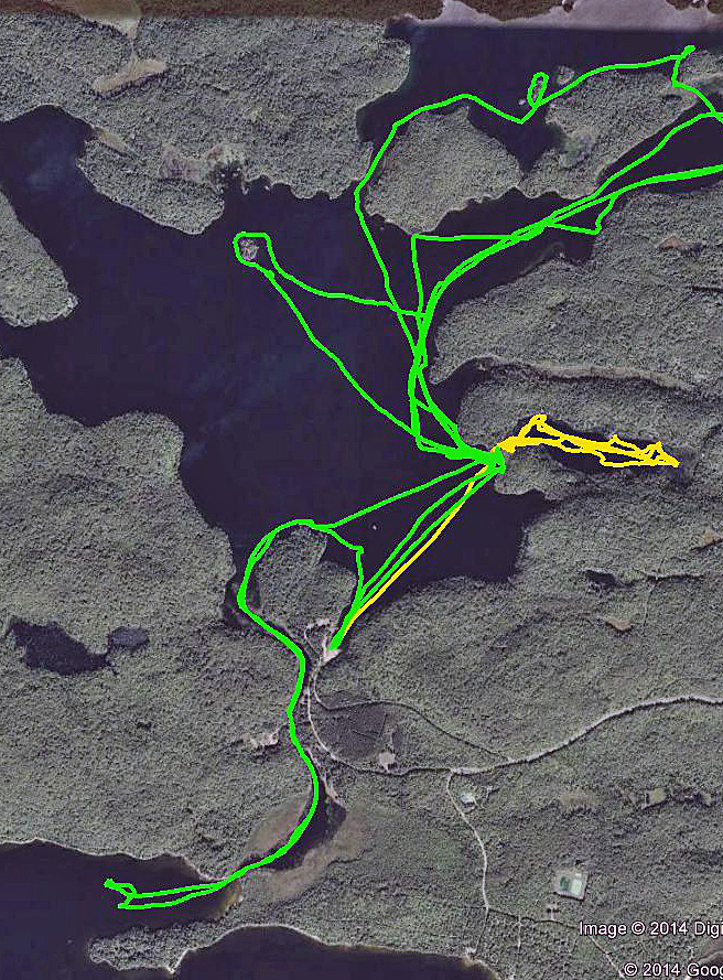
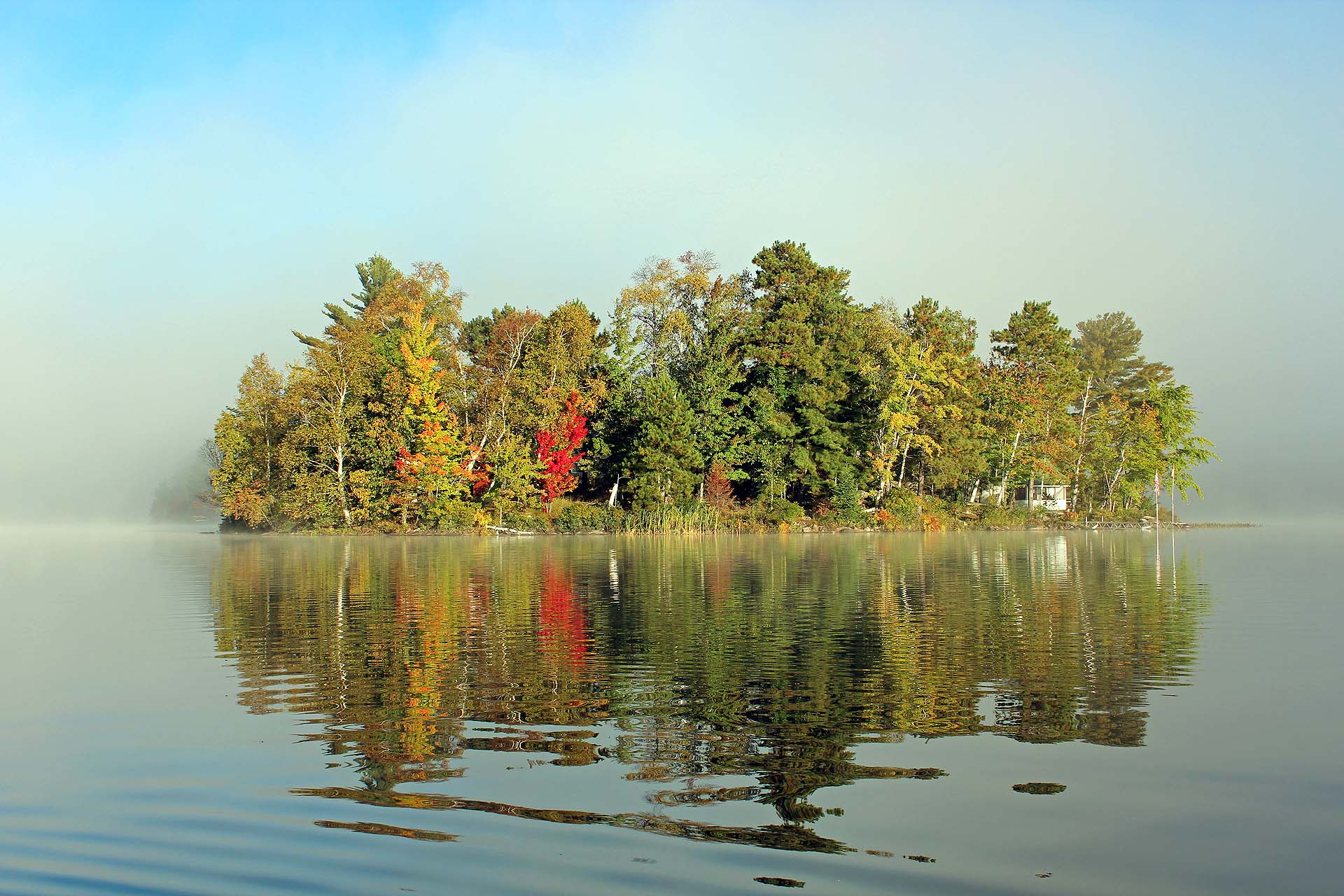
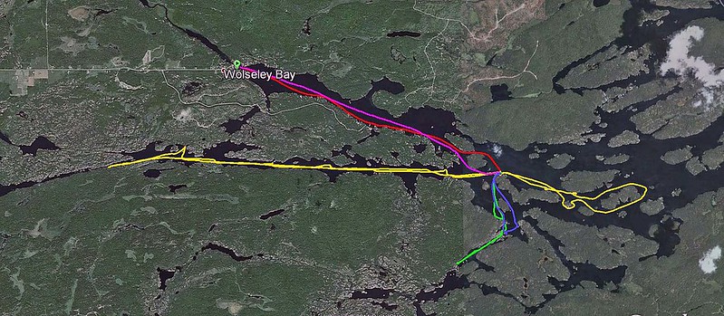
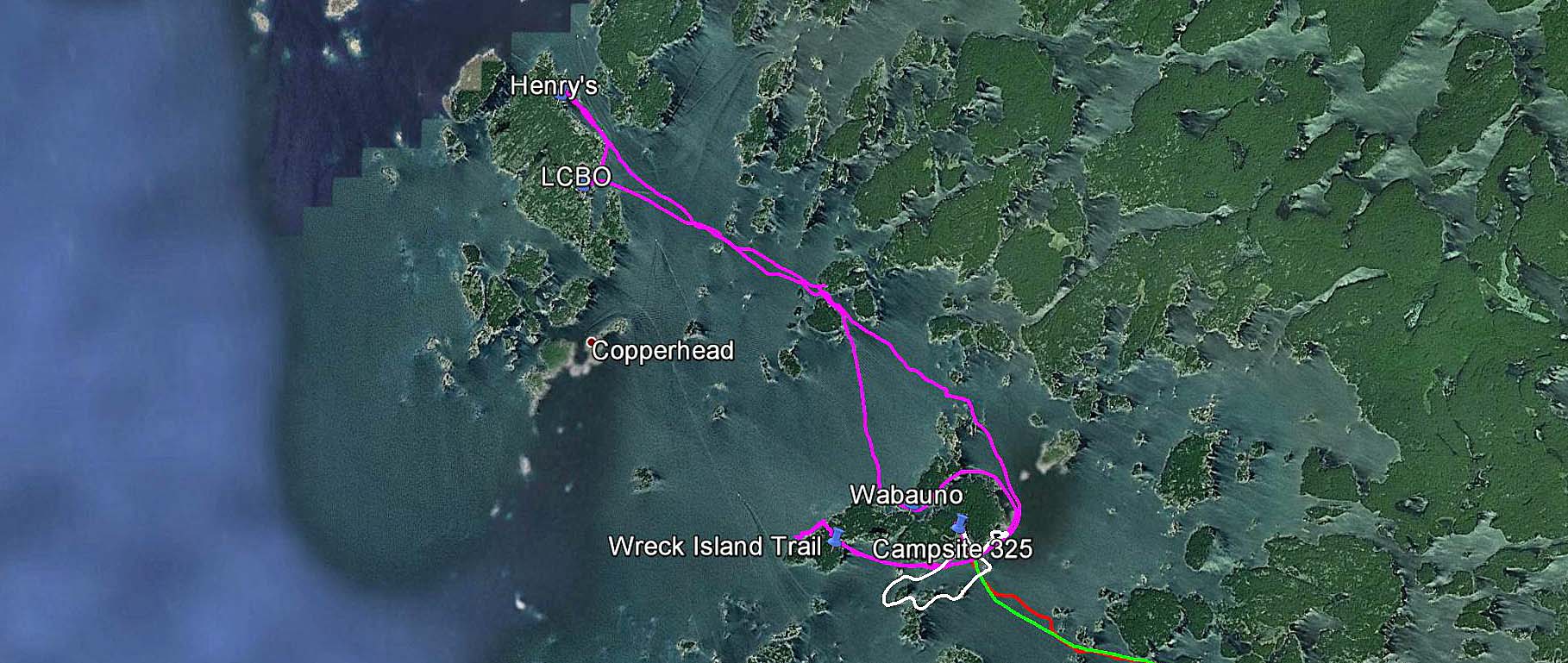
GPS track of our paddling on Charleston Lake
At night we were entertained/serenaded by the transcendent call of the loon. This experience alone is worth staying on an interior campsite.

The next day (Saturday) we paddled to the car (as there was a 60% chance of rain) and drove around the campsites in the park, rating their differences. Of course, we also visited the famous rock shelters.

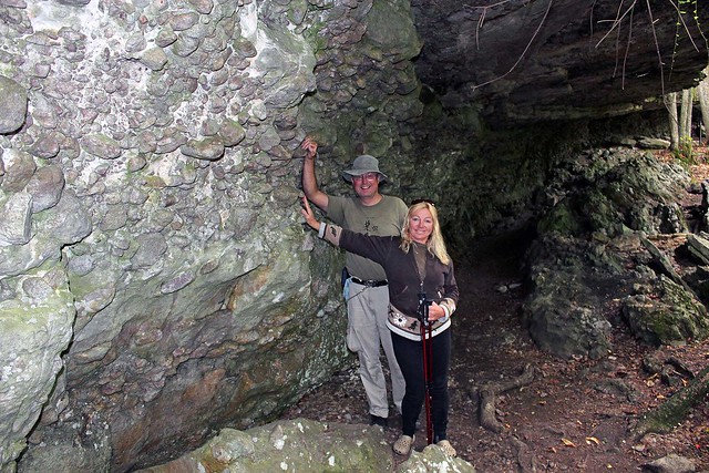
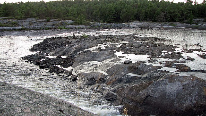
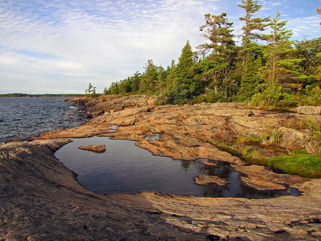
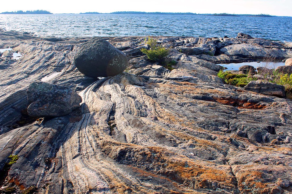
Rock Shelters in Charleston Lake Provincial Lake
The natural shelter, formed by the overhand of one large rock, rises about 50 feet above the water level and is inland approximately one hundred yards. The rock itself is not homogeneous but is composed of boulders of up to 10 inches in diameter set in a type of limestone formation. Over the years, pieces of the overhanging rock have broken off and fallen, with the result that much of the floor is covered with debris, especially as one moves toward the south-west end of the site. Protected as it is from the elements, the site would have provided an excellent shelter for those travelling in the area.

Rock Shelters
One of the most interesting features found on the site was a large pit. It measured about one and one-half feet by three feet by about one foot deep. The pit contained no artifactual material but instead was filled with stones about five inches in diameter and very dark sand. It was beside a large fire area and one possible explanation of its use may be that at one time it was lined with some waterproof substance, possibly birch bark and pitch, and used to heat water by immersion of fire-heated rocks.

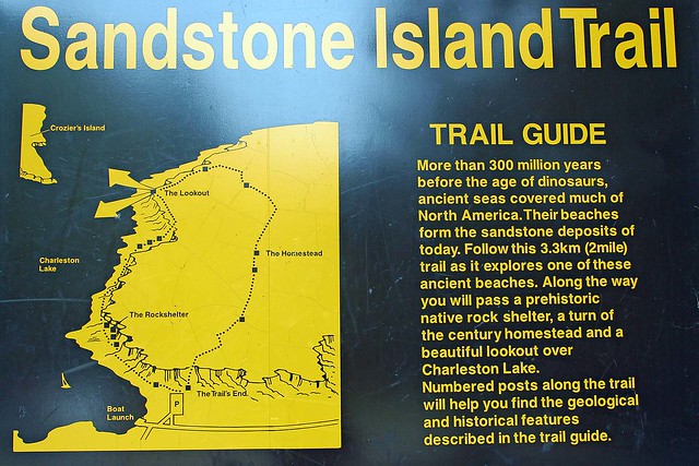
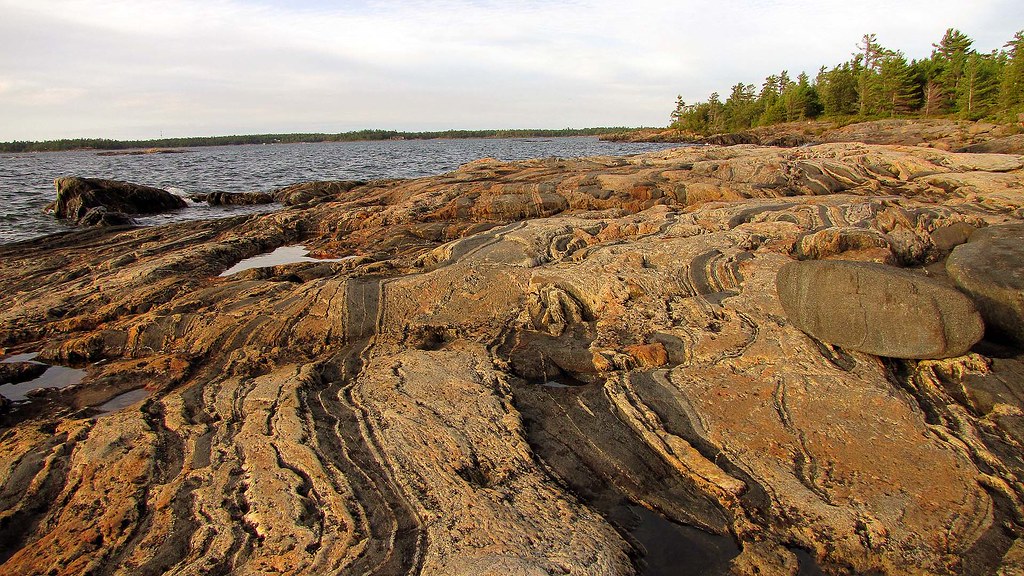
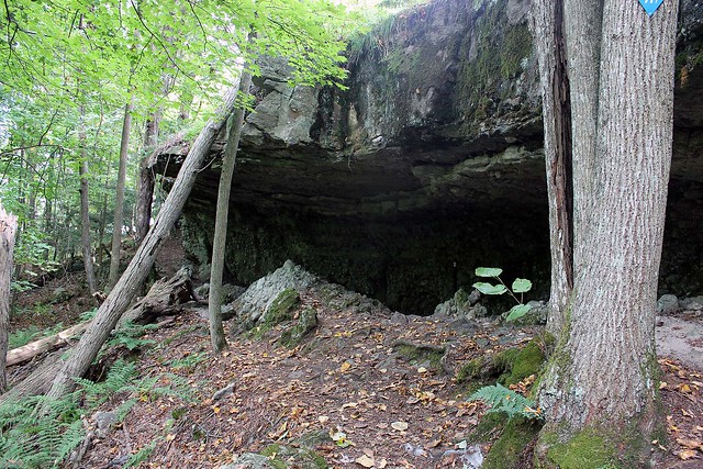
Sandstone Island Trail passes a prehistoric rock shelter
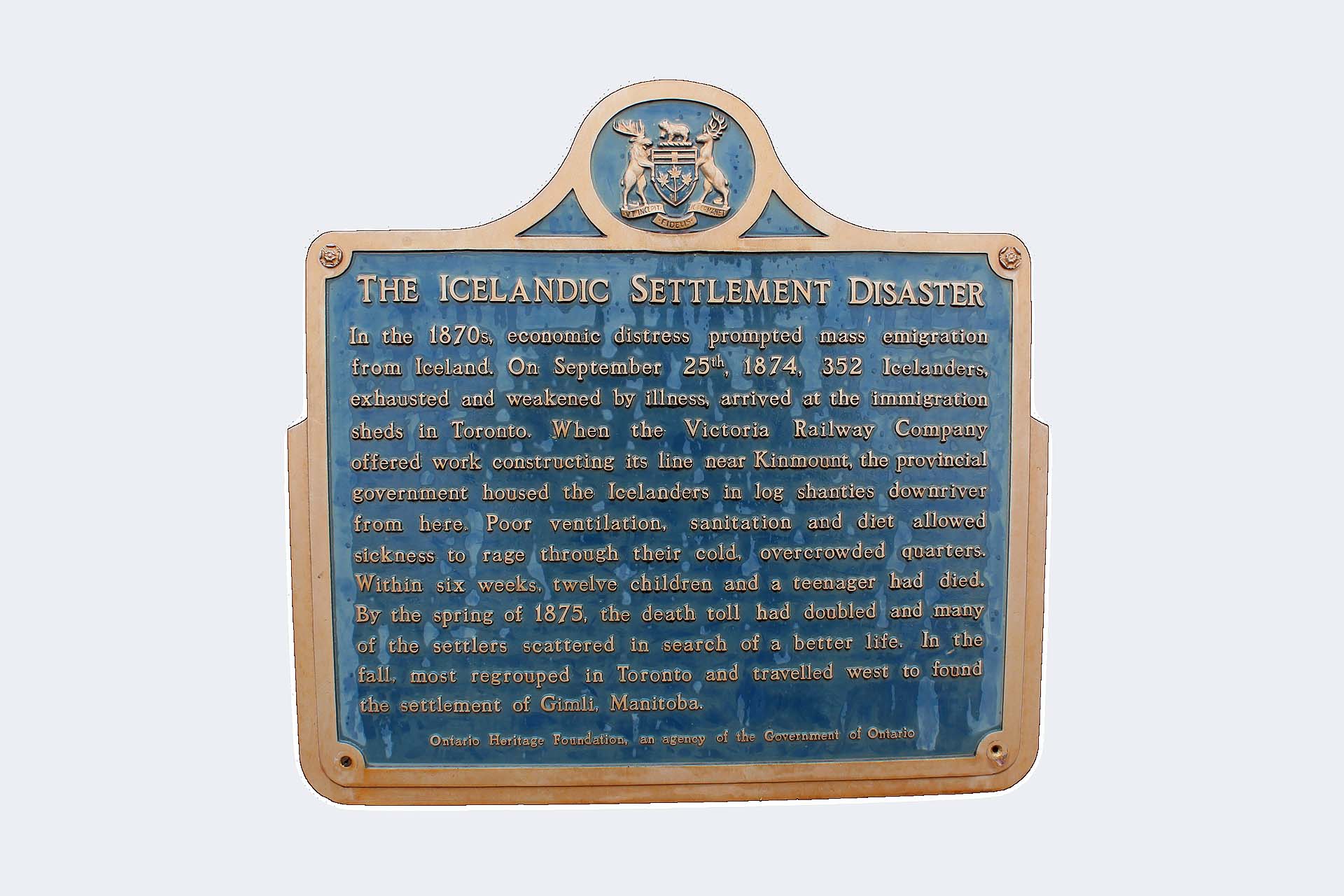
Excavations during the last week of May of 1967, produced evidence of at least two short periods of occupation. During the first period the rock shelters were used as a short-term camp by travellers in the area during the Late Middle Woodland period (about 500 A.D.); pottery and bone tools remains were left by them. The second group left musket balls, flints and a buckle and must have arrived sometime after the contact period. Neither group could have stayed long since the cultural accumulation was slight, but both were there long enough to leave evidence of their stay. [Source: L. Gordon, “The Charleston Lake Rock Shelter”, Accepted in 1969, published in “Ontario Archeology No. 14]

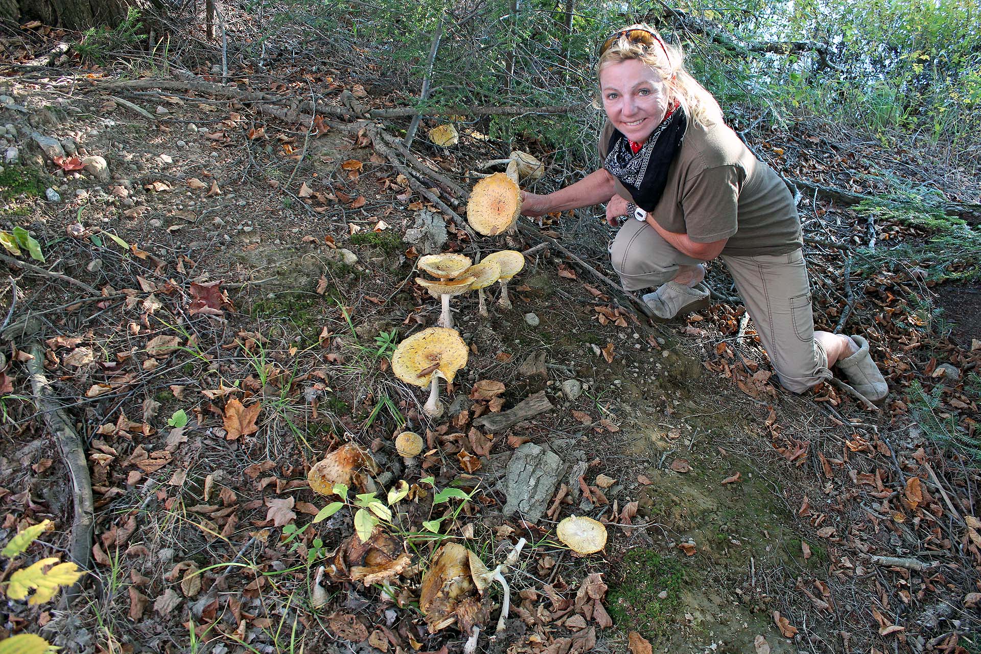
The forest around the shelters was just magical, with all the fallen trees, rocks and amazing mushrooms, ferns and mosses. We tried to imagine the people who used those shelters over 1,500 years ago…

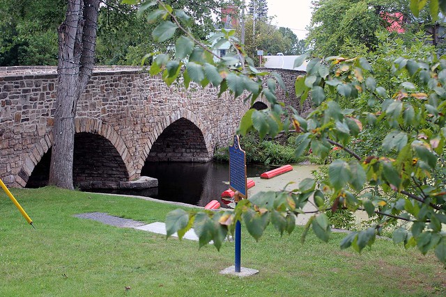
Lyndurst and its famous picturesque stone bridge

Later we visited the nearby town—Lyndhurst, with its old, beautiful stone bridge, where we had the excellent ice cream at “Groceteria” and spent some time at a second-hand/antique shop. It was a trip down the memory lane for Catherine. There was a chip truck near Lyndhurst called “Petras” (whose owner was German) and it sold excellent beefsteak tomatoes.

Another day we drove to the town of Delta. There was an old stone mill, which I had visited in 2004. At that time I was told there were plans to restore it and even bake bread for tourists, but since it was closed, I had no idea if it was operational in any capacity. There was also a gathering of “Old Bastards Vintage Motorcycle Club”—they hold their annual motorcycle rally on the weekend after Labour Day in Delta. The LCBO store was the busiest place in town and across the parking lot McEwan’s gas bar and grocery store/supermarket came in as a close second. We admired old buildings (plenty with ‘for rent’ signs) and old bridge. Sadly, the town seemed to be in decline.

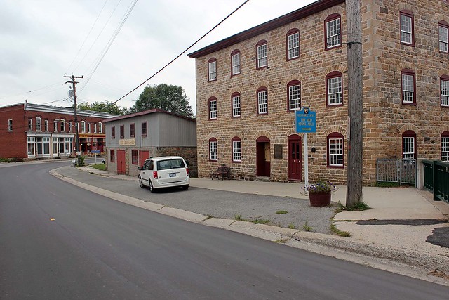
Delat and its old stone mill from 1810

Next town we drove to was Athens. It had very interesting murals. Coincidentally, I had visited Athens in 2004 exactly during the Summer Olympic Games in… Athens! This visit gave me legitimate bragging rights to boast that I was in Athens during the 2004 Olympiad!

We drove back to the park, got into the canoe and paddled to our campsite. Crossing the lake was quite challenging due to the strong wind and we had to make sure the canoe was always positioned towards the waves—even though, some water did get inside.

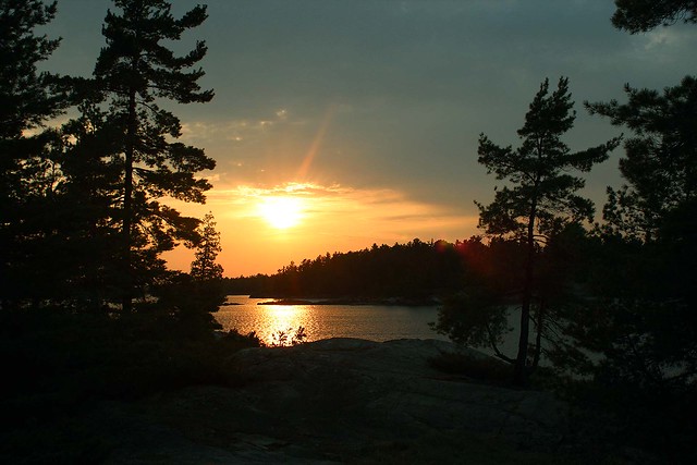
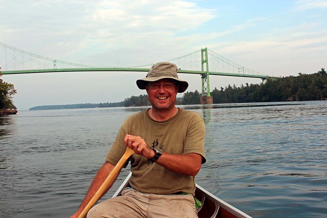
Paddling on Charleston Lake. Recently part of this rock must have fallen off; the roots are still
visible. Hopefully, no canoe was nearby when this happened!
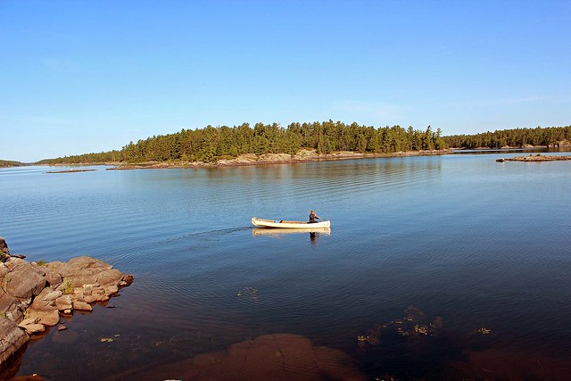
We paddled on Charleston Lake a few times, to check out the other interior campsites. We saw a campsite with two clusters—but it was too dark. The campsite closest to ours (Bob’s Cove), made up of 3 clusters, was quite OK. The campsite closest to the park (2 clusters) was not very nice, required plenty of climbing up and carrying camping equipment.

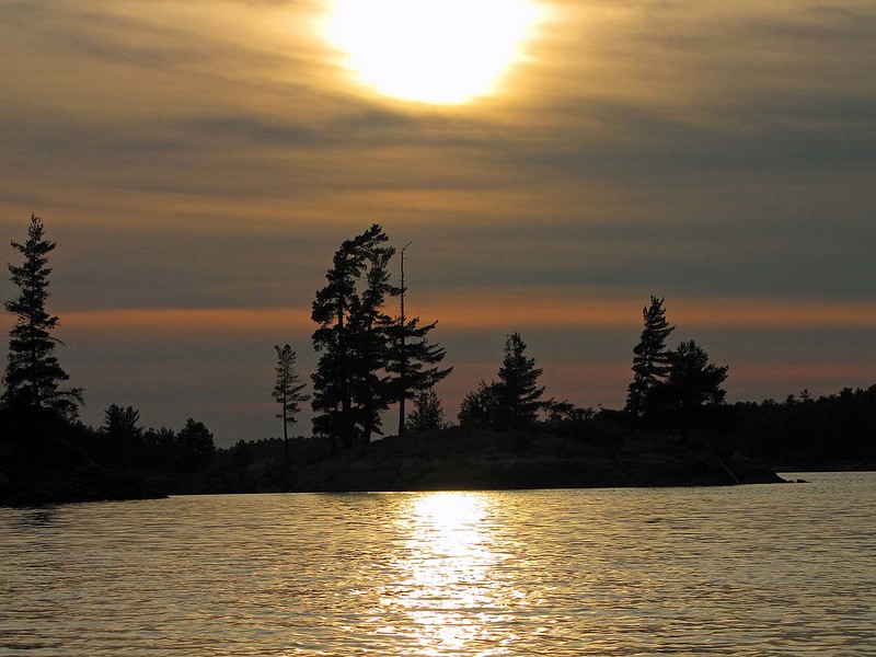
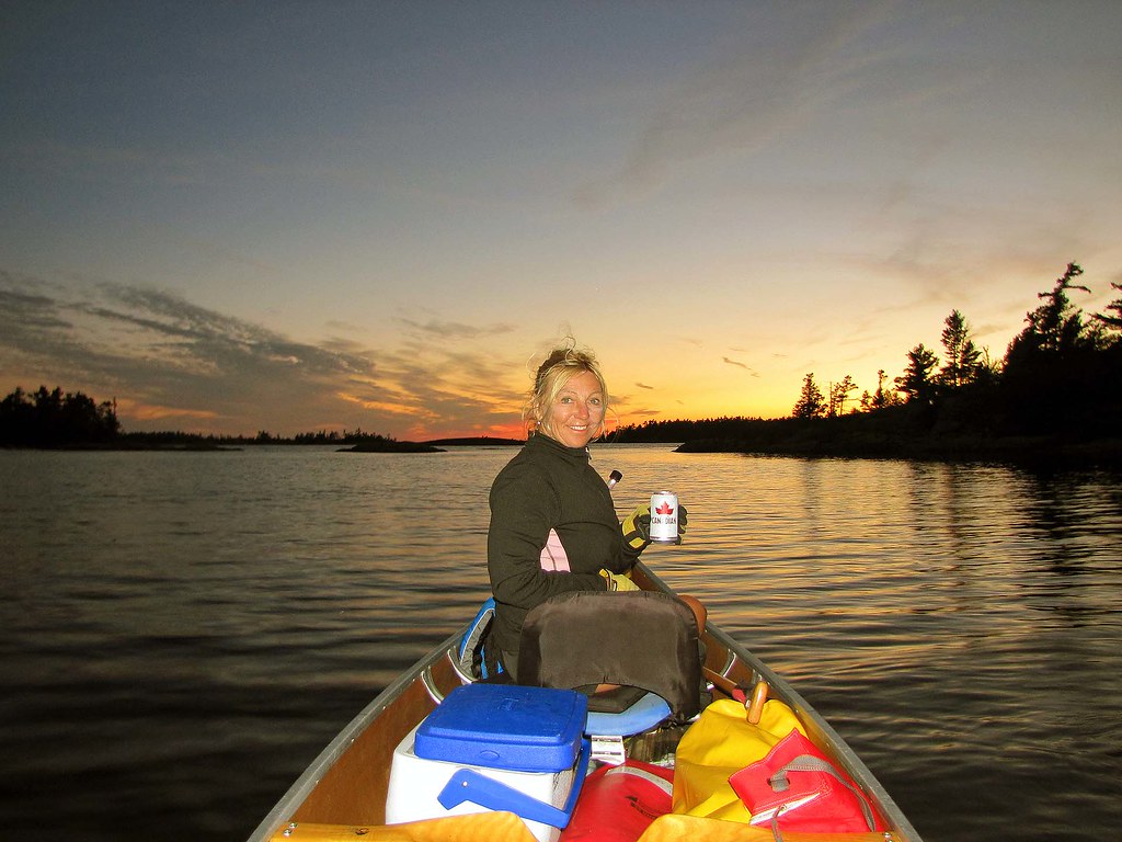
Paddling on Charleston Lake at Sunset is awesome!
One day a park warden came to our campsite (by boat) and we had a very interesting conversation with him about the park, general work and zebra mussels (which were ubiquitous in the lakes). He left 2 bags of wood, just in case we needed them (we did not, as the wood we had bought in the park sufficed).

We spotted plenty of poison ivy in the park, as well as hickory nuts, which are edible, but it is very difficult to get the edible part out of the shell. From time to time we saw majestic blue herons and of course, plenty of loon, whose calls are simply unforgettable! The weather remained quite good—yet one night we had a rather strong thunderstorm, accompanied by heavy rain.

We left the park on September 11, 2013 and commenced the second part of our trip.

Our great campsite at Ivy Lea Park, just near the One Thousand Islands International Bridge
We headed towards the Thousand Islands International Bridge over the Saint Lawrence River, which was opened in 1937 and the following year dedication ceremonies took place. On August 18, 1938, US President Franklin D. Roosevelt and Prime Minister Mackenzie King officially opened the bridges (as the bridge comprises of 5 bridges). The bridge cost over 3 million dollars and today annual crossings exceeded 2 million vehicles. Since we did not have passports with us, we only drove to Hill Island (which is still in Canada) and went to a unique tourist place which had various mounted and stuffed animal heads from the 1950s era. Then we drove to Ivy Lea St. Lawrence Waterway Park, where we were planning to spend at least one night. It was almost +30C, very hot, and we were trying to quickly find a good site. There were several nice sites available along the water and the Saint Lawrence river was so calm and inviting and we were really looking forward to camping in this park. Eventually we picked campsite no. 103, from which we could see the Thousand Island Bridge and passing ships, some full of tourists. We quickly drove to town to buy food supplies and then rushed back 
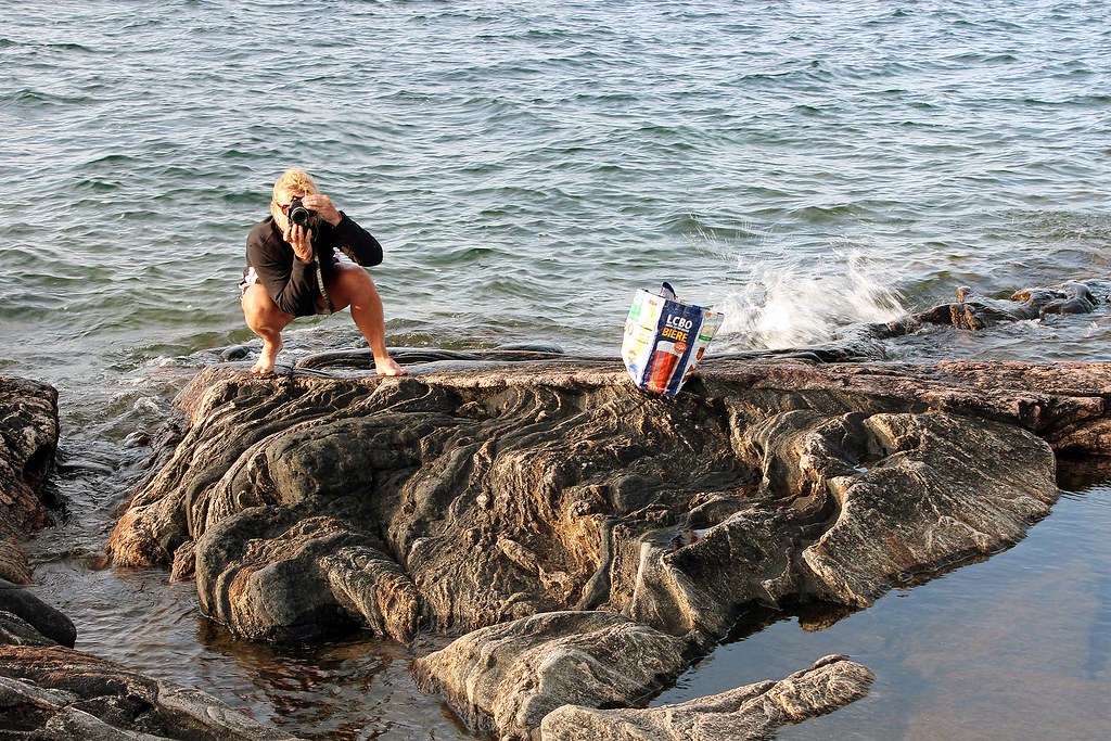
to the park to launch the canoe. We paddled westward (against the current) on the St. Lawrence River towards Gananoque. There were plenty of currents and whirlpools, yet they did not seem to pose any problems for the canoe as we kept close to the shore. We spotted a beautiful sail boat, the Mist of Avalon (which incidentally comes with its own website, www.mistofavalon.ca); later I found a YouTube video featuring this magnificent boat. There were also many islands on the river; on one of them, there was a statue of the Holy Virgin and the island was appropriately called Virgin Island.

The impressive and beautiful "Lady of Avalon" on
St. Lawrence River

Bad weather was in the forecast and indeed, the sky did look ominous. We paddled back to the park dock and decided to leave our canoe chained to the dock in a small bay. We went to the campsite, set up the tent and soon we were sitting around a campfire, watching the lit bridge and the trucks crossing it. They made plenty of rattling noise.

The bay where we left the canoe was called Smugglers Cover. Its name conjured up a very fascinating period of history of the River: When the USA initiated the Prohibition Era in 1920 and Ontario voted away its own dry laws, the stage was set for smuggling alcoholic beverages across this segment of the St. Lawrence River and Lake Ontario. With its hundreds of miles of unguarded boundary, numerous inlets, coves and islands, the 1000 Islands region became a haven for smugglers. Many residents, using their excellent knowledge of the River, turned out to excel at this business.

Tadeusz Pasek
Let me here reminisce a little about one of my past trip. In June and July, 2001 my friend Tadeusz Pasek and I had driven from Toronto to the Catskills Mountains, then to Milford, Connecticut and even visited New York City (yes, we were on the roof of the World Trade Center Tower that would be destroyed in less than 3 months!), then drove via Saratoga, Lake Placid and the Thousand Island Bridge to Canada. Before we crossed back to Canada, we had been planning to stay at Wellesley Island State Park in the US—we drove there and were told there should be a few tent campsites available. It turned out that the park was 99.9% full, packed with huge RVs, trailers, campers and similar vehicles which were crammed like sardines. The only campsite (or just a tiny spot) we managed to find in this modern ghetto to pitch our tent was squeezed between two huge RVs… Yes, zero privacy and fun! That was why we immediately decided to proceed to Canada. We spent a few nights in Ivy Lea Park on campsite no. 121, almost under the bridge—to this day I remember the noise caused by trucks driving on the bridge as well as boisterous July 4th, 2001 celebrations taking place on the other side of the border (i.e., in the RV park in the United States).
Tadeusz Pasek

By the way, Prof. Tadeusz Pasek was a well-known precursor of yoga in his native Poland—after a year-long stay in India in the 1960s, where he had practised yoga and plumbed into the mysteries of this ancient discipline under experienced Hindu yoga gurus, he returned to Poland and began popularizing mental, physical and spiritual practices and benefits of yoga, as well as wrote a book and numerous articles on this subject. Mr. Pasek passed away in 2011 in Toronto at the age of 85.

There was a terrible thunderstorm that night, which lasted till 10:00 am o’clock. When we got up, we decided to stay another night at the park. After breakfast we drove eastward via Brockville. The historical sites were everywhere and we were enchanted with the architecture of the towns we passed and we vowed to return to investigate all the historical sites, particularly those related to the war of 1812 (between Canada and the USA). We stopped at Mallorytown Landing where we had lunch at a restaurant (Mallorytown’s Landing Restaurant Trattatoria ) and spoke to Dale, its friendly owner—he had previously worked at the casino and the Constellation Hotel in Toronto. We drove on the Long Sault Parkway, on a causeway over several islands. Each island is a part of St. Lawrence Park System. We did not stop to check out any of the campsites, as the clouds in the sky were threatening and we even thought that a tornado might develop. On our way back we experience some showers but by the time we reached the campsite, we realized there had been no rain at all at Ivy Lea Park. So, we had a campfire and grilled pork steaks.

Near the One Thousand Islands International
Bridge, on St. Lawrence River

The next day (September 13, 2013) we got up in the morning, packed up, put the canoe on the roof of the van and headed to Toronto.

We drove through Kingston, a very historical town: there was a fur trading post established in 1673 (then Fort Frontenac), in 1841 it was the first capital of the Province of Canada. It was indeed a beautiful town, with old buildings, renowned university (Queen’s University), military college (Royal Military College of Canada) and a military base (CFB Kingston). As we left Kingston, we saw the entrance to the Millhaven Penitentiary, one of the toughest maximum prison in Canada, where some most infamous and notorious convicts were being held—and despite faded warning signs, Catherine decided to drive there. From afar we saw double or triple fences and prison buildings. We stopped in a parking lot and struck up a conversation with a young prison guard who was just walking to his car. He told us that we were not supposed to be there and we were subject to search & vehicle (and canoe too, I presume) seizure if we did not leave immediately. He added that if we wanted to see the prison, we would need a special authorization form the prison authorities… or commit a major criminal offense (although he did not suggest the latter). So, we heeded his advice and quickly drove to the main road.

Canoeing on the St. Lawrence River, near Ivy Lea Park
We headed toward Prince Edward County (located on a headland, although local people said it was an island). It was named after Prince Edward Augustus, Duke of Kent (the son of King George III). After the American Revolution, the Crown made land grants to some of the earliest United Empire Loyalists to encourage their settlements in Ontario and provide compensation for property lost in the Thirteen Colonies. At one point the road, the Loyalist Parkway, ended and we had to take Glenora Ferry. It is free, fast (the passage took no more than 10 minutes) and frequent. Soon, we reached the town of Picton. We parked the van and wandered along the main street, visiting a few shops and a marine museum. I was astounded at the hundreds of marine books in its collection—one could probably do a very extensive academic research on this subject without even leaving the building!

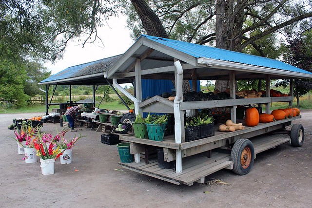
Fruits, vegetables and flowers directly from farmers!
We also visited Sandbanks Provincial Park and drove around its campsites; we had stayed at this park back in 2008 and Catherine loved the park, yet due to the unstable weather, we decided against spending even one night at the park. We also checked out a cottage in the park-it was owned by the park and it was possible to rent it.

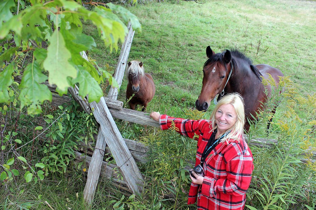
After leaving the park we stopped at a fruit/vegetable stand. The owner and his son had just come back from the fields with fresh picked corn. He was a chatty Dutch man. There was a horse and a pony in a fenced field nearby that belonged to the Dutch farmer—he said he kept them as pets. He gave us a few corn cobs and the animals ran towards us and eagerly started eating the corn husk and all from our hand. We also bought excellent tomatoes, onions, garlic and two giant pumpkins, perfect as Halloween decoration.

Farmer's horse and pony, they loved fresh corn!
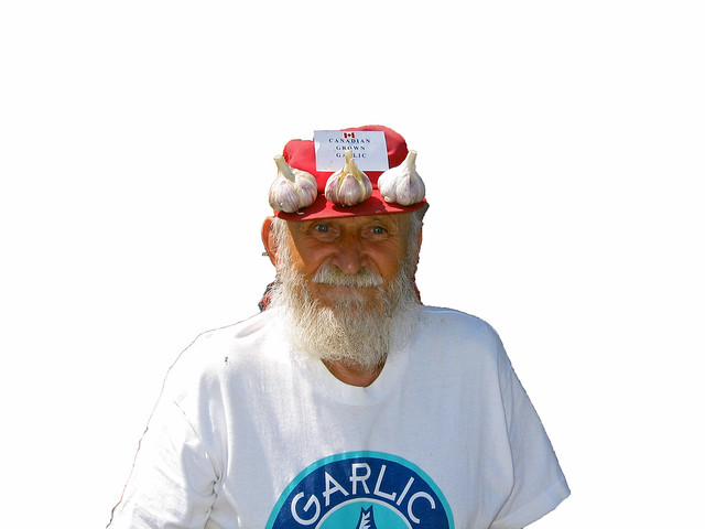
As I was buying garlic, I mentioned that nine years ago I had met a very interesting fellow who had been growing garlic and attended plenty of garlic festivals (I had even run across photographs of him in tourist brochures). His name was Ted Maczka, he was called ‘the king of garlic’ and ‘the garlic man’ and was residing in the area. Well, they knew him and one of the locals said that he had recently seen Mr. Maczka in a local supermarket! When I had met Mr. Maczka in 2004 in the city of Perth in Ontario, during a garlic festival, I found out he was Polish, born in Tarnow, and we continued our conversation in Polish. He walked with a noticeable limp—he said that during the Second World War his family had been deported by the Soviets and he had spent some time in a Soviet labour camp, he had broken his hip and it had never been properly healed. He arrived to Canada via Persia, Jerusalem and London.
Ted Maczka, 'Garlic Man'. Picture taken in the city of Perth in Ontario, in 2004,
during a garlic festival
Well, hundreds of thousands of Polish people had suffered similar fate on the ‘inhuman land’.
According to historians, the number of Poles deported to the Soviet labour camps after the Soviet invasion of Poland on September 17, 1939 (just over 2 weeks following the German invasion) ranges from 566,000 verified victims and a total estimate of 934,000 victims—and at least 10% of them perished of deprivation, hunger, disease, exposure, public executions, forced death marches and during transit.

Ted Maczka, 'Garlic Man'. Picture taken in the city of Perth in Ontario, in 2004,
during a garlic festival
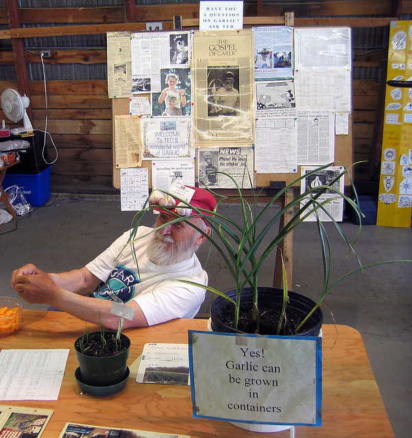
Mr. Maczka used to run an ‘experimental garlic farm’, was always willing to provide advice on growing garlic and its health benefits and was also selling garlic, mostly to those who wanted to plant ‘his’ garlic in their gardens. He incessantly extoled the benefits of garlic (for example, he said that it was placed on wounds during the war as no other medicines were available—and most likely he knew it from his own terrible experience!) and was adamantly against imported Chinese garlic (‘why should you buy this shit’, he told me, ‘when you can buy healthy Ontario garlic?’). At his stand at the garlic festival there were plenty of newspaper clippings on display in which he had been featured—yes, he was quite well-known in the ‘garlic circles’. I will never forget one of the articles published in “The Brantford Expositor” on September 1, 1990, “Learning from garlic man”. The journalist and editor, K. J. Strachan, happened to meet and listen to two individuals that day: David Peterson, premier of Ontario and Ted Maczka, ‘Fish Lake Garlic Man’ (the title that appeared on the business card). The latter regaled him with a plethora of garlic-related stories and his often unconventional wisdom. At the end of his article, Mr. Strachan wrote the following:

“Tuesday was a terrific day. I came home knowing more than I had when I went to work, which is one of the joys of working for a newspaper. I had enjoyed the unexpected pleasure of listening to the premier of Ontario, and to Fish Lake Garlic Lake. And I had learned something of value—from one of them.”

Methinks the author did not mean the premier of Ontario! Sadly, Ted Maczka passed away in January, 2014, at the age of 85 (or 87).

After a while we got on the freeway no. 401 and arrived in Toronto past midnight, exhausted, yet full of amazing memories!


Wednesday, July 23, 2014

FRENCH RIVER—CANOEING ON WOLSELEY BAY AND CAMPING ON BOOMERANG ISLAND, AUGUST, 2013


GPS tracks
Here we come, French River, again! Yes, we stayed here in 2011, two years ago, but because it was so windy every day, we could hardly paddle anywhere—even a very short trip around an adjacent island turned out to be a major chore. So, we hoped to make up all that lost time now!

We were planning to launch the canoe from Wolseley Lodge, but we took a wrong turn and ended up at Pine Cove Lodge. Unfortunately, it did not have a ramp and we were supposed to carry our belongings to the water and, on top of that, pay for that privilege $7.00 launch fee plus $8.00 per day for parking the car at a remote parking lot. So, we turned around and drove to Wolseley Lodge.
Setting up the tent

The put-in was free and parking was just $2.00 per day—much cheaper and we could literally drive the car into the water—as well as the parking was next to the water and the lodge. The lodge owner said they kept an eye on the parked vehicles—and Catherine believed her since she was German—maybe because Catherine has a German name too.

After paddling for over one hour—and hearing a few stinging comments from passing boaters about how much stuff we were carrying (to which we had already gotten accustomed), we arrived at our beautiful campsite—hallelujah, nobody was on it! Since we had camped on the very same campsite in 2011, we realized it was probably one of the best campsites in the area. Quickly, we claimed it. It had not changed significantly over the past two years. A primitive plywood table was quite convenient; there were several white bones kicking around, probably belonging to previous campers, who might have had a nasty encounter with a hungry black bear… OK, I am kidding… the bones were probably deer’s or moose’s and they were neatly laid out on the rock. The campsite was very spacious, with many potential tent sites, two thunder boxes (i.e., outhouse sans the house) and beautiful view of sunsets. At night we did not see anything around, just an occasional boat showed up here and there, with some fishermen, who kept fishing, but in most cases, to no avail. Because the shape of the island resembled a boomerang, I had always been calling it Boomerang Island.
At our awesome campsite!

It was full moon (blue moon) and in the evening we went for a paddle to other islands with several campsites—all of them were unoccupied. The moon was soon up and indeed, it was very bright, round and yellow-golden. While paddling, I was also trolling and finally caught a 63 cm pike. Alas, according to the Fishing Regulations, it had to be released; being a good, law-abiding citizen, release it I did, albeit half-heartedly. So long, our supper!
View from our campsite

Whereas evening paddles are relaxing, so are morning jaunts. Thus, one day we awoke early in the morning, at 5:00 am, got into the canoe and went for a sally on the lake in North Channel. The moon was still visible, everything was so quiet and we did not see any motorboats on the river. There was a tent pitched on the north shore of the channel, which was crown land, no park fee required. The campers were apparently asleep, yet their dog quietly ran down to the shore to check us out. On we went, finally reaching the characteristic pine we had seen from our campsite while sitting at the rock and admiring sunsets. There was a cottage on the other shore, at the park boundary. We loved paddling along the rocks and at one point came ashore—there was a fire pit made of rocks as well as a table: apparently somebody (or a group of people) frequented this camp.
Morning paddle in North Channel to the Cedar Rapids

Eventually we reached the Cedar Rapids. The water level was quite low, judging upon the water lines on the trees and rocks. We secured the canoe to a tree and took a nap, being lulled to sleep by the sound of the rushing water.

The paddle back to the campsite took us at least 2 hours. We also took other trips. Once we paddled to the Five Mile Rapids, just across from Crane’s Lochaven Wilderness Lodge. After carried the canoe through a shallow and rocky stretch of the river, we were able to again paddle for a while, until we reached another obstacle requiring a (longer) portage, the Little Pine Rapids (which obviously we did not attempt to portage). The area was very scenic and beautiful and we spent about one hour walking around.
North Channel-we saw this distinctive pine from our campsite

That evening I caught a 5-6 kg ugly looking catfish which I cleaned and later fried. It was the only fish I caught and ate this whole summer! Well, I can proudly boast that I rarely exceed the daily catch limit—in the whole year!

As I mentioned before, we had stayed on the very same campsite 2 years ago and of course, I wrote an extensive blog, in which I extolled virtues of this campsite. The next day after our arrival a few canoes paddled by and one of the canoeists shouted towards us:

            “Is this the famous campsite number XXX?”

            “Why was it famous?”, I asked.

            “It was featured in a very well-known blog”, she said.

I was almost flabbergasted at her words and would not say anything. Should I have told her that it was I who wrote that blog? During our stay at the campsite, we saw at least 3 other groups of canoeists who apparently were looking forwards to stay at this site and some were extremely disillusioned to find out that it had already been occupied. Well, it seems that people do read my blog and even act upon its recommendations!
Sunset

While we were sitting on the rock at the campsite, we saw two loons performing a mating dance ritual, which ended in hopefully a new baby loon gracing this earth.

On Sunday we got up early, packed up and headed to the car. Our plan was to drive to Oastler Lake Provincial Park, located 6 km south of Parry Sound. No sooner did we get all our gear packed into the van when it began thundering, lighting and heavy rain pelted down. We drove to the Hungry Bear Restaurant on highway 69 (just north of the French River bridge) to have a traditional grilled hamburger. The place was packed; moreover, the cream soup, which Catherine wanted so badly, was not available. So we drove next door to the truck stop, had a very good salad and chatted with the owner for some time.
Near the Little Pine Rapids 

Catherine had a burning desire to once again drive through Shawanaga Indian Reserve, so she made a detour off highway 69 into the reserve and looped back out onto highway 69.

When we arrived in Parry Sound, it was still raining. We visited a few stores and then went to Walmart, probably the only store open after 6 pm. While inside, we could hear the rain pounding the metal roof of the store and very loud claps of thunder. At one point the store lost its power (as we were about to pay), but the generator kicked in and we were able to complete our payment. Some of the shoppers were buying plenty of tarps—they were camping in the nearby provincial parks (Killbear, Oastler) and their presumably cheap tents were already leaking.
We enjoyed watching such beautiful sunsets from our campsite

Considering the weather, we realized it would be impossible to set up a tent in the park. So, we made the wise choice and drove straight to Toronto, arriving about midnight. Because the weather was very crappy the next few days, this decision certainly saved us from a camping nightmare experience.


Overall, we enjoyed this trip very much. And although Catherine was always trying to visit an area we had not visited yet, I was discreetly planning our next trip to another stretch of the French River!


Friday, July 11, 2014

The Massasauga Park, Ontario, August, 2013: Camping and Canoeing at Blackstone Harbour and Wreck Island


Our GPS tracks in the Massassauga Park
Initially Catherine and I were planning to stay in the Massasauga Provincial Park over the Canada Day long weekend, on a campsite near the channel. In March, 2013 we called Ontario Park Reservation and the site was still available, yet a day or two later, when we finally called to book it, it was taken! Since it was still available for the Simcoe Day long weekend in August, we quickly booked it — and managed to reserve a campsite in Killarney Park over the July long weekend instead. But it was not the end of the story: a month later, while chatting with my clients, it turned out that they were also spending weekends camping and canoeing and were looking forward to going camping over the Canada Day long weekend.

“Which park are you going to?” I asked.
“The Massasauga”, they said. “We had already reserved a campsite”.
“Which one?”
“The one near the channel”, they said to my astonishment!

Wow, what are the chances of this happening?

Pete's Place, we depart from here
So, on August 1, 2013 (the 69th anniversary of the Warsaw Uprising) we arrived at the Massasauga Park, Pete’s Place, to start our sixth trip in this park. There were not too many people around — we met a young guy of Serbian or Croatian origin from Toronto who was dragging his small kayak to the water. He was staying on one of the campsites located along Captain’s Allan Strait and we paddled together until we reached our campsite.

Evening paddle on Woods Bay
We had stayed on that campsite in July, 2011 with some friends, as well as part of our group had camped on it in 2010. It was located on the shores of the only channel leading to Woods Bay (and to Georgian Bay), so there was plenty of boat traffic. Nevertheless, the boats did not bother us — we could hardly see them — and we even enjoyed sitting on the rock and watching the passing boats and the setting sun. The campsite also looked out on a small island (private, but without any structures), sometimes we swam to the island and relaxed on its rocks.

Lynn, Catherine, Jack and Wayne at our Blackstone
Harbour campsite, near the channel
The next day Lynn and Wayne arrived and set up their new tent and a tarp. Later in the evening all of us went for a paddle on Woods Bay, around Georgina and Fritz Islands. The weather was perfect and we could enjoy the wonderful sunset. Once we were back, we had a campfire.

Since Catherine had left her hat in the car, the next morning we paddled to Pete’s Point (about 15 minutes) to fetch it and then we headed to Calhoun Lodge, facing a rather strong head wind. While Catherine, Lynn and Wayne went on a rigorous hike on the Baker Homestead hiking trail, I spent all this time exploring the lodge and adjacent buildings. 

Calhoun Lodge
Although I had visited the lodge several years ago (also with the same group), this time I appreciated its past history much more: Several months ago I had been contacted by Mr. Dave Nadzam from Ohio, who had seen my photos of Calhoun Lodge and made a few comments. It turned out that Dave, as a teenager, used to visit the Lodge and of course, knew its owner, Joseph Calhoun. He emailed me several photos depicting him having a wonderful time at the Lodge and wrote a couple of stories about the Lodge, ‘Judge’ Calhoun and his family. I also sent him the Massasauga Park tabloid and a brochure about Calhoun Lodge. So, now I was taking photographs and videos of the Lodge and later emailed them to Dave.

At Calhoun Lodge
I intended to incorporate his stories and some of the photographs in my blog — but he created his own blog, “The Calhoun Lodge: Willebejobe”, (https://dhnadzam.wordpress.com/), where you can find plenty of photos and very interesting stories related to the Lodge and its inhabitants-it is really worth visiting! I found it fascinating to read about the owner, “Judge” Jo Calhoun and his family (including his sister, who starred in almost 50 silent movies), Dave’s personal stories and finally stories about the Taylor family, who purchased the property from Mr. Calhoun.

The Maintenance Shed
Most of the buildings still survive in various state of (dis)repair. One of them, the maintenance shed, has a rather gloomy history: On May 24, 1968, Jerome Cassanette, the caretaker, dressed in his best clothes, and with a bottle of the Judge’s finest scotch, went to the maintenance shed, closed the shed door, started the tractor and then lay on the work bench until he succumbed to the fumes. The Judge, arriving from Ohio the next day, discovered his body. It is said that Jerome’s ghost haunts the property even to this day. While I was there alone, taking photos and exploring the buildings, I did not see any ghosts, although I was rather more concerned about encountering a black bear or an Eastern Massasauga Rattlesnake, the only venomous snake in Ontario (the park is named after this snake).

Inside Calhoun Lodge
Dave also scanned and posted a brochure published by Ontario Parks called “Calhoun Lodge and the Baker Homestead” (https://dhnadzam.files.wordpress.com/2013/08/calhoun-lodge-and-baker-homestead1.pdf) which has many photographs and tells about the Lodge and its history. Sometimes when we see abandoned houses, we wonder what had occurred there and wish they could speak. Well, this time all you have to do is go to Dave’s blog and in no time you will look at this place from a very different perspective!

Map of the Massasauga area at the Moon River Marina
On Sunday, August 4, 2013, we paddled to the falls (vis-à-vis Pete’s) and later gave a lift to Lynn & Wayne to the parking lot where they had parked their car; after saying good bye, we drove to the town of MacTier with our canoe on the roof. Yeah, we were planning to do some paddling on Lake Joseph, but eventually got too lazy and just spent a few hours in town.

Wreck Island
On Tuesday, August 6, 2014, we packed up our stuff and headed to Wreck Island. The weather was awesome and even though we had to paddle on relatively open water, we had no problems with waves or winds. Unfortunately, some motorboats were totally oblivious to our presence and we had to carefully watch for the big rollers they created. At one point three powerful speedboats darted about 100 meters in front of our canoe. In no time they vanished, yet the high waves they had left behind literally swamped our canoe — had not we positioned the canoe perpendicularly to the waves, it would have likely capsized.

Our campsite on Wreck Island
We had visited Wreck Island twice before: in 2008, during our first canoeing trip (it was just a day visit) and then in 2009, when we stayed for several days on the only campsite located on the island. We truly enjoyed our stay and thus 4 years later we were looking forward to visiting our ‘old’ campsite again!

Since the water level was lower than in 2009, our ‘private’ island on the ‘private’ bay became a peninsula. We still remembered plenty of water snakes inhabiting the island in 2009-they were quite ubiquitous, swimming everywhere and sticking their heads from numerous crevices. They were there again-one, very long and thick, was living under a flat rock, most of the time part of his body exposed to the sun. It was shocking to think that we probably had seen him as a toddler back in 2009! Others either swam or hid in cracks.

Water Snake
While Catherine spent several hours painting the canoe with First Nation artwork, I tried fishing, but she was obviously much more successful in her activity than I was at mine. This time we did not see any wildlife — we kind of missed the lonely, shy black bear that inhabited the island in 2009 and sometimes was observing us from across the small bay!

At Henry's Restaurant on Fryingpan Island
On August 8, 2013, we paddled to the famous Henry’s Restaurant on Frying Pan Island. As our trip required us to be traverse through quite exposed areas, I had made sure that the weather forecast did not call for any rapid weather changes and we were monitoring the sky and cloud patterns. We saw an OPP (Ontario Provincial Police) boat, checking boaters’ safety equipment-one hapless kayaker, who seemingly forgot to bring a life jacket, was turned back by the police. When we arrived at Henry’s, there were plenty of impressive boats, cruisers and sailboats (and one float plane) at the restaurant’s docks, yet we did not see any other canoes — we were the only brave ones!

We were the only canoeists that have arrive by canoe!
We just had French fries and briefly talked to the restaurant’s owner. Whereas the chips and fish are good, we did not think they were that great to justify their high price. Later we headed to the small store on the island.  Catherine bought ice cream, I opted for several cans of cold beer and we headed back to Wreck Island. At one point we were almost hit by a fast-moving motorboat — the driver saw us at the last moment and appeared visibly embarrassed and even terrified.

GPS tracks-poaddling to Fryingpan Island and back to Wreck Island
Instead of paddling directly to our campsite on the south shores of the island, I proceeded towards an entrance to a passage between Wreck Island and Bradden Island. There I was paddling back and forth around small rocky islands at the mouth of the passage and constantly scanning the area around the canoe. Catherine had no idea what I was doing or looking for and became quite perplexed by my peculiar behavior, yet I totally ignored her bemusement and kept paddling hither and thither.

“Do you remember the story of the Waubuno?” I asked her.

Considering all the many stories I had been regaling her with, Catherine could not recall this name.

Remains of the hull of the Waubuno
“Well, there is a Historical Plaque in Parry Sound in Waubuno Park, where a sizable anchor is located. So, to make the story short, let me just read you what it says”, I said and pulled out a sheet of paper containing the text.

“This anchor, recovered in 1959, belonged to the steamer "Waubuno", a wooden sidewheeler of some 180 tonnes which was built at Port Robinson in 1865. She carried freight and passengers in the shipping trade which flourished on Lake Huron during the nineteenth century. Commanded by Captain J. Burkett, she sailed from Collingwood on November 22, 1879, bound for Parry Sound. The "Waubuno" encountered a violent gale later that day and sank in Georgian Bay some 32 km south of here. All on board perished, and although some wreckage was later discovered, the bodies of the 24 victims were never found. The specific cause of this disaster has never been determined.”

“Wow, what a terrible disaster!” she exclaimed.

I pointed to something sticking out of the water.

“And we’re now looking at what remains of the hull of the Waubuno!”

Both of us were quietly looking at this old, rusty and decaying object which 134 years ago was part of this well-known ship.

Rock formation on Wreck Island

Then we paddled past the campsite to the beginning of the Wreck Island hiking trail. There was one cruiser docked, whose occupants were having a small campfire on shore. We spoke to them for a while-they complained about the price of gas the boat was consuming-even a short trip ended up costing several dozens dollars. Also, when it was windy, they often had to wake up in the middle of the night to check if the wind did not push the boat towards the rocky shore. Listening to such stories-and they are quite common-made us appreciate our canoe even more!

Rock formation on Wreck Island
The Wreck Island Trail is quite short, but it is absolutely spectacular due to impressive rock formations! I was devouring the amazing and unique scenery and every few seconds took a photo — I could literally feel my camera overheating! I am not a geologist, but let me quote a few passages from “Wreck Island Trail” by Ontario Parks:

Geologists believe that the rocks in this area have experienced a mid-continental collision beginning some 1.1 billion years ago. Mountain building was followed by millions of years of erosion. Some 450 million years ago a marine sea flooded this area leaving deposits of limestone, yet none of these thick deposits have survived the subsequent erosion on Wreck Island.

Fantastic rock formations on Wreck Island
Glaciation has also contributed to sculpting the park’s landscape. Continental glaciation finished the job of removing the last traces of soft limestone. The last sheet covered the Wreck Island area approximately 60,000 years ago, however, it was 14,000 years ago that an event far to the north of Hudson Bay would leave a lasting record on the island. A catastrophic release of glacial meltwater occurred, releasing a huge quantity of debris-laden water with “nowhere to go”. Ice still covered this part of Georgian Bay, including Wreck Island, as the water rushed southward. It traveled beneath the ice under tremendous pressure. The water was able to push up the base of the glacier and travel along the ground. The rushing torrents was filled with sharp grit, cobbles and boulders. This torrent attacked the rock surfaces of Wreck Island much like a giant sand blaster, resulting in the erosional processes evident today.
Percussion Boulder

Percussion Boulders

Fourteen thousand years ago a catastrophic release of glacial meltwater occurred, releasing a huge quantity of debris-laden water with “nowhere to go”. Ice still covered this part of Georgian Bay, including Wreck Island, as the water rushed southward. It traveled beneath the ice under tremendous pressure.

Taking photos on Wreck Island
The water was able to push up the base of the glacier and travel along the ground. The rushing torrent was filled with sharp grit, cobbles and boulders. This torrent attacked the rock surfaces of Wreck Island much like a giant sand blaster, resulting in the erosional processes evident today. The large, black boulders is one of those rocks which were bouncing along under the ice hammering the rock surfaces. These rocks are known as percussion boulders, they were swept along in a high speed sheet of water under tremendous pressure. Geologists think this incredible flow may have been short lived, lasting anywhere from only a number of hours to several days.

Amazing sunset on Wreck Island
We know that these percussion boulders have traveled a long distance; this black boulder looks very different than the bedrock on which it sits. The boulder is gabbro from far north of here and contains green epidote.

It was a wonderful evening and I took over one hundred photographs with the rock bathed with the setting sun, yet no photograph will convey the exceptional beauty of this area.

Enjoying the sunset near Wreck Island
It was getting dark and we slowly returned to the canoe. It was very hot, I was thirsty and had a few cans of still cold beer-it was so delicious and refreshing! We paddled for a while and finally reached our campsite in total darkness.

Next day we paddled back to Pete’s Access point, stopping along the way in Captain Allan Strait to eat Pickerel Weed, examine Arrowheads and look (unsuccessfully) for wild rice. At one point a group of seadoo riders suddenly showed up in the channel and kept going very fast in spite of our canoe being there. Since it was still early, we went to Moon River Marine for popsicles and beer, then sat down in wooden chairs and were watching and chatting with patrons loading their boats to depart to their cottages-well, a very busy Friday evening! In less than 30 minutes we arrived to the Pete’s Access point, packed the car and placed the canoe on the roof—just in time before a thunderstorm hit.

On Wreck Island-Percussion Boulder
What can I say… yet another awesome canoeing & camping trip!