Friday, September 30, 2011

Restoule Provincial Park, Ontario, September 15-21, 2011

Blog in Polish/Blog po polsku: http://ontario-nature-polish.blogspot.com/2011/09/restoule-provincial-park-on.html
More photos:
http://www.flickr.com/photos/jack_1962/sets/72157628606261077


Restoule Provincial Park, Ontario, September 2011

Restoule Provincial Park, Ontario, September 2011

In the past I had visited Restoule Provincial Park twice—in September 1999 and 2000, also with Christopher, with whom I went there this year. Our both trips were not very successful—in 1999, on the second day after our arrival, the temperature plummeted in the morning to below 0C and soon it started raining—after two miserable nights we rented a cottage on Lake Commanda where we spent the next ten days. It turned out to be a great decision since it would rain very often and once a power storm, with lighting and thunder, kept us awake for hours—but at least we were not roughing it in a tent! In 2000 our trip was nicer, but because we did not have a boat or canoe, we had to rely on renting them which was not an easy task: plenty of resorts had already been closed, those that rented boats were quite expensive and we had to travel far from the park, even to Lake Nipissing, to rent fishing boats—and frequently we were not satisfied with them. This year, however, we brought with us a canoe, so at least we knew we would be able to spend a lot of time on the water and do some fishing.

Restoule Provincial Park, Ontario, September 2011

When we left Toronto on September 15, 2011, it was so windy that I was somehow reluctant to drive on the highway (400) with the canoe attached to the roof. In fact, strong gusts of wind were whipping the canoe and twice we had to stop on the highway's shoulder to adjust the canoe—on one occasion 1/3 of the canoe shifted from the roof. Just before reaching Barrie, we got off the 400 and driving on side roads, arrived at the MEC Store (Mountain Equipment Co-Op), one of the best outdoor stores in Ontario. We talked to the store staff and one salesperson even took a look at the canoe and suggested we buy additional, higher canoe blocks. Maybe they helped a little, but we did not feel too confident to continue driving on the highway for the next 200 km. So, we decided to go to Six Mile Provincial Park instead (which we had visited many times for the past 20 years). I took a number of country roads and tried to drive just at the speed limit, yet at one point, when we were on the top of a hill, the wind again caused the canoe to shift a little, forcing us to stop and adjust it. In the town of Port Severn we bought a bag of firewood and after 10 minutes arrived at the park. As we expected, there were very few campers in the park and we could pick any site we wanted (not that we cared that much—after all, we were going to stay there for just one night). We picked site number 68, set up the tent, started the campfire and for the next few hours sat around the fire, drinking beer, grilling sausage and enjoying its warmth as it was quite chilly. Nobody drove nor walked by our campsite nor did we hear any other people. I also realized that I had not brought a mattress and had to quickly make an improvised 'pad', using various pieces of clothing and my life jacket.

Restoule Provincial Park, Ontario, September 2011

On September 16, 2011, we were up before 7:00 am, quickly packed up the tent and in less than one hour were back on highway 400, heading north. We passed plenty of lakes and admired the morning mist rising off the water. Once we reached the town of Parry Town, we had breakfast at Tim Horton's, then I went to a Canadian Tire store, bought a mattress (which proved to be defective and kept loosing most of its air every night—I returned it after our trip). Before noon we arrived at Restoule Provincial Park.

Restoule Provincial Park, Ontario, September 2011

The park's campsites are quite good, yet the privacy level, so to say, is so-so, usually you can see several other campsites and there is not that much vegetation between the campsites. Of course, in September the park was nearly empty, so we were enjoying total privacy and did not see any other campers around. On the campgrounds without electricity (where we stayed) perhaps only 10 campsites were occupied and all of them were near the water, far away from us; the electrical campsites did have quite a few campers, mainly living in trailers. We spent an hour driving on the park's roads, checking out campsites; eventually we decided to choose campsite number 214. It was a good camping site and there were not even distant neighbours during our stay. We were surrounded by beautiful autumn colours, the whole place was covered by fallen leaves which created a 'leaf carpet'. We pitched our tents, spread the tarp over the park bench (just in case of rain) and started a fire. It was a chilly night, so we were sitting close to the fire, enjoying beer, red wine and grilling steaks.

Restoule Provincial Park, Ontario, September 2011

The next day, September 17, 2011 (72nd anniversary of the Soviet Union's invasion of Poland) was sunny, so after breakfast we drove to Restoule Lake, put the canoe on the water, unpacked our fishing rods and paddled all over the lake, stopping from time to time to cast. The lake was quite big and there were plenty of houses on its shores; from time to time a motor boat passed by. After five hours we turned back to the dock, without catching one lousy fish! I went for a 20 minute swim—the water was very cold, but I did not mind and after a few minutes I hardly noticed how cold it was; in fact, I felt very refreshed! While driving to the campsite, we were listening to the CBC news and found out that there was a plane crash in Reno, Nevada, resulting in numerous casualties. Again, we had a nice fire and had delicious grilled steaks.

Restoule Provincial Park, Ontario, September 2011

On September 18 and 20, 2011, we canoed on the other lake, located north of the park—Stormy Lake. It was much nicer than Lake Restoule, there were very few cottages and once we departed from the dock, we saw a huge rocky escarpment with a fire tower located on its top. In the old days fire towers were a common sight all over Ontario; a guard would sit there and observe the area—in case of fire, he notified local firefighters. Now planes or helicopters are performing such duties and fire towers have become tourist attractions. We also found out that Restoule Park had a number of interior campsites, accessible only by water. It was a pity we were not aware of them—we could have stayed on an interior campsite! When we were leaving the park dock, a motor boat, driven by a lone woman and laden with camping equipment just docked. Apparently, she just returned from an interior camping trip; she told me she had stayed on crown land, where everyone could camp for free, but she also mentioned the park's interior campsites. Indeed, about 15 minutes from the dock and nearby the rocky escarpment, we found an interior camping site; about 50 meters behind that site was Hazel Lake. Since an angler told us it was a good lake to catch a pike, we decided to try our luck there. There used to be a short channel connecting Hazel Lake to Stormy Lake years ago, but now a big beaver dam was erected between the two lakes. Chris bravely carried the canoe to Hazel Lake. It was a small, yet very picturesque lake! There were a lot of beaver lodges all over the lake and soon we spotted a few beavers swimming in the water. We paddled to the end of the lake and back, casting and trolling all the time, yet did not catch anything. Chris again portaged the canoe to Stormy Lake and we tried our fishing luck on that lake again—to no avail! Then we paddled to the north and reached Clear Lake. It was probably in that area that we could camp on crown land, as we did not see any cottages and it did not belong to the park either. We met one fellow who had a motorboat and from the number of fishing equipment we could infer he took his fishing hobby very seriously! He said he had been fishing in this area for 40 years and also complained about poor fishing (i.e., he did not catch anything either—he said fish had disappeared since August). He told us a story about coming across a wreck of a military plane that had crashed in the dense wood in the 1950s. We also spoke to other fishermen—most of them had motor boats, sophisticated fish finders and about 20 fishing rods—and they had not caught anything either. So, at least we were in a good company!

Restoule Provincial Park, Ontario, September 2011

Once day, when the weather appeared to be uncertainly, we drove to the town of Powassan and had lunch in “The Hawk & Fox Restaurant”. It was a typical local restaurant, where everyone knew everyone and most customers were regulars. I noticed a photo of a young girl displayed inside—her name was Amber Lynn Booth, she used to work in the restaurant not long ago (as well as she had worked in Restoule Park). On June 5, 2011, she died in a car accident shortly after getting her driving licence, she was only 20 years old. Another tragedy that happens every day... After lunch we drove around town—in 2000 we had gone to a nice coffee shop called, if my memory serves me well, “Cobbler's Corner” and talked to its owner, but now the restaurant was gone. We also drove on many back roads between Powassan and Restoule Park. We passed a very impressive Catholic Church in Alsace, located almost in the middle on nowhere (more about this church: http://www.toeppner.ca/Alsace_Cemetery_Project/history.html). We also drove on “Rousseau-Nipissing Colonization Road”, built in 1866—one of many colonization roads that the Canadian government built to encourage pioneers to settle in the north. We stopped at the old store, “Commanda Store”, a beautiful Victorian building from 1855, strategically located near the colonization road. For many decades it was an important trading place for passing travellers. Its owner, James Arthurs, was a Member of Parliament and Senator for almost 30 years, representing in Ottawa the local constituency.

Restoule Provincial Park, Ontario, September 2011

The town of Restoule has changed since our last visit. There are more stores and it was even possible to buy beer and alcoholic beverages there (previously we had to drive to Powassan). We also went to the local landfill to see bears, but we did not see any, yet we saw bear poop everywhere. We visited an apiary and then went to a farmer on the other side of the road to get campfire wood. He talked about the town of Restoule, when it was so isolated, and the hardships faced by the early pioneers. He pointed to an old gentleman sitting nearby, who was about 80 years old, and said he still remembered the original pioneers. I asked him about farming in the area, as I had seen several farms here and there (Restoule is located on the Canadian Shield, where the soil is very poor and rocks are scattered all over). He said farmers had it very hard, some tried to cultivate wheat and cereals but they could not even break even. He mentioned that often you could see, in the middle of the forest, remains of abandoned farm buildings—in fact, I have also run into such remnants. In the nineteen century, many immigrants, encouraged by the government promise of free farmland (and by the colonization roads, which were supposed to take them there), kept coming and settling in the area, along the colonization roads. Of course, they realized that there were rocks everywhere, but they also saw huge, hundred years old trees that were growing on those rocks, so they figured out that if this thin layer of soil could support such dense forest, it would certainly be suitable for farming and agriculture. Unfortunately, they were wrong! At the beginning, where there was a thriving logging industry, it was possible for them to supplement income by trading with loggers and selling their modest agricultural products to them as well as obtain some logging work. Once the land was cleared of trees, erosion set in and very quickly the already poor soil was being washed away and became unsuitable for any crops. Soon, all the trees were cut down and loggers moved out of the area, causing the farmers to lose an important source of income and many customers. Transporting their products to towns on terrible, rugged and often impassable roads was totally uneconomical. Thus, most of the settlers simply abandoned their farms and moved on to better lands and only those stayed who were lucky to get a farm with a thicker layer of soil that could sustain some agriculture and cow & pig farming. Abandoned houses, some over 100 years old, have been almost completely absorbed by the forest, but often one can see a mound of stones in the middle of a forest—a sign that someone had tried to fight with the forest, tried to farm there and cleared the land of rocks, often with his bare hands—yet lost his battle, leaving such ghostly signs of his brief presence.

Restoule Provincial Park, Ontario, September 2011

On September 22, 2011 we packed up and again drove to Powassan to the “Hawk & Fox Restaurant” where we had breakfast and several hours later reached Toronto.

Blog in Polish/Blog po polsku: http://ontario-nature-polish.blogspot.com/2011/09/restoule-provincial-park-on.html
More photos: http://www.flickr.com/photos/jack_1962/sets/72157628606261077

Emily Provincial Park and Kawathra Lakes, Ontario, September 2011

More photos: http://www.flickr.com/photos/jack_1962/sets/72157628471174703/ 


Emily Provincial Park is located in the Kawathra Lakes, an area of hundreds of beautiful lakes in the south-central part of Ontario. The name is derived from an Indian word „Ka-wa-tae-gum-maug”, coined in 1895 by aboriginal Martha Whetung of the Curve lake First Nations. We used the park as our camping base and it made a perfect launching pad for our canoeing trips on nearby lakes.


On our way from Toronto to the park, we stopped in a small private zoo south of Peterborough, “The Jungle Cat World Wildlife Park” (www.junglecatworld.com ), where we could see lions, tigers, goats, monkeys, birds, otters, lamas and many other interesting animals—as well as play with some of them (what a wonderful treat for kids!). Our timing was perfect—it was the feeding time and the zoo staff was on hand, providing information on the animals and answering visitors’ questions. Nearby there was a large animal (pet) cemetery—judging upon the number of grave tombs, it must have been very popular. Many inscriptions were extremely poignant, extolling virtues of the buried animals and the irreparable loss caused by their passing. You rarely see such heartbreaking inscriptions at ‘human’ cemeteries—and the ones at the pet cemetery were entirely coming from their owners’ heart—not because of an obligation or tradition, as it often happens after people die... When I read long obituaries in newspapers, almost each and every recently deceased individual appears to have been such a wonderful, generous, kind and fantastic person that I am always sorry I did not meet him while he was alive! Because I spotted a Canadian and German flags at the zoo’s main building, I inferred that the owner must be from Germany. “I’m curious if he is from East or West Germany”, I joked. Several minutes later I had an opportunity to meet him—the first thing I noticed was a small pin he was wearing—it was the flag of East Germany! Indeed, he did come from East Germany; after immigrating to Canada, he founded this zoo and has been running it since then. Later we met his wife and son and I promised to mail them a very good movie about East Germany, “Good Bye, Lenin” as I was sure he would enjoy watching it.


Emily Provincial Park is, in my opinion, an average park. However, since we arrived on September 05, 2011, on Monday (it was the Labour Day weekend, which traditionally is the last long weekend of the summer and the next day school starts), the park was almost vacant. Even though the site we were staying on (# 38) was quite exposed and adjacent to many other campsites, we had plenty of privacy as nobody else was camping around. That is why we try to visit more remote areas or parks in July and August, at the peak season—they are hardly ever full and no reservations are required; before and after those months we visit all the other parks, which are very popular and crowded in the summer, but in other months are quiet and mostly empty.


We were regularly visited by chipmunks, they loved peanuts and were very eager to get as many of them as possible. Soon, however, they had a rival--a rather brave Blue Jay (a popular bird with very characteristic blue feathers). It sat on a nearby tree while the chipmunk was stuffing his pouches with the peanuts and once they became full, it also grabbed a peanut or two in his mouth and was heading to his burrow. Then the Blue Jay commenced his attack, trying to snatch the peanut from the chipmunk! Besides, a squirrel with an impressive, bushy tail, would visit the campsite a few times, but it was much more timid than the usually very friendly and persistent chipmunk. At night we saw raccoons and one skunk; in fact, I am more afraid of skunks than of bears, yet I know that skunks never attack (by releasing their foul smelling liquid) unprovoked, so we were observing it for some time until it vanished in the darkness.


During our stay at the park we went canoeing on three lakes: Pigeon Lake, Lovesick Lake and Clear Lake, as well as we paddled to Wolf Island. The island is part of Wolf Lake Provincial Park and we saw several vacant campsites with recently-used fire pits. Later we found out that camping was not allowed at this park—what a pity! The island, with adjoining headland, makes a natural ‘dam’ between Lovesick Lake and Lower Buckhorn Lake. Because the famous Trent-Severn Waterway (that runs between Georgian Bay and Lake Ontario) criss-crosses these lakes, there are a few dams and locks between those lakes—well, the whole waterway is dotted with locks!


The three lakes were quite sizable and we had to watch the waves. Plenty of cottages were built along their shores, yet there were not any rocks—the Canadian Shield starts just a few kilometres to the north of the lakes—in comparison to the ‘northern’ lakes, the difference was striking! Of course, I much prefer the northern lakes, dotted with rocks, rocky island, inlets, channels and shores!


In addition to canoeing, we also drove a lot in the area, visiting a few very picturesque towns—Lakefield, Bobcaygeon, Burleight Falls, young’s Point, Buckhorn, Omemee.


Yet the most memorable was the stop at the Curve Lake Indian Reserve. We visited an amazing store/gallery “Whetung Ojibwa Crafts and Art Gallery” (http://www.whetung.com) and spent at least 2 hours there (and that was why we did not have the time to go canoeing that day).


It had incredibly original Indian craft—paintings, carvings, masks, photographs, china, necklaces, jewellery and many other very unique works of art. I bought over 10 postcards with native motives, but I wish I had bought a few paintings that I liked very much! Well, maybe next time!


One day we visited a very charming and remarkable town of Lakefield. In the 1830s two sisters, Susanna Moodie and Catharine Parr Traill along with their husbands arrived from England in the Lakefield area and in the middle of dense forest, on the shores of Katchewanooka Lake, began their pioneer settlement (of course, the town of Lakefield did not exist at that time—it was their brother, Samuel Strickland, who was founded Lakefield and who also had a farm in that area). Susanna Moodie and Catharine Parr Traill were exceptional women, who even before coming to Canada had written several books back in England (their sister, Agnes Strickland, who resided in England, was also a writer). They were very intelligent, perceptive, observant and were able to accurately describe their new pioneer life which was full of hardships and totally unlike the one they led in England. Their books—among others, “The Backwoods of Canada” and “Roughing it in the Bush”—to this day are Canadian classics and constitute an important source of information on pioneer life in Canada. There is a commemorative plaque at the site of Susanna Moodie’s farm (which was so beautifully described in her books), one can see a house in which Catherine Parr Traill lived later in her life as well as their brother Samuel’s imposing mansion still remains. In the 1970s Margaret Laurence, a very well-known Canadian author moved to Lakefield and it was in her house in Lakefield where he committed suicide in 1987. The house still stands and there is a plaque dedicated to her. Lakefield is also the home of the renowned private school, “Lakefield College School”, on the shores of Katchewanooka Lake—Prince Andrew, son of Queen Elizabeth II attended it in 1977. Many years ago Lakefield could be reached from Peterborough by train; nowadays the tracks are gone, but fortunately the train station survives, turned into a quaint second-hand bookshop.


Before leaving for Toronto, we drove to a small town of Omemee, close to Emily Park, where we got a delicious pizza, walked to the river and had a picnic near the Pigeon River near the dam (in the native language “Omemee” means “Pigeon”; the name of one of Toronto’s district, Mimico, is also derived from the same word and means “plentiful in pigeons’). Overall, it was a very nice trip, as we were able to paddle on new lakes. 


Wednesday, August 31, 2011

Canoeing on the French River (Wolseley Bay) and in Killarney Park, Ontario, August 21-29, 2011

Blog in Polish/blog po polsku: http://ontario-nature-polish.blogspot.com/2011/08/wosley-bay-and-killarney.html 


Over the past 4 years I have visited the French River several times. Since it is a relatively long river, consisting of numerous bays, legs and peninsulas and dotted with a myriad of rocky islands and rocks, it would take months to explore the whole river and EXPERIENCE its incomparable beauty. Thus, almost each time I canoe on the French, I travel on a different part of the river (please see my other blogs). This time, it was river's Wolseley Bay that I was going to paddle on! 


August 21, 2011, Sunday


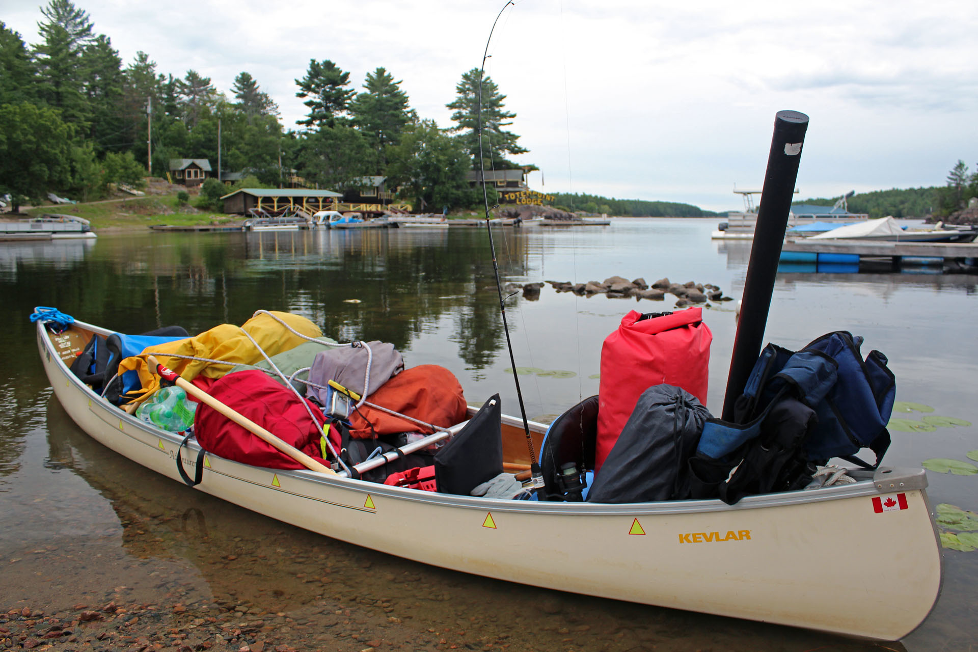
Our trips to the French River area have almost become a routine: a pleasant drive of 300 km. up north on highway 400, de rigueur stop in the Hungry Bear Restaurant for lunch—and then a quick jaunt to a small town of Noelville, where most of its inhabitants speak French, albeit they have sometimes problems understanding French-speaking people from Quebec. After doing some last-minute shopping in Noelville, we drove to Wolseley Bay Lodge located at the end of road no. 528, loaded the canoe, parked the car at Wolseley Bay Lodge for $6.00 per day fee and began paddling towards south-east.


There were some cottages and lodges, notably Totem Lodge with its colourful totem pole mascot guarding the point along the shores of the bay; the weather was just perfect, a nice sunny day and we leisurely reached North Channel—a popular canoe route for those paddling around Eighteen Mile Island. Most of the land around us belonged to the park, yet there were some swaths of privately-owned land, usually with cottages.

Three campsites were located in that area—one on the shores of very big Eighteen Mile Island (no. 323), one on a small island nearby (no. 322), which actually looked quite nice—and another on the northern tip of an island (no. 321)--which we immediately liked and decided to stay on! The island had a boomerang-like shape, was rocky and heavily forested. The campsite was located on a more-less flat rock, there was another massive rock that at one point formed a level, stage-like field (perfect for impromptu performances!) and the fire pit was close to the rock's vertical wall.


In addition, there was a washroom (the thunder box, as it is called) and park bench. We did not see any other campsites from our site; there were plenty of wood some 200-300 meters in the forest. When we set up the tent, two canoeists paddled by and apparently were planning to stay on this site—well, too late!--but fortunately, there were plenty of other campsites available. While the sun was still up, I cleaned a pike I had caught while paddling on Wolseley Bay and later grilled in over the campfire.

  August 22, 2011, Monday


We were up at 11 am. Usually I keep my radio in the tent and try to listen to the news before leaving the tent. When I turned on the radio, I was shocked to learn that Jack Layton, the head of the New Democratic Party, who just in the May, 2011 federal elections in Canada had lead the party to an unprecedented victory and become the Leader of the Opposition, died this morning at 5:00 o'clock. Not long ago he successfully beat prostate cancer; later, he underwent a hip surgery and while campaigning, he was still using his cane—which, by the way, later became one of the symbols of his election triumph, as he was waving it on the election night. Less than one month ago Jack Layton had appeared on TV, quite haggard, and speaking with visible difficulty, he announced he had just been diagnosed with a different kind of cancer and thus was temporary stepping down as the party's leader. He was only 61 years old. Although I had never been a supporter of this left-wing party (NDP) and its socialist ideology, I was, as most of Canadians, quite affected by his rapid and untimely demise. Another news item was about Libya, where the fighters overtook the capital of Tripoli and were looking for Qaddafi.


It was windy, cloudy and only +21 C. We went into the forest to get some wood. It was a very nice area, rocky, with plenty of felled trees, apparently by storms. In the evening we paddled to the Little Pine Rapids, located between Eighteen Mile Island and Commanda Island; the picturesque rapids formed a mouth of another of the French River's channels, the Main Channel, circling Eighteen Mile Island from the south and eventually merging with the North Channel.


Vis-à-vis the rapids was the Lochaven Wilderness Lodge. Live guitar music wafted out from the deck where diners enjoyed their American Plan "all you can eat "fish fry. We pulled up to their dock where . Catherine made a phone call on a good old Bell land-line (the cell coverage was extremely spotty and unreliable) and we talked to a nice young fellow, whose family had apparently owned the lodge for many years.


We departed towards our campsite when it was already dark, but had no problems finding the way; besides, we had left a flashing light attached to a tree which helped us locate our campsite. Soon it started raining; using a tarp, tree sticks and rocks, Catherine built a VERY decent shelter—which we did not have to use that night as it stopped raining. Despite my efforts, I did not catch any fish, so we enjoyed grilled chicken. 

  August 23, 2011, Tuesday


Sunny, but windy—our plans to paddle to the Chaudiere Dam (and the other end of the Chaudiere Portage—yes, the same portage which we had paddled to during our French River “Dokis” trip in July, 2011—see blog http://ontario-nature.blogspot.com/2011/07/french-river-dokis.html ) were dashed.  


In the evening we paddled east, with the wind, reaching campsite no. 316 on an island, but it was too windy to paddled further and we paddled back to the campsite, this time against the wind: it turned out to be a rather difficult task, at some points we hardly moved—it was so disappointing. Once we reached the campsite, we had a nice fire—and Catherine's shelter came really handy: not only did it protect us from the storm and rain, but it also covered the fire pit, thus allowing us to enjoy the campfire! 

  August 24, 2011, Wednesday  


The weather forecast was really bad and indeed, it was windy, chilly, wavy and raining; on top of that, we had a storm with thunder and lighting. In spite of this weather, a number of people paddled in their canoes by our campsite and eventually camped in the area of campsites nos. 313 and 314. Then Environment Canada weather forecast issued a number of weather warnings, even calling for tornadoes and white squalls. Needless to say, we stayed put, under the tarp. Catherine did develop a touch of campground fever in late afternoon and talked me into a paddle, but as soon as we got ready to push off, a dark cloud and rain appeared and we easily changed our minds 

  August 25, 2011, Thursday


It was our last day on the French River, so we packed and paddled to the Wolseley Lodge where the car was. It was disappointing as we had not done 3/4 of what we'd planned but hey... there is always next year! We had lunch on the terrace of the lodge. The view was awesome! And the food was good too. According to photos at the restaurant, a lot of people had caught huge muskies and pikes (and I mean HUGE!), but from my own experiences and a number of conversations with experienced fishermen over the past years, I am sure that it is becoming more and more difficult to catch fish—after all, I was trolling for hours and then casting and most of the time did not even catch ONE decent fish for dinner—and many others, who had from 10 to 20 fishing rods, expensive fish finders, motor boats and plenty of experience, either did not catch anything or just one or two fish. Well, I am not after that big pike or Muskie—I just want to catch one or two fish that I can later grill over the campfire!


After lunch we stopped in Noelville, went to the LCBO store and the supermarket to replenish our food supplies, as well as visited a small dollar store next to the Beer Store where I bought a pair of nice clogs. We asked the saleslady where we could get water—she incredulously advised us to drive to her house and get water from her garden hose as her well was very deep and had much better water than in other places. Believe it or not, we had some problems finding her house and asked local people—they were very friendly and in no time literally led us to her residence—as well as told us a few things about the town.


Having left Noelville, we drove to Killarney Park (St. George Office), picked up our permits (but wished they were available to print off online), bought a map and drove on Bell Lake Road (9 km) and reached Bell Lake, where we unloaded and parked the car. Unfortunately, it was impossible to drive to the lake—there was a 100 m. 'portage' from the parking lot to Bell Lake (it was not indicated on the map), so we drove to the private area of Blue Mountain Lodge and departed from there, thus avoiding that annoying portage. We had some explaining to do to the 20 year old park guy' who immediately showed up in a motor boat to tell us it was verboten to use the launch site and checking to see if we were on his permit list. There was a number of campsites on the lake, all on the 'first come first serve basis'.


It was getting a little late and we did not have much time to look for a campsite, yet as we kept paddling north on the lake, we saw campsites on its west and east shores—all were occupied!


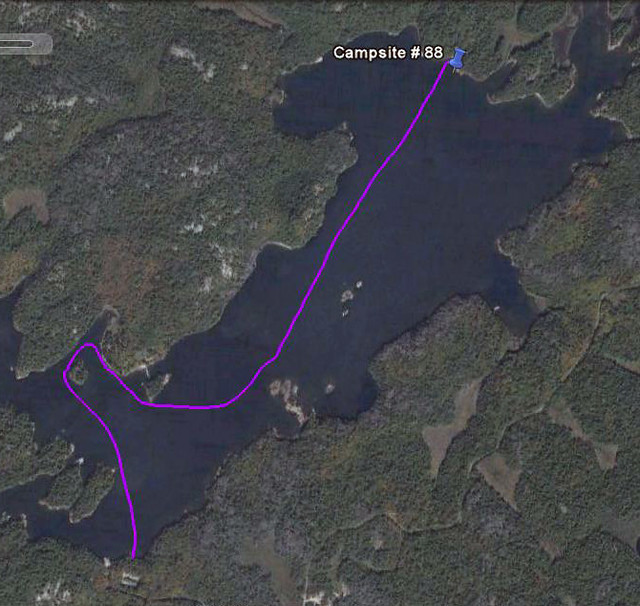
Finally we reached a small bay—one campsite on its outer shores (no. 86) was quite nice, but it was occupied; another one inside the bay (no. 87) was vacant, yet it was somehow dark because it faced the east and then we proceeded to another campsite no. 88—it was located on a rocky hill, near a very small bay with a narrow, sandy beach.


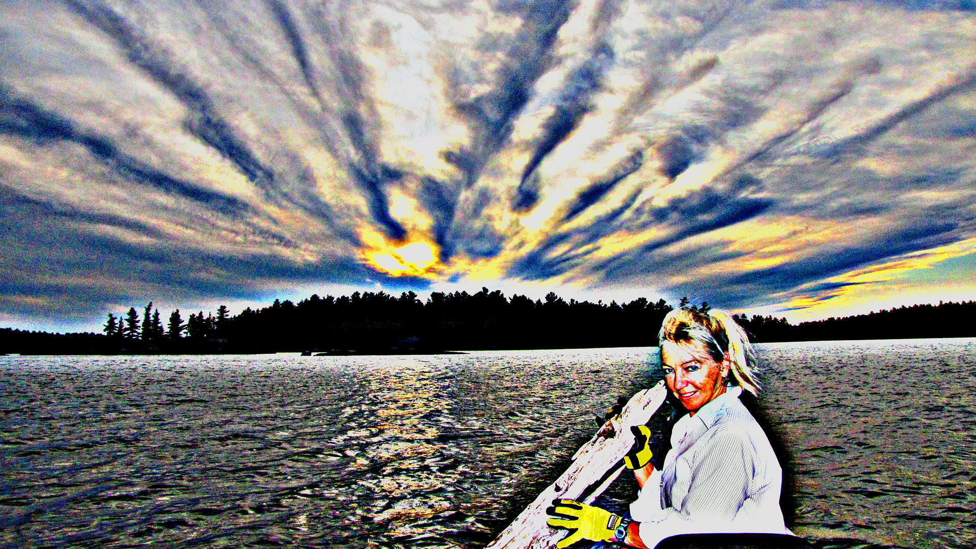
We knew that it would require dragging our stuff up the steep rocky wall... but otherwise it was excellent and we decided to camp there. The adjacent campsite (no. 89) was on an island; it was also quite nice, but was occupied by a family with children. I brought the tent up the hill and was setting it up as Catherine carried all the rest of the equipment up the hill (she is in great shape!) and later pulled the canoe on the sandy beach in the small bay and flipped it. Soon we were sitting on the top of the rock, just meters from the tent, facing the west and admiring beautiful sunset! Once it became dark, we saw several campfires along the shores of Bell Lake; in fact, during the day we saw the put-in point (where the car was parked), located over 2 km from our campsite. The campsite had a thunder box (i.e., washroom) and there was plenty of wood in the forest, so we enjoyed a wonderful campfire! 

  August 26, 2011, Friday


We were up at 10:00 am. The weather was nice, but a little windy. We swam, read a little, relaxed and about 4:00 pm went paddling, but due to the wind we only paddled to campsite number 86—the previous campers had left and it was now vacant. It was a very nice campsite, with a great view and plenty of wood everywhere. The family on the island (no. 89) left too, but another family with one kid arrived and now was camping there. We paddled around 'our' bay, picked up some wood along the shores (in fact, the park encourages campers to pick up wood while canoeing and not around the campsite—in addition, we brought one bag of wood, just in case). We paddled inside a very small bay near campsite no. 87 (which was occupied—it was the campsite that we had considered taking yesterday, but found it to be too dark), Catherine got out of the canoe and brought plenty of wood.


We were back at our campsite before 6:00 pm, unloaded the wood and later sat on the rock, enjoying a glass of red wine and watching the sunset. The 08:00 o'clock news was about the life of Jack Layton and the events in Libya. Once it got dark, we started the fire and with my headlight on, for the next few hours I was absorbed in reading “The Economist”--an absolutely first-class magazine! Nevertheless, I had never agreet with this magazine's left-wing approach. Sometimes I was shocked at the idiotic statements made there. Well, it only proves that intelligence and stupidity can coexist!

  August 27, 2011, Saturday


The weather was nice, so we were up in the morning and paddled to Balsam Lake—where we had paddled for the first time in August, 2008. There was a beaver dam between Bell and Balsam Lakes, so a portage was required. For many years there had been the 'famous' Bell Lake Tramway—run by Blue Mountain Lodge—consisting of a cart with wheels moving along built-in tracks.


 It was possible to place even a motorboat on the cart—we successfully used the cart in 2008. Unfortunately, for some time the cart has been gone as the lodge no longer wanted to maintain it. Yet Catherine happily carried the canoe and I carried the rest of our equipment and after several minutes we were paddling on Balsam Lake.


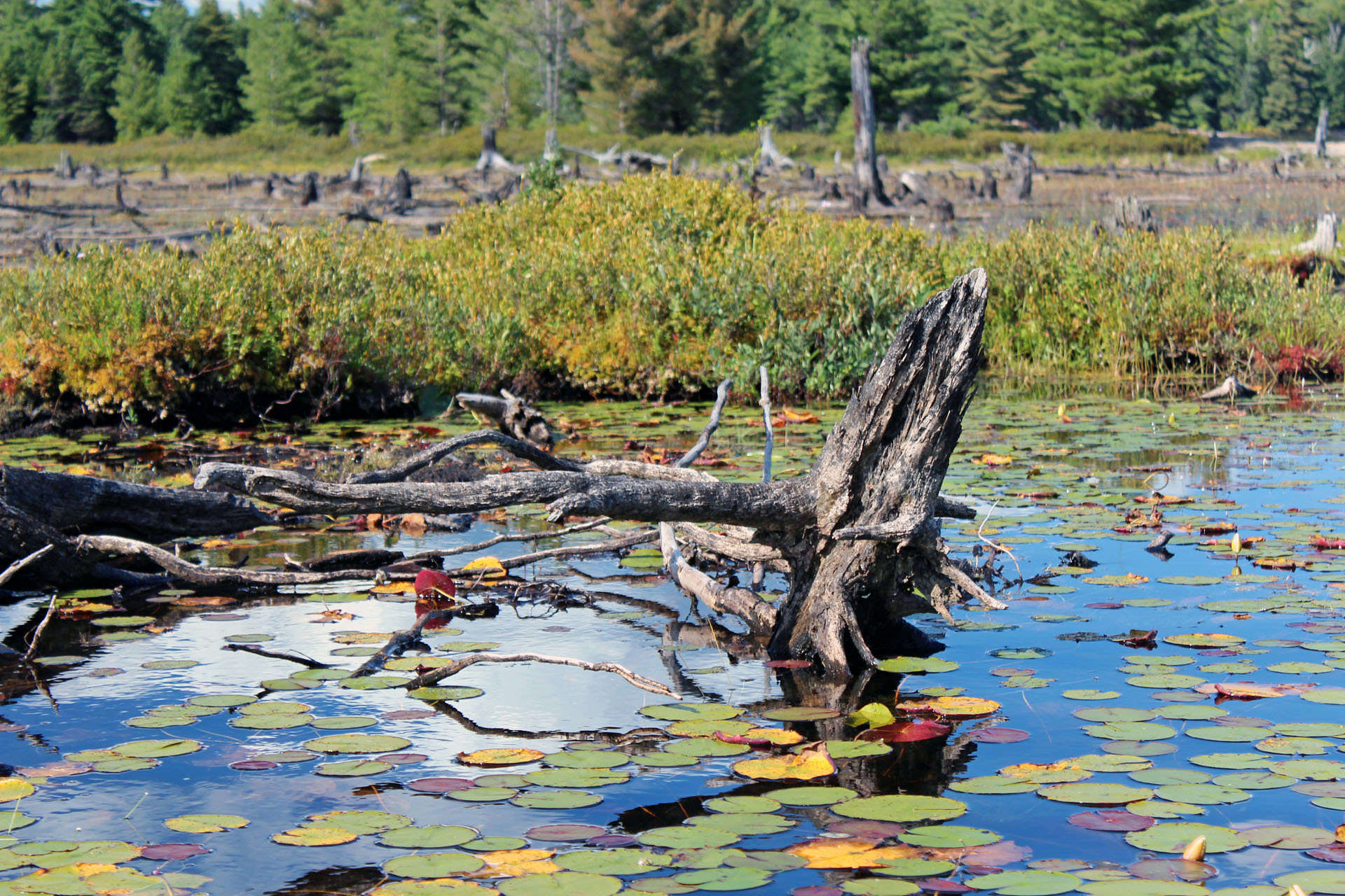
Most campsites on Balsam Lake were occupied—no wonder, it was a very nice lake, had plenty of beaver lodges, swamps, lily pads, lily flowers and fascinating stumps sticking out of the water. It was a very pleasant paddle, but after reaching campsites #117 and #118, we had to turn back.


While paddling near campsite no. 116, we saw a small black bear on the shore, but it was quite timid and did not want to pose for photos. At the Bell Lake portage we encountered a group of girls, part of the Tim Horton Children's Foundation which organizes camps for kids. They helped us out, without even us asking them, carrying the canoe and some of our equipment—thanks! Catherine was surprised they could travel so lightly; turns out they used dehydrated food. We showed them which few campsites on balsam lake were available. Arriving at our campsite just before the sunset, we could again observe this interesting phenomenon which so many people take for granted and never even think of.


We also spoke to the family camping on the adjacent island (no. 89), they also had gone hiking to the Crack and saw a bear. Then I started the fire, read another engrossing issue of “The Economist” and listened to the news—in the morning some of the radio and TV stations broadcast live Jack Layton's funeral and we could listen to some of its highlights. We went to bed at 1:00 am. 

  August 28, 2011, Sunday


We were up at 11:00 am and paddled to the put-in point, i.e., the Bell Lake parking. Near campsite no. 86 we saw a family (2 canoes and 1 kayak) asking us if campsite no. 88 (i.e., ours) was empty. We told them this one and the other one on the islands were not available, but pointed to campsite no. 86, just 100 m. from where they were (which they had just passed by), that was very nice and empty—they apparently had no map and had not noticed that campsite's tiny sign. We kept on paddling; it was becoming quite windy and as we approached the put in area, the waves made it quite difficult to paddle—and we were paddling WITH the wind, reaching speeds of up to 9 km/h. In fact, some people, who were about to start their trip, were standing on the shore, unsure whether or not they should go on water. We (that is, Catherine, who by now had mastered the art of portaging and did not want to pass any opportunity to practice it) carried the canoe to the parking lot and put it on the car.


We then drove to the town of Killarney where we went to the Herbert Fish and Chips Restaurant, bought excellent French Fries, then got beer at the LCBO store and drove to a small park in Killarney (Nancy Pitfield Memorial Park) where we unloaded the car, dragged the canoe and our stuff to the shore, chatted with a kayaking club from Sudbury who warned us it was rough seas ahead, parked the car and started paddling in the Killarney Channel.


This channel formed between the town of Killarney and George Island, which for centuries has offered a safe passage and excellent docking place (for more information of this area, please see my blog: http://ontario-nature.blogspot.com/2010/08/canoeing-around-philip-edward-island.html ). It was windy, but the channel was quite calm and sheltered us from the wind. We paddled towards south-east and soon left the channel, paddling on more-less open waters of Georgian Bay, towards the lighthouse. The waves suddenly became quite high and we had to paddle very carefully to keep the canoe in the right position. A big yacht entered the channel and its wake almost overturned our canoe. Far away we saw a number of somehow familiar looking islands—of course, they were the Fox Islands which we had visited just a month ago; especially the round and hilly Centre Fox Island was clearly visible.


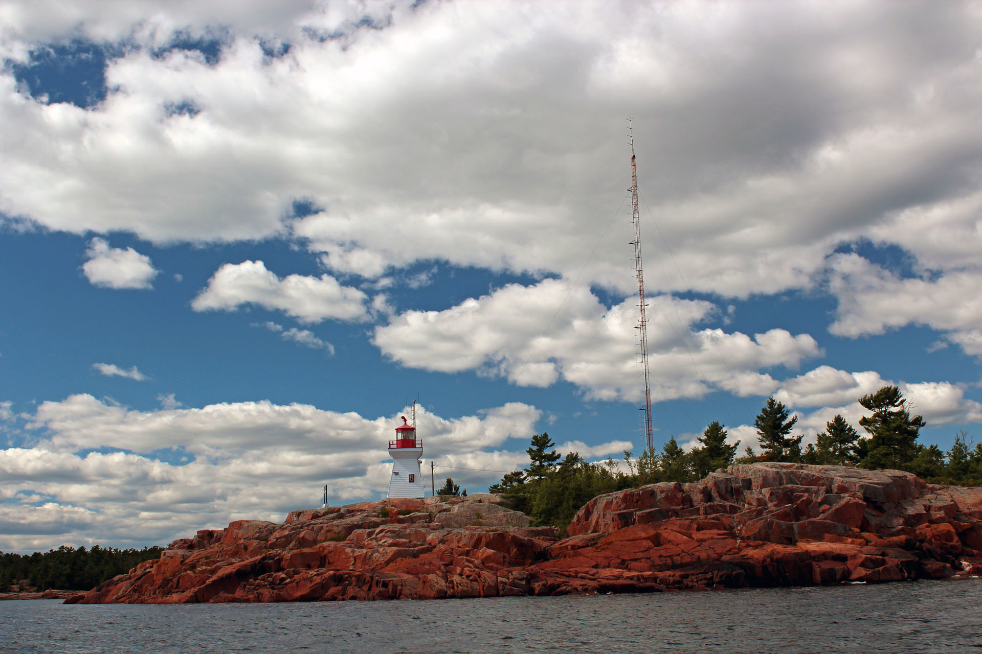
Some canoeists do paddle to the Fox Islands from Killarney, but it requires a lot of paddling on open waters. We reached the unmanned lighthouse, located on amazing pinkish rock formation (we had visited the lighthouse and explored the rock with the MeetUp group “TOADS”, later known as “GET OUT”, in August, 2008) and then paddled back into the channel.


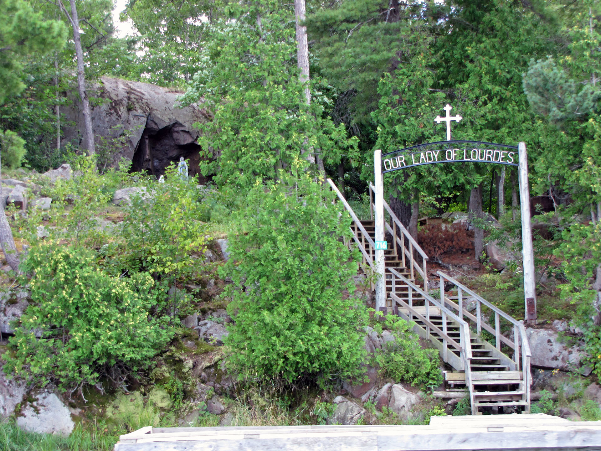
Plenty of motorboats, yachts and sailboats were moored along its shores. We saw a “Lady of Lourdes” cave on St. George Island, with the Lady's figure. We paddled to the other end of the channel and once we left it, we immediately experienced very high and rough waves, propelled by the strong wind.


Again, we had to be very careful to keep the canoe from capsizing, keeping it perpendicular to the waves. We saw the white La Cloche Mountains in front of us. Soon, we turned back as it was becoming a little too risky (even though we were less than 50 meters from the much calmer mouth of the channel). Catherine visited the Sportsman Inn, I observed impressive yachts moored in front of the Inn (I was wondering, how much do they cost? how much gas do they use? how far do they go? and I was sooooo glad I did not own such a boat!).


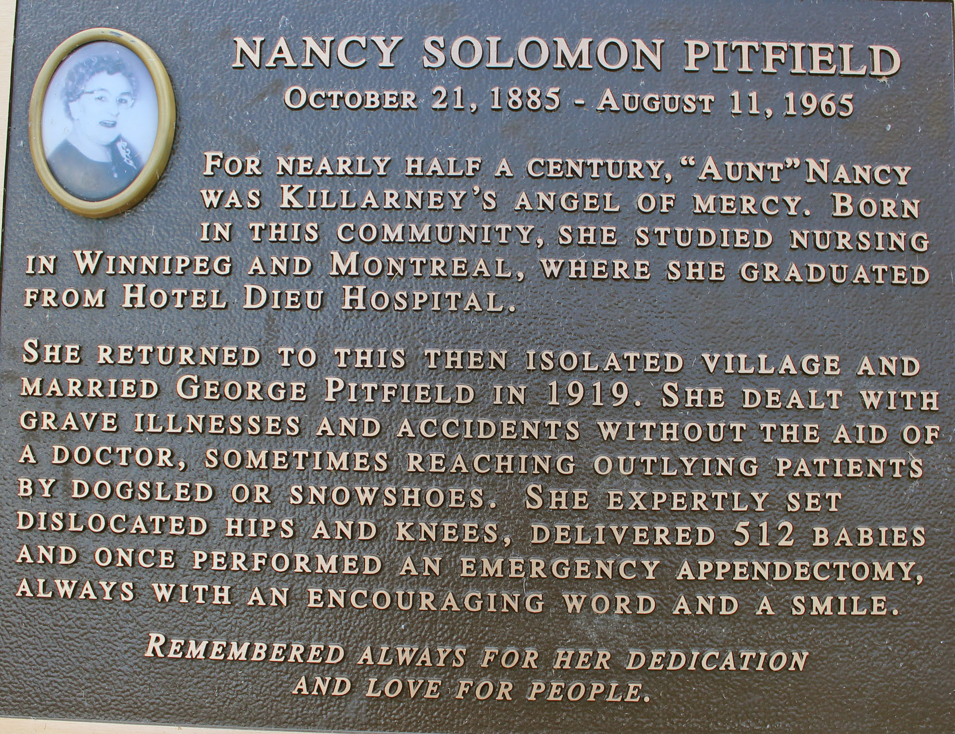
We got back to the Nancy Pitfield Memorial Park where the car was parked and put the canoe on the roof of the car. I read a very interesting inscription on a plaque attached to a boulder in the park:


Nancy Solomon Pitfield, October 21, 1885—August 11, 1965. For nearly half a century, "Aunt" Nancy Pitfield was Killarney's angel of mercy. Born in this community, she studied nursing in Winnipeg and Montreal, where she graduated from Hotel Dieu Hospital. She returned to this then isolated village and married George Pitfield in 1919. She dealt with grave illnesses and accidents without the aid of a doctor, sometimes reaching outlying patients by dogsled or snowshoes. She expertly set dislocated hips and knees, delivered 512 babies, and once performed an emergency appendectomy, always with an encouraging word and a smile. Remembered always for her dedication and love for people. Indeed, I can only imagine how difficult life must have been in the past, when there was no road and the town was accessible only by air or water. I found more information on that special individual on this site: http://www.killarneyhistory.com .

I find it really fascinating, as it also shows Killarney's history: Aunt Nancy", as she was known to all of the younger folks, was born here on October 21st, 1887, one of ten children of William and Catherine Solomon. After training as a nurse, Aunt Nancy returned to Killarney shortly after the death of her father in 1913. With no road access to the village, she became our lifeline, serving as nurse, dentist, doctor, surgeon, midwife, and undertaker. She travelled on foot, by boat, horse and sleigh, dog team, and on snowshoes to provide medical care to anyone needing help. In March 1915, she attended at the birth of three infants in one day --delivering Basil Roque in the morning and the Jackman twins, Catherine and Mary, that afternoon. One winter a logger from the nearby mills at Collins Inlet had his hand blown off by an accidental dynamite blast. He was brought to Aunt Nancy, who trimmed away the shredded flesh, cleaned the wound, and sewed up the stump of his arm.


In an interview with Bruce West, of the Hamilton Spectator, Aunt Nancy remembered the time she was called to attend a Native woman in labour at Beaverstone Bay. She and Father Paquin, the Jesuit missionary serving Killarney, travelled there by dog team. They broke through the ice near the woman's cabin, and were pulled from the water by a man who had been watching for their arrival. After entering the cabin, she made Father Paquin strip off his clothes and get into bed. She explained to the family, who didn't speak English, that Father Paquin needed dry clothes. A girl named Big Agnes finally gave him a set of her bloomers. "We put these on poor Father Paquin," said Aunt Nancy, "they were as big as a tent, but Father Paquin didn't get pneumonia and the baby arrived just fine". After years of dealing with a wide range of human experiences, she was well prepared to deal effectively with situations even she could not have anticipated. In the late 1930s, Aunt Nancy had prepared for burial the body of an elderly man living on George Island, across the Killarney channel. A wake was always held in the home of a family member (as it often is today), for three days and nights of ritual prayer. Several people remained with the deceased throughout each night. This time, on the last night of the wake, the family went to bed and Aunt Nancy went home, leaving a small group of teenagers to stay the night. The young folks, craving that era's version of junk food, decided to make pull taffy.


Warm taffy is elastic and very sticky -- pulling it apart as it cools makes it firmer; easier to eat. One teenager was too close to the casket during the process, and a large glob of taffy dropped down onto the old man, becoming entangled in the great thick beard he had worn most of his life. The teenagers tried to pull it off, scrape it off, and wash it off, but it wouldn't budge. Finally, in panic and desperation, they shaved it off. But they didn't remove just the taffy-filled section of the beard. They shaved the deceased clean. Hoping no one would notice anything wrong, the teenagers said nothing when Aunt Nancy returned early in the morning. Following tradition, she immediately knelt at the casket to pray, and of course saw that the beard was gone. Fortunately, the family was still in bed. After listening to the group's explanation, Aunt Nancy sent them home, with strict instructions to say nothing about the incident. It is not known exactly what Aunt Nancy told the family—one of the teenagers thought she closed the casket, and told the family that the body had deteriorated too much to leave it open. In any case, the feelings of the family were spared and the old gentleman was buried with dignity.


For decades, Aunt Nancy faced dangerous waters, storms, and perilous ice conditions to give us the gift of good health. Until 1951, when electricity came to the village, she travelled to night calls with only the soft glow of coal-oil lamps to light her way and illuminate her work. In 1965, three years after Killarney became accessible by road, Aunt Nancy died at the age of 80. She had served her people for over fifty years, sharing with us her expertise, her good humour, and her compassion. We have nothing to give her in return but our gratitude and the promise that she will never be forgotten. 

We also went to Pitfield's and bought sausages, got a block of ice and excellent smoked fish from Herbert's Fisheries and drove to Killarney Park where we had a quick shower. We left the park at 6:20 pm and drove back to the Bell Lake parking lot. As we were driving on Bell Lake road, we saw a black bear just standing in the middle of the road and looking at us; I wanted to take a better photo of the bear and slowly drove towards it, but then it started running and for a while it looked liked I was chasing the bear with the car, but soon it ran off the road and disappeared in the forest.


At 07:05 pm we were on the water, paddling very hard (up to 8 km/h) and reached the campsite at 07:28 pm, unloaded the canoe, got the cold beer, went up on the rock and drinking beer, observed the sunset. The other campsites (nos. 86 and 87) were also occupied. We talked to two fishermen who were fishing close by; they said they always stayed on our campsite when it was available. They also caught some bass and said fishing was good in this lake. We had a nice fire and had the sausages. 

  August 29, 2011, Monday


Last day of our trip... we dragged our stuff down the hill—we wished we could have just thrown it into the water—and paddled towards the parking lot. On our way back we paddled around the Blue Mountain Lodge which had some nice cottages. This time we did not use the Lodge's parking lot, so Catherine carried the canoe as no one offered to help and then we carried the rest of our stuff which required several trips—even such an easy and short portage was quite arduous as we had to carry many pieces of our belongings step-by-step.


We drove to the Hungry Bear Restaurant for dinner, then shopped in the adjacent Trading Post (some of the products were really original) and drove to Toronto. Just past Port Severn we stopped to get gas in Waubaushene and also went to an avant-garde store selling a variety of funny items and candies. Arrived in Toronto before midnight. It was another great, safe and pleasant trip, although the windy weather prevented us from paddling on some days